Chetwode

Settlement in Buckinghamshire

England

Chetwode

Old Great Central Railway trackbed A view south east on the old overgrown Great Central Railway trackbed just north of Barton Hill Farm Road which was carried over the railway by this three arch bridge.  The line was closed in 1966 and the area has reverted to woodland.  They are building the new HS2 line close to here, just to the left of this picture, which means that this woodland will be left undisturbed.
Old Great Central Railway trackbed Credit: Bob Walters

Chetwode is a small village and civil parish located in the Aylesbury Vale district of Buckinghamshire, England. Situated approximately 5 miles northwest of the market town of Buckingham, Chetwode is a rural community surrounded by picturesque countryside.

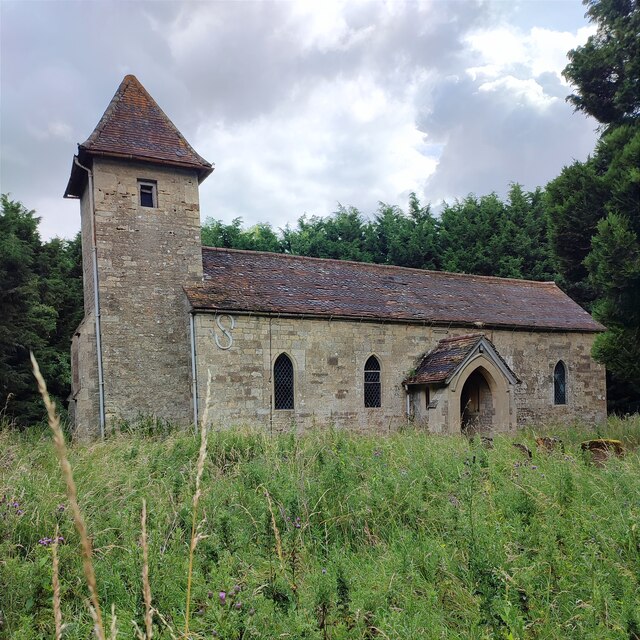
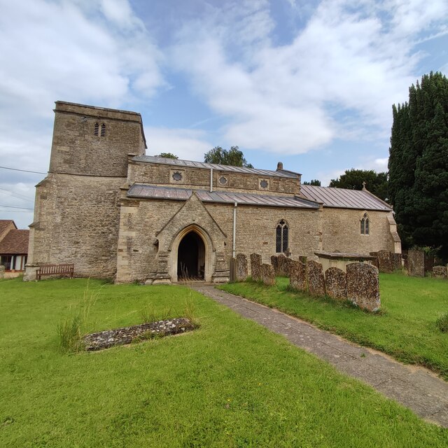
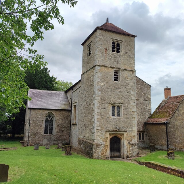
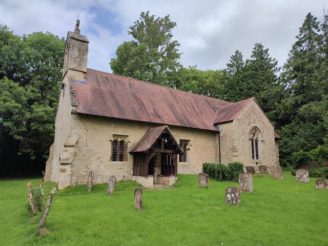
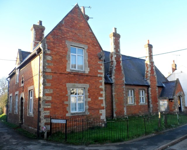
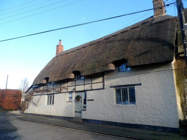
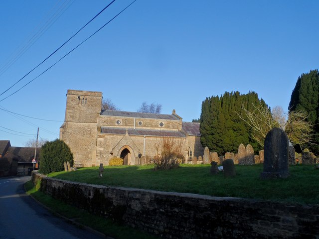
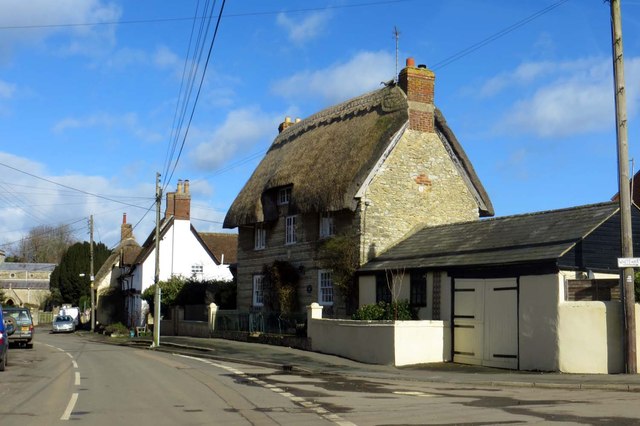
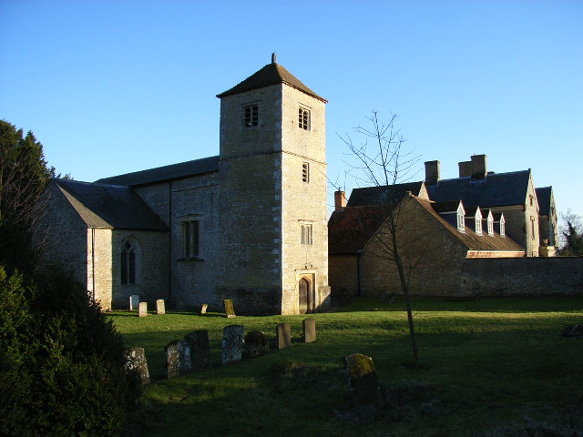
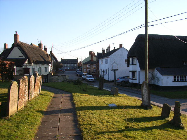
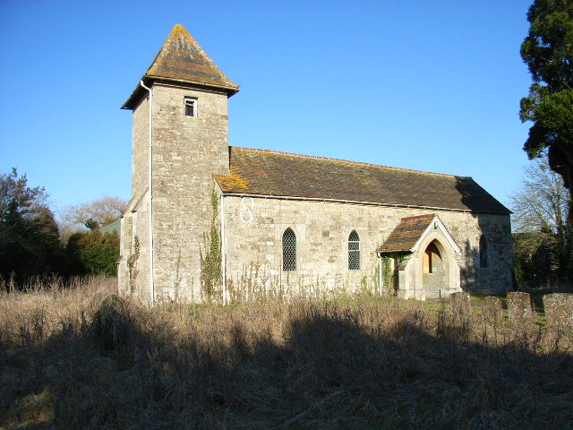
The village is known for its charming and traditional architectural style, with many homes and buildings dating back several centuries. The centerpiece of Chetwode is the historic St. Mary's Church, which was originally built in the 12th century and has undergone several renovations over the years.

Chetwode is home to a close-knit community, with a population of around 200 residents. The village has a strong sense of community spirit, with regular events and activities organized by local groups and organizations. The Chetwode Village Hall serves as a hub for these activities, hosting various social gatherings, meetings, and community events.

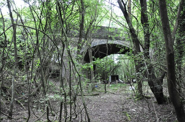
Surrounded by rolling hills and farmland, Chetwode offers a peaceful and idyllic setting for residents and visitors alike. The village is also located near several nature reserves, providing opportunities for outdoor activities such as walking, cycling, and bird-watching.

Despite its small size, Chetwode benefits from its proximity to nearby towns and cities. Buckingham offers a range of amenities, including shops, supermarkets, restaurants, and leisure facilities. The village is well-connected by road, with easy access to the A413 and A421, allowing residents to easily reach larger urban centers like Milton Keynes and Oxford.

Overall, Chetwode is a charming and tranquil village with a rich history and strong sense of community, making it an attractive place to live or visit for those seeking a peaceful rural lifestyle.

If you have any feedback on the listing, please let us know in the comments section below.
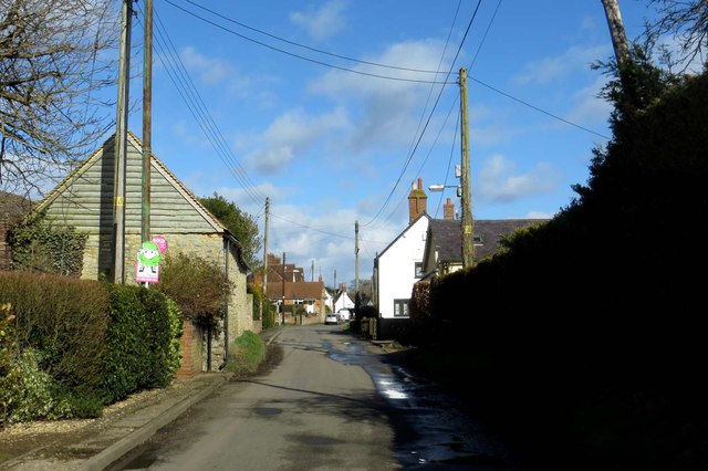
Chetwode Images

Images are sourced within 2km of 51.960178/-1.065682 or Grid Reference SP6429. Thanks to Geograph Open Source API. All images are credited.

Old Great Central Railway trackbed A view south east on the old overgrown Great Central Railway trackbed just north of Barton Hill Farm Road which was carried over the railway by this three arch bridge.  The line was closed in 1966 and the area has reverted to woodland.  They are building the new HS2 line close to here, just to the left of this picture, which means that this woodland will be left undisturbed.
Old Great Central Railway trackbed
A view south east on the old overgrown Great Central Railway trackbed just north of Barton Hill Farm Road which was carried over the railway by this three arch bridge. The line was closed in 1966 and the area has reverted to woodland. They are building the new HS2 line close to here, just to the left of this picture, which means that this woodland will be left undisturbed.
Holy Trinity Church, Godington
Church of St John the Baptist, Preston Bissett
St Mary and St Nicholas Church, Chetwode
Church of St James, Barton Hartshorn
Footpath to Preston Bissett
Former school building, Preston Bissett
Church House, Preston Bissett Built in C17. See <span class="nowrap"><a title="http://www.britishlistedbuildings.co.uk/en-399754-church-house-preston-bissett-buckinghams" rel="nofollow ugc noopener" href="http://www.britishlistedbuildings.co.uk/en-399754-church-house-preston-bissett-buckinghams">Link</a><img style="margin-left:2px;" alt="External link" title="External link - shift click to open in new window" src="https://s1.geograph.org.uk/img/external.png" width="10" height="10"/></span> for entry in British Listed Buildings
Church House, Preston Bissett
Built in C17. See LinkExternal link for entry in British Listed Buildings
St John the Baptist, Preston Bissett A C14 church incorporating c12 masonry presumably from an earlier structure. Restored  C19.
St John the Baptist, Preston Bissett
A C14 church incorporating c12 masonry presumably from an earlier structure. Restored C19.
The road to Preston Bissett
Footpath to Preston Bissett
The road to Edgcott
The road to Edgcott
The road to Casemore Farm
The road to Preston Bissett
Main Street into Preston Bissett
Main Street in Preston Bissett
Thatched house on Main Street
Show me another place!

Chetwode is located at Grid Ref: SP6429 (Lat: 51.960178, Lng: -1.065682)

Unitary Authority: Buckinghamshire

Police Authority: Thames Valley

What 3 Words

///broadcast.appendix.headings. Near Tingewick, Buckinghamshire

Nearby Locations

Chetwode Chetwode

Related Wikis

Chetwode

Chetwode () is a village and civil parish about 4 miles (6.4 km) southwest of Buckingham in the Aylesbury Vale district of Buckinghamshire. The parish...

Barton Hartshorn

Barton Hartshorn is a civil parish about 4 miles (6.4 km) southwest of Buckingham in Buckinghamshire, within the Buckinghamshire Council unitary authority...
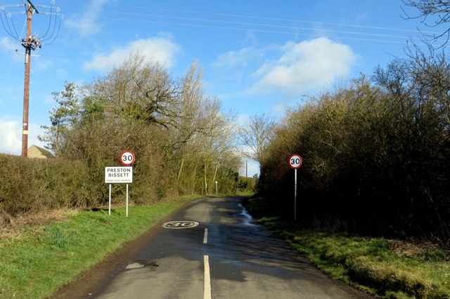
Preston Bissett

Preston Bissett is a village and civil parish in the unitary authority area of Buckinghamshire, England. It is about four miles SSW of Buckingham, six...

Godington

Godington is a village and civil parish about 5 miles (8 km) northeast of Bicester in Oxfordshire. The parish is bounded on all but the west side by a...

Nearby Amenities

Located within 500m of 51.960178,-1.065682
Barrier: stile
Lat/Long: 51.9634939/-1.070203
Post Box
Ref: MK18 188
Lat/Long: 51.9634831/-1.0697005
Power: pole
Source: Bing
Lat/Long: 51.9584586/-1.068198
Power: pole
Source: Bing
Lat/Long: 51.960789/-1.0603528
Power: pole
Source: Bing
Lat/Long: 51.95985/-1.0645746
Power: pole
Source: Bing
Lat/Long: 51.9603163/-1.0634266
Power: pole
Source: Bing
Lat/Long: 51.9594089/-1.0658216
Power: pole
Source: Bing
Lat/Long: 51.9589163/-1.0670152
Power: pole
Source: Bing
Lat/Long: 51.9607096/-1.0587489
Power: pole
Source: Bing
Lat/Long: 51.9576385/-1.0705238
Power: pole
Source: Bing
Lat/Long: 51.9617328/-1.0630482
Power: pole
Source: Bing
Lat/Long: 51.9624054/-1.0640003
Power: pole
Source: Bing
Lat/Long: 51.9608857/-1.0619069
Power: pole
Source: Bing
Lat/Long: 51.9645473/-1.0658618
Power: pole
Source: Bing
Lat/Long: 51.9639341/-1.0660093
Power: pole
Source: Bing
Lat/Long: 51.963088/-1.0648962
Power: pole
Lat/Long: 51.9634252/-1.0686176
Power: pole
Lat/Long: 51.9637177/-1.0670927
Information: guidepost
Tourism: information
Lat/Long: 51.9608937/-1.0666635
The data included in this document is from www.openstreetmap.org. The data is made available under ODbL.

Have you been to Chetwode?

Leave your review of Chetwode below (or comments, questions and feedback).