Chettisham

Settlement in Cambridgeshire East Cambridgeshire

England

Chettisham

Lynn Road Looking along Lynn Road from King Edgar Close.
Lynn Road Credit: Mary and Angus Hogg

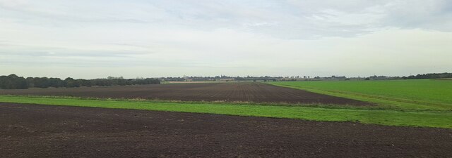
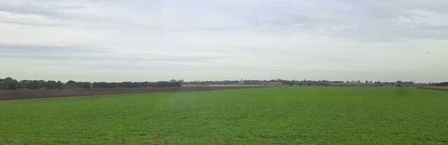
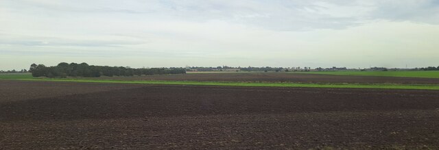
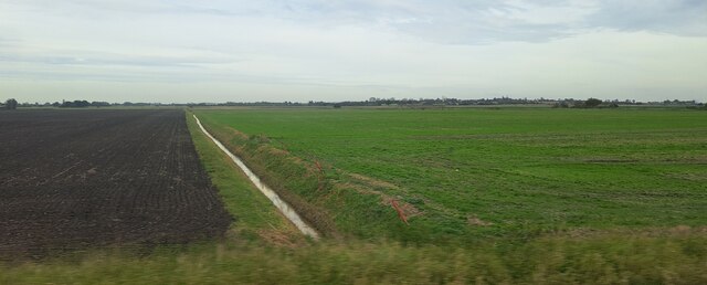
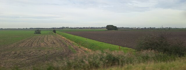
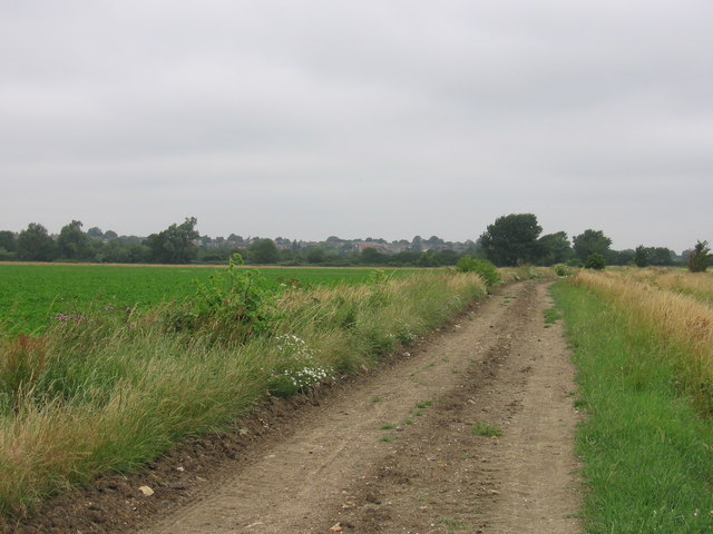
Chettisham is a small village located in the county of Cambridgeshire, England. It lies approximately 2 miles northeast of the city of Ely and is situated in the East Cambridgeshire district. The village is set amidst the beautiful and picturesque Cambridgeshire Fens, which are renowned for their flat and fertile agricultural landscape.

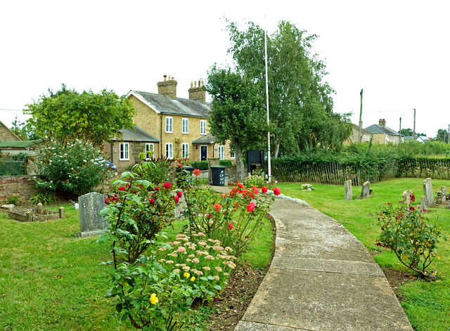
Chettisham is a primarily residential village with a population of around 600 residents. It has a close-knit community feel and offers a peaceful and rural setting for its inhabitants. The village is characterized by its charming cottages and traditional architecture, which adds to its quaint and idyllic atmosphere.

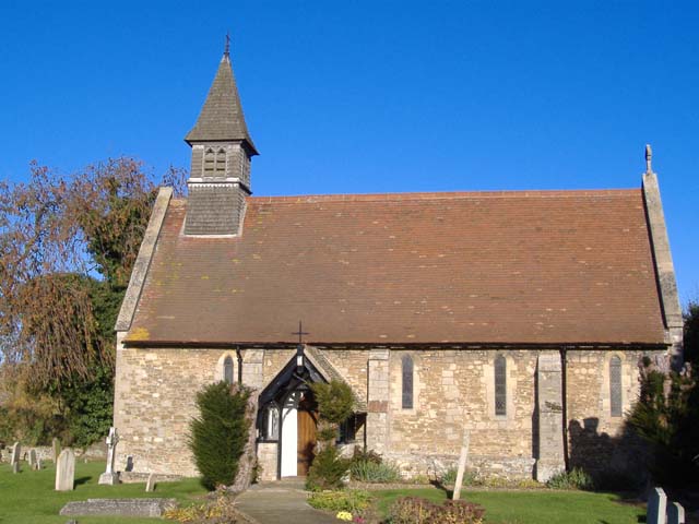
Despite its small size, Chettisham has a rich history. The village is mentioned in the Domesday Book of 1086, and evidence of its ancient past can still be seen in the form of historical buildings and landmarks. The St. Michael and All Angels Church, dating back to the 12th century, is a prominent feature of the village and serves as a reminder of its long-standing heritage.

The village benefits from its proximity to Ely, which offers a range of amenities and services including shops, schools, and healthcare facilities. Additionally, Chettisham benefits from good transport links, with the A10 road passing through the nearby area, providing easy access to Cambridge and other major towns in the region.

Overall, Chettisham is a charming village that combines a rich history, rural beauty, and a strong sense of community, making it an attractive place to live for those seeking a peaceful and picturesque setting in Cambridgeshire.

If you have any feedback on the listing, please let us know in the comments section below.

Chettisham Images

Images are sourced within 2km of 52.424421/0.273714 or Grid Reference TL5483. Thanks to Geograph Open Source API. All images are credited.

Lynn Road Looking along Lynn Road from King Edgar Close.
Lynn Road
Looking along Lynn Road from King Edgar Close.
Chettisham Garage Viewed from Lynn Road on the edge of Chettisham village.
Chettisham Garage
Viewed from Lynn Road on the edge of Chettisham village.
At Chettisham Church The access path for the Church of St Michael and All Angels goes through the surrounding graveyard.
At Chettisham Church
The access path for the Church of St Michael and All Angels goes through the surrounding graveyard.
Level crossing near Chettisham The traffic was waiting to go south towards Ely.
Level crossing near Chettisham
The traffic was waiting to go south towards Ely.
Looking across Waterden Fen, from the Ely-Manea railway line In the distance, the railway line from Ely north to Kings Lynn, beyond which runs the River Great Ouse; the single tree just to the right of the centre of the picture lies on the far bank of the river.
Looking across Waterden Fen, from the Ely-Manea railway line
In the distance, the railway line from Ely north to Kings Lynn, beyond which runs the River Great Ouse; the single tree just to the right of the centre of the picture lies on the far bank of the river.
Fields west of Redmoor Plantation, from the railway Redmoor Plantation is on the right of the picture.
Fields west of Redmoor Plantation, from the railway
Redmoor Plantation is on the right of the picture.
Wood Fen, from the railway line The broad green stripe across the field on the left marks the line of Coffue Drove, a public right of way.
Wood Fen, from the railway line
The broad green stripe across the field on the left marks the line of Coffue Drove, a public right of way.
Wood Fen, from the railway line
Wood Fen, from the railway line The broad green stripe across the field in the middle distance marks the line of Coffue Drove, a public right of way.
Wood Fen, from the railway line
The broad green stripe across the field in the middle distance marks the line of Coffue Drove, a public right of way.
Ditch in North Fen, from the railway
Ditch in Wood Fen, from the railway
Beild Drove and Wood Fen, from the railway
Water tower, seen from the B1382 between Ely and Queen Adelaide Taken from the bridge where the road goes over the railway, the picture shows a water tower and new houses being built on the eastern outskirts of Ely.
Water tower, seen from the B1382 between Ely and Queen Adelaide
Taken from the bridge where the road goes over the railway, the picture shows a water tower and new houses being built on the eastern outskirts of Ely.
St. Michael and All Angels, Chettisham Chettisham is a small village on the old A10 Ely to Littleport road. The new A10 road now bypasses Ely and Littleport to the west. The church is near the end of a road leading west off the old A10.
St. Michael and All Angels, Chettisham
Chettisham is a small village on the old A10 Ely to Littleport road. The new A10 road now bypasses Ely and Littleport to the west. The church is near the end of a road leading west off the old A10.
Aerial tower at Princess of Wales Hospital, Ely The tower block houses the ambulance garage in its ground floor.
Aerial tower at Princess of Wales Hospital, Ely
The tower block houses the ambulance garage in its ground floor.
Princess of Wales Hospital, Ely Once a hospital for RAF personnel, it is now a hospital for the general community.
Princess of Wales Hospital, Ely
Once a hospital for RAF personnel, it is now a hospital for the general community.
The Hereward Way at West Fen The Hereward Way at West Fen leading into Little Downham.
The Hereward Way at West Fen
The Hereward Way at West Fen leading into Little Downham.
Farm on Bield Drove Bield Drove is one of the many cul-de-sac "droves" in this part of the Fens.
Farm on Bield Drove
Bield Drove is one of the many cul-de-sac "droves" in this part of the Fens.
Show me another place!

Chettisham is located at Grid Ref: TL5483 (Lat: 52.424421, Lng: 0.273714)

Division: Isle of Ely

Administrative County: Cambridgeshire

District: East Cambridgeshire

Police Authority: Cambridgeshire

What 3 Words

///feel.typist.titles. Near Ely, Cambridgeshire

Nearby Locations

Chettisham

Related Wikis

Chettisham railway station

Chettisham railway station is a former railway station in Chettisham, Cambridgeshire. It was on the Great Eastern Railway route between Ely and March....

Chettisham

Chettisham is a hamlet in East Cambridgeshire between Ely and Littleport. The main claim to fame is St. Michael church. There are some pictures and a...

Chettisham Meadow

Chettisham Meadow is a 0.7-hectare (1.7-acre) biological Site of Special Scientific Interest west of Chettisham, 3 km (2 mi) north of Ely in Cambridgeshire...

Princess of Wales Hospital, Ely

The Princess of Wales Hospital is a healthcare facility in Ely, Cambridgeshire. It is managed by the Cambridgeshire and Peterborough NHS Foundation Trust...

Nearby Amenities

Located within 500m of 52.424421,0.273714
Chettisham
Place: village
Wikidata: Q1995557
Lat/Long: 52.4248794/0.2750528
Parking
Lat/Long: 52.4260875/0.2788456
Fuel
Chettisham Garage
Lat/Long: 52.4220268/0.2747873
Farm
Church Farm
Lat/Long: 52.4269451/0.2728975
Post Box
Collection Times: Mo-Fr 17:15; Sa 10:00
Operator: Royal Mail
Post Box Type: lamp
Ref: CB6 38
Royal Cypher: EIIR
Royal Cypher Wikidata: Q33102113
Source: survey
Lat/Long: 52.4236444/0.2765198
Chettisham Level Crossing
Crossing Barrier: double_half
Railway: level_crossing
Lat/Long: 52.4267633/0.2792271
Bus Stop
The Hamlet
Naptan AtcoCode: 0500EELYY034
Naptan Bearing: SW
Naptan CommonName: The Hamlet
Naptan Indicator: opp
Naptan Landmark: The Hamlet
Naptan NaptanCode: cmbdgptd
Naptan ShortCommonName: The Hamlet
Naptan Street: Lynn Road
Naptan Verified: no
Source: naptan_import
Lat/Long: 52.4234798/0.276533
JT Cycles
Note: location estimated
Shop: bicycle
Lat/Long: 52.4218781/0.2746976
Power: pole
Lat/Long: 52.4239652/0.2724453
Power: pole
Lat/Long: 52.4268738/0.2682719
Power: pole
Lat/Long: 52.4251101/0.2710184
Power: pole
Lat/Long: 52.424535/0.2717332
Power: pole
Lat/Long: 52.4257341/0.2702459
Power: pole
Lat/Long: 52.4264269/0.2690111
Power: pole
Lat/Long: 52.4231427/0.2734592
Power: pole
Lat/Long: 52.4282981/0.2773805
Power: pole
Lat/Long: 52.4254801/0.2759267
Power: pole
Lat/Long: 52.426546/0.276492
Power: pole
Lat/Long: 52.4277469/0.2770826
Power: pole
Lat/Long: 52.4224494/0.2742852
Power: pole
Lat/Long: 52.4208914/0.2738272
Power: pole
Lat/Long: 52.4220062/0.274228
Power: pole
Lat/Long: 52.4231298/0.2743675
Chettisham Level Crossing
Crossing Barrier: double_half
Railway: level_crossing
Lat/Long: 52.4267319/0.2791985
The data included in this document is from www.openstreetmap.org. The data is made available under ODbL.

Have you been to Chettisham?

Leave your review of Chettisham below (or comments, questions and feedback).