Barn Wood

Wood, Forest in Devon

England

Barn Wood

Renney Road and the junction with Bovisand Lane, Down Thomas
Renney Road and the junction with Bovisand Lane, Down Thomas Credit: Ruth Sharville

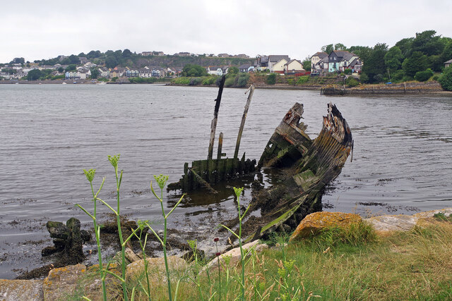
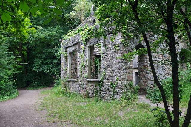
Barn Wood is a picturesque forest located in Devon, England. Stretching over an area of approximately 200 acres, it is a haven for nature lovers and outdoor enthusiasts. The forest is characterized by its dense woodland, towering trees, and abundant wildlife.

The wood is predominantly composed of native British species such as oak, beech, and birch trees, which lend a distinctive charm to the landscape. The forest floor is covered with a rich carpet of moss, ferns, and wildflowers, adding to its natural beauty.

Barn Wood offers a range of activities and amenities for visitors to enjoy. Numerous walking trails crisscross the forest, allowing visitors to explore its diverse ecosystem at their own pace. These trails vary in difficulty, providing options for both casual strollers and more experienced hikers. Along the way, visitors may encounter various woodland creatures, including squirrels, deer, and a wide array of bird species.

For those seeking a more immersive experience, camping facilities are available within the forest. These designated areas allow visitors to spend the night under the canopy of trees, truly connecting with nature. Additionally, the forest is equipped with picnic spots and barbecue areas, making it an ideal destination for family outings and picnics.

Barn Wood is easily accessible, with ample parking facilities and well-maintained paths. It is a popular destination for both locals and tourists, offering a tranquil escape from the hustle and bustle of everyday life.

If you have any feedback on the listing, please let us know in the comments section below.
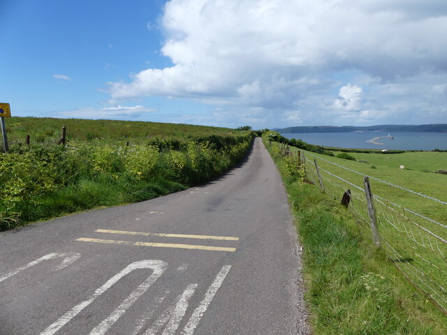
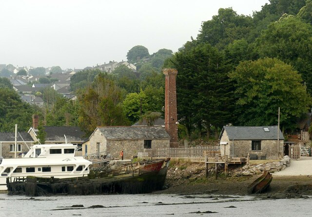
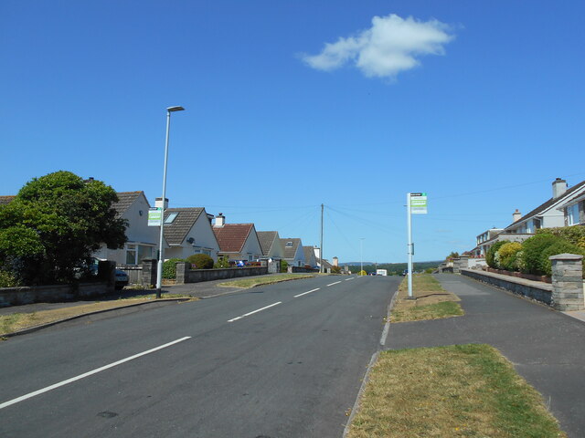
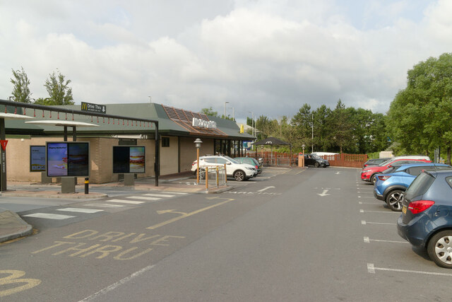
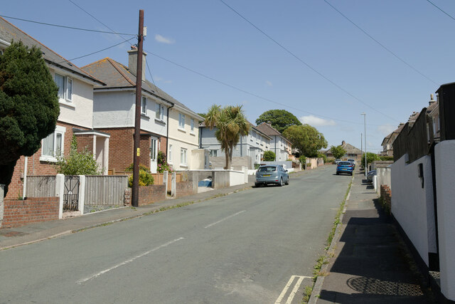
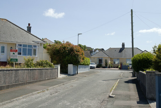
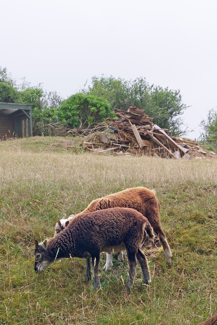
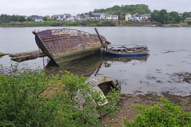
Barn Wood Images

Images are sourced within 2km of 50.349941/-4.1005537 or Grid Reference SX5052. Thanks to Geograph Open Source API. All images are credited.

Renney Road and the junction with Bovisand Lane, Down Thomas
"Slow" instruction needs a repaint - Bovisand Lane, Down Thomas This is a single track road with passing places for most of its length.
"Slow" instruction needs a repaint - Bovisand Lane, Down Thomas
This is a single track road with passing places for most of its length.
Farm pasture next to Bovisand Lane, Down Thomas In the distance can be seen the Plymouth Breakwater.
Farm pasture next to Bovisand Lane, Down Thomas
In the distance can be seen the Plymouth Breakwater.
Looking towards Plymouth Sound Camping and Caravan Park, Down Thomas Peaks of Dartmoor can be seen in the far distance.
Looking towards Plymouth Sound Camping and Caravan Park, Down Thomas
Peaks of Dartmoor can be seen in the far distance.
Looking from Bovisand Lane across a field towards a pretty hedgerow, Down Thomas The Plymouth Sound Camping and Caravan Park is to the extreme right of the photo.
Looking from Bovisand Lane across a field towards a pretty hedgerow, Down Thomas
The Plymouth Sound Camping and Caravan Park is to the extreme right of the photo.
The pillar in Hooe Lake This was a discharge tower where sewage sludge was pumped into barges for disposal at sea, a procedure now discontinued.
The pillar in Hooe Lake
This was a discharge tower where sewage sludge was pumped into barges for disposal at sea, a procedure now discontinued.
Hexton Hill Quay The old buildings with chimney served a quarry on the hillside to the right.
Hexton Hill Quay
The old buildings with chimney served a quarry on the hillside to the right.
Rotting hulls Probably late 19th century coasting/fishing vessels.
Rotting hulls
Probably late 19th century coasting/fishing vessels.
Two bus stops One either side of the road in Mountbatten Way.
Two bus stops
One either side of the road in Mountbatten Way.
McDonald's, Pomphlett Road
Meadow Park, Hooe
Meadow Park, Hooe
Berry Park Close
Berry Park Close
Berry Park Road
Berry Park Road
Soay lambs Soay sheep are descended from a population of feral sheep on the island of Soay off the Western Isles of Scotland. These two lambs, however, live in the altogether more benign environment of the Plymouth suburbs.
Soay lambs
Soay sheep are descended from a population of feral sheep on the island of Soay off the Western Isles of Scotland. These two lambs, however, live in the altogether more benign environment of the Plymouth suburbs.
Hooe Lake One of Hooe Lake's hulks (there are over 30 abandoned vessels around the lake) lies just east of Hexton Quay. The boat next to it is much newer but is equally derelict having been burnt out at some point.
Hooe Lake
One of Hooe Lake's hulks (there are over 30 abandoned vessels around the lake) lies just east of Hexton Quay. The boat next to it is much newer but is equally derelict having been burnt out at some point.
Hooe Lake One of the many Hooe Lake hulks languishes here at the eastern end.
Hooe Lake
One of the many Hooe Lake hulks languishes here at the eastern end.
Armoury Cottage, Radford Lake Armoury Cottage is one of a group of ruined buildings on the south side of Radford Lake in Radford Woods that include an old boathouse. They formed part of the grounds of Radford House which was demolished in 1937. Collectively the buildings are grade II listed and it is said they are haunted by the White Lady who searches the ruins for her lover.
Armoury Cottage, Radford Lake
Armoury Cottage is one of a group of ruined buildings on the south side of Radford Lake in Radford Woods that include an old boathouse. They formed part of the grounds of Radford House which was demolished in 1937. Collectively the buildings are grade II listed and it is said they are haunted by the White Lady who searches the ruins for her lover.
Fireplace - Armoury Cottage, Radford Lake This grand fireplace suggests that the ruined Armoury Cottage was once a dwelling of some importance. Above the fireplace is a date - 1640 - and a fleur-de-lys carving. The fleur-de-lys design is typically associated with French heraldry and it may signify the original owners of Radford House, the 'le Abbé' family, who later changed their name to 'de Radford'. See <a href="https://www.geograph.org.uk/photo/7529687">SX5052 : Armoury Cottage, Radford Lake</a> for an external view of the cottage.
Fireplace - Armoury Cottage, Radford Lake
This grand fireplace suggests that the ruined Armoury Cottage was once a dwelling of some importance. Above the fireplace is a date - 1640 - and a fleur-de-lys carving. The fleur-de-lys design is typically associated with French heraldry and it may signify the original owners of Radford House, the 'le Abbé' family, who later changed their name to 'de Radford'. See SX5052 : Armoury Cottage, Radford Lake for an external view of the cottage.
Show me another place!

Barn Wood is located at Grid Ref: SX5052 (Lat: 50.349941, Lng: -4.1005537)

Unitary Authority: Plymouth

Police Authority: Devon and Cornwall

What 3 Words

///varieties.jacket.voters. Near Plymstock, Devon

Related Wikis

Radford, Plymstock

Radford in the parish of Plymstock in Devon is a historic manor and the oldest recorded seat of the prominent Harris family. It is today a low-cost housing...

Elburton

Elburton is a small suburb of Plymstock, part of the City of Plymouth in the English county of Devon. It lies on the south eastern edge of Plymouth and...

Hooe, Plymouth

Hooe is a suburb of Plymstock, Plymouth in the English county of Devon. == History == Hooe was built over the site of the estate of Radford, the family...

Radford Cave

Radford Cave, in Hexton Wood, near Hooe, Plymouth, Devon is a small phreatic cave of some ecological interest. It has been known to speleologists and...

Staddon Fort

Staddon Fort is a 19th-century fort, built as a result of the Royal Commission on National Defence of 1859. Part of an extensive scheme known as Palmerston...

Plymstock

Plymstock is a commuter suburb of Plymouth and former civil parish in the English county of Devon. == Geography == Situated on the east bank of the River...

Turnchapel railway station

Turnchapel railway station served the suburb of Turnchapel, Plymouth, England from 1897 to 1961 on the Turnchapel Branch. == History == The station opened...

Oreston railway station

Oreston railway station served the suburb of Oreston, Plymouth, England from 1897 to 1961 on the Turnchapel Branch. == History == The station opened on...

Nearby Amenities

Located within 500m of 50.349941,-4.1005537
Mini Roundabout
Direction: clockwise
Source: Yahoo imagery
Lat/Long: 50.3534626/-4.100385
Mini Roundabout
Direction: clockwise
Source: Yahoo imagery
Lat/Long: 50.3521075/-4.1036006
Turning Circle
Lat/Long: 50.3528825/-4.0957693
Barrier: kissing_gate
Lat/Long: 50.3462615/-4.0968661
Crossing
Crossing: marked
Crossing Island: yes
Crossing Markings: yes
Image: https://storage13.openstreetcam.org/files/photo/2021/11/13/lth/3930041_791fb13bd52d454bc150a2938019675d.jpg
Survey Date: 2021-11-13
Tactile Paving: yes
Lat/Long: 50.3534367/-4.1005967
Crossing
Crossing: unmarked
Crossing Island: yes
Crossing Markings: no
Tactile Paving: yes
Lat/Long: 50.3541753/-4.098966
Crossing
Crossing: unmarked
Crossing Island: yes
Crossing Markings: no
Mapillary: 601020577894905
Survey Date: 2021-12-11
Tactile Paving: yes
Lat/Long: 50.3529272/-4.1013184
Barrier: kissing_gate
Foot: yes
Lat/Long: 50.3464094/-4.1021659
Direction: 280
Generator Method: photovoltaic
Generator Output Electricity: yes
Generator Solar Modules: 16
Generator Source: solar
Generator Type: solar_photovoltaic_panel
Location: roof
Power: generator
Lat/Long: 50.3536306/-4.0972507
Direction: 100
Generator Method: photovoltaic
Generator Output Electricity: yes
Generator Solar Modules: 8
Generator Source: solar
Generator Type: solar_photovoltaic_panel
Location: roof
Power: generator
Lat/Long: 50.3536432/-4.097206
Direction: 280
Generator Method: photovoltaic
Generator Output Electricity: yes
Generator Solar Modules: 16
Generator Source: solar
Generator Type: solar_photovoltaic_panel
Location: roof
Power: generator
Lat/Long: 50.3536736/-4.0974377
Direction: 100
Generator Method: photovoltaic
Generator Output Electricity: yes
Generator Solar Modules: 8
Generator Source: solar
Generator Type: solar_photovoltaic_panel
Location: roof
Power: generator
Lat/Long: 50.3536543/-4.0973743
Direction: SSE
Generator Method: photovoltaic
Generator Output Electricity: yes
Generator Solar Modules: 16
Generator Source: solar
Generator Type: solar_photovoltaic_panel
Location: roof
Power: generator
Lat/Long: 50.3537496/-4.0992371
Direction: SSW
Generator Method: photovoltaic
Generator Output Electricity: yes
Generator Solar Modules: 8
Generator Source: solar
Generator Type: solar_photovoltaic_panel
Location: roof
Power: generator
Lat/Long: 50.3535354/-4.0995607
Direction: 190
Generator Method: photovoltaic
Generator Output Electricity: yes
Generator Solar Modules: 17
Generator Source: solar
Generator Type: solar_photovoltaic_panel
Location: roof
Power: generator
Lat/Long: 50.3527679/-4.0970813
Direction: 105
Generator Method: photovoltaic
Generator Output Electricity: yes
Generator Solar Modules: 8
Generator Source: solar
Generator Type: solar_photovoltaic_panel
Location: roof
Power: generator
Lat/Long: 50.3502218/-4.0981022
Direction: 285
Generator Method: photovoltaic
Generator Output Electricity: yes
Generator Solar Modules: 8
Generator Source: solar
Generator Type: solar_photovoltaic_panel
Location: roof
Power: generator
Lat/Long: 50.3502302/-4.0981452
Direction: 255
Generator Method: photovoltaic
Generator Output Electricity: yes
Generator Solar Modules: 6
Generator Source: solar
Generator Type: solar_photovoltaic_panel
Location: roof
Power: generator
Lat/Long: 50.3531914/-4.1048366
Direction: 165
Generator Method: photovoltaic
Generator Output Electricity: yes
Generator Solar Modules: 6
Generator Source: solar
Generator Type: solar_photovoltaic_panel
Location: roof
Power: generator
Lat/Long: 50.3531811/-4.1047803
Direction: 165
Generator Method: photovoltaic
Generator Output Electricity: yes
Generator Solar Modules: 10
Generator Source: solar
Generator Type: solar_photovoltaic_panel
Location: roof
Power: generator
Lat/Long: 50.3503776/-4.1014101
Direction: S
Generator Method: photovoltaic
Generator Output Electricity: yes
Generator Solar Modules: 16
Generator Source: solar
Generator Type: solar_photovoltaic_panel
Location: roof
Power: generator
Lat/Long: 50.3507737/-4.1008941
Direction: S
Generator Method: photovoltaic
Generator Output Electricity: yes
Generator Solar Modules: 14
Generator Source: solar
Generator Type: solar_photovoltaic_panel
Location: roof
Power: generator
Lat/Long: 50.3514398/-4.1009507
Direction: SSE
Generator Method: photovoltaic
Generator Output Electricity: yes
Generator Solar Modules: 13
Generator Source: solar
Generator Type: solar_photovoltaic_panel
Location: roof
Power: generator
Lat/Long: 50.3518148/-4.1011855
Direction: SSE
Generator Method: photovoltaic
Generator Output Electricity: yes
Generator Solar Modules: 14
Generator Source: solar
Generator Type: solar_photovoltaic_panel
Location: roof
Power: generator
Lat/Long: 50.3517369/-4.1010896
Direction: S
Generator Method: photovoltaic
Generator Output Electricity: yes
Generator Solar Modules: 16
Generator Source: solar
Generator Type: solar_photovoltaic_panel
Location: roof
Power: generator
Lat/Long: 50.3512968/-4.1032192
Direction: 175
Generator Method: photovoltaic
Generator Output Electricity: yes
Generator Solar Modules: 12
Generator Source: solar
Generator Type: solar_photovoltaic_panel
Location: roof
Power: generator
Lat/Long: 50.3537595/-4.1036927
Direction: 175
Generator Method: photovoltaic
Generator Output Electricity: yes
Generator Solar Modules: 12
Generator Source: solar
Generator Type: solar_photovoltaic_panel
Location: roof
Power: generator
Lat/Long: 50.3537659/-4.1036027
Direction: 175
Generator Method: photovoltaic
Generator Output Electricity: yes
Generator Solar Modules: 12
Generator Source: solar
Generator Type: solar_photovoltaic_panel
Location: roof
Power: generator
Lat/Long: 50.3537801/-4.1034137
Direction: 175
Generator Method: photovoltaic
Generator Output Electricity: yes
Generator Solar Modules: 12
Generator Source: solar
Generator Type: solar_photovoltaic_panel
Location: roof
Power: generator
Lat/Long: 50.3537844/-4.1033305
Direction: 165
Generator Method: photovoltaic
Generator Output Electricity: yes
Generator Solar Modules: 9
Generator Source: solar
Generator Type: solar_photovoltaic_panel
Location: roof
Power: generator
Lat/Long: 50.3522184/-4.1048439
Direction: 190
Generator Method: photovoltaic
Generator Output Electricity: yes
Generator Solar Modules: 9
Generator Source: solar
Generator Type: solar_photovoltaic_panel
Location: roof
Power: generator
Lat/Long: 50.3527066/-4.1058592
Direction: 190
Generator Method: photovoltaic
Generator Output Electricity: yes
Generator Solar Modules: 9
Generator Source: solar
Generator Type: solar_photovoltaic_panel
Location: roof
Power: generator
Lat/Long: 50.3529024/-4.1055115
Direction: 190
Generator Method: photovoltaic
Generator Output Electricity: yes
Generator Solar Modules: 8
Generator Source: solar
Generator Type: solar_photovoltaic_panel
Location: roof
Power: generator
Lat/Long: 50.351786/-4.1068267
Direction: S
Generator Method: photovoltaic
Generator Output Electricity: yes
Generator Solar Modules: 16
Generator Source: solar
Generator Type: solar_photovoltaic_panel
Location: roof
Power: generator
Lat/Long: 50.3514505/-4.1006637
Direction: 190
Generator Method: photovoltaic
Generator Output Electricity: yes
Generator Solar Modules: 13
Generator Source: solar
Generator Type: solar_photovoltaic_panel
Location: roof
Power: generator
Lat/Long: 50.3509755/-4.0945338
Direction: 195
Generator Method: photovoltaic
Generator Output Electricity: yes
Generator Solar Modules: 16
Generator Source: solar
Generator Type: solar_photovoltaic_panel
Location: roof
Power: generator
Lat/Long: 50.3496931/-4.095675
Direction: 190
Generator Method: photovoltaic
Generator Output Electricity: yes
Generator Solar Modules: 16
Generator Source: solar
Generator Type: solar_photovoltaic_panel
Location: roof
Power: generator
Lat/Long: 50.3495798/-4.0943145
Bench
Backrest: yes
Material: wood
Lat/Long: 50.3499717/-4.1052879
Crossing
Crossing: unmarked
Crossing Markings: no
Lat/Long: 50.352853/-4.0995486
Crossing
Crossing: unmarked
Crossing Markings: no
Lat/Long: 50.3524323/-4.0976218
Man Made: street_cabinet
Survey Date: 2022-03-07
Lat/Long: 50.3542948/-4.0990114
Man Made: street_cabinet
Survey Date: 2022-03-07
Lat/Long: 50.3542844/-4.0990471
Street Lamp
Ref: 1
Survey Date: 2022-04-20
Lat/Long: 50.3542962/-4.0988854
Grit Bin
Survey Date: 2022-03-25
Lat/Long: 50.3507835/-4.1029759
Street Lamp
Survey Date: 2022-03-25
Lat/Long: 50.3508029/-4.1032191
Fire Hydrant
Emergency: fire_hydrant
Fire Hydrant Type: underground
Survey Date: 2022-03-25
Lat/Long: 50.3505777/-4.1018896
Street Lamp
Ref: 12
Survey Date: 2022-03-25
Lat/Long: 50.3506957/-4.100358
Street Lamp
Survey Date: 2022-03-25
Lat/Long: 50.3518996/-4.1061786
Street Lamp
Survey Date: 2022-03-25
Lat/Long: 50.3519194/-4.1045358
Bus Stop
Homer Park
Bench: yes
Bin: no
Bus: yes
Departures Board: timetable
Lit: yes
Naptan AtcoCode: 1180PLB11965
Naptan Bearing: E
Naptan CommonName: Homer Park
Naptan Indicator: E-bound
Naptan NaptanCode: plyjpwm
Naptan PlusbusZoneRef: PLYMTH
Naptan Street: Hooe Road
Public Transport: platform
Shelter: yes
Survey Date: 2022-03-25
Tactile Paving: yes
Lat/Long: 50.3520525/-4.104396
Street Lamp
Survey Date: 2022-03-25
Lat/Long: 50.3519873/-4.1042447
Street Lamp
Survey Date: 2022-03-25
Lat/Long: 50.3520836/-4.1037673
Bus Stop
Reddicliff Road
Bench: no
Bus: yes
Lit: yes
Naptan AtcoCode: 1180PLB11959
Naptan Bearing: S
Naptan CommonName: Reddicliff Road
Naptan Indicator: S-bound
Naptan NaptanCode: plyjtam
Naptan PlusbusZoneRef: PLYMTH
Naptan Street: Reddicliff Road
Public Transport: platform
Shelter: no
Survey Date: 2022-03-25
Lat/Long: 50.3517238/-4.1034153
Man Made: street_cabinet
Survey Date: 2022-03-25
Lat/Long: 50.3519288/-4.1053568
Fire Hydrant
Emergency: fire_hydrant
Fire Hydrant Type: underground
Survey Date: 2022-03-25
Lat/Long: 50.3519384/-4.106354
Man Made: utility_pole
Material: wood
Survey Date: 2022-03-25
Lat/Long: 50.3518545/-4.1058001
Street Lamp
Survey Date: 2022-03-25
Lat/Long: 50.3519295/-4.1057082
Man Made: street_cabinet
Survey Date: 2022-03-25
Lat/Long: 50.3519161/-4.1055117
Street Lamp
Survey Date: 2022-03-25
Lat/Long: 50.3520757/-4.1064788
Street Lamp
Survey Date: 2022-03-25
Lat/Long: 50.351858/-4.1053954
Man Made: utility_pole
Material: wood
Survey Date: 2022-03-25
Lat/Long: 50.3519231/-4.1051023
Street Lamp
Survey Date: 2022-03-25
Lat/Long: 50.3518602/-4.1050503
Bus Stop
Homer Park
Bench: no
Bin: no
Bus: yes
Lit: yes
Naptan AtcoCode: 1180PLB11964
Naptan Bearing: W
Naptan CommonName: Homer Park
Naptan Indicator: W-bound
Naptan NaptanCode: plyjptw
Naptan PlusbusZoneRef: PLYMTH
Naptan Street: Hooe Road
Public Transport: platform
Shelter: no
Survey Date: 2022-03-25
Tactile Paving: no
Lat/Long: 50.3519752/-4.1042796
Street Lamp
Survey Date: 2022-03-25
Lat/Long: 50.3519724/-4.1034835
Grit Bin
Survey Date: 2022-03-25
Lat/Long: 50.3520951/-4.1040556
Street Lamp
Survey Date: 2022-03-25
Lat/Long: 50.3520684/-4.1038672
Street Lamp
Survey Date: 2022-03-25
Lat/Long: 50.3520822/-4.1036917
Fire Hydrant
Emergency: fire_hydrant
Fire Hydrant Type: underground
Survey Date: 2022-03-25
Lat/Long: 50.3516801/-4.1035595
Fire Hydrant
Emergency: fire_hydrant
Fire Hydrant Type: underground
Survey Date: 2022-03-25
Lat/Long: 50.3508439/-4.1033469
Man Made: street_cabinet
Survey Date: 2022-03-25
Lat/Long: 50.3508246/-4.1032534
Man Made: street_cabinet
Survey Date: 2022-03-25
Lat/Long: 50.3507201/-4.1030116
Street Lamp
Ref: 3
Survey Date: 2022-03-25
Lat/Long: 50.3513951/-4.1035857
Street Lamp
Survey Date: 2022-03-25
Lat/Long: 50.3511037/-4.1035056
Man Made: street_cabinet
Survey Date: 2022-03-25
Lat/Long: 50.3508643/-4.1033954
Street Lamp
Survey Date: 2022-03-25
Lat/Long: 50.3508267/-4.1029427
Bus Stop
Broom Park
Bench: no
Bus: yes
Naptan AtcoCode: 1180PLB11960
Naptan Bearing: E
Naptan CommonName: Broom Park
Naptan Indicator: E-bound
Naptan NaptanCode: plyjtgj
Naptan PlusbusZoneRef: PLYMTH
Naptan Street: Reddicliff Road
Public Transport: platform
Shelter: no
Survey Date: 2022-03-25
Lat/Long: 50.350648/-4.1018653
Street Lamp
Survey Date: 2022-03-25
Lat/Long: 50.3506909/-4.1028902
Street Lamp
Survey Date: 2022-03-25
Lat/Long: 50.3506556/-4.1018714
Street Lamp
Survey Date: 2022-03-25
Lat/Long: 50.3505684/-4.1013782
Street Lamp
Ref: 13
Survey Date: 2022-03-25
Lat/Long: 50.350768/-4.0998487
Street Lamp
Ref: 11
Survey Date: 2022-03-25
Lat/Long: 50.350577/-4.1009329
Fire Hydrant
Emergency: fire_hydrant
Fire Hydrant Type: underground
Survey Date: 2022-03-25
Lat/Long: 50.3506667/-4.1007097
Grit Bin
Survey Date: 2022-03-25
Lat/Long: 50.3505764/-4.0996029
Post Box
Collection Times: Mo-Fr 16:30; Sa 11:30
Post Box Type: lamp
Ref: PL9 86
Royal Cypher: EIIR
Royal Cypher Wikidata: Q33102113
Survey Date: 2022-03-25
Lat/Long: 50.3506402/-4.0997794
Street Lamp
Ref: 14
Survey Date: 2022-03-25
Lat/Long: 50.3508152/-4.0993785
Street Lamp
Ref: 14
Survey Date: 2022-03-25
Lat/Long: 50.3512147/-4.0992927
Street Lamp
Ref: 13
Survey Date: 2022-03-25
Lat/Long: 50.3513906/-4.0991902
Street Lamp
Survey Date: 2022-03-25
Lat/Long: 50.3531393/-4.1010285
Street Lamp
Ref: 40
Survey Date: 2022-04-20
Lat/Long: 50.3533608/-4.1007008
Fire Hydrant
Emergency: fire_hydrant
Fire Hydrant Type: underground
Survey Date: 2022-03-25
Lat/Long: 50.3508339/-4.099329
Fire Hydrant
Emergency: fire_hydrant
Fire Hydrant Type: underground
Survey Date: 2022-03-25
Lat/Long: 50.3514649/-4.0994069
Street Lamp
Ref: 10
Survey Date: 2022-03-25
Lat/Long: 50.3516239/-4.0992658
Bus Stop
Radford Dip
Bench: no
Bin: no
Bus: yes
Departures Board: timetable
Lit: yes
Mapillary: 3204763029803172
Naptan AtcoCode: 1180PLA06924
Naptan Bearing: SW
Naptan CommonName: Radford Dip
Naptan Indicator: SW-bound
Naptan NaptanCode: plypatw
Naptan PlusbusZoneRef: PLYMTH
Naptan Street: Hooe Road
Public Transport: platform
Shelter: no
Survey Date: 2022-03-25
Tactile Paving: yes
Lat/Long: 50.3531411/-4.100982
Bus Stop
Radford Dip
Bench: yes
Bus: yes
Departures Board: timetable
Lit: yes
Naptan AtcoCode: 1180PLA06907
Naptan Bearing: NE
Naptan CommonName: Radford Dip
Naptan Indicator: NE-bound
Naptan NaptanCode: plypamt
Naptan PlusbusZoneRef: PLYMTH
Naptan Street: Hooe Road
Public Transport: platform
Shelter: yes
Survey Date: 2022-03-25
Tactile Paving: yes
Lat/Long: 50.3533875/-4.1009011
Street Lamp
Survey Date: 2022-03-25
Lat/Long: 50.3534244/-4.1004495
Street Lamp
Ref: 44
Survey Date: 2022-04-20
Lat/Long: 50.3534764/-4.1002697
Street Lamp
Survey Date: 2022-03-25
Lat/Long: 50.3536166/-4.1002564
Street Lamp
Ref: 27
Survey Date: 2022-03-25
Lat/Long: 50.3541836/-4.0983807
Man Made: street_cabinet
Survey Date: 2022-03-25
Lat/Long: 50.354079/-4.0983877
Street Lamp
Ref: 26
Survey Date: 2022-03-25
Lat/Long: 50.353985/-4.0981459
Man Made: utility_pole
Material: wood
Survey Date: 2022-03-25
Lat/Long: 50.3539895/-4.0991631
Street Lamp
Survey Date: 2022-03-25
Lat/Long: 50.3536995/-4.0996915
Street Lamp
Ref: 47
Survey Date: 2022-04-20
Lat/Long: 50.3538043/-4.0994062
Bus Stop
Underlane
Bench: no
Bin: no
Bus: yes
Lit: yes
Naptan AtcoCode: 1180PLB11950
Naptan Bearing: NW
Naptan CommonName: Underlane
Naptan Indicator: NW-bound
Naptan NaptanCode: plyjwgw
Naptan PlusbusZoneRef: PLYMTH
Naptan Street: Green Park Road
Public Transport: platform
Shelter: no
Survey Date: 2022-03-25
Tactile Paving: no
Lat/Long: 50.3540994/-4.0983996
Man Made: street_cabinet
Survey Date: 2022-03-25
Lat/Long: 50.3540435/-4.0983714
Bus Stop
Green Park Road West
Bench: yes
Bin: no
Bus: yes
Lit: yes
Naptan AtcoCode: 1180PLB11951
Naptan Bearing: SE
Naptan CommonName: Underlane
Naptan Indicator: SE-bound
Naptan NaptanCode: plyjwjm
Naptan PlusbusZoneRef: PLYMTH
Naptan Street: Green Park Road
Public Transport: platform
Shelter: yes
Survey Date: 2022-03-25
Tactile Paving: no
Lat/Long: 50.3540638/-4.0982405
Street Lamp
Ref: 25
Survey Date: 2022-03-25
Lat/Long: 50.3538125/-4.0978802
Man Made: utility_pole
Material: wood
Survey Date: 2022-03-25
Lat/Long: 50.353778/-4.0977043
Street Lamp
Ref: 48
Survey Date: 2022-03-25
Lat/Long: 50.3540499/-4.0990308
Man Made: street_cabinet
Survey Date: 2022-03-25
Lat/Long: 50.3541866/-4.0985676
Street Lamp
Ref: 24
Survey Date: 2022-04-20
Lat/Long: 50.3537433/-4.0973392
Man Made: street_cabinet
Survey Date: 2022-03-25
Lat/Long: 50.3539613/-4.0982766
Man Made: utility_pole
Material: wood
Survey Date: 2022-03-25
Lat/Long: 50.3539376/-4.0982441
Fire Hydrant
Emergency: fire_hydrant
Fire Hydrant Type: underground
Survey Date: 2022-04-20
Lat/Long: 50.3507779/-4.1064145
Fire Hydrant
Emergency: fire_hydrant
Fire Hydrant Type: underground
Survey Date: 2022-04-20
Lat/Long: 50.3512302/-4.1059244
Fire Hydrant
Emergency: fire_hydrant
Fire Hydrant Type: underground
Survey Date: 2022-04-20
Lat/Long: 50.3524135/-4.1022812
Street Lamp
Survey Date: 2022-04-20
Lat/Long: 50.3522217/-4.1033635
Man Made: utility_pole
Survey Date: 2022-04-20
Lat/Long: 50.3522949/-4.1030068
Street Lamp
Ref: 35
Survey Date: 2022-04-20
Lat/Long: 50.3524628/-4.1017449
Street Lamp
Ref: 33
Survey Date: 2022-04-20
Lat/Long: 50.3522921/-4.1024962
Street Lamp
Ref: 34
Survey Date: 2022-04-20
Lat/Long: 50.3523556/-4.1021319
Street Lamp
Ref: 36
Survey Date: 2022-04-20
Lat/Long: 50.352685/-4.1014714
Man Made: utility_pole
Material: wood
Survey Date: 2022-04-20
Lat/Long: 50.3538049/-4.0997751
Man Made: utility_pole
Material: wood
Survey Date: 2022-04-20
Lat/Long: 50.3524391/-4.1018185
Street Lamp
Survey Date: 2022-04-20
Lat/Long: 50.3529457/-4.1013735
Street Lamp
Survey Date: 2022-04-20
Lat/Long: 50.3531384/-4.101149
Street Lamp
Survey Date: 2022-04-20
Lat/Long: 50.3535017/-4.1004374
Street Lamp
Survey Date: 2022-04-20
Lat/Long: 50.3541379/-4.0992233
Fire Hydrant
Emergency: fire_hydrant
Fire Hydrant Type: underground
Survey Date: 2022-04-20
Lat/Long: 50.353775/-4.0977935
Crossing
Crossing: marked
Crossing Markings: yes
Lat/Long: 50.3521107/-4.1038109
Social Facility
Social Facility: day_care
Lat/Long: 50.3536178/-4.1011827
Traffic Calming: cushion
Lat/Long: 50.353868/-4.0995127
The data included in this document is from www.openstreetmap.org. The data is made available under ODbL.

Have you been to Barn Wood?

Leave your review of Barn Wood below (or comments, questions and feedback).