Cleave Wood

Wood, Forest in Devon Torridge

England

Cleave Wood

Higher Darracott The farmhouse, which gives the impression of being an old building, is on a bend on the lane between Huntshaw and Darracott Cross.
Higher Darracott Credit: Derek Harper

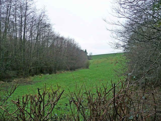
Cleave Wood, located in the county of Devon, is a picturesque forest renowned for its natural beauty and diverse wildlife. Spanning over an area of approximately 500 acres, this ancient woodland is a popular destination for nature lovers, hikers, and photographers alike.

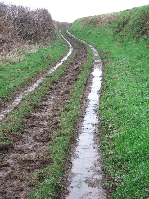
The wood is characterized by its dense canopy of towering trees, predominantly consisting of oak, beech, and ash. These majestic trees, some of which are hundreds of years old, create a serene and tranquil environment that is perfect for exploring and immersing oneself in nature. The forest floor is adorned with a rich carpet of wildflowers, ferns, and mosses, adding to the enchanting ambiance of the wood.

Cleave Wood is home to a wide variety of wildlife, making it a haven for animal enthusiasts. Visitors can catch glimpses of deer, foxes, badgers, and an array of bird species, including woodpeckers, owls, and warblers. The wood’s diverse ecosystem also supports a range of insects, amphibians, and small mammals, providing ample opportunities for wildlife observation and photography.

Several well-maintained footpaths wind their way through the wood, offering visitors the chance to explore its beauty at their own pace. These trails lead to scenic viewpoints, babbling brooks, and secluded picnic spots, allowing visitors to fully immerse themselves in the natural surroundings. Additionally, the wood is equipped with informative signposts and educational displays, providing insights into the local flora and fauna.

Cleave Wood, with its stunning landscapes and abundant biodiversity, is a true gem in the heart of Devon, offering an unforgettable experience for those seeking a connection with nature.

If you have any feedback on the listing, please let us know in the comments section below.
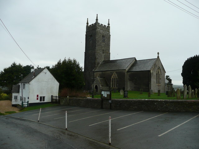
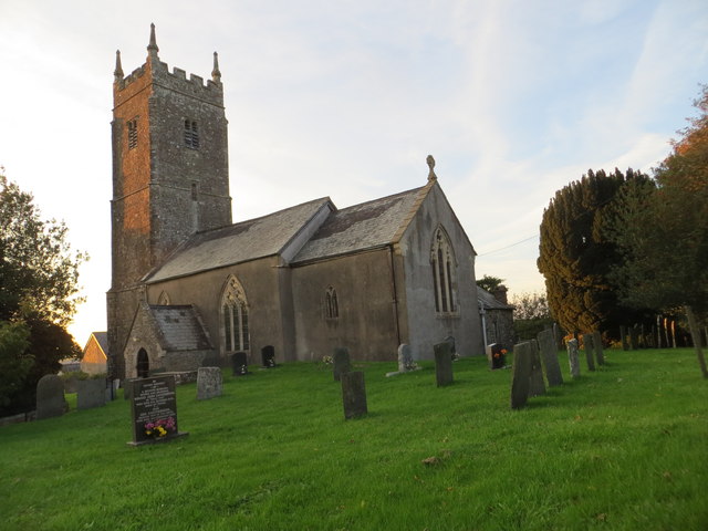
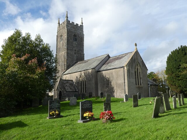
Cleave Wood Images

Images are sourced within 2km of 50.976875/-4.1527594 or Grid Reference SS4821. Thanks to Geograph Open Source API. All images are credited.

Higher Darracott The farmhouse, which gives the impression of being an old building, is on a bend on the lane between Huntshaw and Darracott Cross.
Higher Darracott
The farmhouse, which gives the impression of being an old building, is on a bend on the lane between Huntshaw and Darracott Cross.
Green lane to Delve's Grave Cross The other end of <a href="https://www.geograph.org.uk/photo/658522">SS5121 : Green lane to Higher Darracott</a>, close to Higher Darracott, and similar in character except for a steeper gradient - and the rain was heavier.
Green lane to Delve's Grave Cross
The other end of SS5121 : Green lane to Higher Darracott, close to Higher Darracott, and similar in character except for a steeper gradient - and the rain was heavier.
St. Mary Magdalene's church, Huntshaw Large church, tiny village.
St. Mary Magdalene's church, Huntshaw
Large church, tiny village.
Old school house, Huntshaw Right next to the church in this tiny village.
Old school house, Huntshaw
Right next to the church in this tiny village.
The Huntshaw valley Woodland in a steep-sided feature.
The Huntshaw valley
Woodland in a steep-sided feature.
The church of St Mary Magdalene at Huntshaw
Ordnance Survey Cut Mark This mark can be found on the wall of St Mary Magdalene Church.
For more detail see : <span class="nowrap"><a title="http://www.bench-marks.org.uk/bm52415" rel="nofollow ugc noopener" href="http://www.bench-marks.org.uk/bm52415">Link</a><img style="margin-left:2px;" alt="External link" title="External link - shift click to open in new window" src="https://s1.geograph.org.uk/img/external.png" width="10" height="10"/></span>
Ordnance Survey Cut Mark
This mark can be found on the wall of St Mary Magdalene Church. For more detail see : LinkExternal link
Priestacott Moor The view west over Priestacott Moor, viewed from Durracott Cross.
Priestacott Moor
The view west over Priestacott Moor, viewed from Durracott Cross.
Foxes' Cross The OS map shows Foxes' Cross in woodland though as can be seen the trees to the right have been felled.  Also it's not actually a cross, just a T-junction of roads.
Foxes' Cross
The OS map shows Foxes' Cross in woodland though as can be seen the trees to the right have been felled. Also it's not actually a cross, just a T-junction of roads.
Clearfell at Foxes' Cross Clearfell viewed from the road at Foxes' Cross.
Clearfell at Foxes' Cross
Clearfell viewed from the road at Foxes' Cross.
Huntshaw church Huntshaw church is dedicated to St Mary Magdalene.
Huntshaw church
Huntshaw church is dedicated to St Mary Magdalene.
Country road near Huntshaw
Ordnance Survey Cut Mark This OS cut mark can be found on the south face of St Mary Magdalene's Church. It marks a point 119.765m above mean sea level.
Ordnance Survey Cut Mark
This OS cut mark can be found on the south face of St Mary Magdalene's Church. It marks a point 119.765m above mean sea level.
Staines Trailers
Staines Trailers
Turning for Foxes Cross
Primrose Cottage
Primrose Cottage
The Old Schoolhouse, Huntshaw
The church of St. Mary Magdalene, Huntshaw
Show me another place!

Cleave Wood is located at Grid Ref: SS4821 (Lat: 50.976875, Lng: -4.1527594)

Administrative County: Devon

District: Torridge

Police Authority: Devon and Cornwall

What 3 Words

///lessening.pocket.version. Near Great Torrington, Devon

Related Wikis

Berry Castle, Huntshaw

Berry Castle is an Iron Age Hill fort in the civil parish of Huntshaw, close to Weare Giffard in Devon, England, to the north of Great Torrington. The...

Huntshaw

Huntshaw is a village and civil parish located 2.5 north north east of Great Torrington, in the Torridge district, in the county of Devon, England. In...

Beam, Great Torrington

Beam is an historic estate in the parish of Great Torrington, Devon, England. Beam House is situated about 1 1/2 miles north-west and downstream of that...

Torrington railway station

Torrington railway station was a railway station located in Great Torrington, Devon. It was closed by British Railways in 1965 as part of the Beeching...

Related Videos

Devon Holiday Cottage virtual tour video animation

Here's one of our viral eye-catching Holiday Cottage videos. 360 virtual tours can also be made into easily shareable videos great ...

Great Torrington, North Devon Area Guide

Great Torrington is a charming market town located in North Devon. Visitors to Great Torrington can enjoy a variety of local shops, ...

Walking In A Winter Wonderland Cover | Guitar

A frosty morning and a "beautiful sight." I hope you enjoy this frozen-themed cover! I film, record and edit everything myself but I ...

🎅 MERRY CHRISTMAS! It's the BIG 2019 REVIEW Video! From MEXICO to SERBIA and BEYOND!!

I have a new WEBSITE! Head over to https://www.thetaoofdavid.com/ for Travel, Digital Nomad and Teaching blog posts ...

Nearby Amenities

Located within 500m of 50.976875,-4.1527594
Power: pole
Source: bing
Lat/Long: 50.9793428/-4.1516251
Power: pole
Source: bing
Lat/Long: 50.978545/-4.1510873
Power: pole
Source: bing
Lat/Long: 50.977627/-4.1504597
Power: pole
Source: bing
Lat/Long: 50.9766974/-4.1498253
Power: pole
Source: bing
Lat/Long: 50.9756014/-4.1490837
Poles: bipole
Power: pole
Source: bing
Lat/Long: 50.9744977/-4.1483434
Power: pole
Source: bing
Lat/Long: 50.9738905/-4.147937
Direction: NE
Generator Method: photovoltaic
Generator Output Electricity: yes
Generator Solar Modules: 67
Generator Source: solar
Generator Type: solar_photovoltaic_panel
Location: roof
Power: generator
Lat/Long: 50.9795658/-4.1546077
Power: pole
Source: bing
Lat/Long: 50.9801365/-4.1558254
Power: pole
Source: bing
Lat/Long: 50.9809556/-4.1550207
Power: pole
Source: bing
Lat/Long: 50.9796654/-4.1576989
Power: pole
Source: bing
Lat/Long: 50.9796814/-4.156276
Power: pole
Source: bing
Lat/Long: 50.9806887/-4.1493022
Power: pole
Source: bing
Lat/Long: 50.979917/-4.1498186
Power: pole
Source: bing
Lat/Long: 50.9794062/-4.1501565
Power: pole
Source: bing
Lat/Long: 50.9786057/-4.1496898
Power: pole
Source: bing
Lat/Long: 50.9782469/-4.1494766
Power: pole
Source: bing
Lat/Long: 50.9778188/-4.1466951
Power: pole
Source: bing
Lat/Long: 50.9780451/-4.1469124
Power: pole
Source: bing
Lat/Long: 50.9782595/-4.1482602
Power: pole
Source: bing
Transformer: distribution
Lat/Long: 50.978273/-4.147135
Power: pole
Source: bing
Lat/Long: 50.9809995/-4.1527489
Power: pole
Source: bing
Lat/Long: 50.9804422/-4.1523586
Power: pole
Source: bing
Lat/Long: 50.9775553/-4.1569962
Power: pole
Source: bing
Lat/Long: 50.9767118/-4.1589931
Power: pole
Source: bing
Lat/Long: 50.9776575/-4.1592425
Power: pole
Source: bing
Lat/Long: 50.978387/-4.1590923
Power: pole
Source: bing
Lat/Long: 50.9781354/-4.1583735
Power: pole
Source: bing
Lat/Long: 50.9778753/-4.157652
The data included in this document is from www.openstreetmap.org. The data is made available under ODbL.

Have you been to Cleave Wood?

Leave your review of Cleave Wood below (or comments, questions and feedback).