Chester-Le-Street

Settlement in Durham

England

Chester-Le-Street

Benchmark on bridge Benchmark on left bottom of Lumley dene bridge
Benchmark on bridge Credit: Michael Gibson

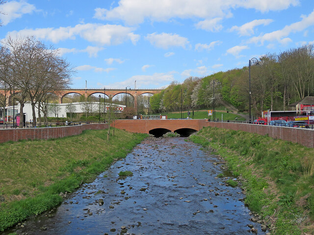
Chester-le-Street is a town located in the county of Durham, in the northeast of England. Situated approximately 10 miles south of Newcastle upon Tyne and 8 miles north of Durham city, it lies on the River Wear. The town is part of the ceremonial county of Durham and falls within the Chester-le-Street district.

With a population of around 37,000 people, Chester-le-Street has a rich history that dates back to Roman times. It is believed that a Roman fort once stood on the site of the present-day town. Throughout the centuries, it has served as an important center for coal mining and the manufacturing of textiles.

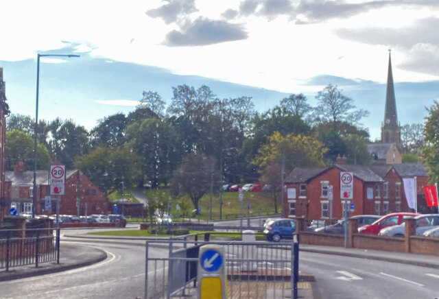
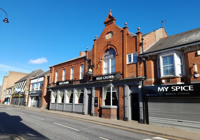
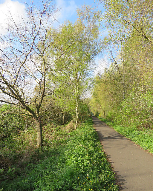
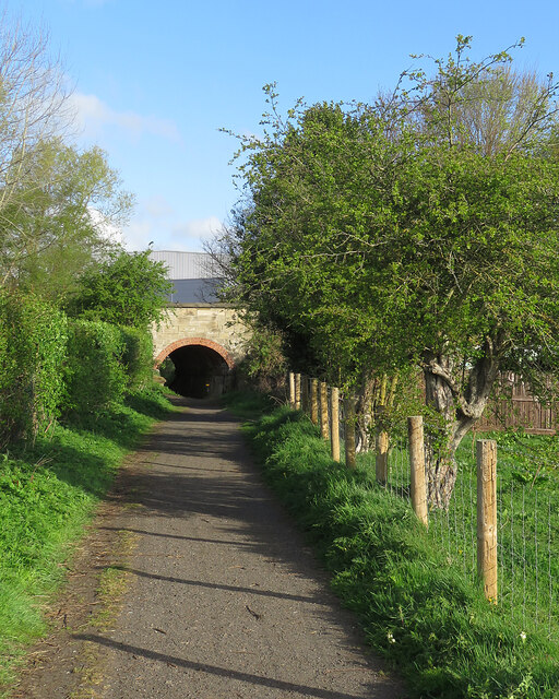
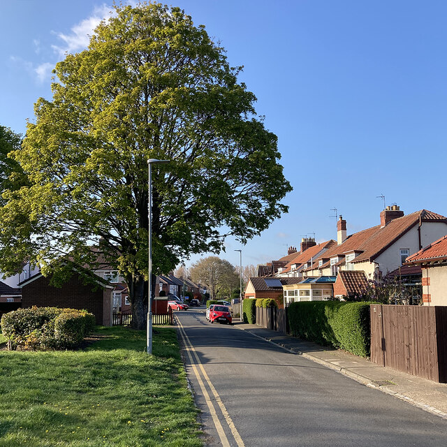
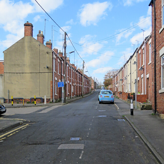
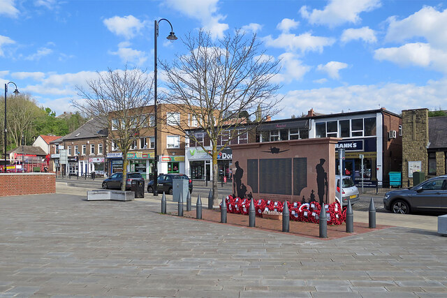
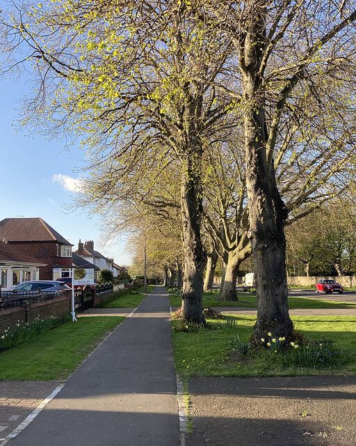
Today, Chester-le-Street is a bustling town that offers a mix of residential, commercial, and leisure facilities. The town center features a range of shops, restaurants, and pubs, catering to the needs of locals and visitors alike. The Riverside Park, located along the River Wear, provides a picturesque setting for outdoor activities, including walking, cycling, and picnicking.

The town is known for its strong sense of community and hosts various events throughout the year, such as the Lumiere Festival, which showcases stunning light installations. Chester-le-Street is also home to a number of notable landmarks, including the medieval St. Mary and St. Cuthbert Church, Lumley Castle, and Emirates Riverside cricket ground, which hosts international matches.

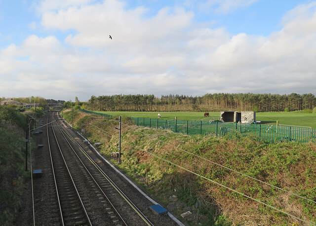
Connected by road and rail, Chester-le-Street offers easy access to nearby towns and cities. The town has several schools, healthcare facilities, and recreational amenities, making it an attractive place to live for families and professionals seeking a balance between urban convenience and a more relaxed lifestyle.

If you have any feedback on the listing, please let us know in the comments section below.

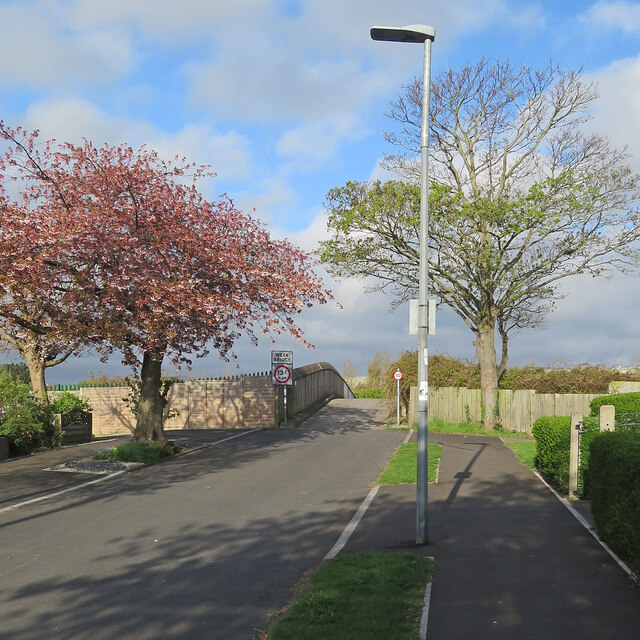
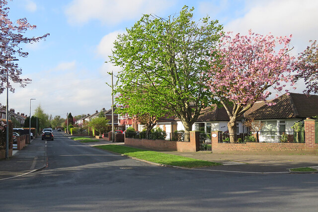
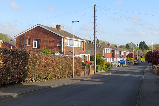
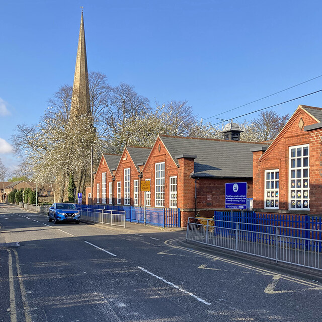
Chester-Le-Street Images

Images are sourced within 2km of 54.856619/-1.586706 or Grid Reference NZ2651. Thanks to Geograph Open Source API. All images are credited.

Benchmark on bridge Benchmark on left bottom of Lumley dene bridge
Benchmark on bridge
Benchmark on left bottom of Lumley dene bridge
Derelict Warehouse, Stella Gill This very long building was a National Coal Board warehouse. It was formerly part of the Stella Gill Coke Works and was retained when the remaining buildings on the site were demolished. It was subsequently used to store fertiliser but is now derelict and vandalised.
The trees in the foreground are on land previously occupied by railway tracks.
Derelict Warehouse, Stella Gill
This very long building was a National Coal Board warehouse. It was formerly part of the Stella Gill Coke Works and was retained when the remaining buildings on the site were demolished. It was subsequently used to store fertiliser but is now derelict and vandalised. The trees in the foreground are on land previously occupied by railway tracks.
Chester-le-Street
Chester-le-Street
Blind Lane Blind Lane is in Chester-Le-Street; it lies north of and parallel to the A693; the road is residential and has detached bungalows. Being a cul-de-sac it's aptly named - perhaps for that very reason.
Blind Lane
Blind Lane is in Chester-Le-Street; it lies north of and parallel to the A693; the road is residential and has detached bungalows. Being a cul-de-sac it's aptly named - perhaps for that very reason.
The High Crown Inn The High Crown Inn public house.
The High Crown Inn
The High Crown Inn public house.
Cycle path on former railway The Consett and Sunderland cycle path near South Pelaw, photographed just before eight o'clock on a fine spring morning.
Cycle path on former railway
The Consett and Sunderland cycle path near South Pelaw, photographed just before eight o'clock on a fine spring morning.
Footpath and former railway bridge The path leads to Drum Industrial Estate. The bridge carries the Consett and Sunderland cycle path.
Footpath and former railway bridge
The path leads to Drum Industrial Estate. The bridge carries the Consett and Sunderland cycle path.
The East Coast Main Line south of Low Flatts Road Bridge Looking south towards Chester-le-Street on a bright Sunday morning in late April.
The East Coast Main Line south of Low Flatts Road Bridge
Looking south towards Chester-le-Street on a bright Sunday morning in late April.
Chester-le-Street: on Low Flatts Road The end of a residential street on the northern fringe of Chester-le-Street. The road ends here and becomes a footpath beyond the bridge over the East Coast Main Line.
Chester-le-Street: on Low Flatts Road
The end of a residential street on the northern fringe of Chester-le-Street. The road ends here and becomes a footpath beyond the bridge over the East Coast Main Line.
Chester-le-Street: Lyndhurst Avenue South of Low Flatts Road, off North Road on the northern fringe of Chester-le-Street.
Chester-le-Street: Lyndhurst Avenue
South of Low Flatts Road, off North Road on the northern fringe of Chester-le-Street.
Chester-le-Street: Wear Lodge North of Low Flatts Road, off North Road on the northern fringe of Chester-le-Street.
Chester-le-Street: Wear Lodge
North of Low Flatts Road, off North Road on the northern fringe of Chester-le-Street.
Chester-le-Street: Church Chare on an April evening The tall spire of the parish church of St Mary and St Cuthbert and the red-brick Cestria Primary School.
Chester-le-Street: Church Chare on an April evening
The tall spire of the parish church of St Mary and St Cuthbert and the red-brick Cestria Primary School.
Chester-le-Street: Holmlands Park Looking towards Lindom Avenue and Roman Avenue on a bright April evening.
Chester-le-Street: Holmlands Park
Looking towards Lindom Avenue and Roman Avenue on a bright April evening.
Chester-le-Street: up Co-operative Street A steep terraced street west of Front Street.
Chester-le-Street: up Co-operative Street
A steep terraced street west of Front Street.
Chester-le-Street: flood alleviation Chester (or Cong) Burn was culverted under the Market Place in 1962. Following floods in 2012 this was identified as the main cause and a £6.2m scheme funded by Durham County Council, the Environment Agency and the European Union Regional Development Fund which uncovered the burn should reduce the risk of flooding from exceptional storms. A nearby information board explains that the flood walls north and south of the re-exposed burn increase its capacity, allowing it to hold more water to reduce the risk of flooding. The area has been landscaped to "create a more welcoming, park-like feel". The railway viaduct is in the distance to the left of centre.
Chester-le-Street: flood alleviation
Chester (or Cong) Burn was culverted under the Market Place in 1962. Following floods in 2012 this was identified as the main cause and a £6.2m scheme funded by Durham County Council, the Environment Agency and the European Union Regional Development Fund which uncovered the burn should reduce the risk of flooding from exceptional storms. A nearby information board explains that the flood walls north and south of the re-exposed burn increase its capacity, allowing it to hold more water to reduce the risk of flooding. The area has been landscaped to "create a more welcoming, park-like feel". The railway viaduct is in the distance to the left of centre.
Chester-le-Street: buses and the Market Tavern Newcastle and Sunderland buses at the stops on the south side of the Market Place. The railway viaduct shows above the No 8 bus.
Chester-le-Street: buses and the Market Tavern
Newcastle and Sunderland buses at the stops on the south side of the Market Place. The railway viaduct shows above the No 8 bus.
Chester-le-Street War Memorial On the north side of the Market Place.
Chester-le-Street War Memorial
On the north side of the Market Place.
North Road on an April evening On the northern edge of Chester-le-Street.
North Road on an April evening
On the northern edge of Chester-le-Street.
Show me another place!

Chester-Le-Street is located at Grid Ref: NZ2651 (Lat: 54.856619, Lng: -1.586706)

Unitary Authority: County Durham

Police Authority: Durham

What 3 Words

///logs.insist.films. Near Chester-le-Street, Co. Durham

Related Wikis

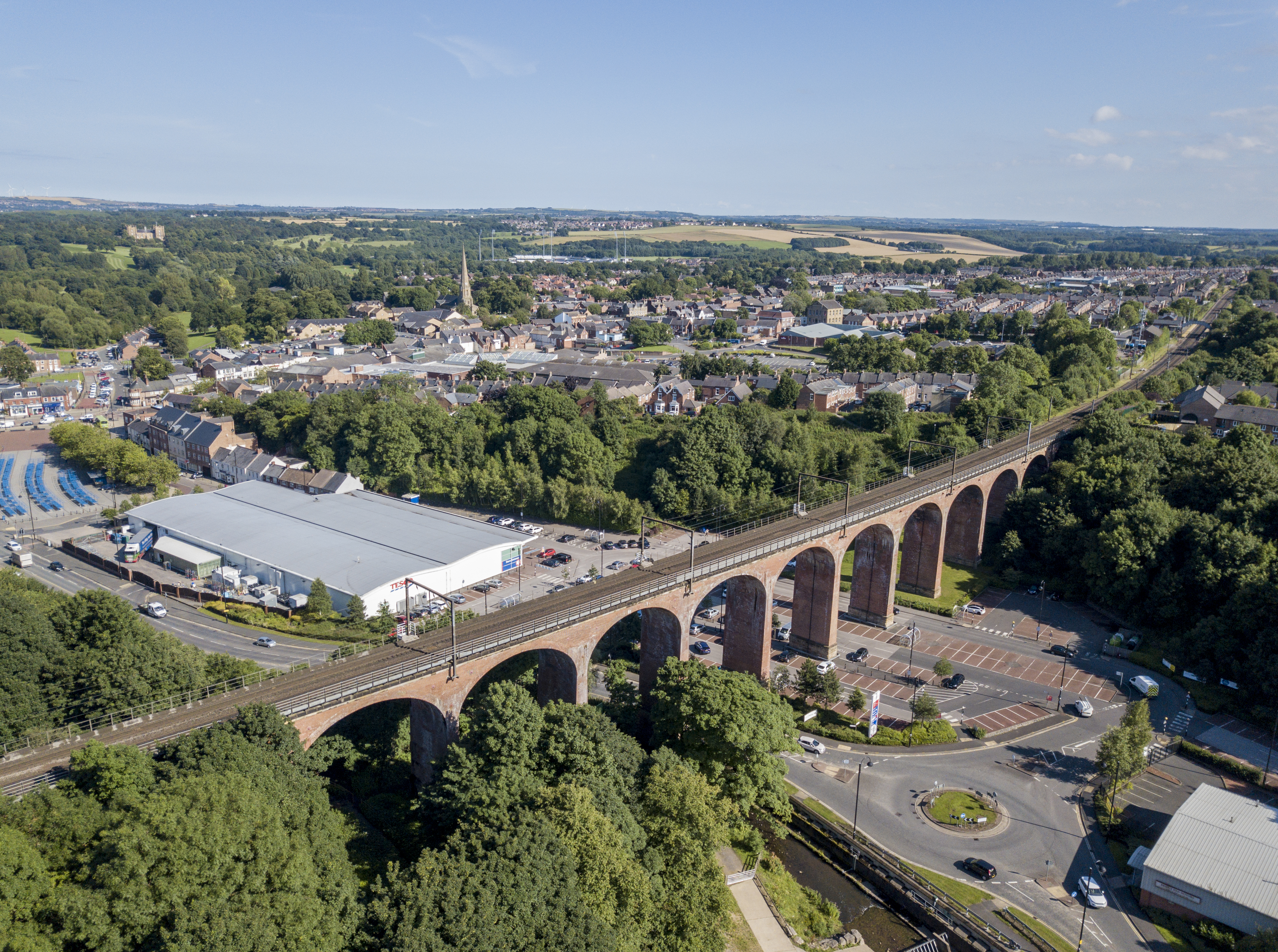
Chester Burn Viaduct

Chester Burn viaduct is a railway viaduct in Chester-le-Street, County Durham, England. It is an imposing structure, dominating the marketplace and north...

Chester-le-Street railway station

Chester-le-Street is a railway station on the East Coast Main Line, which runs between London King's Cross and Edinburgh Waverley. The station, situated...

Hermitage Academy, Chester-le-Street

Hermitage Academy (formerly The Hermitage School and The Hermitage Academy) is a mixed secondary school and sixth form located in Chester-le-Street, County...

Chester-le-Street (district)

Chester-le-Street was a local government district in County Durham, England. Its council was based in Chester-le-Street. Other places in the district...

Nearby Amenities

Located within 500m of 54.856619,-1.586706
Crossing
Crossing: zebra
Crossing Island: no
Kerb: lowered
Tactile Paving: yes
Lat/Long: 54.8541391/-1.5819063
Bus Stop
Spa Bridge
Bench: no
Bin: no
Bus: yes
Covered: no
Lit: yes
Naptan AtcoCode: 13002159D
Naptan Bearing: SE
Naptan CommonName: Spa Bridge
Naptan Indicator: south east bound
Naptan Landmark: Landmark not known
Naptan NaptanCode: duramdta
Naptan Notes: Approx 50m NW of Menceforth Cottages on Pelton Fell Road- Chester-Le-Street
Naptan Street: B6513 Pelton Fell Road
Naptan Verified: no
Public Transport: platform
Shelter: no
Source: naptan_import
Tactile Paving: no
Lat/Long: 54.8598425/-1.5832861
Bus Stop
Spa Bridge
Bench: yes
Bin: no
Bus: yes
Lit: yes
Naptan AtcoCode: 13002159H
Naptan Bearing: NW
Naptan CommonName: Spa Bridge
Naptan Indicator: north west bound
Naptan Landmark: Landmark not known
Naptan NaptanCode: duramdtd
Naptan Notes: On Pelton Fell Road- at junction with North Approach- Chester-Le-Street
Naptan Street: B6513 Pelton Fell Road
Naptan Verified: no
Public Transport: platform
Shelter: yes
Source: naptan_import
Tactile Paving: no
Lat/Long: 54.8598177/-1.5862479
Bus Stop
Glen Terrace
Bench: no
Bin: no
Bus: yes
Lit: yes
Naptan AtcoCode: 13002160D
Naptan Bearing: SE
Naptan CommonName: Glen Terrace
Naptan Indicator: south east bound
Naptan Landmark: Landmark not known
Naptan NaptanCode: duramdtg
Naptan Notes: In front of 19 Glen Terrace- Chester-Le-Street
Naptan Street: B6313Pelton Fell Road
Naptan Verified: yes
Public Transport: platform
Shelter: no
Source: naptan_import
Tactile Paving: no
Lat/Long: 54.8606824/-1.5888167
Bus Stop
Bullion Hall
Bench: yes
Bin: no
Bus: yes
Check Date Shelter: 2024-01-04
Lit: yes
Naptan AtcoCode: 13002181D
Naptan Bearing: SE
Naptan CommonName: Bullion Hall
Naptan Indicator: south east bound
Naptan Landmark: Landmark not known
Naptan NaptanCode: duramgpg
Naptan Notes: On South Approach- 10m NE junction with Lumley Close- round corner from Council Yard on Bullion
Naptan Street: South Approach
Naptan Verified: yes
Public Transport: platform
Shelter: yes
Source: naptan_import
Tactile Paving: no
Lat/Long: 54.8537741/-1.5812984
Bus Stop
Bullion Lane (Schools)
Bench: no
Bus: yes
Naptan AtcoCode: 13002182B
Naptan Bearing: NE
Naptan CommonName: Bullion Lane (Schools)
Naptan Indicator: north east bound
Naptan Landmark: Landmark not known
Naptan NaptanCode: duramgpm
Naptan Notes: In front of 47 Bullion Lane- nearly opposite Bullion Lane School- Chester-Le-Street
Naptan Street: Bullion Lane
Naptan Verified: yes
Public Transport: platform
Shelter: no
Source: naptan_import
Tactile Paving: no
Lat/Long: 54.8534633/-1.5849931
Bus Stop
Bullion Lane (Schools)
Bench: no
Bus: yes
Naptan AtcoCode: 13002182E
Naptan Bearing: S
Naptan CommonName: Bullion Lane (Schools)
Naptan Indicator: south bound
Naptan Landmark: Landmark not known
Naptan NaptanCode: duramgpt
Naptan Notes: In front of 19 Second Avenue- S of junction with Bullion Lane- Chester-Le-Street
Naptan Street: Second Avenue
Naptan Verified: yes
Public Transport: platform
Shelter: no
Source: naptan_import
Tactile Paving: no
Lat/Long: 54.8530692/-1.5853866
Bus Stop
Cragside
Bench: yes
Bin: yes
Bus: yes
Covered: yes
Lit: yes
Naptan AtcoCode: 13002195B
Naptan Bearing: NE
Naptan CommonName: Orbital Road-Cragside
Naptan Indicator: north east bound
Naptan Landmark: Landmark not known
Naptan NaptanCode: duramjdg
Naptan Notes: On main road- at entrance to walkway between 10 & 11 Lingholme- Chester-Le-Street
Naptan Street: Orbital Road
Naptan Verified: yes
Public Transport: platform
Shelter: yes
Source: naptan_import
Tactile Paving: no
Lat/Long: 54.8573831/-1.5929961
Bus Stop
Cragside
Bench: yes
Bin: no
Bus: yes
Covered: yes
Lit: yes
Naptan AtcoCode: 13002195F
Naptan Bearing: SW
Naptan CommonName: Orbital Road-Cragside
Naptan Indicator: south west bound
Naptan Landmark: Landmark not known
Naptan NaptanCode: duramjdj
Naptan Notes: On main road- SE of 14 Lingholme- Chester-Le-Street
Naptan Street: Orbital Road
Naptan Verified: yes
Public Transport: platform
Shelter: yes
Source: naptan_import
Tactile Paving: no
Lat/Long: 54.8570799/-1.5932799
Bus Stop
Wynyard
Bench: yes
Bin: yes
Bus: yes
Lit: yes
Naptan AtcoCode: 13002196C
Naptan Bearing: E
Naptan CommonName: Orbital Road-Wynyard
Naptan Indicator: east bound
Naptan Landmark: Landmark not known
Naptan NaptanCode: duramjdm
Naptan Notes: On nameless road- approx 50m E of junction with Wynard (road name)- Chester-Le-Street
Naptan Street: Orbital Road
Naptan Verified: yes
Public Transport: platform
Shelter: yes
Source: naptan_import
Tactile Paving: no
Lat/Long: 54.8579215/-1.5890739
Bus Stop
Wynyard
Bench: yes
Bin: no
Bus: yes
Lit: yes
Naptan AtcoCode: 13002196G
Naptan Bearing: W
Naptan CommonName: Orbital Road-Wynyard
Naptan Indicator: west bound
Naptan Landmark: Landmark not known
Naptan NaptanCode: duramjdp
Naptan Notes: On nameless road- approx 40m E of junction with Wynard (road name)- Chester-Le-Street
Naptan Street: Orbital Road
Naptan Verified: yes
Public Transport: platform
Shelter: no
Source: naptan_import
Tactile Paving: no
Lat/Long: 54.8577659/-1.5893724
Bus Stop
The Avenue-Sixth Avenue
Bench: no
Bin: yes
Bus: yes
Check Date Route Ref: 2021-05-23
Lit: yes
Naptan AtcoCode: 13002197A
Naptan Bearing: N
Naptan CommonName: The Avenue-Sixth Avenue
Naptan Indicator: north bound
Naptan Landmark: Landmark not known
Naptan NaptanCode: duramjdt
Naptan Notes: In front of 52 The Avenue- Chester-Le-Street
Naptan Street: The Avenue
Naptan Verified: yes
Public Transport: platform
Route Ref: 34;50;701D
Shelter: no
Source: naptan_import
Tactile Paving: no
Lat/Long: 54.8572059/-1.5862009
Bus Stop
The Avenue - Sixth Avenue
Bench: no
Bin: no
Bus: yes
Check Date Route Ref: 2021-05-23
Covered: no
Lit: yes
Naptan AtcoCode: 13002197D
Naptan Bearing: SE
Naptan CommonName: The Avenue-Sixth Avenue
Naptan Indicator: south east bound
Naptan Landmark: Landmark not known
Naptan NaptanCode: duramjdw
Naptan Notes: In front of boundary of 43 & 45 The Avenue- Chester-Le-Street
Naptan Street: The Avenue
Naptan Verified: yes
Public Transport: platform
Route Ref: none
Shelter: no
Source: naptan_import
Tactile Paving: no
Lat/Long: 54.8570697/-1.5857973
Bus Stop
The Avenue - The Green
Bench: no
Bin: no
Bus: yes
Check Date Route Ref: 2021-05-23
Lit: yes
Naptan AtcoCode: 13002198D
Naptan Bearing: SE
Naptan CommonName: The Avenue-The Green
Naptan Indicator: south east bound
Naptan Landmark: Landmark not known
Naptan NaptanCode: duramjga
Naptan Notes: On The Avenue- E of 25 The Green- Chester-Le-Street
Naptan Street: The Avenue
Naptan Verified: yes
Public Transport: platform
Route Ref: none
Shelter: no
Source: naptan_import
Tactile Paving: no
Lat/Long: 54.8557965/-1.5840034
Bus Stop
The Avenue - The Green
Bench: no
Bin: no
Bus: yes
Flag: no
Lit: yes
Naptan AtcoCode: 13002198H
Naptan Bearing: NW
Naptan CommonName: The Avenue-The Green
Naptan Indicator: north west bound
Naptan Landmark: Landmark not known
Naptan NaptanCode: duramjgd
Naptan Notes: On The Avenue- E of 23 The Green- Chester-Le-Street
Naptan Street: The Avenue
Naptan Verified: yes
Public Transport: platform
Shelter: no
Source: naptan_import
Tactile Paving: no
Lat/Long: 54.8559702/-1.5844532
Bus Stop
The Avenue - Sainsburys
Bench: no
Bin: no
Bus: yes
Check Date Route Ref: 2021-05-23
Lit: yes
Naptan AtcoCode: 13002199D
Naptan Bearing: SE
Naptan CommonName: The Avenue-The Crescent
Naptan Indicator: south east bound
Naptan Landmark: Landmark not known
Naptan NaptanCode: duramjgj
Naptan Notes: In front of 7 The Avenue- S of junction with The Crescent and Fife Avenue- Chester-Le-Street
Naptan Street: The Avenue
Naptan Verified: yes
Public Transport: platform
Route Ref: none
Shelter: no
Source: naptan_import
Tactile Paving: no
Lat/Long: 54.8543156/-1.5819625
Bus Stop
The Avenue - Sainsburys
Bench: yes
Bin: no
Bus: yes
Check Date Route Ref: 2021-05-23
Check Date Shelter: 2024-01-04
Lit: yes
Naptan AtcoCode: 13002199H
Naptan Bearing: NW
Naptan CommonName: The Avenue-The Crescent
Naptan Indicator: north west bound
Naptan Landmark: Landmark not known
Naptan NaptanCode: duramjgm
Naptan Notes: In front of 10 The Avenue- N of junction with The Crescent and Fife Avenue- Chester-Le-Street
Naptan Street: The Avenue
Naptan Verified: yes
Public Transport: platform
Route Ref: 34;50;701D
Shelter: yes
Source: naptan_import
Tactile Paving: no
Lat/Long: 54.8546864/-1.5826441
Noexit: yes
Lat/Long: 54.8538721/-1.5915651
Noexit: yes
Lat/Long: 54.8532596/-1.5816921
Crossing
Crossing: unmarked
Crossing Island: no
Tactile Paving: no
Lat/Long: 54.8541043/-1.5930238
Turning Circle
Lat/Long: 54.8553605/-1.579688
Noexit: yes
Lat/Long: 54.8572838/-1.5798744
Crossing
Crossing: unmarked
Crossing Island: no
Tactile Paving: no
Lat/Long: 54.8598426/-1.584821
Crossing
Crossing: unmarked
Crossing Island: no
Tactile Paving: no
Lat/Long: 54.8581394/-1.5873714
Crossing
Crossing: unmarked
Crossing Island: no
Kerb: lowered
Tactile Paving: no
Lat/Long: 54.8565112/-1.594138
Kerb: raised
Lat/Long: 54.8568567/-1.5884489
Crossing
Crossing: unmarked
Crossing Island: no
Kerb: lowered
Tactile Paving: no
Lat/Long: 54.8578833/-1.5924157
Addr City: Chester-le-Street
Addr Postcode: DH2 2EP
Addr Street: Gainford
Check Date: 2024-01-04
Disused Amenity: pub
Lat/Long: 54.8539473/-1.5918523
Gibside Store
Addr City: Chester-le-Street
Addr Housenumber: 50
Addr Postcode: DH2 2TT
Addr Street: Gibside
Brand: Go Local
Brand Wikidata: Q120634011
Check Date: 2024-01-04
Fhrs Id: 1583597
Opening Hours: 07:00-22:00
Shop: convenience
Source Addr: FHRS Open Data
Wheelchair: limited
Lat/Long: 54.8542252/-1.592275
Fast Food
Dhillons Golden Fry
Addr City: Chester-le-Street
Addr Housenumber: 45
Addr Postcode: DH2 2TT
Addr Street: Gibside
Check Date: 2024-01-04
Cuisine: fish_and_chips;kebab;burger;pizza
Drive Through: no
Fhrs Id: 557855
Indoor Seating: no
Level: 0
Opening Hours: Mo-Sa 11:00-14:00,16:00-23:00; Su 17:00-23:00
Outdoor Seating: no
Phone: +44 191 388 7800
Source Addr: FHRS Open Data
Takeaway: only
Lat/Long: 54.8544316/-1.5925605
Fast Food
Little Milan
Addr City: Chester-le-Street
Addr Housenumber: 48
Addr Postcode: DH2 2TT
Addr Street: Gibside
Drive Through: no
Phone: +44 191 3871020
Source Postcode: NSUL
Takeaway: only
Lat/Long: 54.8542867/-1.5925574
Post Box
Brand: Royal Mail
Brand Wikidata: Q638098
Collection Times: Mo-Fr 09:00, Sa 07:00
Operator: Royal Mail
Operator Wikidata: Q638098
Post Box Type: lamp
Ref: DH2 348D
Royal Cypher: EIIR
Royal Cypher Wikidata: Q33102113
Lat/Long: 54.8543366/-1.592275
Post Box
Collection Times: Mo-Fr 09:00, Sa 07:00
Operator: Royal Mail
Operator Wikidata: Q638098
Ref: DH2 48
Royal Cypher: EIIR
Royal Cypher Wikidata: Q33102113
Lat/Long: 54.8538374/-1.5817055
Simply You - Hair & Beauty
Addr City: Chester-le-Street
Check Date: 2024-01-04
Phone: +44 191 389 2255
Shop: hairdresser
Lat/Long: 54.854108/-1.5805238
Restaurant
Bombay Lounge
Addr City: Chester-le-Street
Addr Housename: Cookson House
Addr Postcode: DH2 2AN
Addr Street: Cookson Terrace
Check Date: 2024-01-04
Cuisine: indian
Fhrs Id: 1631530
Indoor Seating: yes
Opening Hours: 17:30-23:00
Outdoor Seating: no
Phone: +44 191 387 5454
Website: https://bombay-lounge.uk
Lat/Long: 54.8542653/-1.5805565
Give Way
Direction: forward
Lat/Long: 54.8544866/-1.5822082
Wheelchair: yes
Lat/Long: 54.8544521/-1.5819783
Atm
Brand: Sainsbury's Bank
Brand Wikidata: Q7400525
Brand Wikipedia: en:Sainsbury's Bank
Check Date: 2024-01-04
Drive Through: no
Indoor: no
Operator: Sainsbury's Bank
Operator Wikidata: Q7400525
Lat/Long: 54.8543229/-1.5818966
Waste Basket
Check Date: 2021-01-24
Lat/Long: 54.8544731/-1.5819889
Post Box
Check Date: 2021-01-24
Check Date Collection Times: 2024-01-02
Collection Times: Mo-Fr 09:00, Sa 07:00
Operator: Royal Mail
Operator Wikidata: Q638098
Post Box Type: lamp
Ref: DH2 207
Royal Cypher: EIIR
Royal Cypher Wikidata: Q33102113
Lat/Long: 54.8563446/-1.5803203
Fast Food
Welcome Inn
Addr City: Chester-le-Street
Addr Housename: Clandown House
Addr Postcode: DH2 2AT
Addr Street: Murray Road
Cuisine: chinese
Fhrs Id: 747781
Source Addr: FHRS Open Data
Wheelchair: no
Lat/Long: 54.8563932/-1.5806302
Handy Store
Addr City: Chester-le-Street
Addr Postcode: DH2 2AT
Addr Street: Murray Road
Check Date: 2024-01-02
Fhrs Id: 302774
Opening Hours: Mo-Sa 10:00-13:30,14:30-19:30; Su 10:00-14:00,16:00-19:30
Shop: convenience
Source Addr: FHRS Open Data
Wheelchair: no
Lat/Long: 54.8563982/-1.5808998
Post Box
Collection Times: Mo-Fr 09:00, Sa 07:00
Operator: Royal Mail
Operator Wikidata: Q638098
Ref: DH2 60
Royal Cypher: EIIR
Royal Cypher Wikidata: Q33102113
Lat/Long: 54.8578839/-1.5925407
Kerb: raised
Lat/Long: 54.8557678/-1.5901435
Entrance: home
Lat/Long: 54.8557409/-1.5893378
Entrance: home
Lat/Long: 54.855798/-1.5893378
Entrance: home
Lat/Long: 54.855854/-1.5893376
Entrance: home
Lat/Long: 54.8559126/-1.5893366
Entrance: home
Lat/Long: 54.8559687/-1.5893402
Entrance: home
Lat/Long: 54.8566283/-1.5895027
Entrance: home
Lat/Long: 54.8565623/-1.589503
Entrance: home
Lat/Long: 54.8564975/-1.5894785
Entrance: home
Lat/Long: 54.8564292/-1.5894788
Entrance: home
Lat/Long: 54.8563593/-1.5894577
Entrance: home
Lat/Long: 54.8562937/-1.589458
Entrance: home
Lat/Long: 54.8547893/-1.5903029
Entrance: home
Lat/Long: 54.8547014/-1.5902948
Entrance: home
Lat/Long: 54.8546743/-1.5902923
Entrance: home
Lat/Long: 54.8545901/-1.5902845
Entrance: home
Lat/Long: 54.8556305/-1.5902064
Entrance: home
Lat/Long: 54.8555711/-1.5902044
Entrance: home
Lat/Long: 54.855517/-1.5902025
Entrance: home
Lat/Long: 54.8554584/-1.5902005
Entrance: home
Lat/Long: 54.8554008/-1.5901985
Entrance: home
Lat/Long: 54.8553414/-1.5901964
Entrance: home
Lat/Long: 54.8546549/-1.5899879
Entrance: home
Lat/Long: 54.8545718/-1.5899818
Entrance: home
Lat/Long: 54.8545424/-1.5899797
Entrance: home
Lat/Long: 54.8544583/-1.5899735
Waste Basket
Check Date: 2021-02-15
Lat/Long: 54.8543239/-1.5924208
Waste Basket
Check Date: 2021-02-15
Lat/Long: 54.8543656/-1.5924208
Noexit: yes
Lat/Long: 54.8559359/-1.5903541
Addr City: Chester-le-Street
Addr Housenumber: 6
Addr Postcode: DH2 2BL
Addr Street: Eleventh Avenue
Entrance: home
Ref GB Uprn: 100110357477
Lat/Long: 54.8578373/-1.5869648
Addr City: Chester-le-Street
Addr Housenumber: 8
Addr Postcode: DH2 2BL
Addr Street: Eleventh Avenue
Entrance: home
Ref GB Uprn: 100110357478
Lat/Long: 54.8578511/-1.5870372
Addr City: Chester-le-Street
Addr Housenumber: 12
Addr Postcode: DH2 2BL
Addr Street: Eleventh Avenue
Entrance: home
Lat/Long: 54.8577555/-1.5871564
Addr City: Chester-le-Street
Addr Housenumber: 10
Addr Postcode: DH2 2BL
Addr Street: Eleventh Avenue
Entrance: home
Lat/Long: 54.8577943/-1.5871589
Addr City: Chester-le-Street
Addr Housenumber: 14
Addr Postcode: DH2 2BL
Addr Street: Eleventh Avenue
Entrance: home
Ref GB Uprn: 100110357481
Lat/Long: 54.8577319/-1.587201
Addr City: Chester-le-Street
Addr Housenumber: 16
Addr Postcode: DH2 2BL
Addr Street: Eleventh Avenue
Entrance: home
Ref GB Uprn: 100110357482
Lat/Long: 54.8577404/-1.5872623
Addr City: Chester-le-Street
Addr Housenumber: 18
Addr Postcode: DH2 2BL
Addr Street: Eleventh Avenue
Entrance: home
Ref GB Uprn: 100110357483
Lat/Long: 54.8576809/-1.587376
Addr City: Chester-le-Street
Addr Housenumber: 20
Addr Postcode: DH2 2BL
Addr Street: Eleventh Avenue
Entrance: home
Ref GB Uprn: 100110357484
Lat/Long: 54.857639/-1.5873751
Addr City: Chester-le-Street
Addr Housenumber: 26
Addr Postcode: DH2 2BL
Addr Street: Eleventh Avenue
Entrance: home
Ref GB Uprn: 100110357487
Lat/Long: 54.8575808/-1.5877331
Addr City: Chester-le-Street
Addr Housenumber: 28
Addr Postcode: DH2 2BL
Addr Street: Eleventh Avenue
Entrance: home
Ref GB Uprn: 100110357488
Lat/Long: 54.8576018/-1.5877858
Addr City: Chester-le-Street
Addr Housenumber: 30
Addr Postcode: DH2 2BL
Addr Street: Eleventh Avenue
Entrance: home
Ref GB Uprn: 100110357489
Lat/Long: 54.8575788/-1.5879202
Addr City: Chester-le-Street
Addr Housenumber: 32
Addr Postcode: DH2 2BL
Addr Street: Eleventh Avenue
Entrance: home
Ref GB Uprn: 100110357490
Lat/Long: 54.8575495/-1.5879475
Addr City: Chester-le-Street
Addr Housenumber: 34
Addr Postcode: DH2 2BL
Addr Street: Eleventh Avenue
Entrance: home
Ref GB Uprn: 100110357491
Lat/Long: 54.8575474/-1.5879965
Addr City: Chester-le-Street
Addr Housenumber: 36
Addr Postcode: DH2 2BL
Addr Street: Eleventh Avenue
Entrance: home
Ref GB Uprn: 100110357492
Lat/Long: 54.8575708/-1.5880353
Addr City: Chester-le-Street
Addr Housenumber: 38
Addr Postcode: DH2 2BL
Addr Street: Eleventh Avenue
Entrance: home
Ref GB Uprn: 100110357493
Lat/Long: 54.8575562/-1.5881925
Addr City: Chester-le-Street
Addr Housenumber: 40
Addr Postcode: DH2 2BL
Addr Street: Eleventh Avenue
Entrance: home
Ref GB Uprn: 100110357494
Lat/Long: 54.8575251/-1.5882262
Entrance: home
Lat/Long: 54.8551816/-1.5892073
Entrance: home
Lat/Long: 54.8551121/-1.589201
Entrance: home
Lat/Long: 54.8550418/-1.5891947
Entrance: home
Lat/Long: 54.8544011/-1.5896336
Entrance: home
Lat/Long: 54.8549006/-1.5891463
Entrance: home
Lat/Long: 54.8548126/-1.5891387
Entrance: home
Lat/Long: 54.8547497/-1.5891334
Entrance: home
Lat/Long: 54.8547195/-1.5891308
Entrance: home
Lat/Long: 54.8546356/-1.5891236
Addr City: Chester-le-Street
Addr Housenumber: 52
Addr Postcode: DH2 2AY
Addr Street: Jacques Terrace
Entrance: home
Source Postcode: NSUL
Lat/Long: 54.8586168/-1.5822534
Addr City: Chester-le-Street
Addr Housenumber: 53
Addr Postcode: DH2 2AY
Addr Street: Jacques Terrace
Entrance: home
Source Postcode: NSUL
Lat/Long: 54.8585913/-1.582318
Addr City: Chester-le-Street
Addr Housenumber: 54
Addr Postcode: DH2 2AY
Addr Street: Jacques Terrace
Entrance: home
Source Postcode: NSUL
Lat/Long: 54.8584901/-1.5822921
Addr City: Chester-le-Street
Addr Housenumber: 55
Addr Postcode: DH2 2AY
Addr Street: Jacques Terrace
Entrance: home
Source Postcode: NSUL
Lat/Long: 54.8584777/-1.5822168
Addr City: Chester-le-Street
Addr Housenumber: 26
Addr Postcode: DH2 2BW
Addr Street: Twelfth Avenue
Entrance: home
Source Postcode: CodePoint Open
Lat/Long: 54.8584915/-1.5832919
Addr City: Chester-le-Street
Addr Housenumber: 27
Addr Postcode: DH2 2BW
Addr Street: Twelfth Avenue
Entrance: home
Source Postcode: CodePoint Open
Lat/Long: 54.8585284/-1.5831427
Addr City: Chester-le-Street
Addr Housenumber: 28
Addr Postcode: DH2 2BW
Addr Street: Twelfth Avenue
Entrance: home
Source Postcode: CodePoint Open
Lat/Long: 54.8584975/-1.5830885
Addr City: Chester-le-Street
Addr Housenumber: 25
Addr Postcode: DH2 2BW
Addr Street: Twelfth Avenue
Entrance: home
Source Postcode: CodePoint Open
Lat/Long: 54.858445/-1.5832971
Addr City: Chester-le-Street
Addr Housenumber: 6
Addr Postcode: DH2 2BW
Addr Street: Twelfth Avenue
Entrance: home
Source Postcode: CodePoint Open
Lat/Long: 54.8579889/-1.5855571
Addr City: Chester-le-Street
Addr Housenumber: 7
Addr Postcode: DH2 2BW
Addr Street: Twelfth Avenue
Entrance: home
Source Postcode: CodePoint Open
Lat/Long: 54.8580111/-1.5853953
Addr City: Chester-le-Street
Addr Housenumber: 16
Addr Postcode: DH2 2BW
Addr Street: Twelfth Avenue
Entrance: home
Source Postcode: CodePoint Open
Lat/Long: 54.8582102/-1.5844109
Addr City: Chester-le-Street
Addr Housenumber: 18
Addr Postcode: DH2 2BW
Addr Street: Twelfth Avenue
Entrance: home
Source Postcode: CodePoint Open
Lat/Long: 54.858215/-1.5842062
Addr City: Chester-le-Street
Addr Housenumber: 17
Addr Postcode: DH2 2BW
Addr Street: Twelfth Avenue
Entrance: home
Source Postcode: CodePoint Open
Lat/Long: 54.8582447/-1.5842624
Addr City: Chester-le-Street
Addr Housenumber: 15
Addr Postcode: DH2 2BW
Addr Street: Twelfth Avenue
Entrance: home
Source Postcode: CodePoint Open
Lat/Long: 54.8581646/-1.5844141
Addr City: Chester-le-Street
Addr Housenumber: 8
Addr Postcode: DH2 2BW
Addr Street: Twelfth Avenue
Entrance: home
Source Postcode: CodePoint Open
Lat/Long: 54.8579745/-1.5853523
Addr City: Chester-le-Street
Addr Housenumber: 5
Addr Postcode: DH2 2BW
Addr Street: Twelfth Avenue
Entrance: home
Source Postcode: CodePoint Open
Lat/Long: 54.8579436/-1.5855719
Priority: forward
Traffic Calming: choker
Lat/Long: 54.8555668/-1.5837953
Check Date: 2021-04-15
Traffic Calming: bump
Lat/Long: 54.8561112/-1.5839142
Check Date: 2021-04-15
Traffic Calming: bump
Lat/Long: 54.8564887/-1.5831215
Entrance: main
Lat/Long: 54.854438/-1.5819899
Generator Method: photovoltaic
Generator Orientation: 260
Generator Output Electricity: yes
Generator Solar Modules: 8
Generator Source: solar
Generator Type: solar_photovoltaic_panel
Location: roof
Power: generator
Lat/Long: 54.8537164/-1.5824842
Generator Method: photovoltaic
Generator Orientation: 80
Generator Output Electricity: yes
Generator Solar Modules: 8
Generator Source: solar
Generator Type: solar_photovoltaic_panel
Location: roof
Power: generator
Lat/Long: 54.8537257/-1.5824199
Turning Circle
Lat/Long: 54.8549284/-1.5838967
Noexit: yes
Lat/Long: 54.8571147/-1.5796843
Generator Source: solar
Generator Type: solar_photovoltaic_panel
Location: roof
Power: generator
Lat/Long: 54.8527559/-1.5894663
Generator Source: solar
Generator Type: solar_photovoltaic_panel
Location: roof
Power: generator
Lat/Long: 54.8534191/-1.5866393
Generator Source: solar
Generator Type: solar_photovoltaic_panel
Location: roof
Power: generator
Lat/Long: 54.8605845/-1.5864234
Noexit: yes
Lat/Long: 54.8573057/-1.5895193
Generator Source: solar
Generator Type: solar_photovoltaic_panel
Location: roof
Power: generator
Lat/Long: 54.8558077/-1.5913425
Generator Source: solar
Generator Type: solar_photovoltaic_panel
Location: roof
Power: generator
Lat/Long: 54.8540699/-1.5883881
Generator Source: solar
Generator Type: solar_photovoltaic_panel
Location: roof
Power: generator
Lat/Long: 54.8552256/-1.5884243
Generator Source: solar
Generator Type: solar_photovoltaic_panel
Location: roof
Power: generator
Lat/Long: 54.8556861/-1.5884364
Generator Source: solar
Generator Type: solar_photovoltaic_panel
Location: roof
Power: generator
Lat/Long: 54.8556772/-1.588541
Generator Source: solar
Generator Type: solar_photovoltaic_panel
Location: roof
Power: generator
Lat/Long: 54.8561227/-1.5891512
Generator Source: solar
Generator Type: solar_photovoltaic_panel
Location: roof
Power: generator
Lat/Long: 54.857283/-1.5919514
Generator Source: solar
Generator Type: solar_photovoltaic_panel
Location: roof
Power: generator
Lat/Long: 54.857486/-1.5909724
Noexit: yes
Lat/Long: 54.8530933/-1.590613
Addr City: Chester-le-Street
Addr Housenumber: 18
Addr Postcode: DH2 2UE
Addr Street: Alpine Court
Entrance: home
Source Postcode: CodePoint Open
Lat/Long: 54.8570851/-1.5798211
Addr City: Chester-le-Street
Addr Housenumber: 17
Addr Postcode: DH2 2UE
Addr Street: Alpine Court
Entrance: home
Source Postcode: CodePoint Open
Lat/Long: 54.8570708/-1.5798344
Addr City: Chester-le-Street
Addr Housenumber: 16
Addr Postcode: DH2 2UE
Addr Street: Alpine Court
Entrance: home
Source Postcode: CodePoint Open
Lat/Long: 54.8570277/-1.5798744
Addr City: Chester-le-Street
Addr Housenumber: 15
Addr Postcode: DH2 2UE
Addr Street: Alpine Court
Entrance: home
Source Postcode: CodePoint Open
Lat/Long: 54.857015/-1.5798862
Addr City: Chester-le-Street
Addr Housenumber: 14
Addr Postcode: DH2 2UE
Addr Street: Alpine Court
Entrance: home
Source Postcode: CodePoint Open
Lat/Long: 54.8569726/-1.5799256
Addr City: Chester-le-Street
Addr Housenumber: 13
Addr Postcode: DH2 2UE
Addr Street: Alpine Court
Entrance: home
Source Postcode: CodePoint Open
Lat/Long: 54.8569633/-1.5799342
Addr City: Chester-le-Street
Addr Housenumber: 12
Addr Postcode: DH2 2UE
Addr Street: Alpine Court
Entrance: home
Source Postcode: CodePoint Open
Lat/Long: 54.8569214/-1.579973
Addr City: Chester-le-Street
Addr Housenumber: 11
Addr Postcode: DH2 2UE
Addr Street: Alpine Court
Entrance: home
Source Postcode: CodePoint Open
Lat/Long: 54.8569117/-1.579982
Noexit: yes
Lat/Long: 54.8569379/-1.5796441
Generator Source: solar
Generator Type: solar_photovoltaic_panel
Location: roof
Power: generator
Lat/Long: 54.8572752/-1.5814552
Addr City: Chester-le-Street
Addr Housenumber: 51
Addr Postcode: DH2 2AY
Addr Street: Jacques Terrace
Entrance: home
Source Postcode: CodePoint Open
Lat/Long: 54.8584606/-1.5817848
Addr City: Chester-le-Street
Addr Housenumber: 50
Addr Postcode: DH2 2AY
Addr Street: Jacques Terrace
Entrance: home
Source Postcode: CodePoint Open
Lat/Long: 54.8584537/-1.5817046
Addr City: Chester-le-Street
Addr Housenumber: 49
Addr Postcode: DH2 2AY
Addr Street: Jacques Terrace
Entrance: home
Source Postcode: CodePoint Open
Lat/Long: 54.8583573/-1.5816799
Addr City: Chester-le-Street
Addr Housenumber: 48
Addr Postcode: DH2 2AY
Addr Street: Jacques Terrace
Entrance: home
Source Postcode: CodePoint Open
Lat/Long: 54.8583354/-1.5817498
Addr City: Chester-le-Street
Addr Housenumber: 35
Addr Postcode: DH2 2AY
Addr Street: Jacques Terrace
Entrance: home
Source Postcode: CodePoint Open
Lat/Long: 54.8575018/-1.5814293
Addr City: Chester-le-Street
Addr Housenumber: 34
Addr Postcode: DH2 2AY
Addr Street: Jacques Terrace
Entrance: home
Source Postcode: CodePoint Open
Lat/Long: 54.8575438/-1.5813963
Addr City: Chester-le-Street
Addr Housenumber: 33
Addr Postcode: DH2 2AY
Addr Street: Jacques Terrace
Entrance: home
Source Postcode: CodePoint Open
Lat/Long: 54.8575427/-1.5812192
Addr City: Chester-le-Street
Addr Housenumber: 32
Addr Postcode: DH2 2AY
Addr Street: Jacques Terrace
Entrance: home
Source Postcode: CodePoint Open
Lat/Long: 54.857501/-1.581189
Generator Source: solar
Generator Type: solar_photovoltaic_panel
Location: roof
Power: generator
Lat/Long: 54.8535913/-1.5897077
Generator Source: solar
Generator Type: solar_photovoltaic_panel
Location: roof
Power: generator
Lat/Long: 54.8566646/-1.5899465
Generator Source: solar
Generator Type: solar_photovoltaic_panel
Location: roof
Power: generator
Lat/Long: 54.8573601/-1.587393
Generator Source: solar
Generator Type: solar_photovoltaic_panel
Location: roof
Power: generator
Lat/Long: 54.8573331/-1.5875298
Noexit: yes
Lat/Long: 54.8567762/-1.5805037
Noexit: yes
Lat/Long: 54.856892/-1.5804783
Crossing
Crossing: unmarked
Tactile Paving: yes
Lat/Long: 54.8588647/-1.5799539
Crossing
Crossing: unmarked
Tactile Paving: yes
Lat/Long: 54.8588159/-1.58
Crossing
Crossing: unmarked
Tactile Paving: yes
Lat/Long: 54.858591/-1.579727
Crossing
Crossing: unmarked
Tactile Paving: yes
Lat/Long: 54.8586021/-1.5798356
Generator Source: solar
Generator Type: solar_photovoltaic_panel
Location: roof
Power: generator
Lat/Long: 54.8583247/-1.5826998
Waste Basket
Waste: dog_excrement
Lat/Long: 54.8581007/-1.58137
Generator Source: solar
Generator Type: solar_photovoltaic_panel
Location: roof
Power: generator
Lat/Long: 54.8528717/-1.5825194
Waste Basket
Waste: dog_excrement
Lat/Long: 54.855377/-1.5923916
Waste Basket
Waste: trash
Lat/Long: 54.8603621/-1.5863649
Waste Basket
Waste: dog_excrement
Lat/Long: 54.8569818/-1.5863169
Bench
Backrest: yes
Material: plastic
Lat/Long: 54.8599223/-1.5848928
Waste Basket
Waste: trash
Lat/Long: 54.8594186/-1.5822258
Waste Basket
Waste: trash
Lat/Long: 54.8599234/-1.5849946
Noexit: yes
Lat/Long: 54.8585173/-1.5906606
Generator Source: solar
Generator Type: solar_photovoltaic_panel
Location: roof
Power: generator
Lat/Long: 54.8588122/-1.5933555
Noexit: yes
Lat/Long: 54.8581429/-1.5921271
Generator Source: solar
Generator Type: solar_photovoltaic_panel
Location: roof
Power: generator
Lat/Long: 54.8590584/-1.5893403
Generator Source: solar
Generator Type: solar_photovoltaic_panel
Location: roof
Power: generator
Lat/Long: 54.858669/-1.5875123
Noexit: yes
Lat/Long: 54.8532253/-1.5896139
Noexit: yes
Lat/Long: 54.8561752/-1.5930585
Access: yes
Barrier: stile
Material: wood
Stile: stepover
Lat/Long: 54.8585648/-1.586341
Barrier: bollard
Bollard: fixed
Lat/Long: 54.8564001/-1.5862332
Barrier: bollard
Bollard: fixed
Lat/Long: 54.8557425/-1.5864906
Street Lamp
Lat/Long: 54.860818/-1.585445
Street Lamp
Lat/Long: 54.858574/-1.5918971
Street Lamp
Lat/Long: 54.8587662/-1.5918025
Street Lamp
Lat/Long: 54.8587991/-1.5904272
Street Lamp
Lat/Long: 54.8589345/-1.5900055
Street Lamp
Lat/Long: 54.8590264/-1.590222
Street Lamp
Lat/Long: 54.8589936/-1.5909469
Street Lamp
Lat/Long: 54.8590164/-1.587633
Street Lamp
Lat/Long: 54.8590387/-1.5881252
Street Lamp
Lat/Long: 54.8588944/-1.5884176
Street Lamp
Lat/Long: 54.8590573/-1.5885483
Street Lamp
Lat/Long: 54.858894/-1.5889158
Street Lamp
Lat/Long: 54.8587269/-1.5893718
Street Lamp
Lat/Long: 54.8583301/-1.5887334
Street Lamp
Lat/Long: 54.8585601/-1.5885651
Street Lamp
Lat/Long: 54.8585462/-1.588144
Street Lamp
Lat/Long: 54.8582483/-1.5876304
Street Lamp
Lat/Long: 54.8582135/-1.5880756
Street Lamp
Lat/Long: 54.8581773/-1.588494
Street Lamp
Lat/Long: 54.8581263/-1.5889996
Street Lamp
Lat/Long: 54.8581333/-1.5894201
Street Lamp
Lat/Long: 54.8581348/-1.5898492
Street Lamp
Lat/Long: 54.8580954/-1.5903293
Street Lamp
Lat/Long: 54.8580472/-1.5908758
Street Lamp
Lat/Long: 54.8580194/-1.5913264
Street Lamp
Lat/Long: 54.8579704/-1.5917355
Street Lamp
Lat/Long: 54.8574462/-1.5934427
Street Lamp
Lat/Long: 54.8576589/-1.5930129
Street Lamp
Lat/Long: 54.857904/-1.5922136
Street Lamp
Lat/Long: 54.8583189/-1.5922156
Street Lamp
Lat/Long: 54.8582213/-1.593086
Street Lamp
Lat/Long: 54.8579395/-1.5937015
Street Lamp
Lat/Long: 54.8572231/-1.5942467
Street Lamp
Lat/Long: 54.856621/-1.5941273
Street Lamp
Lat/Long: 54.8570444/-1.5936231
Street Lamp
Lat/Long: 54.8572077/-1.5928198
Street Lamp
Lat/Long: 54.8572185/-1.5933153
Street Lamp
Lat/Long: 54.8573397/-1.5922163
Street Lamp
Lat/Long: 54.8575091/-1.5925442
Street Lamp
Ref: 8098
Lat/Long: 54.857535/-1.5920379
Street Lamp
Lat/Long: 54.8576732/-1.5917147
Street Lamp
Lat/Long: 54.8577179/-1.5913244
Street Lamp
Lat/Long: 54.857765/-1.5909369
Street Lamp
Lat/Long: 54.8578052/-1.5905406
Street Lamp
Lat/Long: 54.8578391/-1.5901952
Street Lamp
Ref: 8105
Lat/Long: 54.8578638/-1.5898546
Street Lamp
Ref: 8106
Lat/Long: 54.8578766/-1.5894388
Street Lamp
Lat/Long: 54.8578067/-1.5889185
Street Lamp
Lat/Long: 54.8578307/-1.5885396
Street Lamp
Lat/Long: 54.8578893/-1.588138
Street Lamp
Lat/Long: 54.8579739/-1.5877537
Street Lamp
Lat/Long: 54.8580862/-1.5873843
Street Lamp
Lat/Long: 54.858195/-1.5866413
Street Lamp
Lat/Long: 54.8581661/-1.5868606
Street Lamp
Lat/Long: 54.8581707/-1.5871342
Street Lamp
Lat/Long: 54.8559845/-1.5938886
Street Lamp
Lat/Long: 54.8563161/-1.5936513
Street Lamp
Lat/Long: 54.8563249/-1.5932938
Street Lamp
Lat/Long: 54.8563288/-1.5928647
Street Lamp
Lat/Long: 54.8563222/-1.5925066
Street Lamp
Lat/Long: 54.8568132/-1.5924047
Street Lamp
Lat/Long: 54.8565087/-1.5924557
Street Lamp
Lat/Long: 54.8566511/-1.5926729
Street Lamp
Lat/Long: 54.8569572/-1.5928171
Street Lamp
Lat/Long: 54.8568464/-1.5939061
Street Lamp
Lat/Long: 54.8563921/-1.5943084
Street Lamp
Lat/Long: 54.8561929/-1.5940831
Street Lamp
Lat/Long: 54.8559274/-1.5941763
Street Lamp
Lat/Long: 54.855678/-1.5941951
Grit Bin
Operator: Durham County Council
Operator Type: government
Operator Wikidata: Q5316492
Ref: CH068
Lat/Long: 54.8609135/-1.587362
Generator Source: solar
Generator Type: solar_photovoltaic_panel
Location: roof
Power: generator
Lat/Long: 54.8539395/-1.5854287
Give Way
Direction: backward
Lat/Long: 54.8575819/-1.5922308
Give Way
Direction: backward
Lat/Long: 54.8577379/-1.5903983
Give Way
Direction: backward
Lat/Long: 54.8582767/-1.5869459
Give Way
Direction: forward
Lat/Long: 54.8554596/-1.5835702
Give Way
Direction: forward
Lat/Long: 54.8545373/-1.5824394
Give Way
Direction: forward
Lat/Long: 54.8539034/-1.5815302
Give Way
Direction: backward
Lat/Long: 54.8539283/-1.5817611
Give Way
Direction: backward
Lat/Long: 54.8533133/-1.585493
Give Way
Direction: forward
Lat/Long: 54.8534038/-1.5854372
Traffic Calming: cushion
Lat/Long: 54.8533118/-1.5860055
Traffic Calming: cushion
Lat/Long: 54.8532611/-1.586808
Traffic Calming: cushion
Lat/Long: 54.8534838/-1.58464
Traffic Calming: cushion
Lat/Long: 54.8538333/-1.5824821
Traffic Calming: cushion
Lat/Long: 54.8536785/-1.5835731
Street Lamp
Lat/Long: 54.856062/-1.5901984
Street Lamp
Lat/Long: 54.8561027/-1.5897325
Street Lamp
Lat/Long: 54.8561458/-1.5893099
Street Lamp
Lat/Long: 54.8564532/-1.5888141
Street Lamp
Lat/Long: 54.8564125/-1.5893557
Street Lamp
Lat/Long: 54.8564547/-1.5871487
Street Lamp
Lat/Long: 54.8564255/-1.5876378
Street Lamp
Lat/Long: 54.8563833/-1.5882301
Street Lamp
Lat/Long: 54.8566012/-1.5884223
Street Lamp
Lat/Long: 54.8576772/-1.5865256
Street Lamp
Ref: 1277
Lat/Long: 54.857795/-1.587251
Street Lamp
Ref: 1328
Lat/Long: 54.8576805/-1.5886078
Street Lamp
Lat/Long: 54.8576312/-1.5891577
Street Lamp
Lat/Long: 54.8575364/-1.5902
Street Lamp
Lat/Long: 54.8570667/-1.5907782
Street Lamp
Lat/Long: 54.8569656/-1.5906759
Street Lamp
Lat/Long: 54.8569187/-1.5910494
Street Lamp
Lat/Long: 54.8567099/-1.5912806
Street Lamp
Lat/Long: 54.8555276/-1.592392
Street Lamp
Lat/Long: 54.8550382/-1.5923205
Street Lamp
Lat/Long: 54.8548936/-1.5918812
Street Lamp
Lat/Long: 54.8547897/-1.5922273
Street Lamp
Lat/Long: 54.854519/-1.5920839
Street Lamp
Lat/Long: 54.8543151/-1.5919985
Street Lamp
Lat/Long: 54.8543079/-1.5915552
Street Lamp
Lat/Long: 54.8545507/-1.5916774
Street Lamp
Lat/Long: 54.8548222/-1.5906509
Street Lamp
Lat/Long: 54.8549013/-1.5909853
Street Lamp
Lat/Long: 54.8549774/-1.5914609
Street Lamp
Lat/Long: 54.8557657/-1.5932682
Street Lamp
Lat/Long: 54.8553524/-1.5928179
Street Lamp
Lat/Long: 54.8553318/-1.5932871
Street Lamp
Lat/Long: 54.8550377/-1.592986
Street Lamp
Lat/Long: 54.855111/-1.5932863
Street Lamp
Lat/Long: 54.8561116/-1.5933916
Street Lamp
Lat/Long: 54.8559972/-1.5930475
Street Lamp
Lat/Long: 54.8563194/-1.5920397
Street Lamp
Lat/Long: 54.8560685/-1.5924732
Street Lamp
Lat/Long: 54.8567681/-1.5894257
Street Lamp
Lat/Long: 54.8561468/-1.5907482
Street Lamp
Lat/Long: 54.8560314/-1.5908921
Street Lamp
Lat/Long: 54.8562445/-1.591635
Street Lamp
Lat/Long: 54.8565313/-1.5915826
Street Lamp
Lat/Long: 54.8565313/-1.5912682
Street Lamp
Lat/Long: 54.8562325/-1.5911184
Street Lamp
Lat/Long: 54.8560304/-1.5918055
Street Lamp
Lat/Long: 54.8557417/-1.5910544
Street Lamp
Lat/Long: 54.8553978/-1.5912973
Street Lamp
Lat/Long: 54.8553409/-1.5908281
Street Lamp
Lat/Long: 54.8555702/-1.5910269
Street Lamp
Lat/Long: 54.8555856/-1.5914312
Street Lamp
Lat/Long: 54.8555722/-1.5919145
Street Lamp
Lat/Long: 54.855292/-1.5923746
Street Lamp
Lat/Long: 54.8589542/-1.5805292
Street Lamp
Lat/Long: 54.8590561/-1.5809584
Street Lamp
Ref: 8345
Lat/Long: 54.8591943/-1.5814278
Street Lamp
Ref: 8346
Lat/Long: 54.8593433/-1.5819629
Street Lamp
Lat/Long: 54.8597586/-1.582966
Street Lamp
Lat/Long: 54.8598867/-1.5835735
Street Lamp
Lat/Long: 54.8597616/-1.5859855
Street Lamp
Lat/Long: 54.8596354/-1.5858078
Entrance: main
Lat/Long: 54.8587469/-1.5801073
Street Lamp
Lat/Long: 54.8552002/-1.5938719
Street Lamp
Lat/Long: 54.8554538/-1.5942065
Crossing
Crossing: uncontrolled
Tactile Paving: no
Lat/Long: 54.8582085/-1.5796409
Entrance: home
Lat/Long: 54.8547118/-1.5801791
Entrance: home
Lat/Long: 54.8547182/-1.5800477
Entrance: home
Lat/Long: 54.8547243/-1.5799224
Entrance: home
Lat/Long: 54.8547307/-1.5797928
Entrance: home
Lat/Long: 54.8547365/-1.5796726
Traffic Calming: bump
Lat/Long: 54.8568424/-1.5832309
Traffic Calming: bump
Lat/Long: 54.8566963/-1.5824213
Traffic Calming: bump
Lat/Long: 54.8566044/-1.5819152
Traffic Calming: bump
Lat/Long: 54.8563767/-1.5815003
Traffic Calming: bump
Lat/Long: 54.8563884/-1.582601
Traffic Calming: hump
Lat/Long: 54.8561965/-1.5815456
Street Lamp
Lat/Long: 54.8565272/-1.5829566
Street Lamp
Lat/Long: 54.856069/-1.5839202
Street Lamp
Lat/Long: 54.855859/-1.584112
Street Lamp
Lat/Long: 54.8556105/-1.5837713
Post Box
Collection Times: Mo-Fr 09:00; Sa 07:00
Operator: Royal Mail
Operator Wikidata: Q638098
Ref: DH2 108D
Royal Cypher: EIIR
Royal Cypher Wikidata: Q33102113
Lat/Long: 54.8574033/-1.5861257
Waste Basket
Waste: dog_excrement
Lat/Long: 54.8582517/-1.5876448
Crossing
Crossing: uncontrolled
Crossing Island: yes
Tactile Paving: no
Lat/Long: 54.8597091/-1.5856686
Waste Basket
Waste: dog_excrement
Lat/Long: 54.853295/-1.5877671
Grit Bin
Lat/Long: 54.8596379/-1.5855772
Noexit: yes
Lat/Long: 54.8564932/-1.5803187
Noexit: yes
Lat/Long: 54.8564631/-1.5800994
Barrier: fence
Lat/Long: 54.8547176/-1.5883023
Barrier: fence
Lat/Long: 54.854063/-1.5881574
Generator Source: solar
Generator Type: solar_photovoltaic_panel
Location: roof
Power: generator
Lat/Long: 54.8559922/-1.5885919
Generator Source: solar
Generator Type: solar_photovoltaic_panel
Location: roof
Power: generator
Lat/Long: 54.8572509/-1.5813875
Generator Source: solar
Generator Type: solar_photovoltaic_panel
Location: roof
Power: generator
Lat/Long: 54.8583351/-1.5826247
Generator Source: solar
Generator Type: solar_photovoltaic_panel
Location: roof
Power: generator
Lat/Long: 54.8582969/-1.5826575
Generator Source: solar
Generator Type: solar_photovoltaic_panel
Location: roof
Power: generator
Lat/Long: 54.8539175/-1.5854799
Generator Source: solar
Generator Type: solar_photovoltaic_panel
Location: roof
Power: generator
Lat/Long: 54.8534388/-1.5867003
Generator Source: solar
Generator Type: solar_photovoltaic_panel
Location: roof
Power: generator
Lat/Long: 54.8561227/-1.5890908
Entrance: main
Lat/Long: 54.8524654/-1.5844469
Crossing
Crossing: uncontrolled
Tactile Paving: yes
Lat/Long: 54.8583398/-1.579965
Crossing
Crossing: uncontrolled
Tactile Paving: yes
Lat/Long: 54.8584667/-1.579957
Street Lamp
Lat/Long: 54.8528192/-1.5867251
Street Lamp
Lat/Long: 54.8528818/-1.5865414
Street Lamp
Lat/Long: 54.8528401/-1.5861806
Street Lamp
Lat/Long: 54.853289/-1.5919259
Street Lamp
Lat/Long: 54.8534041/-1.5919561
Street Lamp
Lat/Long: 54.8534357/-1.5877035
Street Lamp
Lat/Long: 54.8529775/-1.5875284
Street Lamp
Lat/Long: 54.8526776/-1.5874553
Street Lamp
Lat/Long: 54.8526007/-1.5877739
Street Lamp
Lat/Long: 54.8533184/-1.5867348
Street Lamp
Lat/Long: 54.8532022/-1.5872005
Street Lamp
Lat/Long: 54.8532747/-1.587509
Street Lamp
Lat/Long: 54.8532531/-1.5878919
Street Lamp
Lat/Long: 54.8531871/-1.5886972
Street Lamp
Lat/Long: 54.8531647/-1.5882634
Street Lamp
Lat/Long: 54.8532543/-1.5899042
Street Lamp
Lat/Long: 54.8532408/-1.5903199
Street Lamp
Lat/Long: 54.853186/-1.5906425
Street Lamp
Lat/Long: 54.8535805/-1.5916134
Street Lamp
Lat/Long: 54.8533516/-1.5914083
Street Lamp
Lat/Long: 54.8527057/-1.5905298
Street Lamp
Lat/Long: 54.8527204/-1.5901114
Street Lamp
Lat/Long: 54.8526598/-1.5894683
Street Lamp
Lat/Long: 54.8526517/-1.5884645
Street Lamp
Lat/Long: 54.8528964/-1.5886033
Street Lamp
Lat/Long: 54.852676/-1.5890037
Street Lamp
Lat/Long: 54.8534712/-1.5902971
Street Lamp
Lat/Long: 54.8539784/-1.5894958
Street Lamp
Lat/Long: 54.8537341/-1.5894523
Street Lamp
Lat/Long: 54.8535793/-1.5892068
Street Lamp
Lat/Long: 54.8533323/-1.588604
Street Lamp
Lat/Long: 54.8533535/-1.5890452
Street Lamp
Lat/Long: 54.8531944/-1.5892491
Street Lamp
Lat/Long: 54.8534643/-1.5897949
Street Lamp
Lat/Long: 54.8533921/-1.5895133
Grit Bin
Colour: grey
Operator: Durham County Council
Operator Type: government
Operator Wikidata: Q5316492
Ref: CH052
Ref Signed: no
Seasonal: no
Lat/Long: 54.8544513/-1.5929351
Dentist
Alpha Dental Studio
Addr City: Chester-le-Street
Addr Postcode: DH2 2TT
Addr Street: Gibside
Check Date: 2024-01-04
Level: 0
Phone: +44 191 388 7092
Website: https://alphadental.co.uk
Lat/Long: 54.8543323/-1.5925574
Noexit: yes
Lat/Long: 54.8541609/-1.5927648
Grit Bin
Colour: grey
Operator: Durham County Council
Operator Type: government
Operator Wikidata: Q5316492
Ref: CH055
Lat/Long: 54.8555333/-1.5905888
Grit Bin
Colour: yellow
Operator: Durham County Council
Operator Type: government
Operator Wikidata: Q5316492
Ref: CH054
Lat/Long: 54.8564624/-1.5908215
Communication Mobile Phone: yes
Man Made: mast
Tower Construction: freestanding
Tower Type: communication
Lat/Long: 54.8566777/-1.5941039
Street Lamp
Lat/Long: 54.8609689/-1.5859707
Street Lamp
Lat/Long: 54.8610472/-1.5874232
Street Lamp
Lat/Long: 54.8607439/-1.5869162
Street Lamp
Lat/Long: 54.8605598/-1.5866118
Street Lamp
Lat/Long: 54.8603703/-1.5862262
Street Lamp
Lat/Long: 54.860652/-1.5858621
Bench
Backrest: yes
Material: metal
Lat/Long: 54.8577602/-1.5892829
Check Date: 2024-01-04
Shop: vacant
Lat/Long: 54.8542388/-1.5924518
Bicycle Parking
Access: yes
Bicycle Parking: stands
Capacity: 4
Covered: no
Fee: no
Lat/Long: 54.8537995/-1.5806804
Community Centre
Centre of Light
Check Date: 2024-01-04
Operator: Karbon Homes
Lat/Long: 54.8543816/-1.5925535
Atm
Check Date: 2024-01-04
Operator: Note Machine
Lat/Long: 54.8542689/-1.592162
Barrier: cycle_barrier
Lat/Long: 54.8543322/-1.5904627
Generator Method: photovoltaic
Generator Modules: 5
Generator Source: solar
Generator Type: solar_photovoltaic_panel
Location: roof
Power: generator
Lat/Long: 54.8544107/-1.5886765
The data included in this document is from www.openstreetmap.org. The data is made available under ODbL.

Have you been to Chester-Le-Street?

Leave your review of Chester-Le-Street below (or comments, questions and feedback).