Chester Moor

Settlement in Durham

England

Chester Moor

The High Crown Inn The High Crown Inn public house.
The High Crown Inn Credit: Colin Kinnear

Chester Moor is a small village located in the county of Durham, in northeast England. Situated about 2 miles southwest of Chester-le-Street, the village is nestled in a picturesque rural setting surrounded by rolling hills, fields, and woodlands. The village is part of the Chester-le-Street electoral ward and falls under the jurisdiction of Durham County Council.

Chester Moor boasts a close-knit community, with a population of around 1,500 residents. The village offers a peaceful and tranquil environment, making it an ideal place for families and those seeking a quieter lifestyle. The village is primarily residential, with a mix of old stone cottages and more modern houses.

Despite its small size, Chester Moor provides a range of amenities and services for its residents. These include a primary school, a community center, a local convenience store, and a post office. The village also has a cricket club and a football club, which play an active role in promoting sports and community engagement.

For those seeking outdoor activities, Chester Moor is surrounded by stunning countryside, making it perfect for walking, cycling, and exploring nature. The nearby Riverside Park and the Lambton Estate offer beautiful green spaces, perfect for picnics and leisurely walks.

Chester Moor benefits from good transport links, with easy access to the A1(M) motorway and regular bus services connecting the village to nearby towns and cities. The village is also conveniently located for commuting to larger employment centers such as Durham, Newcastle, and Sunderland.

In summary, Chester Moor is a charming village with a strong sense of community, offering residents a peaceful and idyllic lifestyle in the heart of the Durham countryside.

If you have any feedback on the listing, please let us know in the comments section below.
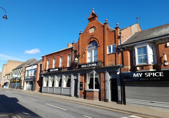
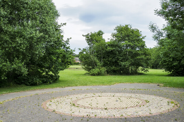
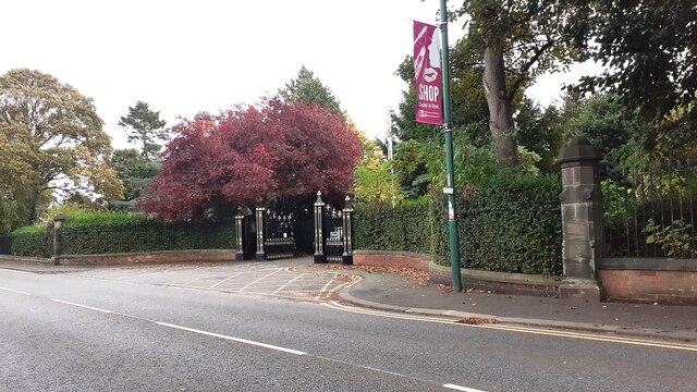
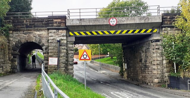
Chester Moor Images

Images are sourced within 2km of 54.838024/-1.588764 or Grid Reference NZ2649. Thanks to Geograph Open Source API. All images are credited.

The High Crown Inn The High Crown Inn public house.
The High Crown Inn
The High Crown Inn public house.
Brick feature at Waldridge Millennium Green Waldridge Millennium Green is a park in the southern part of the County Durham town of Chester-le-Street; it takes its name from the nearby village at Waldridge and the area of lowland heath, Waldridge Fell.
The foreground brick feature has hundreds of bricks, partly arranged concentrically, most of which have designs by children on their exposed faces.
Brick feature at Waldridge Millennium Green
Waldridge Millennium Green is a park in the southern part of the County Durham town of Chester-le-Street; it takes its name from the nearby village at Waldridge and the area of lowland heath, Waldridge Fell. The foreground brick feature has hundreds of bricks, partly arranged concentrically, most of which have designs by children on their exposed faces.
Benchmark on #29 Waldridge Road Ordnance Survey cut mark benchmark levelled at 55.385m above Newlyn Datum verified in 1962
Benchmark on #29 Waldridge Road
Ordnance Survey cut mark benchmark levelled at 55.385m above Newlyn Datum verified in 1962
Houses on south side of Waldridge Road There is an Ordnance Survey benchmark <a href="https://www.geograph.org.uk/photo/7313860">NZ2650 : Benchmark on #29 Waldridge Road</a> on the corner of the nearest house, left of a black downpipe
Houses on south side of Waldridge Road
There is an Ordnance Survey benchmark NZ2650 : Benchmark on #29 Waldridge Road on the corner of the nearest house, left of a black downpipe
Benchmark on wall pier at entrance to cemetery on south side of Ropery Lane Ordnance Survey cut mark benchmark levelled at 18.376m above Newlyn Datum verified 1962
Benchmark on wall pier at entrance to cemetery on south side of Ropery Lane
Ordnance Survey cut mark benchmark levelled at 18.376m above Newlyn Datum verified 1962
Entrance to cemetery on south side of Ropery Road There is an Ordnance Survey benchmark <a href="https://www.geograph.org.uk/photo/7314736">NZ2750 : Benchmark on wall pier at entrance to cemetery on south side of Ropery Lane</a> on the wall pier near the right hand edge of the image
Entrance to cemetery on south side of Ropery Road
There is an Ordnance Survey benchmark NZ2750 : Benchmark on wall pier at entrance to cemetery on south side of Ropery Lane on the wall pier near the right hand edge of the image
View along Waldridge Road with bus stop on NW side
Bridge ECM5 219 taking East Coast Main Line over West Lane Ordnance Survey documents indicate that a rivet benchmark levelled at 32.803m above Newlyn Datum was verified in 1962 on the bridge wall, at its far end, on the right hand side of the road
Bridge ECM5 219 taking East Coast Main Line over West Lane
Ordnance Survey documents indicate that a rivet benchmark levelled at 32.803m above Newlyn Datum was verified in 1962 on the bridge wall, at its far end, on the right hand side of the road
Benchmark on wall fronting Evangel Church west side of Durham Road Ordnance Survey cut mark benchmark levelled at 25.305m above Newlyn Datum verified 1964
Benchmark on wall fronting Evangel Church west side of Durham Road
Ordnance Survey cut mark benchmark levelled at 25.305m above Newlyn Datum verified 1964
Evangel Church on west side of Durham Road There is an Ordnance Survey benchmark <a href="https://www.geograph.org.uk/photo/7325448">NZ2750 : Benchmark on wall fronting Evangel Church west side of Durham Road</a> on the coping stone midway between the two brick wall piers left of the salt bin
Evangel Church on west side of Durham Road
There is an Ordnance Survey benchmark NZ2750 : Benchmark on wall fronting Evangel Church west side of Durham Road on the coping stone midway between the two brick wall piers left of the salt bin
Edward VII GPO cable marker against the wall in front of Evangel Church For details of the marker see <span class="nowrap"><a title="https://gpo-markers.derektp.co.uk/detail?post=609" rel="nofollow ugc noopener" href="https://gpo-markers.derektp.co.uk/detail?post=609">Link</a><img style="margin-left:2px;" alt="External link" title="External link - shift click to open in new window" src="https://s1.geograph.org.uk/img/external.png" width="10" height="10"/></span>
Edward VII GPO cable marker against the wall in front of Evangel Church
For details of the marker see LinkExternal link
Evangel Church on west side of Durham Road at Clifford Terrace junction There is a GPO cable marker <a href="https://www.geograph.org.uk/photo/7325472">NZ2750 : Edward VII GPO cable marker against the wall in front of Evangel Church</a> in the pavement against the wall in the middle of the image
Evangel Church on west side of Durham Road at Clifford Terrace junction
There is a GPO cable marker NZ2750 : Edward VII GPO cable marker against the wall in front of Evangel Church in the pavement against the wall in the middle of the image
Benchmark on outbuilding at rear of #11 The Parade Ordnance Survey cut mark benchmark levelled at 30.248m above Newlyn Datum verified 1964
Benchmark on outbuilding at rear of #11 The Parade
Ordnance Survey cut mark benchmark levelled at 30.248m above Newlyn Datum verified 1964
#11 The Parade, 'Hollycroft' with its rear outbuilding There is an Ordnance Survey benchmark on the near corner, left hand face, of the outbuilding
#11 The Parade, 'Hollycroft' with its rear outbuilding
There is an Ordnance Survey benchmark on the near corner, left hand face, of the outbuilding
Benchmark on wall pier at entrance to The Hermitage Estate Ordnance Survey cut mark benchmark levelled at 34.305m above Newlyn Datum verified 1964
Benchmark on wall pier at entrance to The Hermitage Estate
Ordnance Survey cut mark benchmark levelled at 34.305m above Newlyn Datum verified 1964
East Lodge at entrance to The Hermitage Estate There is an Ordnance Survey benchmark <a href="https://www.geograph.org.uk/photo/7326867">SE7071 : Great Lake</a> on the right hand wall pier
East Lodge at entrance to The Hermitage Estate
There is an Ordnance Survey benchmark SE7071 : Great Lake on the right hand wall pier
The Wicket Gate The local Wetherspoons or "Spoons" located on the southern end of Front Street.  The name is a connection to the local cricket club and ground on nearby Ropery Lane - their home since the 1860's
The Wicket Gate
The local Wetherspoons or "Spoons" located on the southern end of Front Street. The name is a connection to the local cricket club and ground on nearby Ropery Lane - their home since the 1860's
St Cuthberts RC Church Ropery Lane Chester-le-Street
Show me another place!

Chester Moor is located at Grid Ref: NZ2649 (Lat: 54.838024, Lng: -1.588764)

Unitary Authority: County Durham

Police Authority: Durham

What 3 Words

///fries.zones.trails. Near Chester-le-Street, Co. Durham

Related Wikis

Iveston

Iveston is a village in County Durham, England. It is situated a short distance to the east of Consett. Housing in the area consists of a mixture of traditional...

Chester-le-Street Town F.C.

Chester-le-Street Town Football Club is a football club based in Chester-le-Street, County Durham, England. They are currently members of the Northern...

Chester Moor

Chester Moor is a village in County Durham, England. It is situated a short distance to the south of Chester-le-Street. == References ==
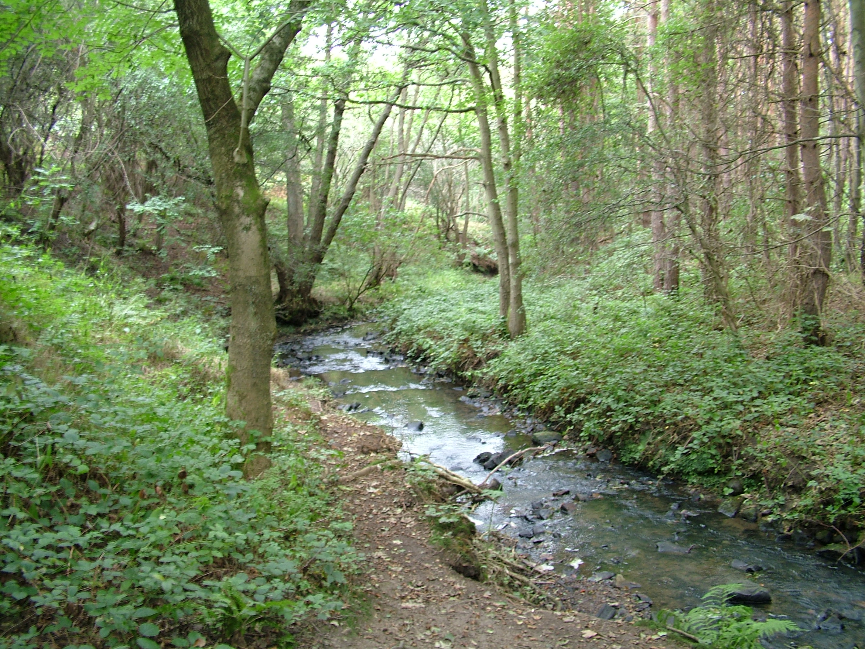
South Burn

The South Burn is a small river in County Durham, England. One branch of the river has its source on Waldridge Fell, the other (and longer) branch, known...

Nearby Amenities

Located within 500m of 54.838024,-1.588764
Crossing
Crossing: unmarked
Tactile Paving: no
Lat/Long: 54.8395856/-1.5842081
Crossing
Check Date Tactile Paving: 2023-12-22
Crossing: unmarked
Tactile Paving: no
Lat/Long: 54.8364563/-1.5939271
Post Box
Brand: Royal Mail
Brand Wikidata: Q638098
Brand Wikipedia: en:Royal Mail
Collection Times: Mo-Fr 09:00; Sa 07:00
Operator: Royal Mail
Operator Wikidata: Q638098
Ref: DH2 100D
Royal Cypher: EIIR
Royal Cypher Wikidata: Q33102113
Lat/Long: 54.8365646/-1.5920978
Bus Stop
Farm (south only)
Bench: yes
Bin: no
Bus: yes
Check Date Shelter: 2021-07-06
Naptan AtcoCode: 13002211F
Naptan Bearing: SW
Naptan CommonName: Farm (south only)
Naptan Indicator: south west bound
Naptan Landmark: Landmark not known
Naptan NaptanCode: duramjwm
Naptan Notes: On A167- just W of 12 The Oval- Chester Moor- Chester-Le-Street
Naptan Street: A167
Naptan Verified: no
Public Transport: platform
Shelter: yes
Source: naptan_import
Lat/Long: 54.8387887/-1.585206
Bus Stop
Inn
Bench: yes
Bin: no
Bus: yes
Check Date Shelter: 2021-07-06
Lit: yes
Naptan AtcoCode: 13002212B
Naptan Bearing: NE
Naptan CommonName: Inn
Naptan Indicator: north east bound
Naptan Landmark: Landmark not known
Naptan NaptanCode: duramjwp
Naptan Notes: On A167- N of junction with Waldridge Lane- near The Chester Moor (PH)- Chester Moor- Chester-L
Naptan Street: A167
Naptan Verified: no
Public Transport: platform
Shelter: yes
Source: naptan_import
Tactile Paving: no
Lat/Long: 54.8376125/-1.5872572
Bus Stop
Inn
Bench: yes
Bin: yes
Bus: yes
Departures Board: timetable
Lit: yes
Naptan AtcoCode: 13002212F
Naptan Bearing: S
Naptan CommonName: Inn
Naptan Indicator: south bound
Naptan Landmark: Landmark not known
Naptan NaptanCode: duramjwt
Naptan Notes: On A167- S of junction with Waldridge Lane- near The Chester Moor (PH)- Chester Moor- Chester-L
Naptan Street: A167
Public Transport: platform
Shelter: yes
Source: naptan_import
Tactile Paving: no
Lat/Long: 54.8364647/-1.5878471
Bus Stop
Estate
Bench: yes
Bin: no
Bus: yes
Departures Board: timetable
Lit: yes
Naptan AtcoCode: 13002213D
Naptan Bearing: SE
Naptan CommonName: Estate
Naptan Indicator: south east bound
Naptan Landmark: Landmark not known
Naptan NaptanCode: durampad
Naptan Notes: Approx 80m SE of junction of unnamed road that travels N from A167- and crosses over Waldridge
Naptan Street: New Link Road
Naptan Verified: yes
Public Transport: platform
Shelter: yes
Source: naptan_import
Tactile Paving: no
Lat/Long: 54.8358387/-1.5934186
Bus Stop
Estate
Bench: yes
Bin: no
Bus: yes
Lit: yes
Naptan AtcoCode: 13002213H
Naptan Bearing: NW
Naptan CommonName: Estate
Naptan Indicator: north west bound
Naptan Landmark: Landmark not known
Naptan NaptanCode: durampag
Naptan Notes: Approx 70m NW of junction of unnamed road that travels N from A167- and crosses over Waldridge
Naptan Street: New Link Road
Naptan Verified: no
Public Transport: platform
Shelter: yes
Source: naptan_import
Tactile Paving: no
Lat/Long: 54.8370421/-1.5949083
Turning Circle
Lat/Long: 54.8375424/-1.5923203
Crossing
Bicycle: yes
Crossing: unmarked
Crossing Island: no
Tactile Paving: no
Lat/Long: 54.8352628/-1.589255
Crossing
Bicycle: yes
Crossing: unmarked
Lat/Long: 54.8370784/-1.5871105
Crossing
Bicycle: yes
Crossing: unmarked
Tactile Paving: no
Lat/Long: 54.837798/-1.5862835
Barrier: kerb
Kerb: lowered
Lat/Long: 54.8389199/-1.5849987
Crossing
Bicycle: yes
Crossing: unmarked
Lat/Long: 54.8389612/-1.58496
Noexit: yes
Lat/Long: 54.8394093/-1.5840842
Noexit: yes
Lat/Long: 54.8358422/-1.5883098
Noexit: yes
Lat/Long: 54.8396892/-1.5834193
Addr City: Chester-le-Street
Addr Housenumber: 20
Addr Postcode: DH2 3TB
Addr Street: The Dene
Source Postcode: CodePoint Open
Lat/Long: 54.8397352/-1.5834965
Addr City: Chester-le-Street
Addr Housenumber: 18
Addr Postcode: DH2 3TB
Addr Street: The Dene
Source Postcode: CodePoint Open
Lat/Long: 54.8398048/-1.5832303
Addr City: Chester-le-Street
Addr Housenumber: 16
Addr Postcode: DH2 3TB
Addr Street: The Dene
Source Postcode: CodePoint Open
Lat/Long: 54.8396794/-1.5831495
Addr City: Chester-le-Street
Addr Housenumber: 15
Addr Postcode: DH2 3TB
Addr Street: The Dene
Source Postcode: CodePoint Open
Lat/Long: 54.8396115/-1.583292
Addr City: Chester-le-Street
Addr Housenumber: 19
Addr Postcode: DH2 3TB
Addr Street: The Dene
Source Postcode: CodePoint Open
Lat/Long: 54.8397793/-1.5834474
Crossing
Crossing: unmarked
Tactile Paving: no
Lat/Long: 54.8366353/-1.5878701
Crossing
Crossing: unmarked
Tactile Paving: no
Lat/Long: 54.8368026/-1.5879782
Crossing
Crossing: unmarked
Lat/Long: 54.8347257/-1.5913015
Crossing
Crossing: unmarked
Lat/Long: 54.8348029/-1.5911648
Crossing
Crossing: unmarked
Lat/Long: 54.8351287/-1.5901341
Crossing
Crossing: unmarked
Lat/Long: 54.8350474/-1.5899948
Barrier: kerb
Lat/Long: 54.835022/-1.5899512
Post Box
Brand: Royal Mail
Brand Wikidata: Q638098
Brand Wikipedia: en:Royal Mail
Check Date Collection Times: 2021-11-20
Collection Times: Mo-Fr 16:30; Sa 09:30
Operator: Royal Mail
Operator Wikidata: Q638098
Post Box Type: lamp
Ref: DH2 250
Royal Cypher: EIIR
Royal Cypher Wikidata: Q33102113
Lat/Long: 54.8364876/-1.5878161
Crossing
Check Date Tactile Paving: 2023-12-22
Crossing: unmarked
Tactile Paving: no
Lat/Long: 54.8363117/-1.5946031
Crossing
Check Date Tactile Paving: 2023-12-22
Crossing: unmarked
Tactile Paving: no
Lat/Long: 54.8365505/-1.5943524
Crossing
Check Date Tactile Paving: 2023-12-22
Crossing: unmarked
Tactile Paving: no
Lat/Long: 54.8365204/-1.594461
Defibrillator
Access: yes
Check Date: 2023-04-02
Emergency: defibrillator
Indoor: no
Lat/Long: 54.8367262/-1.5873044
Bus: yes
Public Transport: stop_position
Lat/Long: 54.8364881/-1.5879105
Material: wood
Power: pole
Lat/Long: 54.8369568/-1.5934883
Material: wood
Power: pole
Lat/Long: 54.8371274/-1.594592
Power: pole
Lat/Long: 54.8373476/-1.5959948
Generator Source: solar
Generator Type: solar_photovoltaic_panel
Location: roof
Power: generator
Lat/Long: 54.8422385/-1.5912822
Crossing
Bicycle: yes
Crossing: unmarked
Lat/Long: 54.8365949/-1.5876525
Crossing
Check Date Tactile Paving: 2023-12-22
Crossing: unmarked
Tactile Paving: no
Lat/Long: 54.8362103/-1.5939549
Crossing
Check Date Tactile Paving: 2023-12-22
Crossing: unmarked
Tactile Paving: no
Lat/Long: 54.8361686/-1.5940854
Crossing
Check Date Tactile Paving: 2023-12-22
Crossing: unmarked
Tactile Paving: no
Lat/Long: 54.8362321/-1.5945603
Crossing
Check Date Tactile Paving: 2023-12-22
Crossing: unmarked
Tactile Paving: no
Lat/Long: 54.8363816/-1.593886
Street Lamp
Lat/Long: 54.8362871/-1.593923
Street Lamp
Lat/Long: 54.8350386/-1.5898975
Street Lamp
Lat/Long: 54.834837/-1.5902113
Street Lamp
Lat/Long: 54.834832/-1.5905017
Street Lamp
Lat/Long: 54.8349895/-1.5905875
Street Lamp
Lat/Long: 54.8346617/-1.590279
Street Lamp
Lat/Long: 54.8344157/-1.5904091
Street Lamp
Lat/Long: 54.8348567/-1.5909597
Street Lamp
Lat/Long: 54.8347146/-1.5911501
Street Lamp
Lat/Long: 54.8351992/-1.5920808
Street Lamp
Lat/Long: 54.8355773/-1.5929177
Street Lamp
Lat/Long: 54.8360404/-1.5937438
Street Lamp
Lat/Long: 54.8360948/-1.5940415
Street Lamp
Lat/Long: 54.8361477/-1.5942923
Street Lamp
Lat/Long: 54.8362628/-1.5946135
Street Lamp
Lat/Long: 54.8364201/-1.5945567
Street Lamp
Lat/Long: 54.8389834/-1.5962627
Street Lamp
Lat/Long: 54.8384232/-1.5958161
Street Lamp
Lat/Long: 54.8378637/-1.5953679
Street Lamp
Lat/Long: 54.8373458/-1.5949364
Street Lamp
Lat/Long: 54.8368521/-1.5945474
Street Lamp
Lat/Long: 54.8365949/-1.5943252
Street Lamp
Lat/Long: 54.8365221/-1.5941287
Crossing
Crossing: unmarked
Tactile Paving: no
Lat/Long: 54.8396547/-1.5843811
Noexit: yes
Lat/Long: 54.8400252/-1.5845291
Street Lamp
Lat/Long: 54.8386721/-1.5961719
Street Lamp
Lat/Long: 54.838116/-1.5957226
Street Lamp
Lat/Long: 54.8353286/-1.5926072
Barrier: kerb
Check Date Tactile Paving: 2023-12-22
Kerb: lowered
Tactile Paving: no
Lat/Long: 54.8364752/-1.5939202
Barrier: kerb
Check Date Tactile Paving: 2023-12-22
Kerb: lowered
Tactile Paving: no
Lat/Long: 54.8365656/-1.5943091
Barrier: kerb
Check Date Tactile Paving: 2023-12-22
Kerb: lowered
Tactile Paving: no
Lat/Long: 54.8365358/-1.5943949
Barrier: kerb
Check Date Tactile Paving: 2023-12-22
Kerb: lowered
Tactile Paving: no
Lat/Long: 54.8365266/-1.5944237
Barrier: kerb
Check Date Tactile Paving: 2023-12-22
Kerb: lowered
Tactile Paving: no
Lat/Long: 54.8365103/-1.5945223
Barrier: kerb
Check Date Tactile Paving: 2023-12-22
Kerb: lowered
Tactile Paving: no
Lat/Long: 54.8362195/-1.5939231
Barrier: kerb
Check Date Tactile Paving: 2023-12-22
Kerb: lowered
Tactile Paving: no
Lat/Long: 54.8361979/-1.5945583
Noexit: yes
Lat/Long: 54.8370182/-1.5948985
Barrier: kerb
Check Date Tactile Paving: 2023-12-22
Kerb: lowered
Tactile Paving: no
Lat/Long: 54.8363389/-1.5946296
Barrier: kerb
Check Date Tactile Paving: 2023-12-22
Kerb: lowered
Tactile Paving: no
Lat/Long: 54.8362833/-1.5945753
Barrier: kerb
Check Date Tactile Paving: 2023-12-22
Kerb: lowered
Tactile Paving: no
Lat/Long: 54.8362593/-1.5945632
Barrier: kerb
Check Date Tactile Paving: 2023-12-22
Kerb: lowered
Tactile Paving: no
Lat/Long: 54.8361505/-1.5941372
Barrier: kerb
Check Date Tactile Paving: 2023-12-22
Kerb: lowered
Tactile Paving: no
Lat/Long: 54.836184/-1.5940415
Barrier: kerb
Check Date Tactile Paving: 2023-12-22
Kerb: lowered
Tactile Paving: no
Lat/Long: 54.8361925/-1.5940167
Barrier: kerb
Check Date Tactile Paving: 2023-12-22
Kerb: lowered
Tactile Paving: no
Lat/Long: 54.8363624/-1.5938692
Barrier: kerb
Check Date Tactile Paving: 2023-12-22
Kerb: lowered
Tactile Paving: no
Lat/Long: 54.8364107/-1.5939154
Barrier: kerb
Check Date Tactile Paving: 2023-12-22
Kerb: lowered
Tactile Paving: no
Lat/Long: 54.8364269/-1.5939255
Barrier: kerb
Kerb: lowered
Tactile Paving: no
Lat/Long: 54.8364922/-1.5933126
Barrier: kerb
Kerb: lowered
Lat/Long: 54.8389865/-1.5849324
Barrier: kerb
Kerb: lowered
Tactile Paving: no
Lat/Long: 54.8377738/-1.5863121
Barrier: kerb
Kerb: lowered
Tactile Paving: no
Lat/Long: 54.8378169/-1.5862608
Barrier: kerb
Lat/Long: 54.8371025/-1.587087
Barrier: kerb
Lat/Long: 54.8370505/-1.5871378
Noexit: yes
Lat/Long: 54.8370228/-1.5880521
Barrier: kerb
Kerb: lowered
Tactile Paving: no
Lat/Long: 54.8365777/-1.587698
Barrier: kerb
Kerb: lowered
Tactile Paving: no
Lat/Long: 54.8366131/-1.5878087
Barrier: kerb
Kerb: lowered
Tactile Paving: no
Lat/Long: 54.8366212/-1.5878315
Barrier: kerb
Kerb: lowered
Tactile Paving: no
Lat/Long: 54.8366563/-1.5879274
Barrier: kerb
Kerb: flush
Tactile Paving: no
Lat/Long: 54.8367714/-1.5879046
Barrier: kerb
Kerb: flush
Tactile Paving: no
Lat/Long: 54.8368255/-1.588032
Barrier: kerb
Kerb: flush
Tactile Paving: no
Lat/Long: 54.8341175/-1.5911508
Barrier: kerb
Lat/Long: 54.8350732/-1.590039
Barrier: kerb
Kerb: flush
Lat/Long: 54.8351016/-1.5900876
Barrier: kerb
Kerb: flush
Lat/Long: 54.835151/-1.5901722
Barrier: kerb
Lat/Long: 54.8347072/-1.5913505
Barrier: kerb
Lat/Long: 54.8348271/-1.591124
Barrier: kerb
Lat/Long: 54.834784/-1.5911968
Barrier: kerb
Lat/Long: 54.8347413/-1.5912603
Grit Bin
Colour: grey
Operator: Durham County Council
Operator Type: government
Operator Wikidata: Q5316492
Ref: CH043
Lat/Long: 54.8364406/-1.5878972
Grit Bin
Colour: grey
Operator: Durham County Council
Operator Type: government
Operator Wikidata: Q5316492
Ref: CH044
Lat/Long: 54.8364735/-1.5928939
Noexit: yes
Lat/Long: 54.8380193/-1.5912993
Barrier: cycle_barrier
Cycle Barrier: double
Material: metal
Lat/Long: 54.837786/-1.5918873
Barrier: cycle_barrier
Cycle Barrier: double
Material: metal
Lat/Long: 54.8376523/-1.5929123
Barrier: step
Lat/Long: 54.8375569/-1.5924194
Chester Moor
Place: village
Wikidata: Q5093664
Wikipedia: en:Chester Moor
Lat/Long: 54.8370355/-1.5900564
Parking
Parking: surface
Lat/Long: 54.8364516/-1.5859419
Noexit: yes
Lat/Long: 54.8378739/-1.5855141
Entrance: main
Lat/Long: 54.8380794/-1.5857893
Artwork Type: sculpture
Tourism: artwork
Lat/Long: 54.8378538/-1.5860405
Noexit: yes
Lat/Long: 54.8356615/-1.5879422
Noexit: yes
Lat/Long: 54.8357673/-1.5881065
Chester Moor
Alt Name: Chester South Moor
Disused: yes
Man Made: mineshaft
Resource: coal
Website: http://www.dmm.org.uk/colliery/c002.htm
Lat/Long: 54.8379994/-1.5830612
Give Way
Lat/Long: 54.8390243/-1.5851386
The data included in this document is from www.openstreetmap.org. The data is made available under ODbL.

Have you been to Chester Moor?

Leave your review of Chester Moor below (or comments, questions and feedback).