Bullapit Plantation

Wood, Forest in Devon Torridge

England

Bullapit Plantation

Boating lake - Buckland House See also <a href="https://www.geograph.org.uk/photo/3604405">SS4609 : Boathouse, Buckland Filleigh</a> for the lake in use, I presume by guests at Buckland House.
Boating lake - Buckland House Credit: Mr Ignavy

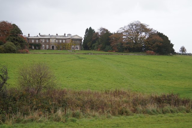
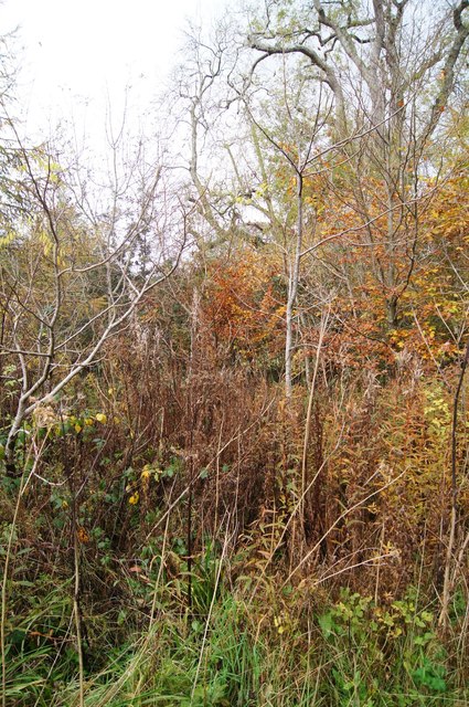
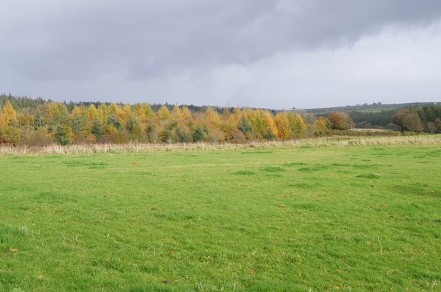
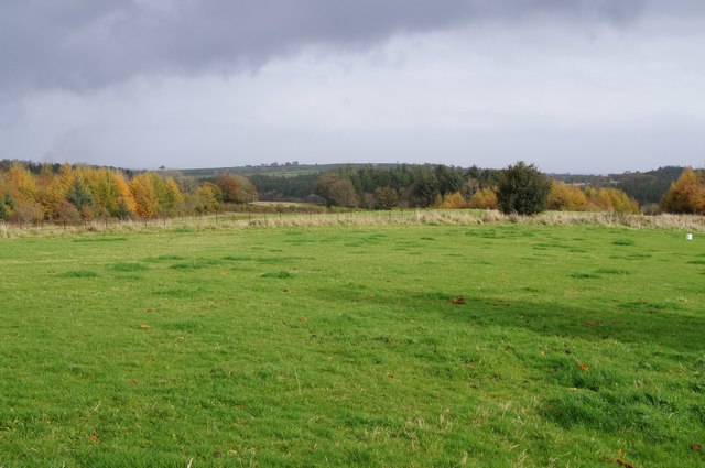
Bullapit Plantation is a picturesque woodland located in Devon, England. Situated in the heart of the county, this expansive forest covers an area of approximately 500 acres. It is known for its diverse range of flora and fauna, making it a popular destination for nature enthusiasts and hikers alike.

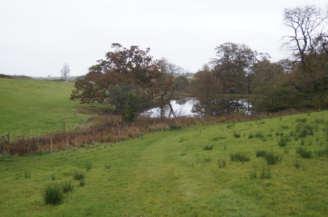
The woodland is primarily composed of native tree species, including oak, beech, and ash. These majestic trees provide a dense canopy, creating a tranquil and shaded environment. Underneath the towering trees, a rich understory of smaller plants and shrubs can be found, such as bluebells, ferns, and wild garlic, adding to the beauty and biodiversity of the area.

Bullapit Plantation is home to a variety of wildlife, making it an important habitat for many species. Deer, foxes, badgers, and rabbits can frequently be spotted roaming among the trees, while numerous bird species, such as woodpeckers, owls, and thrushes, inhabit the forest, filling the air with their melodic songs.

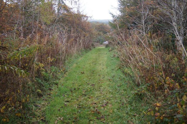
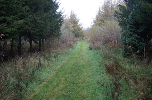
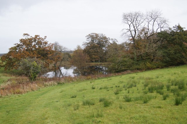
The plantation is intersected by several walking trails and footpaths, allowing visitors to fully explore its natural wonders. These paths lead to hidden streams and small ponds, providing peaceful spots for reflection and relaxation. In addition, the forest is equipped with picnic areas and benches, inviting visitors to enjoy a leisurely lunch amidst the tranquil surroundings.

Bullapit Plantation truly offers a haven of natural beauty and tranquility in the heart of Devon. Whether one seeks a peaceful escape or an opportunity to immerse oneself in the wonders of nature, this woodland is an ideal destination for all nature lovers.

If you have any feedback on the listing, please let us know in the comments section below.

Bullapit Plantation Images

Images are sourced within 2km of 50.867587/-4.1821415 or Grid Reference SS4609. Thanks to Geograph Open Source API. All images are credited.

Boating lake - Buckland House See also <a href="https://www.geograph.org.uk/photo/3604405">SS4609 : Boathouse, Buckland Filleigh</a> for the lake in use, I presume by guests at Buckland House.
Boating lake - Buckland House
See also SS4609 : Boathouse, Buckland Filleigh for the lake in use, I presume by guests at Buckland House.
South face - Buckland House
Well kept forest walk It is not entirely clear (no signposts or little yellow arrows) as to whether this is the route of the public footpath but it is going in the same general direction as marked on maps.
Well kept forest walk
It is not entirely clear (no signposts or little yellow arrows) as to whether this is the route of the public footpath but it is going in the same general direction as marked on maps.
A mix of trees & undergrowth Margins of the footpath to/from Buckland House.
A mix of trees & undergrowth
Margins of the footpath to/from Buckland House.
South face - Buckland House
Boating lake - Buckland House
Churchyard - Buckland Filleigh I only took one detail in St Mary's church churchyard and then discovered it had already been taken! See <a href="https://www.geograph.org.uk/photo/3609774">SS4609 : Churchyard, Buckland Filleigh</a>.
Churchyard - Buckland Filleigh
I only took one detail in St Mary's church churchyard and then discovered it had already been taken! See SS4609 : Churchyard, Buckland Filleigh.
St Mary's church grounds
Autumn colours - Buckland House grounds
Access to Buckland House Also the route of the public footpath to St Mary's church.
Access to Buckland House
Also the route of the public footpath to St Mary's church.
St Mary's & Buckland House A public footpath passes through the estate via the churchyard.
St Mary's & Buckland House
A public footpath passes through the estate via the churchyard.
St Mary's interior view
St Mary's interior view South facing windows, a mix of old and new.
St Mary's interior view
South facing windows, a mix of old and new.
St Mary's interior view
War memorial - St Mary's churchyard
Show me another place!

Bullapit Plantation is located at Grid Ref: SS4609 (Lat: 50.867587, Lng: -4.1821415)

Administrative County: Devon

District: Torridge

Police Authority: Devon and Cornwall

What 3 Words

///notifying.scripted.steps. Near Hatherleigh, Devon

Related Wikis

Buckland Filleigh

Buckland Filleigh is a village, civil parish and former manor in the Torridge district of North Devon, England, situated about 8 miles south of the town...

Shebbear College

Shebbear College is an independent day and boarding school for girls and boys aged 4 – 18 situated in Shebbear, Devon, England. The school's 85-acre rural...

Woollaton

Woollaton is a village in Devon, England.

Peters Marland

Peters Marland is a small village and civil parish in the local government district of Torridge, Devon, England. The parish, which lies about four miles...

Have you been to Bullapit Plantation?

Leave your review of Bullapit Plantation below (or comments, questions and feedback).