Anancaun

Settlement in Ross-shire

Scotland

Anancaun

The Kinlochewe River Viewed under the A832 road bridge.
The Kinlochewe River Credit: Peter Jeffery

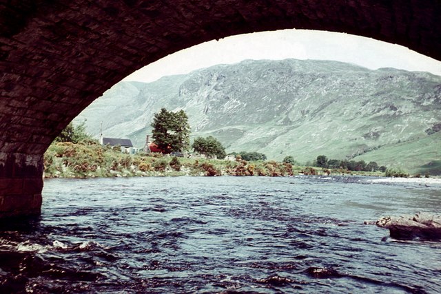
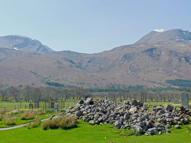
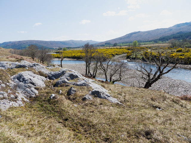
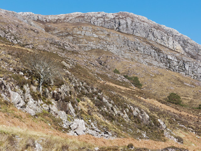
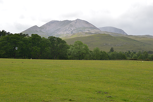
Anancaun is a small village located in the county of Ross-shire, Scotland. Situated in the picturesque Scottish Highlands, it lies approximately 12 miles northwest of the town of Dingwall. The village is nestled in a valley surrounded by rolling hills and offers stunning views of the nearby lochs and countryside.

Anancaun is home to a close-knit community, with a population of around 200 residents. The village is characterized by its charming cottages and traditional stone buildings, giving it a distinct rural Scottish feel. The main industry in the area is agriculture, with many locals involved in farming and livestock rearing.

Despite its small size, Anancaun boasts a few amenities to serve the needs of its residents. These include a local pub, a small convenience store, and a primary school. The village also has a community center, which hosts various events and activities throughout the year, fostering a strong sense of community spirit.

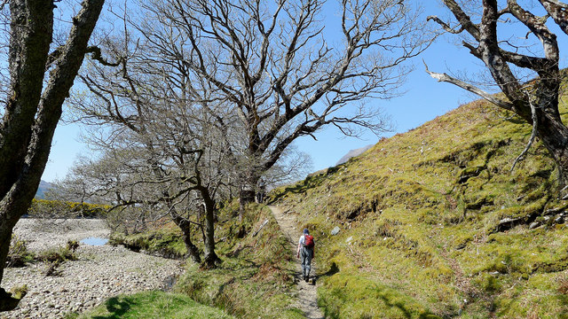
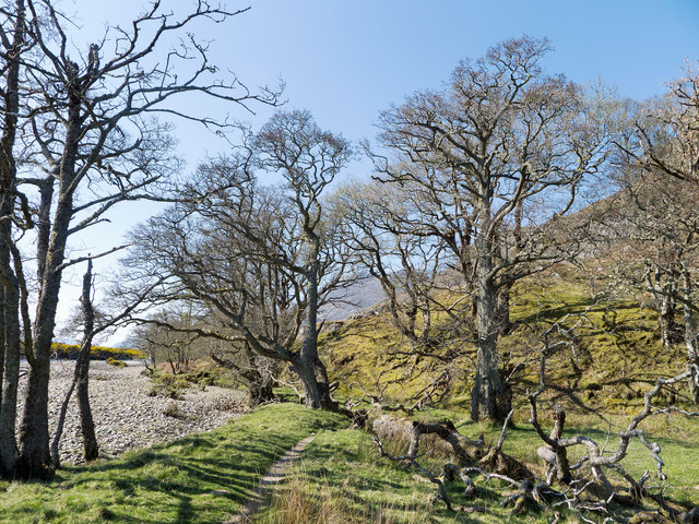
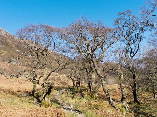
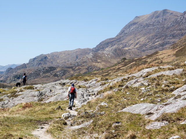
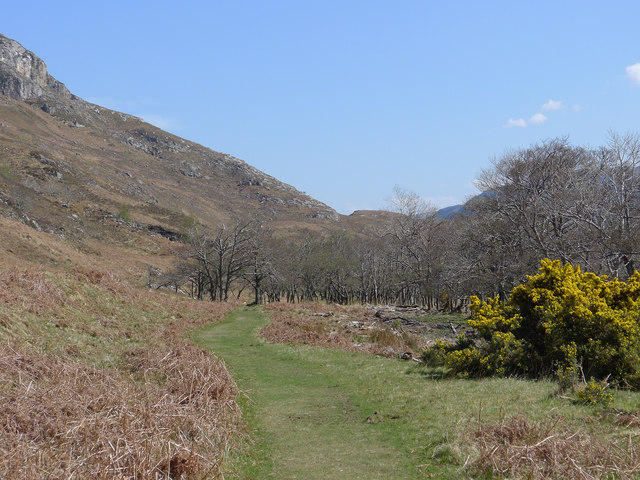
Nature lovers will find plenty to explore in the surrounding area. Anancaun is close to several walking and hiking trails, providing opportunities to discover the region's stunning landscapes, including nearby forests and lochs. The village is also within easy reach of popular tourist attractions, such as the Black Isle Wildlife Park and the Glen Ord Distillery, making it an ideal base for visitors looking to explore the Scottish Highlands.

Overall, Anancaun offers a peaceful, rural retreat for those seeking a slower pace of life, surrounded by breathtaking natural beauty.

If you have any feedback on the listing, please let us know in the comments section below.

Anancaun Images

Images are sourced within 2km of 57.613389/-5.3164395 or Grid Reference NH0263. Thanks to Geograph Open Source API. All images are credited.

The Kinlochewe River Viewed under the A832 road bridge.
The Kinlochewe River
Viewed under the A832 road bridge.
The Kinlochewe River Viewed from the base of the road bridge.
The Kinlochewe River
Viewed from the base of the road bridge.
On the path to Kinlochewe from Slioch The path stays just above the agricultural fields away from the flood plain.
On the path to Kinlochewe from Slioch
The path stays just above the agricultural fields away from the flood plain.
Cemetery at Incheril In a  quiet rural location.
Cemetery at Incheril
In a quiet rural location.
The Allt Chnaimhean and the flank of Beinn a' Mhuinidh The higher birches were in leaf but the trees lower down retained their skeleton structures.
The Allt Chnaimhean and the flank of Beinn a' Mhuinidh
The higher birches were in leaf but the trees lower down retained their skeleton structures.
Trees beside path from Kinlochewe to the east side of Loch Maree Trees adding prominence to a possibly glacial debris beside the path.
Trees beside path from Kinlochewe to the east side of Loch Maree
Trees adding prominence to a possibly glacial debris beside the path.
Path beside the Kinlochewe River Walking towards Slioch on a fine Spring day.
Path beside the Kinlochewe River
Walking towards Slioch on a fine Spring day.
Path beside the Kinlochewe River The established trees are a real bonus on the walk towards Loch Maree. Evident are large tree branches having fallen victim to age and wind and now lying on the ground.
Path beside the Kinlochewe River
The established trees are a real bonus on the walk towards Loch Maree. Evident are large tree branches having fallen victim to age and wind and now lying on the ground.
Path beside the Kinlochewe River The path gives good views to the mountains on all sides of Kinlochewe.
Path beside the Kinlochewe River
The path gives good views to the mountains on all sides of Kinlochewe.
Admiring Slioch from the access path from Kinlochewe On the footpath that leads along the east side of Loch Maree.
Admiring Slioch from the access path from Kinlochewe
On the footpath that leads along the east side of Loch Maree.
The Kinlochewe River Seen from a small rise in the path to Slioch.
The Kinlochewe River
Seen from a small rise in the path to Slioch.
Loch Maree footpath by the Allt na Still A grassy track through the bracken.
Loch Maree footpath by the Allt na Still
A grassy track through the bracken.
The flank of Beinn a Mhuinidh A mountain lower than Slioch to the north of Kinlochewe, viewed from the path that follows the shore of Loch Maree.
The flank of Beinn a Mhuinidh
A mountain lower than Slioch to the north of Kinlochewe, viewed from the path that follows the shore of Loch Maree.
Run-of-river hydro notice Notice describing the five run-of-river hydro schemes being built around Heights of Kinlochewe.
Run-of-river hydro notice
Notice describing the five run-of-river hydro schemes being built around Heights of Kinlochewe.
Beinn Eighe from Incheril
A896 south of Kinlochewe
Beinn Eighe, from near Kinlochewe The two eastern peaks of the mountain's very long backbone can be seen, Sgùrr nan Fhir Duibhe (Peak of the Black Carls) on the left and Creag Dhubh on the right. The Black Carls are the tooth like prominences on the ridge to the right of the summit, and are composed of rotting quartzite; putting your hand on a bit of the mountain and feeling it move is sensational! The hidden rear of the peak is composed almost entirely of such rock.
Beinn Eighe, from near Kinlochewe
The two eastern peaks of the mountain's very long backbone can be seen, Sgùrr nan Fhir Duibhe (Peak of the Black Carls) on the left and Creag Dhubh on the right. The Black Carls are the tooth like prominences on the ridge to the right of the summit, and are composed of rotting quartzite; putting your hand on a bit of the mountain and feeling it move is sensational! The hidden rear of the peak is composed almost entirely of such rock.
Taagan farm, from the campsite With Beinn a' Mhùinidh rising behind, and part of Slioch on the left. Comparing the farm with <a href="https://www.geograph.org.uk/photo/2400529">NH0163 : Taagan farm</a> taken 22 years before, some of the farm buildings have disappeared and the farmhouse is now derelict. The barn nearest the camera is in much the same state.
Taagan farm, from the campsite
With Beinn a' Mhùinidh rising behind, and part of Slioch on the left. Comparing the farm with NH0163 : Taagan farm taken 22 years before, some of the farm buildings have disappeared and the farmhouse is now derelict. The barn nearest the camera is in much the same state.
Show me another place!

Anancaun is located at Grid Ref: NH0263 (Lat: 57.613389, Lng: -5.3164395)

Unitary Authority: Highland

Police Authority: Highlands and Islands

What 3 Words

///gravitate.tweed.movies. Near Kinlochewe, Highland

Nearby Locations

Anancaun

Related Wikis

Anancaun

Anancaun (Scottish Gaelic: Àth nan Ceann) is a small hamlet located in Ross-shire, Scotland, within the Scottish council area of Highland. == References ==

Taagan

Taagan (Scottish Gaelic: Na Tathagan) is a hamlet in Ross and Cromarty, in the Highland council area of Scotland. It is situated about 2 km north west...

Cape Wrath Trail

Cape Wrath Trail is a hiking route that runs through the Scottish Highlands and along the west coast of Scotland. It is approximately 200 miles (321 km...

Kinlochewe

Kinlochewe (Scottish Gaelic: Ceann Loch Iù or Iùbh) is a village in Wester Ross in the Northwest Highlands of Scotland. It is in the parish of Gairloch...

Nearby Amenities

Located within 500m of 57.613389,-5.3164395
Toilets
Access: yes
Contact Phone: +441445760258
Fee: no
Female: no
Male: no
Opening Hours: 24/7
Lat/Long: 57.6134395/-5.3172769
Power: pole
Lat/Long: 57.6136513/-5.3154748
Power: pole
Lat/Long: 57.6134036/-5.3141755
Power: pole
Lat/Long: 57.6131431/-5.3128458
Power: pole
Lat/Long: 57.6147329/-5.3090293
Power: pole
Lat/Long: 57.6143567/-5.3099437
Power: pole
Lat/Long: 57.6139737/-5.3108391
Power: pole
Lat/Long: 57.6135826/-5.31177
Power: pole
Lat/Long: 57.6139458/-5.3096186
Power: pole
Lat/Long: 57.6134138/-5.3092846
The data included in this document is from www.openstreetmap.org. The data is made available under ODbL.

Have you been to Anancaun?

Leave your review of Anancaun below (or comments, questions and feedback).