Cherry Green

Settlement in Essex Uttlesford

England

Cherry Green

Field and Home Wood The footpath north of Horham Hall skits the eastern edges of Home Wood.
Field and Home Wood Credit: Trevor Harris

Cherry Green is a small village located in the county of Essex, England. Situated approximately 30 miles northeast of London, it falls within the administrative district of Harlow. Known for its picturesque countryside and charming rural atmosphere, Cherry Green offers a peaceful and idyllic setting for its residents.

The village is home to a close-knit community, with a population of around 500 people. The majority of the dwellings in Cherry Green are traditional cottages, which add to its quaint and timeless appeal. The village also boasts a number of historic buildings, including St. Mary's Church, which dates back to the 12th century and serves as a focal point for local religious activities.

Despite its small size, Cherry Green offers a range of amenities for its residents. The village has a local pub, The Cherry Green Inn, where locals and visitors alike can enjoy a drink and socialize. Additionally, there are several small businesses and shops that cater to the needs of the community.

The surrounding countryside provides ample opportunities for outdoor activities, such as walking, cycling, and horseback riding. Cherry Green is also close to Epping Forest, a popular destination for nature enthusiasts. The village benefits from excellent transport links, with easy access to nearby towns and cities via road and rail.

Overall, Cherry Green is a charming and tranquil village in the heart of Essex, offering a peaceful retreat from the hustle and bustle of city life. Its picturesque surroundings, community spirit, and convenient location make it an attractive place to live for those seeking a rural lifestyle.

If you have any feedback on the listing, please let us know in the comments section below.
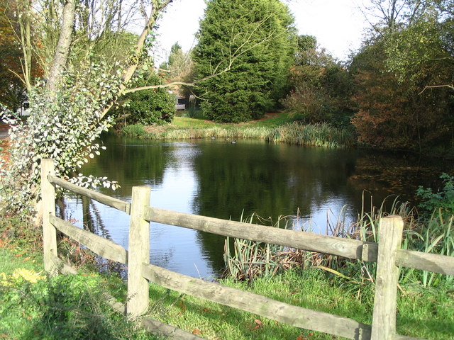
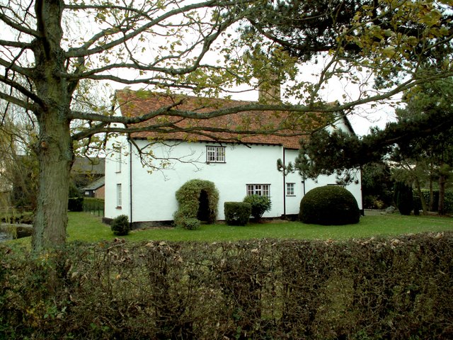
Cherry Green Images

Images are sourced within 2km of 51.943214/0.29080016 or Grid Reference TL5729. Thanks to Geograph Open Source API. All images are credited.

Field and Home Wood The footpath north of Horham Hall skits the eastern edges of Home Wood.
Field and Home Wood
The footpath north of Horham Hall skits the eastern edges of Home Wood.
On the footpath towards Horham Hall A little of the roof of Horham Hall can be seen emerging from the woods ahead. Although the path goes on the pass the hall quite close to the east, little of the hall can be seen from it.
On the footpath towards Horham Hall
A little of the roof of Horham Hall can be seen emerging from the woods ahead. Although the path goes on the pass the hall quite close to the east, little of the hall can be seen from it.
B1051 near Sharpes Cottages Looking west in the direction of Thaxted.
B1051 near Sharpes Cottages
Looking west in the direction of Thaxted.
Hedge, road and field On the road to Sucksted Green.
Hedge, road and field
On the road to Sucksted Green.
Field on Broxted Hill A field of stubble - the remains of a field of barley - beside the lane between Cherry Green and Sucksted Green.
Field on Broxted Hill
A field of stubble - the remains of a field of barley - beside the lane between Cherry Green and Sucksted Green.
Sibleys Lane Coming off Broxted Hill looking in the direction of Sibleys.
Sibleys Lane
Coming off Broxted Hill looking in the direction of Sibleys.
Footpath approaching Cherry Green Farm The path leads from Hamperden End southwards to Cherry Green.
Footpath approaching Cherry Green Farm
The path leads from Hamperden End southwards to Cherry Green.
Tank and tyres at Cherry Green Farm Looking north out of part of the farmyard.
Tank and tyres at Cherry Green Farm
Looking north out of part of the farmyard.
The Old Forge, Cherry Green With the out building displaying the flag in support of Ukraine.
The Old Forge, Cherry Green
With the out building displaying the flag in support of Ukraine.
Long lost line of railway. Across the field are the scant remains of the branch line to Thaxted.
Long lost line of railway.
Across the field are the scant remains of the branch line to Thaxted.
Farmhouse at Scotts Farm
Barn conversion
Barn conversion
Farm buildings
Farm buildings
Loves Farm Track A farm track near Loves Farm looking towards Henham Microwave Tower
Loves Farm Track
A farm track near Loves Farm looking towards Henham Microwave Tower
Cutlers Green Water Tower This tower stands on Love Farm near Thaxted
Cutlers Green Water Tower
This tower stands on Love Farm near Thaxted
Fordson Major This vintage tracked Fordson Major is rusting away on Loves Farm
Fordson Major
This vintage tracked Fordson Major is rusting away on Loves Farm
Microwave Tower, Henham Imposing tower just north of the village
Microwave Tower, Henham
Imposing tower just north of the village
St Mary the Virgin Church at Chickney The church no longer holds services but it is open for visitors to enjoy. In the sky, yet another aeroplane continues its descent into Stansted Airport.
St Mary the Virgin Church at Chickney
The church no longer holds services but it is open for visitors to enjoy. In the sky, yet another aeroplane continues its descent into Stansted Airport.
Show me another place!

Cherry Green is located at Grid Ref: TL5729 (Lat: 51.943214, Lng: 0.29080016)

Administrative County: Essex

District: Uttlesford

Police Authority: Essex

What 3 Words

///offshore.majority.enjoys. Near Thaxted, Essex

Nearby Locations

Cherry Green Broxted Hill

Related Wikis

Nearby Amenities

Located within 500m of 51.943214,0.29080016
Cherry Green
Alt Name: Chaureth Green
Place: hamlet
Wikidata: Q4357731
Lat/Long: 51.9436425/0.2900768
The data included in this document is from www.openstreetmap.org. The data is made available under ODbL.

Have you been to Cherry Green?

Leave your review of Cherry Green below (or comments, questions and feedback).