Coxpark Plantation

Wood, Forest in Cornwall

England

Coxpark Plantation

B3257 joining A390 at Poltair Some modern walling on each side.
B3257 joining A390 at Poltair Credit: David Smith

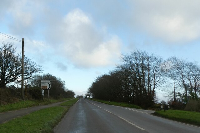
Coxpark Plantation is a picturesque wood located in the county of Cornwall, England. Situated in the heart of the beautiful countryside, the plantation covers a vast area of land and is known for its diverse range of trees and wildlife.

The woodland is predominantly made up of native species, including oak, beech, and ash trees, which create a dense and lush forest. The mature trees stand tall and provide a canopy of shade, making it an ideal spot for leisurely walks or picnics on sunny days. The plantation also boasts a variety of smaller shrubs and ferns, adding to its natural charm.

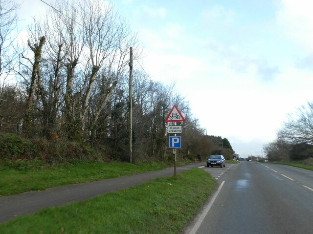
Visitors to Coxpark Plantation can enjoy a network of well-maintained walking trails that wind their way through the woodland. These paths offer an opportunity to explore the plantation's natural beauty and discover its hidden treasures. The peaceful atmosphere and tranquil surroundings make it a popular destination for nature enthusiasts, hikers, and families alike.

The plantation is home to a wide range of wildlife, including birds, mammals, and insects. Birdwatchers will delight in the chance to spot various species, such as woodpeckers, owls, and red kites, among others. The woodland also provides a habitat for deer, foxes, and small mammals, adding to the area's biodiversity.

Coxpark Plantation is a well-preserved natural haven that offers a peaceful retreat from the hustle and bustle of modern life. Its stunning natural features and rich wildlife make it a must-visit destination for those seeking a connection with nature in the beautiful county of Cornwall.

If you have any feedback on the listing, please let us know in the comments section below.

Coxpark Plantation Images

Images are sourced within 2km of 50.529707/-4.2512156 or Grid Reference SX4072. Thanks to Geograph Open Source API. All images are credited.

B3257 joining A390 at Poltair Some modern walling on each side.
B3257 joining A390 at Poltair
Some modern walling on each side.
A390 junction with road south to Harrowbarrow The A390 runs along much of the length of Cornwall. It heads across river valleys rather than along them, and therefore is hilly and windy. As such, it makes it fun to drive, and is never the same throughout its length. It runs 60 miles from Tavistock  <a href="https://www.geograph.org.uk/photo/5707471">SX4773 : A390, Tavistock</a> to Three Burrows.
<span class="nowrap"><a title="http://www.sabre-roads.org.uk/wiki/index.php?title=A390" rel="nofollow ugc noopener" href="http://www.sabre-roads.org.uk/wiki/index.php?title=A390">Link</a><img style="margin-left:2px;" alt="External link" title="External link - shift click to open in new window" src="https://s1.geograph.org.uk/img/external.png" width="10" height="10"/></span>
A390 junction with road south to Harrowbarrow
The A390 runs along much of the length of Cornwall. It heads across river valleys rather than along them, and therefore is hilly and windy. As such, it makes it fun to drive, and is never the same throughout its length. It runs 60 miles from Tavistock SX4773 : A390, Tavistock to Three Burrows. LinkExternal link
Lay-by by A390 to west of Mount Pleasant There is advance warning of cycles crossing because the cycle track is on the left of the road and cyclists will cross to a track on the right.  Pedestrians must also cross, but there is no advance warning, possibly because there is very little pedestrian traffic on the path on the left
Lay-by by A390 to west of Mount Pleasant
There is advance warning of cycles crossing because the cycle track is on the left of the road and cyclists will cross to a track on the right. Pedestrians must also cross, but there is no advance warning, possibly because there is very little pedestrian traffic on the path on the left
Bus shelter by A390 in St Ann's Chapel St Ann's Chapel is a hamlet in the parish of Calstock, Cornwall. It is west of Gunnislake on the A390 between Tavistock and Liskeard. The hamlet has a pub - The Rifle Volunteer.
Bus shelter by A390 in St Ann's Chapel
St Ann's Chapel is a hamlet in the parish of Calstock, Cornwall. It is west of Gunnislake on the A390 between Tavistock and Liskeard. The hamlet has a pub - The Rifle Volunteer.
Thimble Hall
Thimble Hall
Former Wesleyan Chapel
Former Wesleyan Methodist Chapel
New Consols Flue Stack One of two stacks built on the hill at Monk's Corner by the New Consols Mine Company after locals claimed an injunction due to the ill health of livestock and the quality of the adjoining fields caused by fumes from the arsenic works down at Luckett in 1872.
New Consols Flue Stack
One of two stacks built on the hill at Monk's Corner by the New Consols Mine Company after locals claimed an injunction due to the ill health of livestock and the quality of the adjoining fields caused by fumes from the arsenic works down at Luckett in 1872.
Old Milestone south of Haylands Carved stone post by the UC road, in parish of STOKE CLIMSLAND (NORTH CORNWALL District), Haylands, on bend on steep hill, set into Cornish hedge, on East side of road. Callington C tombstone, erected by the Callington turnpike trust in the 18th century. 

Inscription reads:- 
C
3 

Grade II Listed. List Entry Number: 1220243
<span class="nowrap"><a title="https://historicengland.org.uk/listing/the-list/list-entry/1220243" rel="nofollow ugc noopener" href="https://historicengland.org.uk/listing/the-list/list-entry/1220243">Link</a><img style="margin-left:2px;" alt="External link" title="External link - shift click to open in new window" src="https://s1.geograph.org.uk/img/external.png" width="10" height="10"/></span>

Milestone Society National ID: CW_CLHB03.
Old Milestone south of Haylands
Carved stone post by the UC road, in parish of STOKE CLIMSLAND (NORTH CORNWALL District), Haylands, on bend on steep hill, set into Cornish hedge, on East side of road. Callington C tombstone, erected by the Callington turnpike trust in the 18th century. Inscription reads:- C 3 Grade II Listed. List Entry Number: 1220243 LinkExternal link Milestone Society National ID: CW_CLHB03.
Sherwell
Sherwell
Higher Sherwell Farm
Neptune
Neptune
Track to Kittor
Track to Kittor
Road junction, Sevenstones
Tamar View Farmhouse
Indistinct tumuli A tumulus (plural tumuli) is a mound of earth and stones raised over a grave or graves. Tumuli are also known as barrows, burial mounds. In Britain they mainly date from Neolithic to the Bronze Age (2900 - 800BC), although some are later.
Indistinct tumuli
A tumulus (plural tumuli) is a mound of earth and stones raised over a grave or graves. Tumuli are also known as barrows, burial mounds. In Britain they mainly date from Neolithic to the Bronze Age (2900 - 800BC), although some are later.
Field, Sevenstones
Field, Sevenstones
Road to Coxpark
Road to Coxpark
Show me another place!

Coxpark Plantation is located at Grid Ref: SX4072 (Lat: 50.529707, Lng: -4.2512156)

Unitary Authority: Cornwall

Police Authority: Devon and Cornwall

What 3 Words

///calendars.producers.cans. Near Gunnislake, Cornwall

Nearby Locations

Coxpark Coxpark Plantation

Related Wikis

Latchley railway station

Latchley railway station (Cornish: Hallannergh) served the village of Latchley, Cornwall, England, from 1908 to 1966 on the Callington Branch. == History... ==

Coxpark

Coxpark is a hamlet in the parish of Calstock (where the population is included), Cornwall, England. == References ==

Battle of Hingston Down

The Battle of Hingston Down took place in 838, probably at Hingston Down in Cornwall between a combined force of Cornish and Vikings on the one side, and...

Hingston Down

Hingston Down is a hill not far from Gunnislake in Cornwall, England, United Kingdom. It is the subject of an old rhyme, due to the prolific tin mining...

Latchley

Latchley is a village in the Tamar Valley in Cornwall, England, UK. It is in the parish of Calstock (where the population of the 2011 census is included...

Chilsworthy railway station

Chilsworthy railway station (Cornish: Karjyl) served the village of Chilsworthy, Cornwall, England, from 1909 to 1966 on the Callington Branch. == History... ==

Sylvia's Meadow

Sylvia's Meadow, a Site of Special Scientific Interest, is a nature reserve owned and managed by Cornwall Wildlife Trust. It is a herb rich, 5-hectare...

St Ann's Chapel, Cornwall

St Ann's Chapel is a village in the parish of Calstock, Cornwall, England, United Kingdom. It is west of Gunnislake on the A390 between Tavistock and Liskeard...

Related Videos

Walk In The Woods / New Year's Day 2023 / Cornwall

Today I got off my butt and took myself out for a walk to Greenscombe Woods, Luckett , Cornwall. I called up my buddy Stu AKA ...

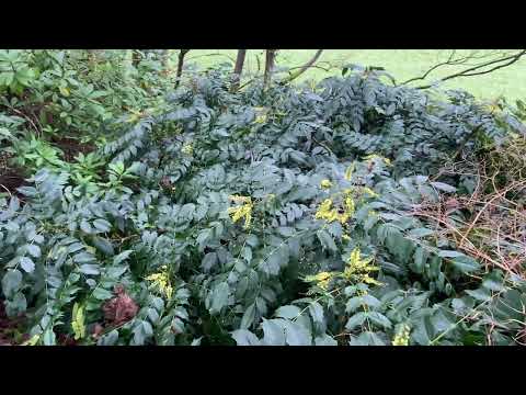
Snowdrops and Sunshine: Welcoming Spring at Barrett’s

Welcome back to Barrett's Mill, as the woodland embraces the subtle but unmistakable signs of spring with a carpet of Snowdrops.

Nearby Amenities

Located within 500m of 50.529707,-4.2512156
Barrier: yes
Lat/Long: 50.5269226/-4.2566345
The data included in this document is from www.openstreetmap.org. The data is made available under ODbL.

Have you been to Coxpark Plantation?

Leave your review of Coxpark Plantation below (or comments, questions and feedback).