Behest Wood

Wood, Forest in Cornwall

England

Behest Wood

A38 Liskeard Road The A38 is a major A-class trunk route. When first designated in 1922, it ran from Derby to Plymouth but it was later extended at both ends so that it now runs for 292 miles from Mansfield in Nottinghamshire to Bodmin in Cornwall.

Prior to the opening of the M5 motorway in the 1960s and 1970s, the A38 formed the main "holiday route" from the Midlands to Somerset, Devon and Cornwall and the south-western section was notorious at holiday times for the congestion. Nowadays, for most of the southern section, the A38 is a fairly quiet road shadowing the M5 extremely closely; often running alongside the motorway as a single carriageway road. The section between Exeter and Plymouth is, however, a busy dual carriageway which serves as the southern extension of the M5 and is known as “the Devon Expressway”.

More information at <span class="nowrap"><a title="http://en.wikipedia.org/wiki/A38_road" rel="nofollow ugc noopener" href="http://en.wikipedia.org/wiki/A38_road">Link</a><img style="margin-left:2px;" alt="External link" title="External link - shift click to open in new window" src="https://s1.geograph.org.uk/img/external.png" width="10" height="10"/></span>  (Wikipedia) and <span class="nowrap"><a title="http://www.sabre-roads.org.uk/wiki/index.php?title=A38" rel="nofollow ugc noopener" href="http://www.sabre-roads.org.uk/wiki/index.php?title=A38">Link</a><img style="margin-left:2px;" alt="External link" title="External link - shift click to open in new window" src="https://s1.geograph.org.uk/img/external.png" width="10" height="10"/></span>  (SABRE).
A38 Liskeard Road Credit: David Dixon

Behest Wood is a picturesque woodland located in the county of Cornwall, in the southwestern part of England. It covers an area of approximately 100 acres and is a popular destination for nature lovers and outdoor enthusiasts.

The wood is characterized by its diverse range of flora and fauna, with a variety of native trees such as oak, beech, and birch dominating the landscape. The dense canopy formed by these trees provides a sheltered habitat for a multitude of wildlife, including birds, squirrels, and deer.

Visitors to Behest Wood can enjoy a peaceful and tranquil environment, as the wood is often described as a haven of serenity. There are several walking trails that wind through the woodland, allowing visitors to explore its beauty at their own pace. The paths are well-maintained and clearly marked, making it easy for visitors to navigate their way through the wood.

Throughout the seasons, Behest Wood exhibits a stunning display of natural beauty. In spring, the woodland floor is carpeted with vibrant wildflowers, while in autumn, the trees transform into a kaleidoscope of warm hues, creating a breathtaking sight. Wildlife enthusiasts will also appreciate the opportunity to spot various species of birds and mammals that call the wood their home.

Behest Wood is a cherished natural treasure in Cornwall, offering an escape from the hustle and bustle of modern life. Whether it's a leisurely stroll, a wildlife-spotting adventure, or simply a moment of tranquility, this woodland has something to offer to all those who venture within its borders.

If you have any feedback on the listing, please let us know in the comments section below.
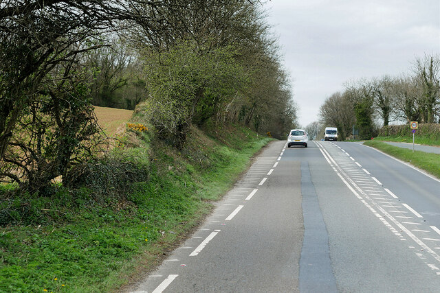
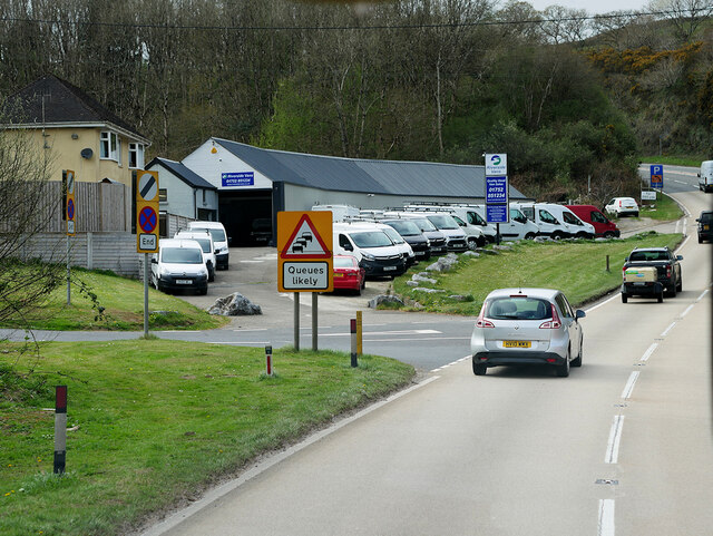
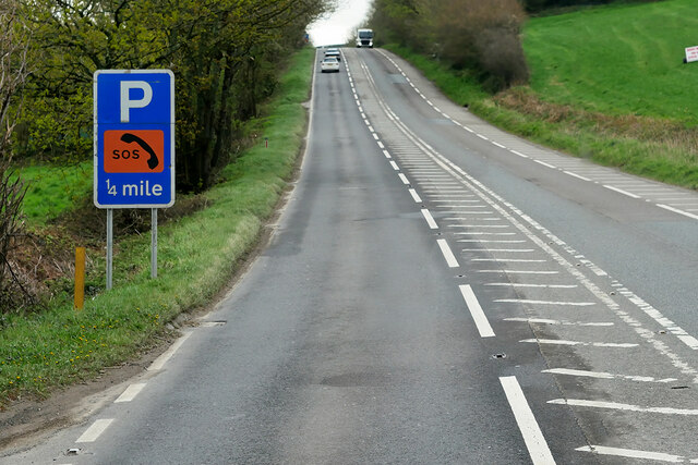
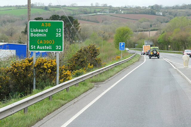
Behest Wood Images

Images are sourced within 2km of 50.419686/-4.2541303 or Grid Reference SX3960. Thanks to Geograph Open Source API. All images are credited.

A38 Liskeard Road The A38 is a major A-class trunk route. When first designated in 1922, it ran from Derby to Plymouth but it was later extended at both ends so that it now runs for 292 miles from Mansfield in Nottinghamshire to Bodmin in Cornwall.

Prior to the opening of the M5 motorway in the 1960s and 1970s, the A38 formed the main "holiday route" from the Midlands to Somerset, Devon and Cornwall and the south-western section was notorious at holiday times for the congestion. Nowadays, for most of the southern section, the A38 is a fairly quiet road shadowing the M5 extremely closely; often running alongside the motorway as a single carriageway road. The section between Exeter and Plymouth is, however, a busy dual carriageway which serves as the southern extension of the M5 and is known as “the Devon Expressway”.

More information at <span class="nowrap"><a title="http://en.wikipedia.org/wiki/A38_road" rel="nofollow ugc noopener" href="http://en.wikipedia.org/wiki/A38_road">Link</a><img style="margin-left:2px;" alt="External link" title="External link - shift click to open in new window" src="https://s1.geograph.org.uk/img/external.png" width="10" height="10"/></span>  (Wikipedia) and <span class="nowrap"><a title="http://www.sabre-roads.org.uk/wiki/index.php?title=A38" rel="nofollow ugc noopener" href="http://www.sabre-roads.org.uk/wiki/index.php?title=A38">Link</a><img style="margin-left:2px;" alt="External link" title="External link - shift click to open in new window" src="https://s1.geograph.org.uk/img/external.png" width="10" height="10"/></span>  (SABRE).
A38 Liskeard Road
The A38 is a major A-class trunk route. When first designated in 1922, it ran from Derby to Plymouth but it was later extended at both ends so that it now runs for 292 miles from Mansfield in Nottinghamshire to Bodmin in Cornwall. Prior to the opening of the M5 motorway in the 1960s and 1970s, the A38 formed the main "holiday route" from the Midlands to Somerset, Devon and Cornwall and the south-western section was notorious at holiday times for the congestion. Nowadays, for most of the southern section, the A38 is a fairly quiet road shadowing the M5 extremely closely; often running alongside the motorway as a single carriageway road. The section between Exeter and Plymouth is, however, a busy dual carriageway which serves as the southern extension of the M5 and is known as “the Devon Expressway”. More information at LinkExternal link (Wikipedia) and LinkExternal link (SABRE).
A38 passing Riverside Vans at Notter The A38 is a major A-class trunk route. When first designated in 1922, it ran from Derby to Plymouth but it was later extended at both ends so that it now runs for 292 miles from Mansfield in Nottinghamshire to Bodmin in Cornwall.

Prior to the opening of the M5 motorway in the 1960s and 1970s, the A38 formed the main "holiday route" from the Midlands to Somerset, Devon and Cornwall and the south-western section was notorious at holiday times for the congestion. Nowadays, for most of the southern section, the A38 is a fairly quiet road shadowing the M5 extremely closely; often running alongside the motorway as a single carriageway road. The section between Exeter and Plymouth is, however, a busy dual carriageway which serves as the southern extension of the M5 and is known as “the Devon Expressway”.

More information at <span class="nowrap"><a title="http://en.wikipedia.org/wiki/A38_road" rel="nofollow ugc noopener" href="http://en.wikipedia.org/wiki/A38_road">Link</a><img style="margin-left:2px;" alt="External link" title="External link - shift click to open in new window" src="https://s1.geograph.org.uk/img/external.png" width="10" height="10"/></span>  (Wikipedia) and <span class="nowrap"><a title="http://www.sabre-roads.org.uk/wiki/index.php?title=A38" rel="nofollow ugc noopener" href="http://www.sabre-roads.org.uk/wiki/index.php?title=A38">Link</a><img style="margin-left:2px;" alt="External link" title="External link - shift click to open in new window" src="https://s1.geograph.org.uk/img/external.png" width="10" height="10"/></span>  (SABRE).
A38 passing Riverside Vans at Notter
The A38 is a major A-class trunk route. When first designated in 1922, it ran from Derby to Plymouth but it was later extended at both ends so that it now runs for 292 miles from Mansfield in Nottinghamshire to Bodmin in Cornwall. Prior to the opening of the M5 motorway in the 1960s and 1970s, the A38 formed the main "holiday route" from the Midlands to Somerset, Devon and Cornwall and the south-western section was notorious at holiday times for the congestion. Nowadays, for most of the southern section, the A38 is a fairly quiet road shadowing the M5 extremely closely; often running alongside the motorway as a single carriageway road. The section between Exeter and Plymouth is, however, a busy dual carriageway which serves as the southern extension of the M5 and is known as “the Devon Expressway”. More information at LinkExternal link (Wikipedia) and LinkExternal link (SABRE).
A38 between Landrake and Saltash The A38 is a major A-class trunk route. When first designated in 1922, it ran from Derby to Plymouth but it was later extended at both ends so that it now runs for 292 miles from Mansfield in Nottinghamshire to Bodmin in Cornwall.

Prior to the opening of the M5 motorway in the 1960s and 1970s, the A38 formed the main "holiday route" from the Midlands to Somerset, Devon and Cornwall and the south-western section was notorious at holiday times for the congestion. Nowadays, for most of the southern section, the A38 is a fairly quiet road shadowing the M5 extremely closely; often running alongside the motorway as a single carriageway road. The section between Exeter and Plymouth is, however, a busy dual carriageway which serves as the southern extension of the M5 and is known as “the Devon Expressway”.

More information at <span class="nowrap"><a title="http://en.wikipedia.org/wiki/A38_road" rel="nofollow ugc noopener" href="http://en.wikipedia.org/wiki/A38_road">Link</a><img style="margin-left:2px;" alt="External link" title="External link - shift click to open in new window" src="https://s1.geograph.org.uk/img/external.png" width="10" height="10"/></span>  (Wikipedia) and <span class="nowrap"><a title="http://www.sabre-roads.org.uk/wiki/index.php?title=A38" rel="nofollow ugc noopener" href="http://www.sabre-roads.org.uk/wiki/index.php?title=A38">Link</a><img style="margin-left:2px;" alt="External link" title="External link - shift click to open in new window" src="https://s1.geograph.org.uk/img/external.png" width="10" height="10"/></span>  (SABRE).
A38 between Landrake and Saltash
The A38 is a major A-class trunk route. When first designated in 1922, it ran from Derby to Plymouth but it was later extended at both ends so that it now runs for 292 miles from Mansfield in Nottinghamshire to Bodmin in Cornwall. Prior to the opening of the M5 motorway in the 1960s and 1970s, the A38 formed the main "holiday route" from the Midlands to Somerset, Devon and Cornwall and the south-western section was notorious at holiday times for the congestion. Nowadays, for most of the southern section, the A38 is a fairly quiet road shadowing the M5 extremely closely; often running alongside the motorway as a single carriageway road. The section between Exeter and Plymouth is, however, a busy dual carriageway which serves as the southern extension of the M5 and is known as “the Devon Expressway”. More information at LinkExternal link (Wikipedia) and LinkExternal link (SABRE).
Approaching Vollards Lane, Hatt
Eastbound A38 near Burraton Blue signs giving advance notice of toll charges on the Tamar Bridge ahead (although traffic will have to negotiate the Saltash Tunnel before reaching the bridge).
Eastbound A38 near Burraton
Blue signs giving advance notice of toll charges on the Tamar Bridge ahead (although traffic will have to negotiate the Saltash Tunnel before reaching the bridge).
Westbound A38 at Carkeel The A38 is a major A-class trunk route. When first designated in 1922, it ran from Derby to Plymouth but it was later extended at both ends so that it now runs for 292 miles from Mansfield in Nottinghamshire to Bodmin in Cornwall.

Prior to the opening of the M5 motorway in the 1960s and 1970s, the A38 formed the main "holiday route" from the Midlands to Somerset, Devon and Cornwall and the south-western section was notorious at holiday times for the congestion. Nowadays, for most of the southern section, the A38 is a fairly quiet road shadowing the M5 extremely closely; often running alongside the motorway as a single carriageway road. The section between Exeter and Plymouth is, however, a busy dual carriageway which serves as the southern extension of the M5 and is known as “the Devon Expressway”.

More information at <span class="nowrap"><a title="http://en.wikipedia.org/wiki/A38_road" rel="nofollow ugc noopener" href="http://en.wikipedia.org/wiki/A38_road">Link</a><img style="margin-left:2px;" alt="External link" title="External link - shift click to open in new window" src="https://s1.geograph.org.uk/img/external.png" width="10" height="10"/></span>  (Wikipedia) and <span class="nowrap"><a title="http://www.sabre-roads.org.uk/wiki/index.php?title=A38" rel="nofollow ugc noopener" href="http://www.sabre-roads.org.uk/wiki/index.php?title=A38">Link</a><img style="margin-left:2px;" alt="External link" title="External link - shift click to open in new window" src="https://s1.geograph.org.uk/img/external.png" width="10" height="10"/></span>  (SABRE).
Westbound A38 at Carkeel
The A38 is a major A-class trunk route. When first designated in 1922, it ran from Derby to Plymouth but it was later extended at both ends so that it now runs for 292 miles from Mansfield in Nottinghamshire to Bodmin in Cornwall. Prior to the opening of the M5 motorway in the 1960s and 1970s, the A38 formed the main "holiday route" from the Midlands to Somerset, Devon and Cornwall and the south-western section was notorious at holiday times for the congestion. Nowadays, for most of the southern section, the A38 is a fairly quiet road shadowing the M5 extremely closely; often running alongside the motorway as a single carriageway road. The section between Exeter and Plymouth is, however, a busy dual carriageway which serves as the southern extension of the M5 and is known as “the Devon Expressway”. More information at LinkExternal link (Wikipedia) and LinkExternal link (SABRE).
St Mary's Church
St Mary's Church
Former Botus Fleming Wesleyan Chapel
Saltash Travelodge
Saltash Travelodge
Notter Bridge, near Saltash, Cornwall Notter Bridge over the River Lynher, near Saltash, Cornwall. The road over the bridge used to form part of the main A38 road into Cornwall until the road was realigned.
Notter Bridge, near Saltash, Cornwall
Notter Bridge over the River Lynher, near Saltash, Cornwall. The road over the bridge used to form part of the main A38 road into Cornwall until the road was realigned.
Quarry Cocks Lane, Notter Bridge, near Saltash A disused (and now re-used for a different purpose) quarry on Quarry Cocks Lane, Notter Bridge, near Saltash. The River Lynher runs just off to the right hand side of the picture.
Quarry Cocks Lane, Notter Bridge, near Saltash
A disused (and now re-used for a different purpose) quarry on Quarry Cocks Lane, Notter Bridge, near Saltash. The River Lynher runs just off to the right hand side of the picture.
Stoketon Cross, near Saltash Stoketon Cross, on the A38 near Saltash has been the scene of many serious road accidents. The road leading into the picture from the left is a fairly steep hill and traffic comes over the crest to sometimes meet slow traffic crossing its path across the staggered junction with inevitable consequences. The car heading towards the camera has come from the Saltash direction.
Stoketon Cross, near Saltash
Stoketon Cross, on the A38 near Saltash has been the scene of many serious road accidents. The road leading into the picture from the left is a fairly steep hill and traffic comes over the crest to sometimes meet slow traffic crossing its path across the staggered junction with inevitable consequences. The car heading towards the camera has come from the Saltash direction.
Road junction, Trematon Junction south of Trematon, near Saltash, Cornwall. The right fork leads to Elm Gate, and the left towards Trehan. Vandals have been busy with the road signs, and have removed some of the stick on letters.
Road junction, Trematon
Junction south of Trematon, near Saltash, Cornwall. The right fork leads to Elm Gate, and the left towards Trehan. Vandals have been busy with the road signs, and have removed some of the stick on letters.
Farmer's tea break, Trematon A scene south of Trematon village, near Saltash. The tractor parked by the side of the road hadn't been there long - the engine was still warm! This view is looking towards Trematon.
Farmer's tea break, Trematon
A scene south of Trematon village, near Saltash. The tractor parked by the side of the road hadn't been there long - the engine was still warm! This view is looking towards Trematon.
Cumble Tor View Taken from the farm gateway at the 90º bend on the lane through Cumble Tor.
A good heap of manure in the foreground and splendid views down the River Lynher past the Boating Centre to the railway viaduct in the distance.
Cumble Tor View
Taken from the farm gateway at the 90º bend on the lane through Cumble Tor. A good heap of manure in the foreground and splendid views down the River Lynher past the Boating Centre to the railway viaduct in the distance.
The Crooked Inn, Stoketon There's a good few farm animals wandering around the grounds of this inn - especially ducks - and they're ducks with attitude too !
The Crooked Inn, Stoketon
There's a good few farm animals wandering around the grounds of this inn - especially ducks - and they're ducks with attitude too !
Holland Inn, Hatt, Saltash The Holland Inn, on the A388 at Hatt, near Saltash
Holland Inn, Hatt, Saltash
The Holland Inn, on the A388 at Hatt, near Saltash
Hatt service station, Saltash, Cornwall Hatt service station, just off the A388 at Hatt, near Saltash, Cornwall.
Hatt service station, Saltash, Cornwall
Hatt service station, just off the A388 at Hatt, near Saltash, Cornwall.
Show me another place!

Behest Wood is located at Grid Ref: SX3960 (Lat: 50.419686, Lng: -4.2541303)

Unitary Authority: Cornwall

Police Authority: Devon and Cornwall

What 3 Words

///fried.serenade.headless. Near Saltash, Cornwall

Nearby Locations

Marsh Wood Behest Wood

Related Wikis

Carkeel

Carkeel is a hamlet north of Saltash in southeast Cornwall, England. == References ==

Botusfleming

Botus Fleming or Botusfleming (Cornish: Bosflumyes) is a village and civil parish in southeast Cornwall, England, United Kingdom. The 2001 census gives...

Trematon

Trematon is a village in Cornwall, England, UK, accessible via the A38 and about two miles (3 km) from the town of Saltash and part of the civil parish...

Notter, Cornwall

Notter and Notter Bridge are adjoining hamlets in southeast Cornwall, England, United Kingdom. They are situated in the civil parish of St Stephens-by...

Nearby Amenities

Located within 500m of 50.419686,-4.2541303
Phone
Emergency: phone
Lat/Long: 50.4171424/-4.2566127
Power: pole
Lat/Long: 50.4230597/-4.2579116
Power: pole
Lat/Long: 50.4234186/-4.2577654
Power: pole
Lat/Long: 50.42233/-4.2594217
Power: pole
Lat/Long: 50.4226684/-4.2580833
Power: pole
Lat/Long: 50.4227376/-4.2588785
Power: pole
Lat/Long: 50.4153016/-4.2540479
Power: pole
Lat/Long: 50.4163391/-4.2561856
Power: pole
Lat/Long: 50.415905/-4.2553246
Power: pole
Lat/Long: 50.416992/-4.2593533
Power: pole
Lat/Long: 50.4166741/-4.2586345
Power: pole
Lat/Long: 50.4219669/-4.2568105
Power: pole
Lat/Long: 50.4205792/-4.2566067
Power: pole
Lat/Long: 50.4184857/-4.2563009
Power: pole
Lat/Long: 50.418431/-4.2535946
Power: pole
Lat/Long: 50.4183951/-4.2526236
Power: pole
Lat/Long: 50.4183541/-4.2502043
Power: pole
Lat/Long: 50.4176124/-4.2563412
Power: pole
Lat/Long: 50.4183695/-4.2575106
Power: pole
Lat/Long: 50.4199777/-4.2599005
Power: pole
Lat/Long: 50.4209313/-4.2604423
Power: pole
Lat/Long: 50.4208902/-4.260622
Power: pole
Lat/Long: 50.4199383/-4.2600855
Power: pole
Lat/Long: 50.4189505/-4.2586425
Power: pole
Lat/Long: 50.4176756/-4.2567864
Power: pole
Lat/Long: 50.4169937/-4.2557967
Power: pole
Lat/Long: 50.4162314/-4.2556706
Power: pole
Lat/Long: 50.4157682/-4.2555848
Power: pole
Lat/Long: 50.4183473/-4.2483401
Power: pole
Lat/Long: 50.417491/-4.2495552
Power: pole
Lat/Long: 50.417409/-4.2509526
Power: pole
Lat/Long: 50.4172329/-4.2539835
Power: pole
Lat/Long: 50.4171424/-4.2556572
Fire Hydrant
Emergency: fire_hydrant
Fire Hydrant Type: underground
Survey Date: 2022-12-14
Lat/Long: 50.4160877/-4.2578505
The data included in this document is from www.openstreetmap.org. The data is made available under ODbL.

Have you been to Behest Wood?

Leave your review of Behest Wood below (or comments, questions and feedback).