Coombedown Wood

Wood, Forest in Cornwall

England

Coombedown Wood

New Consols Mine in 1984 <span class="nowrap"><a title="https://historicengland.org.uk/listing/the-list/list-entry/1409595?section=official-listing" rel="nofollow ugc noopener" href="https://historicengland.org.uk/listing/the-list/list-entry/1409595?section=official-listing">Link</a><img style="margin-left:2px;" alt="External link" title="External link - shift click to open in new window" src="https://s1.geograph.org.uk/img/external.png" width="10" height="10"/></span>
New Consols Mine in 1984 Credit: Sandy Gerrard

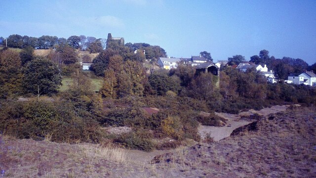
Coombedown Wood is a picturesque woodland located in Cornwall, a county in southwestern England. Covering an area of approximately 50 acres, this enchanting forest is nestled in the heart of the countryside, providing a serene and tranquil escape for nature enthusiasts.

The wood is predominantly composed of a mixture of deciduous and coniferous trees, creating a diverse and vibrant landscape throughout the year. Towering oak, beech, and ash trees dominate the canopy, casting dappled sunlight onto the forest floor. The lower levels are adorned with a rich undergrowth of ferns, wildflowers, and moss-covered rocks, adding to the area's natural beauty.

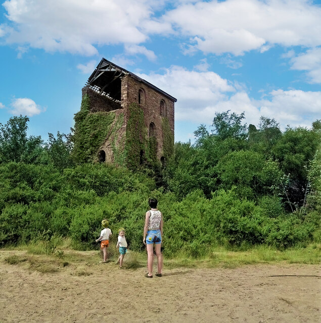
Coombedown Wood is crisscrossed by meandering pathways, allowing visitors to explore the area at their leisure. These well-maintained trails wind through the forest, leading to hidden glades and secluded pockets of tranquility. The wood is home to a variety of wildlife, including deer, foxes, and a myriad of bird species, making it a haven for wildlife enthusiasts and photographers alike.

The wood also boasts a small stream that gently meanders through its heart, adding to the peaceful ambiance of the surroundings. The soothing sound of running water enhances the overall sensory experience, inviting visitors to unwind and connect with nature.

Whether it's a leisurely stroll, a picnic, or a birdwatching expedition, Coombedown Wood offers a respite from the hustle and bustle of everyday life. Its natural charm and serenity make it a popular destination for locals and tourists seeking solace in the heart of Cornwall's countryside.

If you have any feedback on the listing, please let us know in the comments section below.

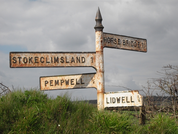
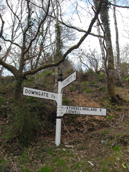
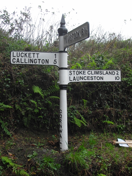
Coombedown Wood Images

Images are sourced within 2km of 50.551734/-4.2674693 or Grid Reference SX3974. Thanks to Geograph Open Source API. All images are credited.

New Consols Mine in 1984 <span class="nowrap"><a title="https://historicengland.org.uk/listing/the-list/list-entry/1409595?section=official-listing" rel="nofollow ugc noopener" href="https://historicengland.org.uk/listing/the-list/list-entry/1409595?section=official-listing">Link</a><img style="margin-left:2px;" alt="External link" title="External link - shift click to open in new window" src="https://s1.geograph.org.uk/img/external.png" width="10" height="10"/></span>
New Consols Mine in 1984
Wheal Martha or New Great Consols, Luckett One of the engine houses on this mine, taken in 1977. This was the 28 inch crusher. The mine was noted for its complicated ores, making separation difficult. These included copper, arsenic, silver, wolfram, tin and pyrite. For many years the main pumping engine remained in its house, rusting away. These days the excessive ivy growth has more or less completely enveloped this house.
Wheal Martha or New Great Consols, Luckett
One of the engine houses on this mine, taken in 1977. This was the 28 inch crusher. The mine was noted for its complicated ores, making separation difficult. These included copper, arsenic, silver, wolfram, tin and pyrite. For many years the main pumping engine remained in its house, rusting away. These days the excessive ivy growth has more or less completely enveloped this house.
St Mary's Church
St Mary's Church
Former Wesleyan Chapel
Old Milestone, Horsebridge Carved stone post by the UC road, in parish of Stokeclimsland (North Cornwall District), Horsebridge, by roadside next to water meadow, on South side of road. Callington C tombstone, erected by the Callington Turnpike Trust in the 18th century. 

Inscription reads:-
C
4¾
MILES
 
Grade II listed. List Entry Number: 1220434
<span class="nowrap"><a title="https://historicengland.org.uk/listing/the-list/list-entry/1220434" rel="nofollow ugc noopener" href="https://historicengland.org.uk/listing/the-list/list-entry/1220434">Link</a><img style="margin-left:2px;" alt="External link" title="External link - shift click to open in new window" src="https://s1.geograph.org.uk/img/external.png" width="10" height="10"/></span>

Milestone Society National ID: CW_CLHB04.
Old Milestone, Horsebridge
Carved stone post by the UC road, in parish of Stokeclimsland (North Cornwall District), Horsebridge, by roadside next to water meadow, on South side of road. Callington C tombstone, erected by the Callington Turnpike Trust in the 18th century. Inscription reads:- C 4¾ MILES Grade II listed. List Entry Number: 1220434 LinkExternal link Milestone Society National ID: CW_CLHB04.
Old Direction Sign - Signpost south west of Tutwell Raised finial - G; by the UC road, in parish of Stoke Climsland (Caradon District), Tutwell T junction, on bank.

Surveyed

Milestone Society National ID: CW_SX3875.
Old Direction Sign - Signpost south west of Tutwell
Raised finial - G; by the UC road, in parish of Stoke Climsland (Caradon District), Tutwell T junction, on bank. Surveyed Milestone Society National ID: CW_SX3875.
Old Direction Sign - Signpost north west of Lidwell, Stokeclimsland Parish Raised finial - G; by the UC road, in parish of Stokeclimsland (Caradon District), at crossroads North West of Lidwell, behind Cornish hedge. Post is in field with just arms showing.

To be surveyed

Milestone Society National ID: CW_SX3774
Old Direction Sign - Signpost north west of Lidwell, Stokeclimsland Parish
Raised finial - G; by the UC road, in parish of Stokeclimsland (Caradon District), at crossroads North West of Lidwell, behind Cornish hedge. Post is in field with just arms showing. To be surveyed Milestone Society National ID: CW_SX3774
Old Direction Sign - Signpost by Broadgate, Stoke Climsland Parish Raised finial - G type; by the UC road, in parish of Stoke Climsland (Caradon District), East of Luckett, on bank.

Cornwall & Scilly HER listed.
HER Number: MCO57731 <span class="nowrap"><a title="https://www.heritagegateway.org.uk/Gateway/Results_Single.aspx?uid=MCO57731&resourceID=1020" rel="nofollow ugc noopener" href="https://www.heritagegateway.org.uk/Gateway/Results_Single.aspx?uid=MCO57731&resourceID=1020">Link</a><img style="margin-left:2px;" alt="External link" title="External link - shift click to open in new window" src="https://s1.geograph.org.uk/img/external.png" width="10" height="10"/></span>

Surveyed

Milestone Society National ID: CW_SX3873
Old Direction Sign - Signpost by Broadgate, Stoke Climsland Parish
Raised finial - G type; by the UC road, in parish of Stoke Climsland (Caradon District), East of Luckett, on bank. Cornwall & Scilly HER listed. HER Number: MCO57731 LinkExternal link Surveyed Milestone Society National ID: CW_SX3873
Old Direction Sign - Signpost by Hampt Wood, Stoke Climsland Pyramid finial - strap repair to arm 1, weld repair to arm 3; Cornwall by the UC road, in parish of Stoke Climsland (North Cornwall District), Middle Hampt, Luckett junction, on bank.

Cornwall & Scilly HER.
HER Number: MCO57021 <span class="nowrap"><a title="https://www.heritagegateway.org.uk/Gateway/Results_Single.aspx?uid=MCO57021&resourceID=1020" rel="nofollow ugc noopener" href="https://www.heritagegateway.org.uk/Gateway/Results_Single.aspx?uid=MCO57021&resourceID=1020">Link</a><img style="margin-left:2px;" alt="External link" title="External link - shift click to open in new window" src="https://s1.geograph.org.uk/img/external.png" width="10" height="10"/></span>

Surveyed

Milestone Society National ID: CW_SX3974
Old Direction Sign - Signpost by Hampt Wood, Stoke Climsland
Pyramid finial - strap repair to arm 1, weld repair to arm 3; Cornwall by the UC road, in parish of Stoke Climsland (North Cornwall District), Middle Hampt, Luckett junction, on bank. Cornwall & Scilly HER. HER Number: MCO57021 LinkExternal link Surveyed Milestone Society National ID: CW_SX3974
Old Milestone west of Horsebridge Carved stone post by the UC road, in parish of Stokeclimsland (North Cornwall District), Horsebridge, by roadside next to water meadow, on South side of road. Callington 'C' tombstone, erected by the Callington Turnpike Trust in the 18th century. Just West of Boundary Marker: CW_STOKE02br <a href="https://www.geograph.org.uk/photo/6645001">SX3974 : Old Boundary Marker</a>

Inscription reads:-
C
4¾
MILES

Grade II listed. 
List Entry Number: 1220434 <span class="nowrap"><a title="https://historicengland.org.uk/listing/the-list/list-entry/1220434" rel="nofollow ugc noopener" href="https://historicengland.org.uk/listing/the-list/list-entry/1220434">Link</a><img style="margin-left:2px;" alt="External link" title="External link - shift click to open in new window" src="https://s1.geograph.org.uk/img/external.png" width="10" height="10"/></span>

Milestone Society National ID: CW_CLHB04.
Old Milestone west of Horsebridge
Carved stone post by the UC road, in parish of Stokeclimsland (North Cornwall District), Horsebridge, by roadside next to water meadow, on South side of road. Callington 'C' tombstone, erected by the Callington Turnpike Trust in the 18th century. Just West of Boundary Marker: CW_STOKE02br SX3974 : Old Boundary Marker Inscription reads:- C 4¾ MILES Grade II listed. List Entry Number: 1220434 LinkExternal link Milestone Society National ID: CW_CLHB04.
Old Boundary Marker County Bridge Marker on the south side of a minor road 100 metres west of Horse Bridge, River Tamar. Stokeclimsland parish. Inscribed C. The stone marks the extent of roadway adjoining the bridge that the County was obliged to maintain.

Milestone Society National ID: CW_STOKE02br
Old Boundary Marker
County Bridge Marker on the south side of a minor road 100 metres west of Horse Bridge, River Tamar. Stokeclimsland parish. Inscribed C. The stone marks the extent of roadway adjoining the bridge that the County was obliged to maintain. Milestone Society National ID: CW_STOKE02br
Luckett village, Cornwall Luckett village, Cornwall
Luckett village, Cornwall
Wood piles at Luckett Wood piles at Luckett, south east Cornwall.
Wood piles at Luckett
Wood piles at Luckett, south east Cornwall.
Green Fields The nearest field is grass, probably for silage but it looks like there are other crops being grown in this square.  It is difficult to tell in late May as almost everything looks green.
Green Fields
The nearest field is grass, probably for silage but it looks like there are other crops being grown in this square. It is difficult to tell in late May as almost everything looks green.
The Tamar Valley from Tutwell Tutwell is a hamlet which sits on the Cornish side of the Tamar Valley and it would command a good view of the valley were it not for all the trees getting in the way!
The Tamar Valley from Tutwell
Tutwell is a hamlet which sits on the Cornish side of the Tamar Valley and it would command a good view of the valley were it not for all the trees getting in the way!
House beyond a grass field You can always tell when you are looking in the direction of Kit Hill, the monument on the top gives it away.
House beyond a grass field
You can always tell when you are looking in the direction of Kit Hill, the monument on the top gives it away.
Cattle on the Tamar Flood Plain This is the scene on the Cornish side of the river at Horsebridge.
Cattle on the Tamar Flood Plain
This is the scene on the Cornish side of the river at Horsebridge.
Grass Field A large grass field, surrounded on all sides by country roads.
Grass Field
A large grass field, surrounded on all sides by country roads.
Show me another place!

Coombedown Wood is located at Grid Ref: SX3974 (Lat: 50.551734, Lng: -4.2674693)

Unitary Authority: Cornwall

Police Authority: Devon and Cornwall

What 3 Words

///flashback.automatic.covenants. Near Gunnislake, Cornwall

Nearby Locations

Hampt Wood Coombedown Wood

Related Wikis

Tutwell

Tutwell is a hamlet in the Tamar Valley east of Stoke Climsland, Cornwall, England, United Kingdom. == References ==

Luckett, Cornwall

Luckett is a hamlet in east Cornwall, England. It is situated in a former mining area beside the River Tamar approximately three miles (5 km) north of...

Sydenham Damerel

Sydenham Damerel, previously South Sydenham, is a village, parish and former manor in Devon, situated 4 miles north-west of Tavistock. The village lies...

Latchley

Latchley is a village in the Tamar Valley in Cornwall, England, UK. It is in the parish of Calstock (where the population of the 2011 census is included...

Pempwell

Pempwell is a hamlet near Stoke Climsland in Cornwall, England, UK. == References ==

Old Mill, Cornwall

Old Mill is a hamlet in the civil parish of Stokeclimsland, Cornwall, England. == References ==

Coxpark

Coxpark is a hamlet in the parish of Calstock (where the population is included), Cornwall, England. == References ==

Latchley railway station

Latchley railway station (Cornish: Hallannergh) served the village of Latchley, Cornwall, England, from 1908 to 1966 on the Callington Branch. == History... ==

Nearby Amenities

Located within 500m of 50.551734,-4.2674693
Horsebridge
Name Kw: Pons Howt
Place: hamlet
Lat/Long: 50.5519556/-4.260453
Milestone
Heritage: yes
Historic: yes
Wikidata: Q26514909
Lat/Long: 50.5515072/-4.2614186
The data included in this document is from www.openstreetmap.org. The data is made available under ODbL.

Have you been to Coombedown Wood?

Leave your review of Coombedown Wood below (or comments, questions and feedback).