Weston Wood

Wood, Forest in Devon

England

Weston Wood

Valley south of Hillside on B3254
Valley south of Hillside on B3254 Credit: David Smith

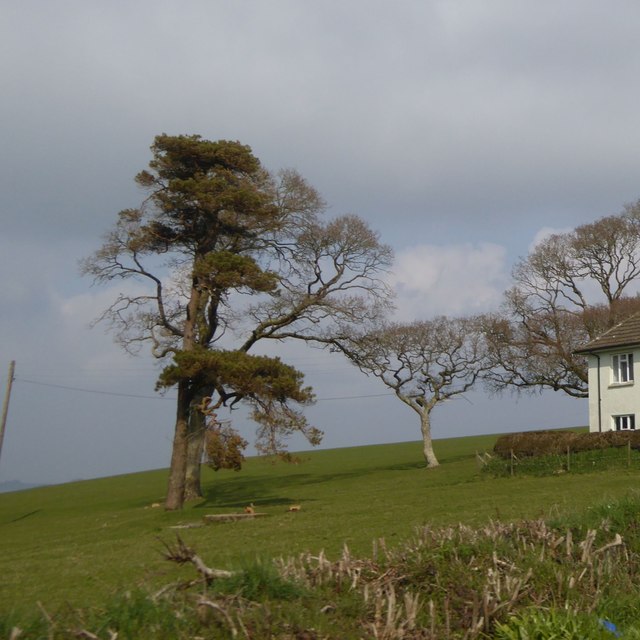
Weston Wood is a picturesque forest located in Devon, England. Spread across an area of approximately 100 acres, it is a popular destination for nature enthusiasts and outdoor lovers. The wood is situated near the small village of Weston, providing easy access for visitors.

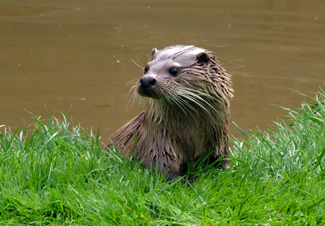
The woodland is primarily composed of a variety of deciduous trees, such as oak, beech, and birch, creating a diverse and vibrant ecosystem. The dense canopy shelters an array of flora and fauna, making it an ideal habitat for a range of wildlife species. Visitors can spot numerous bird species, including woodpeckers, owls, and various songbirds. Additionally, the forest is home to small mammals like foxes, rabbits, and squirrels.

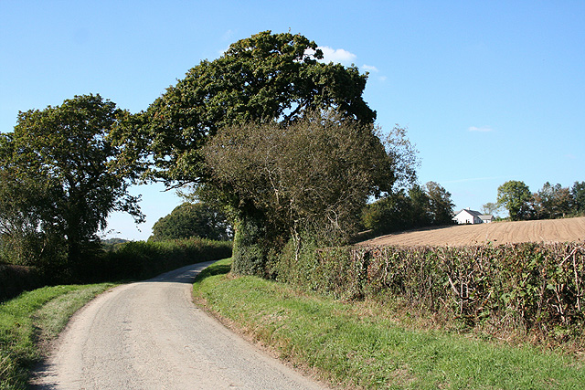
Walking trails wind through the woodland, providing visitors with an opportunity to explore its natural beauty. The paths are well-maintained and suitable for all fitness levels, making it a family-friendly destination. Along the trails, visitors can discover serene ponds, beautiful wildflowers, and enchanting clearings that provide scenic spots for picnics or relaxation.

Weston Wood offers a tranquil escape from the hustle and bustle of everyday life. Its peaceful atmosphere, coupled with the sounds of nature, makes it an ideal place for meditation or simply unwinding amidst the natural surroundings. The forest also hosts occasional events and workshops, allowing visitors to engage further with nature and learn about conservation efforts.

Overall, Weston Wood is a haven for nature lovers and a delightful destination for anyone seeking solace in the beauty of the great outdoors.

If you have any feedback on the listing, please let us know in the comments section below.

Weston Wood Images

Images are sourced within 2km of 50.669874/-4.4080926 or Grid Reference SX2988. Thanks to Geograph Open Source API. All images are credited.

Valley south of Hillside on B3254
Lane past Forda At the junction with the entrance to Forda Cottage (right). The farmhouse at Forda, ahead, has fine chimney stacks. "1844 ...  Vestigial Gothic style" <span class="nowrap"><a title="http://list.historicengland.org.uk/resultsingle.aspx?uid=1160350&searchtype=mapsearch" rel="nofollow ugc noopener" href="http://list.historicengland.org.uk/resultsingle.aspx?uid=1160350&searchtype=mapsearch">Link</a><img style="margin-left:2px;" alt="External link" title="External link - shift click to open in new window" src="https://s1.geograph.org.uk/img/external.png" width="10" height="10"/></span> .
Lane past Forda
At the junction with the entrance to Forda Cottage (right). The farmhouse at Forda, ahead, has fine chimney stacks. "1844 ... Vestigial Gothic style" LinkExternal link .
B3254 near Langdon Cross The B road dips to cross a tributary of the Tala Water as it approaches Langdon Cross.
B3254 near Langdon Cross
The B road dips to cross a tributary of the Tala Water as it approaches Langdon Cross.
In the Bolesbridge Water valley Footpath 529/4/1 passes a small copse as it crosses a tributary of the Bolesbridge Water, and heads upstream along the edge of the flood plain towards Forda Mill. Most of the mature trees visible are along the course of the stream.
In the Bolesbridge Water valley
Footpath 529/4/1 passes a small copse as it crosses a tributary of the Bolesbridge Water, and heads upstream along the edge of the flood plain towards Forda Mill. Most of the mature trees visible are along the course of the stream.
Bolesbridge Water The stream twists and turns its way in tight meanders across this level stretch of valley. Here it has formed a couple of miniature slip-off slopes while undermining the adjacent banks.
Bolesbridge Water
The stream twists and turns its way in tight meanders across this level stretch of valley. Here it has formed a couple of miniature slip-off slopes while undermining the adjacent banks.
Bolesbridge Water Unlike the nearby <a href="https://www.geograph.org.uk/photo/609009">SX2890 : Bolesbridge Water</a>, no slip-off slope is visible on the inside of this meander around a narrow neck of land. In the foreground, a barbed wire fence is gradually being left marooned in mid-air as the bank erodes.
Bolesbridge Water
Unlike the nearby SX2890 : Bolesbridge Water, no slip-off slope is visible on the inside of this meander around a narrow neck of land. In the foreground, a barbed wire fence is gradually being left marooned in mid-air as the bank erodes.
Solitary tree by B3254 south of Langdon
Isolated trees in a field near Peppershill Part of a line of trees that runs across the field, which appear to have lined a former approach to Peppershill
Isolated trees in a field near Peppershill
Part of a line of trees that runs across the field, which appear to have lined a former approach to Peppershill
Old Milestone by the B3254, opposite The Countryman, Langdon Cross Carved stone post by the B3254, in parish of NORTH PETHERWIN (NORTH CORNWALL District), Langdon Cross, on West side of road. N.B. Now relocated to small grass area between the Countryman Inn and Countryman Cottage, by Ian Thompson and Peter Goodchild - see <a href="https://www.geograph.org.uk/photo/6402486">SX3089 : Old Milestone in front of The Countryman, Langdon Cross</a> Launceston pillar, erected by the Launceston turnpike trust in the 19th century.  

Inscription reads:-
L
4

Grade II Listed. List Entry Number: 1142931
<span class="nowrap"><a title="https://historicengland.org.uk/listing/the-list/list-entry/1142931" rel="nofollow ugc noopener" href="https://historicengland.org.uk/listing/the-list/list-entry/1142931">Link</a><img style="margin-left:2px;" alt="External link" title="External link - shift click to open in new window" src="https://s1.geograph.org.uk/img/external.png" width="10" height="10"/></span>

Milestone Society National ID: CW_KHLA15.
Old Milestone by the B3254, opposite The Countryman, Langdon Cross
Carved stone post by the B3254, in parish of NORTH PETHERWIN (NORTH CORNWALL District), Langdon Cross, on West side of road. N.B. Now relocated to small grass area between the Countryman Inn and Countryman Cottage, by Ian Thompson and Peter Goodchild - see SX3089 : Old Milestone in front of The Countryman, Langdon Cross Launceston pillar, erected by the Launceston turnpike trust in the 19th century. Inscription reads:- L 4 Grade II Listed. List Entry Number: 1142931 LinkExternal link Milestone Society National ID: CW_KHLA15.
Old Milestone in front of The Countryman, Langdon Cross Carved stone post by the B3254, in parish of NORTH PETHERWIN (NORTH CORNWALL District), Langdon Cross, between the Countryman Inn and Countryman Cottage, on small grass area (relocated by Ian Thompson and Peter Goodchild), on East side of road. Launceston pillar, erected by the Launceston turnpike trust in the 19th century. See <a href="https://www.geograph.org.uk/photo/5623335">SX3089 : Old Milestone by the B3254, opposite The Countryman, Langdon Cross</a> for original location.

Inscription reads:-
L
4

Grade II listed. 
List Entry Number: 1142931 <span class="nowrap"><a title="https://historicengland.org.uk/listing/the-list/list-entry/1142931" rel="nofollow ugc noopener" href="https://historicengland.org.uk/listing/the-list/list-entry/1142931">Link</a><img style="margin-left:2px;" alt="External link" title="External link - shift click to open in new window" src="https://s1.geograph.org.uk/img/external.png" width="10" height="10"/></span>

Milestone Society National ID: CW_KHLA15.
Old Milestone in front of The Countryman, Langdon Cross
Carved stone post by the B3254, in parish of NORTH PETHERWIN (NORTH CORNWALL District), Langdon Cross, between the Countryman Inn and Countryman Cottage, on small grass area (relocated by Ian Thompson and Peter Goodchild), on East side of road. Launceston pillar, erected by the Launceston turnpike trust in the 19th century. See SX3089 : Old Milestone by the B3254, opposite The Countryman, Langdon Cross for original location. Inscription reads:- L 4 Grade II listed. List Entry Number: 1142931 LinkExternal link Milestone Society National ID: CW_KHLA15.
Tamar Otter Sanctuary An old quarry in the woods of the Tamar Otter Sanctuary.
Tamar Otter Sanctuary
An old quarry in the woods of the Tamar Otter Sanctuary.
Tamar Otter Sanctuary Definitely worth a visit.
Tamar Otter Sanctuary
Definitely worth a visit.
Farmland west of Langore This photo was taken from the road between Egloskerry and Launceston and looks down the hillside onto mainly pastoral farmland.  The large barn on the hillslope on the right of the photograph is in the northeast corner of this grid square.
Farmland west of Langore
This photo was taken from the road between Egloskerry and Launceston and looks down the hillside onto mainly pastoral farmland. The large barn on the hillslope on the right of the photograph is in the northeast corner of this grid square.
St Stephens by Launceston: Langore Village between Launceston and North Petherwin, on a side road. Looking west-north-west
St Stephens by Launceston: Langore
Village between Launceston and North Petherwin, on a side road. Looking west-north-west
St Stephens by Launceston: approaching Cargentle On a side road to North Petherwin from Launceston
St Stephens by Launceston: approaching Cargentle
On a side road to North Petherwin from Launceston
St Stephens by Launceston: edge of wood Near Cargentle
St Stephens by Launceston: edge of wood
Near Cargentle
Egloskerry: in the Ottery valley Looking west-north-west on a lane between Launceston and North Petherwin
Egloskerry: in the Ottery valley
Looking west-north-west on a lane between Launceston and North Petherwin
Egloskerry: Hellescott Bridge A crossing of the river Ottery between Egloskerry and North Petherwin. A causeway leads to the bridge on the southern approach, crossing the floodplain
Egloskerry: Hellescott Bridge
A crossing of the river Ottery between Egloskerry and North Petherwin. A causeway leads to the bridge on the southern approach, crossing the floodplain
Show me another place!

Weston Wood is located at Grid Ref: SX2988 (Lat: 50.669874, Lng: -4.4080926)

Unitary Authority: Cornwall

Police Authority: Devon and Cornwall

What 3 Words

///procures.troubled.backpacks. Near Werrington, Cornwall

Nearby Locations

Weston Wood

Related Wikis

Langdon, Cornwall

Langdon is a hamlet in north Cornwall approximately five miles north of Launceston; it is west of Canworthy. Langdon sits at 50.6839’ latitude and -4.40239954...

Langore

Langore (Cornish: Nansgover) is a village in Cornwall, England. It is in the parish of St Stephens by Launceston Rural (where the population of the 2011...

Petherwin Gate

Petherwin Gate is a hamlet in Cornwall, England. It is about half a mile south of North Petherwin. == References ==

Ladycross

Ladycross is a hamlet near Werrington (where the population of the 2011 census was included.) in Cornwall, England. It is on the B3254 road half a mile...

Have you been to Weston Wood?

Leave your review of Weston Wood below (or comments, questions and feedback).