Burn Wood

Wood, Forest in Cornwall

England

Burn Wood

The Red Post and Red Post Inn Launcells
The Red Post and Red Post Inn Launcells Credit: John Firth

Burn Wood is a serene and picturesque woodland located in Cornwall, England. It covers a sprawling area and is a haven for nature enthusiasts and outdoor adventurers. The wood is characterized by its dense and lush vegetation, consisting mainly of various species of trees such as oak, beech, and sycamore.

The wood is renowned for its rich biodiversity, providing a habitat for a wide array of flora and fauna. Walking through Burn Wood, visitors can encounter a diverse range of plant life, including bluebells, wild garlic, and ferns, which carpet the forest floor. The canopy of towering trees creates a soothing and tranquil ambiance, with sunlight filtering through the leaves, casting dappled shadows on the forest floor.

The wood offers numerous walking trails and pathways, allowing visitors to explore its enchanting beauty. These trails are well-maintained and range in difficulty, catering to all levels of fitness. As visitors traverse the wood, they may catch glimpses of various wildlife, such as squirrels, deer, and a variety of bird species, including woodpeckers and owls.

Burn Wood has a rich history, with evidence of human activity dating back centuries. The wood was once used as a source of timber, and remnants of old saw pits and charcoal platforms can still be found scattered throughout the area. Today, the wood is managed by local conservation groups, ensuring its preservation and protection for future generations to enjoy.

Overall, Burn Wood is a captivating natural gem, offering visitors a peaceful escape from the hustle and bustle of everyday life. Its beauty, biodiversity, and historical significance make it a must-visit destination for nature lovers and history enthusiasts alike.

If you have any feedback on the listing, please let us know in the comments section below.
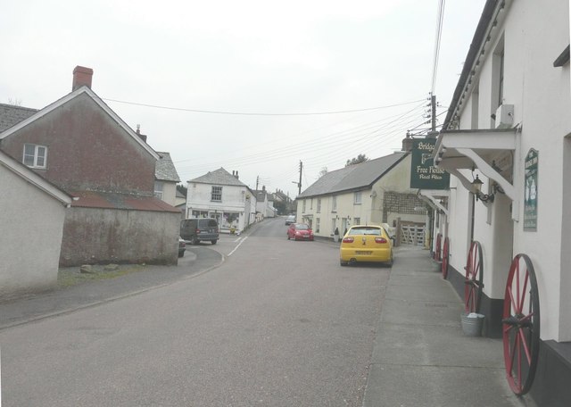
Burn Wood Images

Images are sourced within 2km of 50.808654/-4.4547441 or Grid Reference SS2703. Thanks to Geograph Open Source API. All images are credited.

The Red Post and Red Post Inn Launcells
The centre of Bridgerule There is a signpost on the right pointing to Whitstone down the road on the left. On the immediate right is the Bridge Inn.
The centre of Bridgerule
There is a signpost on the right pointing to Whitstone down the road on the left. On the immediate right is the Bridge Inn.
Looking west at the Red Post crossroads The building on the left is the Red Post Inn.
Looking west at the Red Post crossroads
The building on the left is the Red Post Inn.
Unnamed lane and hedge Near Jewell's Cross, although that is in Devon, this is just over into Cornwall.
Unnamed lane and hedge
Near Jewell's Cross, although that is in Devon, this is just over into Cornwall.
A3072 eastbound Entrance to Willowbank Farm ahead.
A3072 eastbound
Entrance to Willowbank Farm ahead.
Cornwall : The B3254 Heading along the B3254 and a man with a stop / go sign.
Cornwall : The B3254
Heading along the B3254 and a man with a stop / go sign.
Cornwall : The A3072 The A3072 as it crosses into the county of Devon.
Cornwall : The A3072
The A3072 as it crosses into the county of Devon.
South Porch of St Bridget's Church, 1945 The porch dates from the first half of the 15th century, when the south transept of the church was extended westwards to form an aisle.  Above the entrance is an effigy of a man with a book, probably representing St Michael, above a niche containing a sundial of around 1800.  The porch contains the Georgian slate Decalogue tablets which were removed from the chancel in the late 19th-century restorations and a late Norman pillar piscina which now serves as a holy water stoup.
South Porch of St Bridget's Church, 1945
The porch dates from the first half of the 15th century, when the south transept of the church was extended westwards to form an aisle. Above the entrance is an effigy of a man with a book, probably representing St Michael, above a niche containing a sundial of around 1800. The porch contains the Georgian slate Decalogue tablets which were removed from the chancel in the late 19th-century restorations and a late Norman pillar piscina which now serves as a holy water stoup.
Rood screen in St Bridget's Church The screen with its rood and six candles is contemporary with the other Tractarian furnishings in the church and dates from the last decade of the 19th century.
Rood screen in St Bridget's Church
The screen with its rood and six candles is contemporary with the other Tractarian furnishings in the church and dates from the last decade of the 19th century.
A3072 approaching Red Post Crossroads Junction with the B3254.
The crossroads is staggered.
A3072 approaching Red Post Crossroads
Junction with the B3254. The crossroads is staggered.
The A3072 near Anderton Farm
Milestone - Kilkhampton 5 There is an Ordnance Survey Rivet on the top of the milestone. It marks a point 112.410m above mean sea level.
Milestone - Kilkhampton 5
There is an Ordnance Survey Rivet on the top of the milestone. It marks a point 112.410m above mean sea level.
Jewell's Cross A rural road and petrol station on the boundary of Devon and Cornwall near Bridgerule - one of the few areas where Cornwall is north of Devon
Jewell's Cross
A rural road and petrol station on the boundary of Devon and Cornwall near Bridgerule - one of the few areas where Cornwall is north of Devon
Red Post Crossroads Where the A3072 Stratton to Holsworthy road crosses the B3254 Kilkhampton to Launceston road.
Red Post Crossroads
Where the A3072 Stratton to Holsworthy road crosses the B3254 Kilkhampton to Launceston road.
Bridgerule All quiet on a Sunday morning.
Bridgerule
All quiet on a Sunday morning.
The Tamar Where it flows through Bridgerule, it looks swollen after a night of heavy rain.
The Tamar
Where it flows through Bridgerule, it looks swollen after a night of heavy rain.
St Bridget's Church <span class="nowrap"><a title="http://genuki.cs.ncl.ac.uk/DEV/Bridgerule/index.html" rel="nofollow ugc noopener" href="http://genuki.cs.ncl.ac.uk/DEV/Bridgerule/index.html">Link</a><img style="margin-left:2px;" alt="External link" title="External link - shift click to open in new window" src="https://s1.geograph.org.uk/img/external.png" width="10" height="10"/></span>
St Bridget's Church
St Bridget's Churchyard A view southwest.
St Bridget's Churchyard
A view southwest.
Show me another place!

Burn Wood is located at Grid Ref: SS2703 (Lat: 50.808654, Lng: -4.4547441)

Unitary Authority: Cornwall

Police Authority: Devon and Cornwall

What 3 Words

///gained.contracting.tightest. Near Bude, Cornwall

Nearby Locations

Burn Wood

Related Wikis

Buttsbear Cross

Buttsbear Cross is a hamlet in the parish of Launcells, Cornwall, England. Buttsbear Cross lies on the B3254 road and is 2.7 miles (4.3 km) south-east...

Red Post

Red Post is a crossroads near Launcells in Cornwall, England. It is on the A3072 Holsworthy to Stratton road where it is crossed by the B3254 road. �...

Bridgerule

Bridgerule (Cornish: Ponsrowald) is a village and civil parish in Devon, England, a mile from the border with Cornwall. The parish is divided by the River...

Launcells

Launcells (Cornish: Lannseles) is a hamlet and civil parish in north-east Cornwall, England, United Kingdom. It is located 3 miles (4.8 km) east of Bude...

Nearby Amenities

Located within 500m of 50.808654,-4.4547441
Power: pole
Lat/Long: 50.8124372/-4.4509059
Power: pole
Lat/Long: 50.8116347/-4.4496802
Power: pole
Lat/Long: 50.8128668/-4.4562677
Power: pole
Lat/Long: 50.8124745/-4.4543646
Power: pole
Lat/Long: 50.8121144/-4.4525287
Power: pole
Lat/Long: 50.8113297/-4.4509542
Power: pole
Lat/Long: 50.8106144/-4.449538
Power: pole
Lat/Long: 50.8099111/-4.4480896
The data included in this document is from www.openstreetmap.org. The data is made available under ODbL.

Have you been to Burn Wood?

Leave your review of Burn Wood below (or comments, questions and feedback).