Cheddon Fitzpaine

Settlement in Somerset Somerset West and Taunton

England

Cheddon Fitzpaine

Autumn colour reflected in Bridgwater and Taunton Canal The Bridgwater and Taunton Canal is a canal between Bridgwater and Taunton, opened in 1827 and linking the River Tone to the River Parrett. 
Despite commercial traffic ceasing in 1907, the infrastructure was maintained in good order, and the canal was used for the transport of water from 1962. Somerset County Council  have restored the canal as a leisure facility, this was completed in 1994, when the canal was reopened throughout. Bridgwater Docks have been restored as a marina, but there is no navigable connection to the River Parrett, as the canal still transports drinking water for the people of Bridgwater.
Autumn colour reflected in Bridgwater and Taunton Canal Credit: David Smith

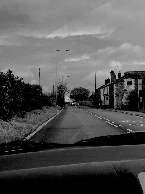
Cheddon Fitzpaine is a small village located in the county of Somerset, England. Situated just 2 miles east of the town of Taunton, it falls within the Taunton Deane district. With a population of around 1,200 residents, it retains a rural and close-knit community atmosphere.

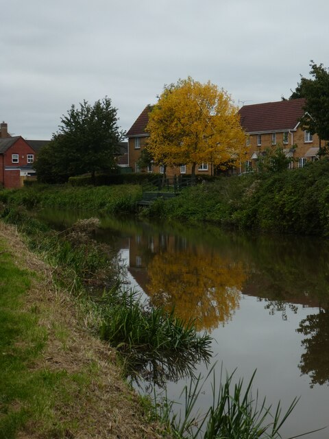
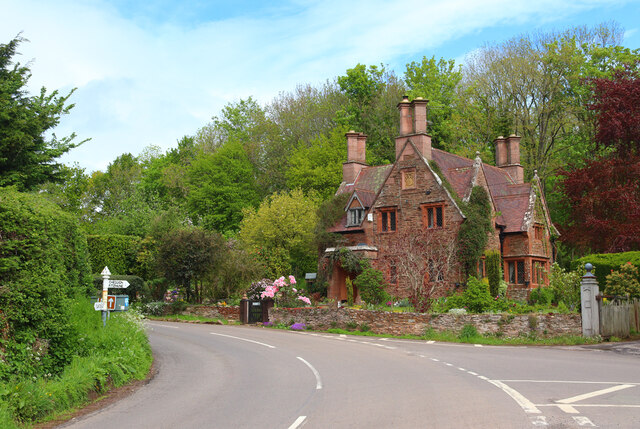
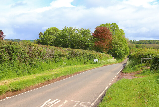
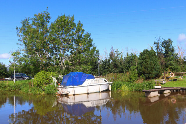
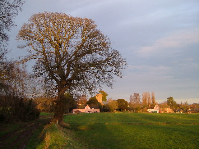
The village is known for its picturesque setting, nestled in the Somerset countryside. Surrounded by rolling hills and farmland, Cheddon Fitzpaine offers a tranquil and peaceful environment for its inhabitants. The village itself boasts a charming collection of traditional stone-built houses and cottages, many of which date back several centuries.

Cheddon Fitzpaine is home to the historic St. Mary's Church, a Grade I listed building that dates back to the 13th century. The church features notable architectural elements, including a Norman font and a 15th-century tower. The churchyard is also the resting place of several notable figures from the local area.

Despite its small size, Cheddon Fitzpaine has a strong sense of community spirit. The village has a village hall, which serves as a central hub for various social events and gatherings. There is also a primary school, providing education for local children, and a few local shops and amenities to cater to the needs of the residents.

Cheddon Fitzpaine benefits from its close proximity to Taunton, which offers a wider range of facilities and services, including supermarkets, shopping centers, and leisure facilities. The village is well-connected to the surrounding areas, with good road links to Taunton and other nearby towns. Overall, Cheddon Fitzpaine offers a peaceful and idyllic place to live, with a strong sense of community and access to both rural and urban amenities.

If you have any feedback on the listing, please let us know in the comments section below.

Cheddon Fitzpaine Images

Images are sourced within 2km of 51.044453/-3.080176 or Grid Reference ST2427. Thanks to Geograph Open Source API. All images are credited.

Autumn colour reflected in Bridgwater and Taunton Canal The Bridgwater and Taunton Canal is a canal between Bridgwater and Taunton, opened in 1827 and linking the River Tone to the River Parrett. 
Despite commercial traffic ceasing in 1907, the infrastructure was maintained in good order, and the canal was used for the transport of water from 1962. Somerset County Council  have restored the canal as a leisure facility, this was completed in 1994, when the canal was reopened throughout. Bridgwater Docks have been restored as a marina, but there is no navigable connection to the River Parrett, as the canal still transports drinking water for the people of Bridgwater.
Autumn colour reflected in Bridgwater and Taunton Canal
The Bridgwater and Taunton Canal is a canal between Bridgwater and Taunton, opened in 1827 and linking the River Tone to the River Parrett. Despite commercial traffic ceasing in 1907, the infrastructure was maintained in good order, and the canal was used for the transport of water from 1962. Somerset County Council have restored the canal as a leisure facility, this was completed in 1994, when the canal was reopened throughout. Bridgwater Docks have been restored as a marina, but there is no navigable connection to the River Parrett, as the canal still transports drinking water for the people of Bridgwater.
South Lodge Turning for Cheddon Fitzpaine.
South Lodge
Turning for Cheddon Fitzpaine.
Near Cheddon Fitzpaine Road leading towards Cheddon Fitzpaine.
Near Cheddon Fitzpaine
Road leading towards Cheddon Fitzpaine.
Church at Cheddon Fitzpaine Church of St Mary.
Church at Cheddon Fitzpaine
Church of St Mary.
Bridgwater & Taunton Canal From the road bridge on Venture Way.
Bridgwater & Taunton Canal
From the road bridge on Venture Way.
Mooring near Bathpool Taunton & Bridgwater Canal.
Mooring near Bathpool
Taunton & Bridgwater Canal.
Dyers Lane View from the canal bridge at Dyers Lane.
Dyers Lane
View from the canal bridge at Dyers Lane.
Bus stop on Cheddon Road at Wellsprings Leisure Centre
Houses on Cheddon Road
Looking north up Pitcher's Hill
Cars and houses at Cheddon Fitzpaine
Old tyre marking a gate entrance
Private car park at Titley Cottages
Junction and sign for Cheddon Fitzpaine
Moorings on the Bridgwater & Taunton Canal Moorings on the Bridgwater & Taunton Canal near Bathpool.
Moorings on the Bridgwater & Taunton Canal
Moorings on the Bridgwater & Taunton Canal near Bathpool.
Monkton Heathfield Road Taken from the passenger seat of a car, pointing up Monkton Heathfield Road, the sign depicted on the right was for a butchers which is now closed. Black and white.
Monkton Heathfield Road
Taken from the passenger seat of a car, pointing up Monkton Heathfield Road, the sign depicted on the right was for a butchers which is now closed. Black and white.
Hestercombe Gardens Example of an Edwardian English garden
Hestercombe Gardens
Example of an Edwardian English garden
Hestercombe Gardens The landscape garden at Hestercombe looking southwards towards the county town of Taunton
Hestercombe Gardens
The landscape garden at Hestercombe looking southwards towards the county town of Taunton
Show me another place!

Cheddon Fitzpaine is located at Grid Ref: ST2427 (Lat: 51.044453, Lng: -3.080176)

Administrative County: Somerset

District: Somerset West and Taunton

Police Authority: Avon and Somerset

What 3 Words

///evoked.exploring.bakers. Near Creech St Michael, Somerset

Related Wikis

Cheddon Fitzpaine

Cheddon Fitzpaine is a village and civil parish in Somerset, England, situated on the Quantock Hills 2 miles (3.2 km) north of Taunton. The village is...

Church of St Mary, Cheddon Fitzpaine

The Anglican Church of St Mary in Cheddon Fitzpaine, Somerset, England was built in the late 13th century. It is a Grade II* listed building. == History... ==
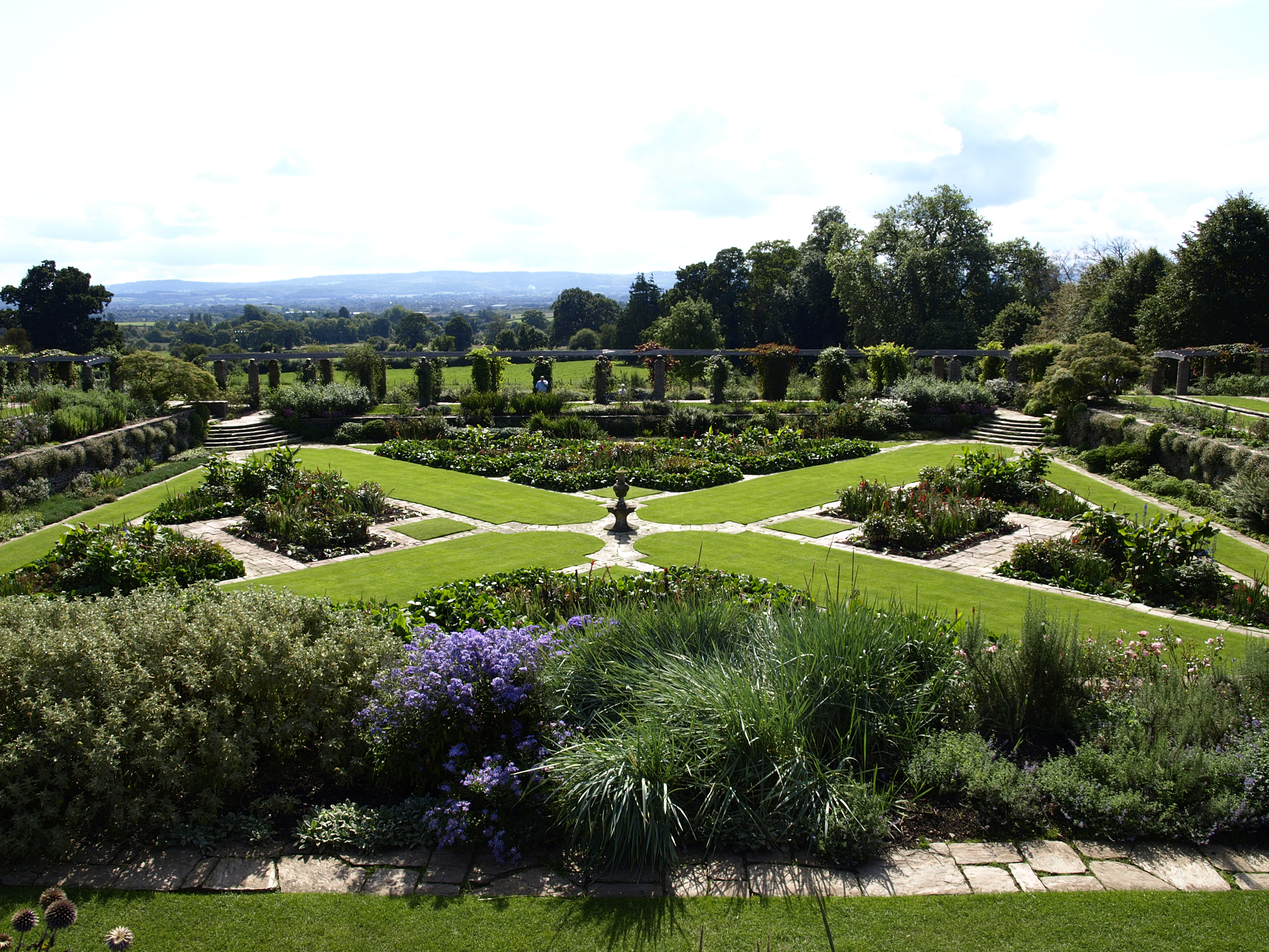
Hestercombe Gardens

Hestercombe Gardens is a garden complex situated on the grounds of Hestercombe House in the southwestern English county of Somerset. The entire garden...

Hestercombe House

Hestercombe House is a historic country house in the parish of West Monkton in the Quantock Hills, near Taunton in Somerset, England. The house is a Grade...

Nearby Amenities

Located within 500m of 51.044453,-3.080176
Cheddon Fitzpaine
Is In: Somerset, England, UK
Place: village
Wikidata: Q4739901
Wikipedia: en:Cheddon Fitzpaine
Lat/Long: 51.042618/-3.0807142
Power: pole
Lat/Long: 51.0428832/-3.0822763
Brand: National Grid
Brand Wikidata: Q1465461
Material: wood
Operator: National Grid Electricity Distribution Plc
Operator Old: Western Power Distribution
Operator Wikidata: Q7988183
Owner: National Grid Electricity Distribution (South West) Plc
Owner Wikidata: Q114397866
Power: pole
Lat/Long: 51.0437538/-3.0844756
Brand: National Grid
Brand Wikidata: Q1465461
Material: wood
Operator: National Grid Electricity Distribution Plc
Operator Old: Western Power Distribution
Operator Wikidata: Q7988183
Owner: National Grid Electricity Distribution (South West) Plc
Owner Wikidata: Q114397866
Power: pole
Lat/Long: 51.0438288/-3.0830197
Power: pole
Lat/Long: 51.043923/-3.0810179
Brand: National Grid
Brand Wikidata: Q1465461
Material: wood
Operator: National Grid Electricity Distribution Plc
Operator Old: Western Power Distribution
Operator Wikidata: Q7988183
Owner: National Grid Electricity Distribution (South West) Plc
Owner Wikidata: Q114397866
Power: pole
Lat/Long: 51.0437056/-3.0855694
Brand: National Grid
Brand Wikidata: Q1465461
Material: wood
Operator: National Grid Electricity Distribution Plc
Operator Old: Western Power Distribution
Operator Wikidata: Q7988183
Owner: National Grid Electricity Distribution (South West) Plc
Owner Wikidata: Q114397866
Power: pole
Lat/Long: 51.0443108/-3.0872041
Barrier: stile
Bicycle: no
Foot: yes
Material: wood
Stile: stepover
Lat/Long: 51.0425105/-3.0861711
Entrance: yes
Lat/Long: 51.0426097/-3.0813453
Power: pole
Lat/Long: 51.0461535/-3.0840054
Power: pole
Lat/Long: 51.0462863/-3.0826591
Power: pole
Lat/Long: 51.0464307/-3.0812946
Power: pole
Lat/Long: 51.0465791/-3.0798844
Power: pole
Lat/Long: 51.0467412/-3.0783476
Power: pole
Lat/Long: 51.0469019/-3.0767749
Power: pole
Lat/Long: 51.0470123/-3.0756325
Power: pole
Lat/Long: 51.0471367/-3.0745462
Post Box
Operator: Royal Mail
Operator Wikidata: Q638098
Post Box Type: wall
Ref: TA2 288
Lat/Long: 51.0420157/-3.0795384
Give Way
Lat/Long: 51.0445311/-3.0801456
Give Way
Lat/Long: 51.0444935/-3.0804748
Defibrillator
Access: yes
Booth: K6
Covered: booth
Defibrillator Location: inside old red phone box in Cheddon Fitzpaine
Disused Amenity: telephone
Emergency: defibrillator
Listed Status: Grade II
Man Made: telephone_box
Operator: Cheddon Fitzpaine Parish Council
Lat/Long: 51.0423755/-3.080973
The data included in this document is from www.openstreetmap.org. The data is made available under ODbL.

Have you been to Cheddon Fitzpaine?

Leave your review of Cheddon Fitzpaine below (or comments, questions and feedback).