Old Plantation

Wood, Forest in Cornwall

England

Old Plantation

Knighton Ford This ford is found on the River Lynher at Knighton. There are signs at the ford warning of electric fishing.
Knighton Ford Credit: John Walton

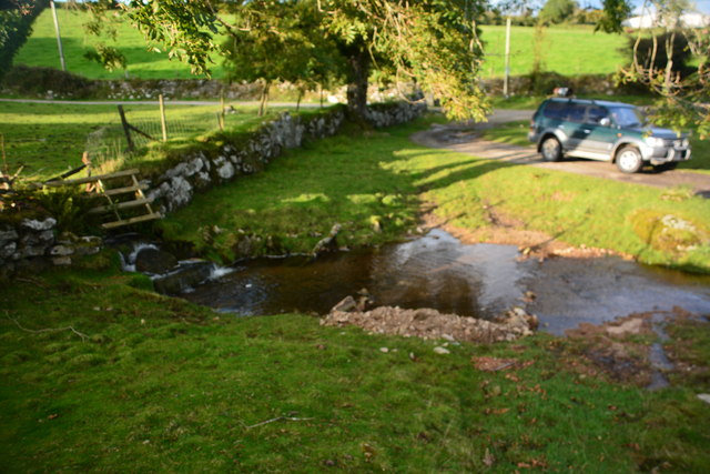
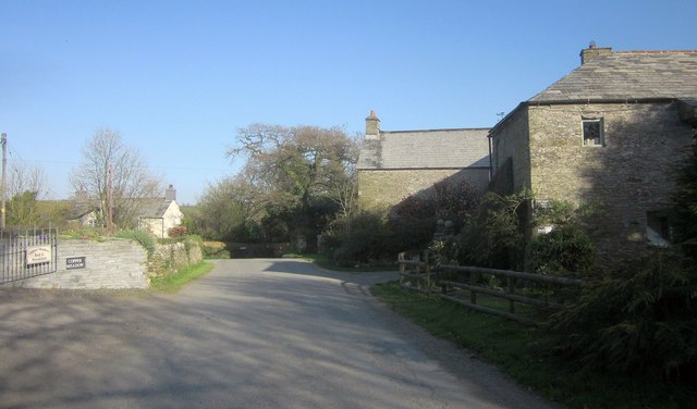
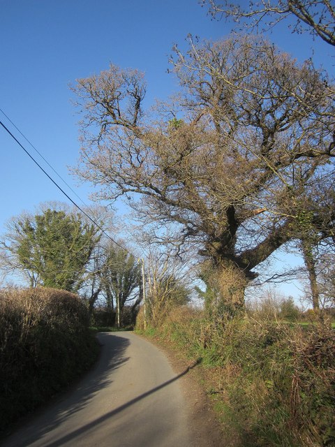
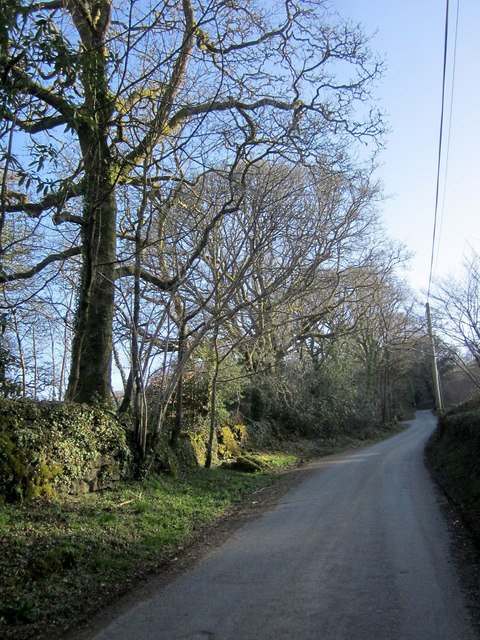
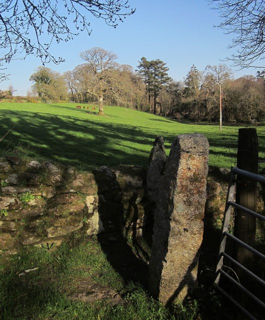
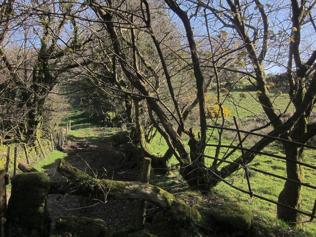
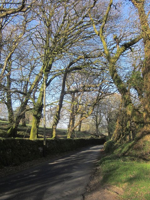
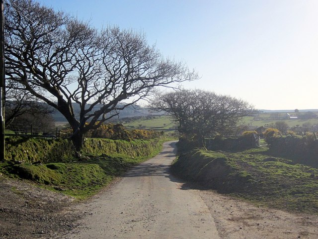
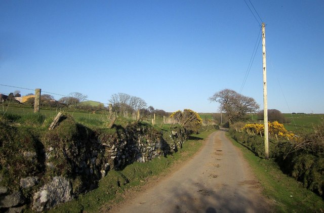
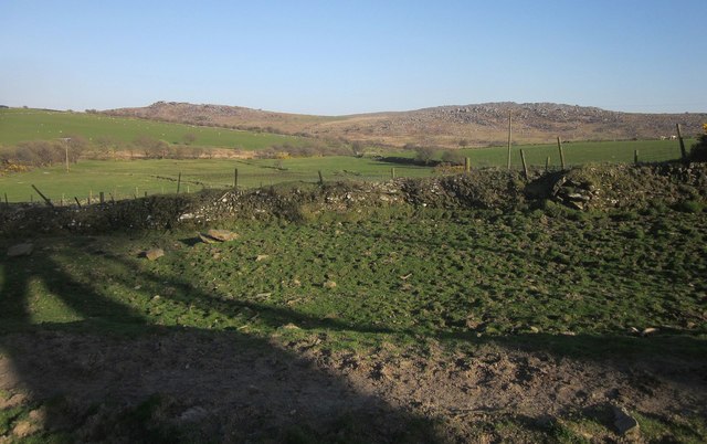
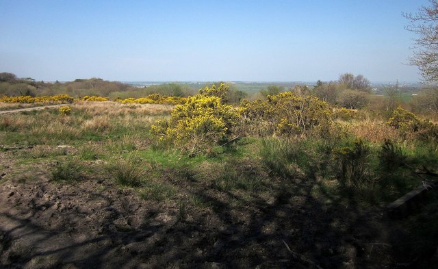
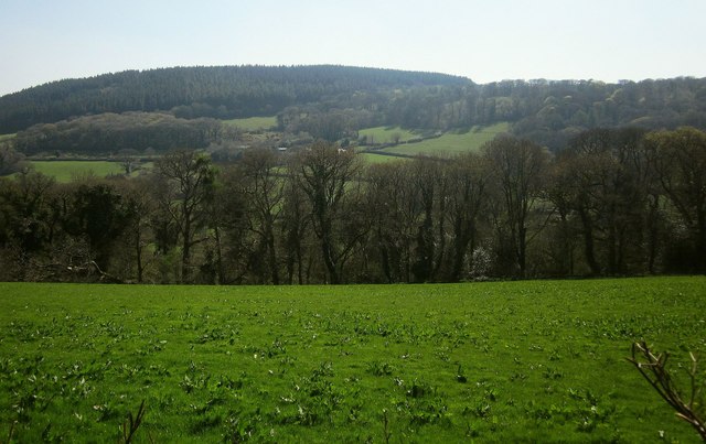
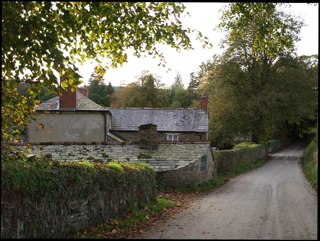
Old Plantation is a picturesque woodland area located in Cornwall, England. This enchanting forest is nestled amidst the rolling hills and scenic landscapes, creating a tranquil haven for nature enthusiasts and adventurers alike. Covering an expansive area, Old Plantation is known for its dense and diverse collection of trees, making it a haven for flora and fauna.

The woodland is characterized by its ancient oaks, towering beeches, and majestic pines, which provide a striking contrast against the vibrant undergrowth of ferns, wildflowers, and moss-covered rocks. The canopy formed by the towering trees creates a shaded ambiance, with dappled sunlight filtering through the foliage, casting an ethereal glow on the forest floor.

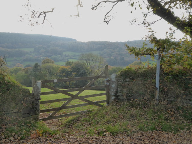
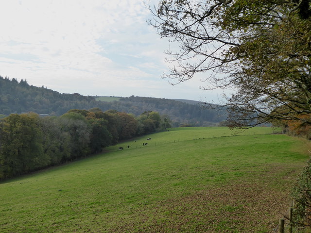
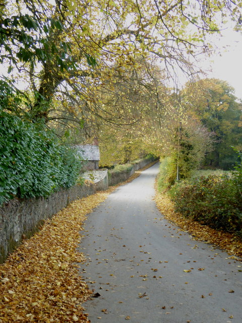
The forest is crisscrossed by a network of well-maintained trails, which meander through the woodland, allowing visitors to explore its beauty at their own pace. These pathways lead to hidden gems such as babbling brooks, small cascading waterfalls, and secluded clearings perfect for picnics or simply immersing oneself in the tranquility of nature.

Old Plantation is also home to a variety of wildlife, from chirping birds and scurrying squirrels to elusive deer and foxes. Nature enthusiasts will be delighted by the opportunity to spot these creatures in their natural habitat or hear the reverberating calls of birdsong that fill the air.

Whether it's a leisurely stroll, a family outing, or a nature photography expedition, Old Plantation in Cornwall offers a captivating experience for all who visit. Its serene atmosphere and breathtaking beauty make it a must-visit destination for those seeking a peaceful retreat in the heart of nature.

If you have any feedback on the listing, please let us know in the comments section below.

Old Plantation Images

Images are sourced within 2km of 50.574571/-4.4698381 or Grid Reference SX2577. Thanks to Geograph Open Source API. All images are credited.

Knighton Ford This ford is found on the River Lynher at Knighton. There are signs at the ford warning of electric fishing.
Knighton Ford
This ford is found on the River Lynher at Knighton. There are signs at the ford warning of electric fishing.
Ford at Tressellern This ford is found at Tressellern.
Ford at Tressellern
This ford is found at Tressellern.
Lane at Trevadlock Manor Approaching the junction at the hamlet's centre. The gable-ended building is the northern part of the L-shaped Trevadlock Manor <span class="nowrap"><a title="http://www.historicengland.org.uk/listing/the-list/list-entry/1249481" rel="nofollow ugc noopener" href="http://www.historicengland.org.uk/listing/the-list/list-entry/1249481">Link</a><img style="margin-left:2px;" alt="External link" title="External link - shift click to open in new window" src="https://s1.geograph.org.uk/img/external.png" width="10" height="10"/></span> .
Lane at Trevadlock Manor
Approaching the junction at the hamlet's centre. The gable-ended building is the northern part of the L-shaped Trevadlock Manor LinkExternal link .
Milestone, Trebartha This fine milestone is of "unusual design ... in the form of a double post with two triangular heads" <span class="nowrap"><a title="http://www.historicengland.org.uk/listing/the-list/list-entry/1250154" rel="nofollow ugc noopener" href="http://www.historicengland.org.uk/listing/the-list/list-entry/1250154">Link</a><img style="margin-left:2px;" alt="External link" title="External link - shift click to open in new window" src="https://s1.geograph.org.uk/img/external.png" width="10" height="10"/></span> . The description then confuses the places and their respective distances, but the milestone itself is impeccably clear. It is also visible in <a href="https://www.geograph.org.uk/photo/4431488">SX2677 : Crossroads, Trebartha</a>.
Milestone, Trebartha
This fine milestone is of "unusual design ... in the form of a double post with two triangular heads" LinkExternal link . The description then confuses the places and their respective distances, but the milestone itself is impeccably clear. It is also visible in SX2677 : Crossroads, Trebartha.
Lane at Stonaford An oak by a lane making a brief visit to this square.
Lane at Stonaford
An oak by a lane making a brief visit to this square.
Lane past Stonaford Stones Plantation A no through road onto Bodmin Moor, seen from the same spot as <a href="https://www.geograph.org.uk/photo/4431506">SX2577 : Lane past  Stonaford House</a>.
Lane past Stonaford Stones Plantation
A no through road onto Bodmin Moor, seen from the same spot as SX2577 : Lane past Stonaford House.
Gateposts, wall and field, Stonaford A short way into the field, well before the tree and cattle, the line of view crosses into <a href="https://www.geograph.org.uk/gridref/SX2577">SX2577</a>.
Gateposts, wall and field, Stonaford
A short way into the field, well before the tree and cattle, the line of view crosses into SX2577.
Track south-west of Stonaford A private track, obstructed in the foreground, leading from the no through lane from Tresellern to Lemarnedown Plantation.
Track south-west of Stonaford
A private track, obstructed in the foreground, leading from the no through lane from Tresellern to Lemarnedown Plantation.
Lane to Stonaford The no through lane from Tresellern, seen from the same spot as <a href="https://www.geograph.org.uk/photo/4701747">SX2577 : Track south-west of Stonaford</a>, running through trees that form a western extension of Old Plantation.
Lane to Stonaford
The no through lane from Tresellern, seen from the same spot as SX2577 : Track south-west of Stonaford, running through trees that form a western extension of Old Plantation.
Lane to Tresellern The no through lane to Tresellern descends towards the stream shown in <a href="https://www.geograph.org.uk/photo/4431602">SX2377 : Stream by Industry</a>, where it ends as a public road.
Lane to Tresellern
The no through lane to Tresellern descends towards the stream shown in SX2377 : Stream by Industry, where it ends as a public road.
Lane from Tresellern The no through lane from Tresellern, with a Cornish hedge on the left, and possibly the right too.
Lane from Tresellern
The no through lane from Tresellern, with a Cornish hedge on the left, and possibly the right too.
View near Tresellern A wider angle version of the scene in <a href="https://www.geograph.org.uk/photo/4431620">SX2376 : View near Tresellern</a>, showing the wide drove-like nature of the route in the foreground, well over 20 metres in width, of which only 5 metres are occupied by the track.
View near Tresellern
A wider angle version of the scene in SX2376 : View near Tresellern, showing the wide drove-like nature of the route in the foreground, well over 20 metres in width, of which only 5 metres are occupied by the track.
Track past Tresellern Climbing from the ford near Industry <a href="https://www.geograph.org.uk/photo/4431602">SX2377 : Stream by Industry</a> and about to pass the buildings at Tresellern, the track is followed by footpath 528 1/1 onto the East Moor. This illustrates the width between walls commented on at <a href="https://www.geograph.org.uk/photo/4701859">SX2376 : View near Tresellern</a>.
Track past Tresellern
Climbing from the ford near Industry SX2377 : Stream by Industry and about to pass the buildings at Tresellern, the track is followed by footpath 528 1/1 onto the East Moor. This illustrates the width between walls commented on at SX2376 : View near Tresellern.
Gorse above East Castick Wood Seen from beside the lane to Twelve Men's Moor.
Gorse above East Castick Wood
Seen from beside the lane to Twelve Men's Moor.
Across the Lynher valley From the same spot as <a href="https://www.geograph.org.uk/photo/4449140">SX2676 : Lynher valley near North Hill</a>, looking to the right, with overlap. The farm on the far slopes is East Castick. Again, Bowdanoddon Wood is on the horizon.
Across the Lynher valley
From the same spot as SX2676 : Lynher valley near North Hill, looking to the right, with overlap. The farm on the far slopes is East Castick. Again, Bowdanoddon Wood is on the horizon.
Field gate in Lynher Way The public footpath leads down into the Lynher valley.
Field gate in Lynher Way
The public footpath leads down into the Lynher valley.
Field in the Lynher valley at North Hill
Autumn leaves on the road at Trebartha
Show me another place!

Old Plantation is located at Grid Ref: SX2577 (Lat: 50.574571, Lng: -4.4698381)

Unitary Authority: Cornwall

Police Authority: Devon and Cornwall

What 3 Words

///edges.reactions.arise. Near North Hill, Cornwall

Related Wikis

Trebartha

Trebartha is a hamlet in Cornwall, England, United Kingdom, in the parish of North Hill and in the valley of the River Lynher. == History == The manor...

Trevadlock

Trevadlock is a hamlet south of Lewannick, Cornwall, United Kingdom. It includes a re-furbished old chapel, old schoolroom and semi-detached cottages....

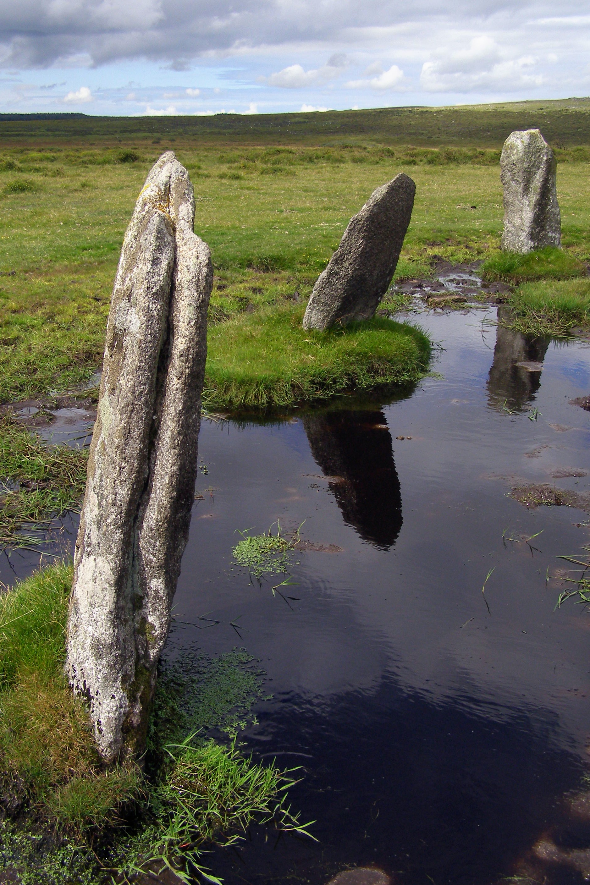
Nine Stones, Altarnun

The Nine Stones (or Altarnun stone circle) is a stone circle 3 kilometres (1.9 mi) south southeast of Altarnun, 11 kilometres (6.8 mi) west of Launceston...

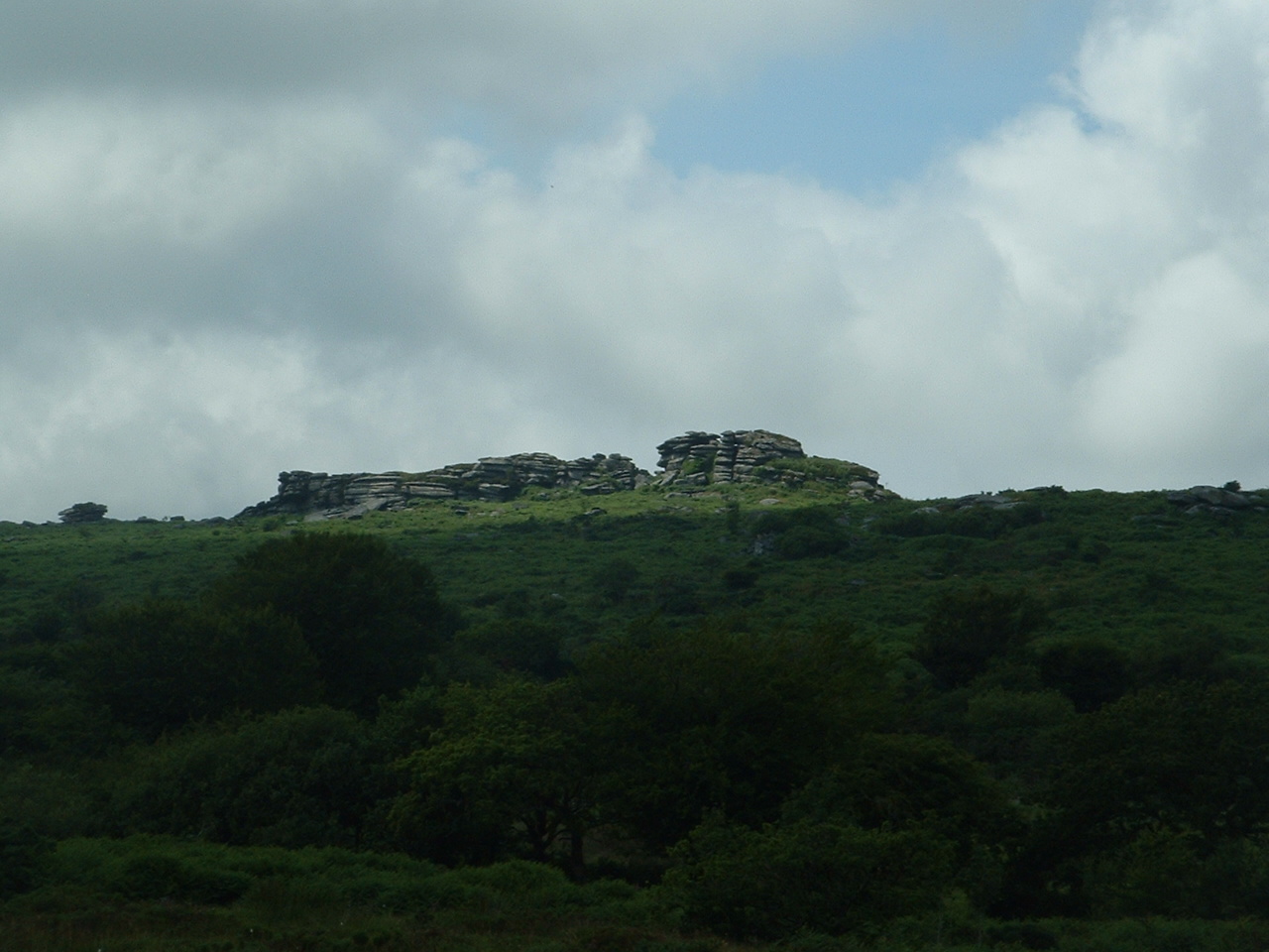
Hawk's Tor, North Hill

Hawk's Tor is an elongated hill, 329 metres (1,079 ft) high and running from WSW to ENE, on Bodmin Moor in the county of Cornwall, England, UK. It stands...

Nearby Amenities

Located within 500m of 50.574571,-4.4698381
Tolcarne
Is In: Cornwall, England, UK
Name Kw: Talkarn
Place: hamlet
Source: NPE
Lat/Long: 50.578252/-4.4731469
The data included in this document is from www.openstreetmap.org. The data is made available under ODbL.

Have you been to Old Plantation?

Leave your review of Old Plantation below (or comments, questions and feedback).