Chedburgh

Settlement in Suffolk West Suffolk

England

Chedburgh

Houses on Old Post Office Road, Chevington
Houses on Old Post Office Road, Chevington Credit: Jonathan Thacker

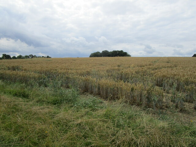
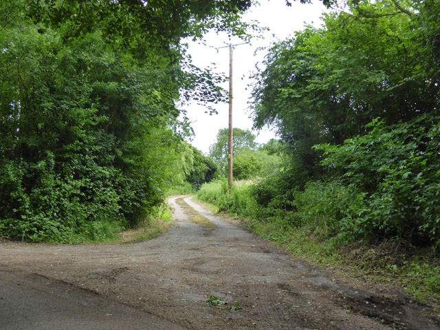
Chedburgh is a small village and civil parish located in the county of Suffolk, England. Situated approximately 10 miles northeast of Bury St Edmunds, it lies on the eastern edge of the county. The village is surrounded by picturesque countryside, characterized by fields, meadows, and farmland, which contribute to its rural charm.

The village dates back to the Anglo-Saxon period and has a rich history. The name "Chedburgh" is believed to derive from the Old English word "Cedde" and the word "burh," meaning a fortified place. This suggests that the settlement was once fortified, although no visible remains exist today.

Chedburgh is a small and close-knit community with a population of around 400 people. It offers a peaceful and tranquil atmosphere, making it an attractive place for those seeking a slower pace of life. The village is primarily residential, with a mix of traditional cottages, modern houses, and some older historic buildings.

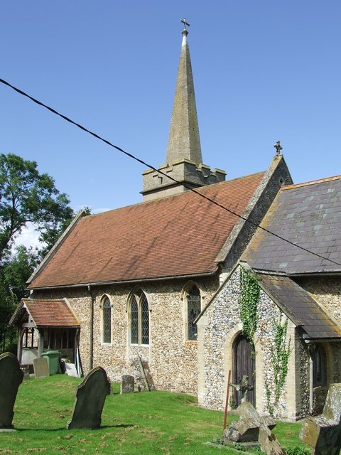
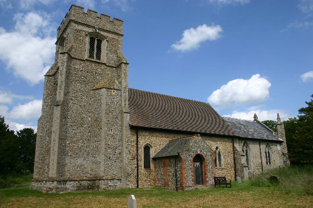
Despite its small size, Chedburgh has a few amenities to serve its residents. These include a village hall, a church, and a primary school. The village also benefits from its proximity to Bury St Edmunds, where residents can access a wider range of services and amenities.

The surrounding countryside offers plenty of opportunities for outdoor activities such as walking, cycling, and horse riding. Additionally, Chedburgh is well-positioned for exploring other parts of Suffolk, including the historic market towns of Bury St Edmunds and Stowmarket, as well as the beautiful landscapes of Thetford Forest and the Suffolk Coast.

Overall, Chedburgh is a quaint and tranquil village, offering a peaceful retreat for those looking to enjoy the charm of rural Suffolk.

If you have any feedback on the listing, please let us know in the comments section below.

Chedburgh Images

Images are sourced within 2km of 52.191067/0.61482907 or Grid Reference TL7857. Thanks to Geograph Open Source API. All images are credited.

Houses on Old Post Office Road, Chevington
Fields near Chevington
Between Hargrave and Chevington Typical Suffolk landscape. Not flat, but not really hilly either.
Between Hargrave and Chevington
Typical Suffolk landscape. Not flat, but not really hilly either.
Farm track near The Grove, Hargrave
Footpath along the parish boundary Follows the boundary between Hargrave (left) and Chevington.
Footpath along the parish boundary
Follows the boundary between Hargrave (left) and Chevington.
Footpath to Wickhambrook Road In gently rolling Suffolk countryside.
Footpath to Wickhambrook Road
In gently rolling Suffolk countryside.
Corner of a field A footpath to Little Knowles Green cuts across this corner.
Corner of a field
A footpath to Little Knowles Green cuts across this corner.
Wheatfield and copse Near Little Knowles Green.
Wheatfield and copse
Near Little Knowles Green.
The Greyhound, Chevington <a title="https://www.geograph.org.uk/photo/4635676" href="https://www.geograph.org.uk/photo/4635676">Link</a>
The Greyhound, Chevington
The sign of The Greyhound public house <a title="https://www.geograph.org.uk/photo/4635674" href="https://www.geograph.org.uk/photo/4635674">Link</a>
The sign of The Greyhound public house
Chevington village sign The sign is close by the village hall
Chevington village sign
The sign is close by the village hall
Chevington village hall
Chedburgh War Memorial The memorial is housed in the 'church' for which there is no keyholder. This image was taken through a (thankfully clean) south window.
The memorial bears 19 names of those lost in WW1. No losses are recorded for WW2.
Chedburgh War Memorial
The memorial is housed in the 'church' for which there is no keyholder. This image was taken through a (thankfully clean) south window. The memorial bears 19 names of those lost in WW1. No losses are recorded for WW2.
Field of rye grass, Chedburgh
Lane to sewage works Off Queens Lane.
Lane to sewage works
Off Queens Lane.
View east from near Selwood House
New housing on New Road, Chevington On the site of a bungalow with a large garden.
New housing on New Road, Chevington
On the site of a bungalow with a large garden.
A143 towards Bury St Edmunds Passing through Depden, although  not much to see on the main road.
A143 towards Bury St Edmunds
Passing through Depden, although not much to see on the main road.
Show me another place!

Chedburgh is located at Grid Ref: TL7857 (Lat: 52.191067, Lng: 0.61482907)

Administrative County: Suffolk

District: West Suffolk

Police Authority: Suffolk

What 3 Words

///snooping.blackouts.relaxed. Near Bury St Edmunds, Suffolk

Nearby Locations

Chedburgh

Related Wikis

Chedburgh

Chedburgh is a village and civil parish in the West Suffolk district of Suffolk in eastern England. Located on the A143 around five miles south-west of...

RAF Chedburgh

Royal Air Force Chedburgh or more simply RAF Chedburgh is a former Royal Air Force satellite station located near Bury St Edmunds, Suffolk, UK. The Bury...

Depden

Depden is a village and civil parish in the West Suffolk district of Suffolk in eastern England. Located on the A143 around five miles south-west of Bury...
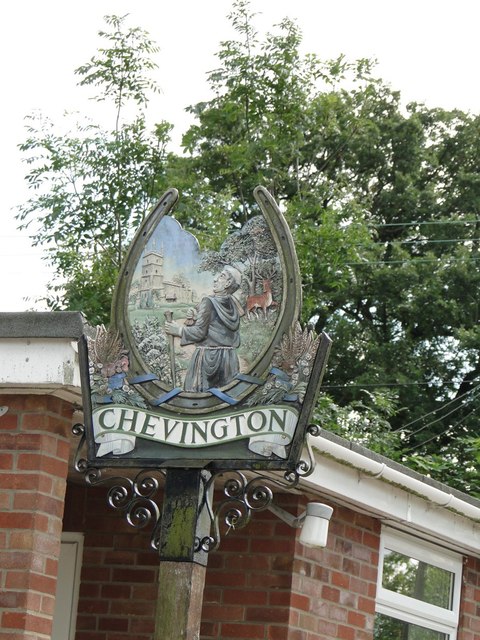
Chevington, Suffolk

Chevington is a village and civil parish in the West Suffolk district of Suffolk in East Anglia, England. Located around 10 km south-west of Bury St Edmunds...

Nearby Amenities

Located within 500m of 52.191067,0.61482907
Chedburgh
Place: village
Source: npe
Wikidata: Q2284995
Lat/Long: 52.1881073/0.6163143
Bus Stop
Majors Close
Naptan AtcoCode: 390050093
Naptan Bearing: SE
Naptan CommonName: Majors Close
Naptan Indicator: adj
Naptan Landmark: Majors Close
Naptan NaptanCode: sufgdjat
Naptan Street: Chevington Road
Naptan Verified: no
Source: naptan_import
Lat/Long: 52.1910975/0.6149473
Bus Stop
Majors Close
Naptan AtcoCode: 390050094
Naptan Bearing: NW
Naptan BusStopType: CUS
Naptan CommonName: Majors Close
Naptan Indicator: opp
Naptan Landmark: Majors Close
Naptan NaptanCode: sufgdjaw
Naptan Street: Chevington Road
Naptan Verified: no
Source: naptan_import
Lat/Long: 52.1909763/0.6148654
Bus Stop
Bus Shelter
Alt Name: Marquis of Cornwallis
Naptan AltCommonName: Marquis of Cornwallis
Naptan AtcoCode: 390050095
Naptan Bearing: SE
Naptan CommonName: Bus Shelter
Naptan Indicator: o/s
Naptan Landmark: Bus Shelter
Naptan NaptanCode: sufgdjda
Naptan Street: The Green
Naptan Verified: no
Source: naptan_import
Lat/Long: 52.1874912/0.6161695
Bus Stop
Bus Shelter
Alt Name: Marquis of Cornwallis
Naptan AltCommonName: Marquis of Cornwallis
Naptan AtcoCode: 390050096
Naptan Bearing: NW
Naptan BusStopType: CUS
Naptan CommonName: Bus Shelter
Naptan Indicator: opp
Naptan Landmark: Bus Shelter
Naptan NaptanCode: sufgdjdg
Naptan Street: The Green
Naptan Verified: no
Source: naptan_import
Lat/Long: 52.1874579/0.6160572
Man Made: tower
Lat/Long: 52.1931204/0.6145297
Historic: memorial
Lat/Long: 52.1878013/0.6158667
Post Box
Post Box Type: lamp
Ref: IP29 2018
Royal Cypher: EIIR
Royal Cypher Wikidata: Q33102113
Lat/Long: 52.1876128/0.6160562
Addr Housenumber: 16
Addr Postcode: IP29 4UW
Addr Street: Lancaster Close
Lat/Long: 52.1906028/0.6144969
Addr Housenumber: 5
Addr Postcode: IP29 4UW
Addr Street: Lancaster Close
Lat/Long: 52.1907475/0.6140946
Addr Housenumber: 8
Addr Postcode: IP29 4UW
Addr Street: Lancaster Close
Lat/Long: 52.1904945/0.6139176
Addr Housenumber: 18
Addr Postcode: IP29 4UW
Addr Street: Lancaster Close
Lat/Long: 52.1906357/0.6148617
Addr Housenumber: 12
Addr Postcode: IP29 4UW
Addr Street: Lancaster Close
Lat/Long: 52.1902741/0.6142394
Addr Housenumber: 17
Addr Postcode: IP29 4UW
Addr Street: Lancaster Close
Lat/Long: 52.1906425/0.6147115
Addr Housenumber: 10
Addr Postcode: IP29 4UW
Addr Street: Lancaster Close
Lat/Long: 52.1901262/0.6138586
Addr Housenumber: 6
Addr Postcode: IP29 4UW
Addr Street: Lancaster Close
Lat/Long: 52.1906785/0.614041
Addr Housenumber: 14
Addr Postcode: IP29 4UW
Addr Street: Lancaster Close
Lat/Long: 52.1904384/0.6143843
Addr Housenumber: 2
Addr Postcode: IP29 4UW
Addr Street: Lancaster Close
Lat/Long: 52.1910599/0.6143467
Addr Housenumber: 4
Addr Postcode: IP29 4UW
Addr Street: Lancaster Close
Lat/Long: 52.1908496/0.6141804
Addr Housenumber: 13
Addr Postcode: IP29 4UW
Addr Street: Lancaster Close
Lat/Long: 52.1903892/0.6143253
Addr Housenumber: 7
Addr Postcode: IP29 4UW
Addr Street: Lancaster Close
Lat/Long: 52.19058/0.6139712
Addr Housenumber: 9
Addr Postcode: IP29 4UW
Addr Street: Lancaster Close
Lat/Long: 52.1901525/0.6137727
Addr Housenumber: 3
Addr Postcode: IP29 4UW
Addr Street: Lancaster Close
Lat/Long: 52.1909087/0.6142394
Addr Housenumber: 11
Addr Postcode: IP29 4UW
Addr Street: Lancaster Close
Lat/Long: 52.1902214/0.6141912
Addr Housenumber: 15
Addr Postcode: IP29 4UW
Addr Street: Lancaster Close
Lat/Long: 52.1905438/0.6144594
Addr Housenumber: 1
Addr Postcode: IP29 4UW
Addr Street: Lancaster Close
Lat/Long: 52.191175/0.6143521
Addr Housenumber: 3
Addr Postcode: IP29 4UP
Addr Street: Chevington Road
Lat/Long: 52.1915055/0.613968
Turning Circle
Lat/Long: 52.1896705/0.6181042
Addr Housenumber: 4
Addr Postcode: IP29 4UP
Addr Street: Chevington Road
Lat/Long: 52.1915713/0.6138822
Addr Housenumber: 2
Addr Postcode: IP29 4UP
Addr Street: Chevington Road
Lat/Long: 52.1914169/0.6141021
Addr Housenumber: 4
Addr Postcode: IP29 4UN
Addr Street: Major's Close
Lat/Long: 52.1906702/0.6158135
Addr Housenumber: 2
Addr Postcode: IP29 4UN
Addr Street: Major's Close
Lat/Long: 52.1906308/0.6158644
Addr Housenumber: 8
Addr Postcode: IP29 4UN
Addr Street: Major's Close
Lat/Long: 52.1907936/0.6156069
Addr Housenumber: 6
Addr Postcode: IP29 4UN
Addr Street: Major's Close
Lat/Long: 52.1907557/0.6156606
Addr Housenumber: 1
Addr Postcode: IP29 4UP
Addr Street: Chevington Road
Lat/Long: 52.1913279/0.6141987
Addr Housenumber: 17
Addr Postcode: IP29 4UN
Addr Street: Major's Close
Lat/Long: 52.1916898/0.6155104
Addr Housenumber: 35
Addr Postcode: IP29 4UN
Addr Street: Major's Close
Lat/Long: 52.1910518/0.6168542
Addr Housenumber: 15
Addr Postcode: IP29 4UN
Addr Street: Major's Close
Lat/Long: 52.1916173/0.6154648
Addr Housenumber: 33
Addr Postcode: IP29 4UN
Addr Street: Major's Close
Lat/Long: 52.1911011/0.6167925
Addr Housenumber: 1
Addr Postcode: IP29 4UN
Addr Street: Major's Close
Lat/Long: 52.1911947/0.6151296
Addr Housenumber: 31
Addr Postcode: IP29 4UN
Addr Street: Major's Close
Lat/Long: 52.1911931/0.6166798
Addr Housenumber: 29
Addr Postcode: IP29 4UN
Addr Street: Major's Close
Lat/Long: 52.1912425/0.6166047
Addr Housenumber: 11
Addr Postcode: IP29 4UN
Addr Street: Major's Close
Lat/Long: 52.1915472/0.6154056
Addr Housenumber: 30
Addr Postcode: IP29 4UY
Addr Street: Paddock Way
Lat/Long: 52.1895833/0.6160683
Addr Housenumber: 11
Addr Postcode: IP29 4UY
Addr Street: Paddock Way
Lat/Long: 52.1901407/0.6146873
Addr Housenumber: 19
Addr Postcode: IP29 4UY
Addr Street: Paddock Way
Lat/Long: 52.1897855/0.6150411
Addr Housenumber: 22
Addr Postcode: IP29 4UY
Addr Street: Paddock Way
Lat/Long: 52.1898463/0.615371
Addr Housenumber: 33
Addr Postcode: IP29 4UY
Addr Street: Paddock Way
Lat/Long: 52.189557/0.6163205
Addr Housenumber: 7
Addr Postcode: IP29 4UY
Addr Street: Paddock Way
Lat/Long: 52.1902328/0.6150679
Addr Housenumber: 32
Addr Postcode: IP29 4UY
Addr Street: Paddock Way
Lat/Long: 52.189575/0.6162668
Addr Housenumber: 31
Addr Postcode: IP29 4UY
Addr Street: Paddock Way
Lat/Long: 52.1895817/0.6161274
Addr Housenumber: 17
Addr Postcode: IP29 4UY
Addr Street: Paddock Way
Lat/Long: 52.1898398/0.6147648
Addr Housenumber: 26
Addr Postcode: IP29 4UY
Addr Street: Paddock Way
Lat/Long: 52.1897083/0.6156928
Addr Housenumber: 38
Addr Postcode: IP29 4UY
Addr Street: Paddock Way
Lat/Long: 52.1892446/0.6164573
Addr Housenumber: 25
Addr Postcode: IP29 4UY
Addr Street: Paddock Way
Lat/Long: 52.189728/0.6156285
Addr Housenumber: 5
Addr Postcode: IP29 4UY
Addr Street: Paddock Way
Lat/Long: 52.1904136/0.6153201
Addr Housenumber: 18
Addr Postcode: IP29 4UY
Addr Street: Paddock Way
Lat/Long: 52.189802/0.6149767
Addr Housenumber: 23
Addr Postcode: IP29 4UY
Addr Street: Paddock Way
Lat/Long: 52.1898119/0.61543
Addr Housenumber: 16
Addr Postcode: IP29 4UY
Addr Street: Paddock Way
Lat/Long: 52.1898744/0.6147299
Addr Housenumber: 27
Addr Postcode: IP29 4UY
Addr Street: Paddock Way
Lat/Long: 52.1896507/0.6157465
Addr Housenumber: 36
Addr Postcode: IP29 4UY
Addr Street: Paddock Way
Lat/Long: 52.1893564/0.6165431
Addr Housenumber: 12
Addr Postcode: IP29 4UY
Addr Street: Paddock Way
Lat/Long: 52.1901145/0.6146468
Addr Housenumber: 24
Addr Postcode: IP29 4UY
Addr Street: Paddock Way
Lat/Long: 52.1897872/0.6154863
Addr Housenumber: 1
Addr Postcode: IP29 4UY
Addr Street: Paddock Way
Lat/Long: 52.1905846/0.6151941
Addr Housenumber: 29
Addr Postcode: IP29 4UY
Addr Street: Paddock Way
Lat/Long: 52.1895882/0.6159959
Addr Housenumber: 37
Addr Postcode: IP29 4UY
Addr Street: Paddock Way
Lat/Long: 52.1892956/0.6164895
Addr Housenumber: 20
Addr Postcode: IP29 4UY
Addr Street: Paddock Way
Lat/Long: 52.1898135/0.6151349
Addr Housenumber: 28
Addr Postcode: IP29 4UY
Addr Street: Paddock Way
Lat/Long: 52.1896327/0.6158055
Addr Housenumber: 8
Addr Postcode: IP29 4UY
Addr Street: Paddock Way
Lat/Long: 52.1902082/0.6150142
Addr Housenumber: 13
Addr Postcode: IP29 4UY
Addr Street: Paddock Way
Lat/Long: 52.1900816/0.6146092
Addr Housenumber: 14
Addr Postcode: IP29 4UY
Addr Street: Paddock Way
Lat/Long: 52.1899516/0.6145475
Addr Housenumber: 15
Addr Postcode: IP29 4UY
Addr Street: Paddock Way
Lat/Long: 52.1899121/0.6146012
Addr Housenumber: 9
Addr Postcode: IP29 4UY
Addr Street: Paddock Way
Lat/Long: 52.1901834/0.6148909
Addr Housenumber: 6
Addr Postcode: IP29 4UY
Addr Street: Paddock Way
Lat/Long: 52.1902624/0.6151162
Addr Housenumber: 10
Addr Postcode: IP29 4UY
Addr Street: Paddock Way
Lat/Long: 52.1901654/0.6148292
Addr Housenumber: 21
Addr Postcode: IP29 4UY
Addr Street: Paddock Way
Lat/Long: 52.1897921/0.6152181
Addr Housenumber: 35
Addr Postcode: IP29 4UY
Addr Street: Paddock Way
Lat/Long: 52.1894074/0.6165753
Addr Housenumber: 34
Addr Postcode: IP29 4UY
Addr Street: Paddock Way
Lat/Long: 52.1895224/0.6164009
Post Box
Post Box Design: type_m
Post Box Type: lamp
Ref: IP29 2146
Royal Cypher: EIIR
Royal Cypher Wikidata: Q33102113
Lat/Long: 52.1910579/0.6149844
Booth: K6
Covered: booth
Disused Amenity: telephone
Man Made: telephone_box
Lat/Long: 52.1912655/0.6145254
Bench
Lat/Long: 52.1910558/0.6150523
Advertising: board
Lat/Long: 52.1910504/0.6150881
Advertising: board
Lat/Long: 52.1876682/0.616006
Defibrillator
Access: yes
Defibrillator Location: Outside the Erskine centre
Emergency: defibrillator
Indoor: no
Ref GB The Circuit: 4155F186-0B14-489D-B16E-AE59009E0E35
Lat/Long: 52.1917352/0.6146914
The data included in this document is from www.openstreetmap.org. The data is made available under ODbL.

Have you been to Chedburgh?

Leave your review of Chedburgh below (or comments, questions and feedback).