Beatland Wood

Wood, Forest in Cornwall

England

Beatland Wood

St Nectan's Well, Welcombe
St Nectan's Well, Welcombe Credit: thejackrustles

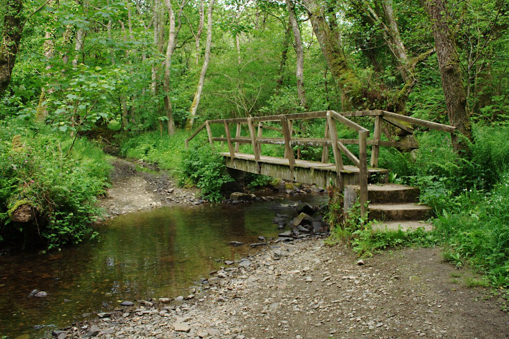
Beatland Wood is a charming woodland located in the county of Cornwall, England. It is nestled in the southwestern part of the country, near the town of Truro. Spread across an area of approximately 100 acres, Beatland Wood is a haven for nature lovers and outdoor enthusiasts.

This ancient woodland is predominantly composed of broadleaf trees, such as oak, beech, and ash, which create a dense and lush canopy. The forest floor is adorned with a rich carpet of wildflowers, ferns, and mosses, adding to the enchanting atmosphere of the wood. The diverse flora provides a thriving habitat for a variety of wildlife, including deer, foxes, badgers, and numerous species of birds.

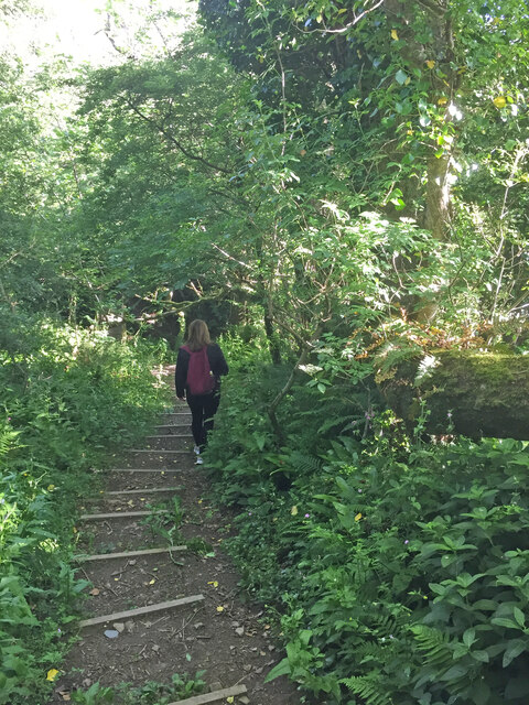
Visitors to Beatland Wood can explore its numerous footpaths and trails, which wind through the trees and offer breathtaking views of the surrounding landscape. The wood is especially popular among hikers, birdwatchers, and photographers, who can capture the beauty of the woodland and its inhabitants.

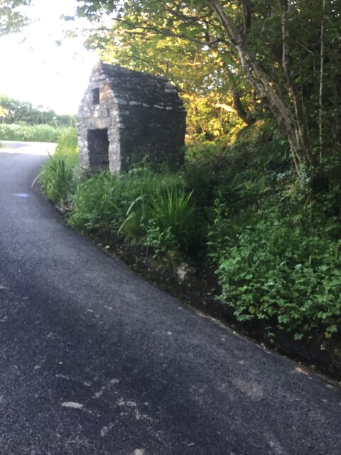
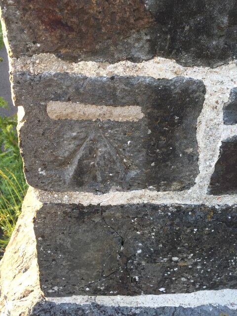
Beatland Wood is also known for its historical significance. It is believed to have been part of a larger forest that covered the area during medieval times. The wood has witnessed centuries of human activity, evident through the presence of old stone walls and earthworks. These remnants of the past add an intriguing layer of history to the woodland experience.

Overall, Beatland Wood is a remarkable natural treasure in Cornwall, offering a serene and captivating environment for visitors to immerse themselves in the beauty of nature.

If you have any feedback on the listing, please let us know in the comments section below.

Beatland Wood Images

Images are sourced within 2km of 50.927236/-4.5015859 or Grid Reference SS2417. Thanks to Geograph Open Source API. All images are credited.

St Nectan's Well, Welcombe
Cut Mark St Nectan's Church, Welcombe <span class="nowrap"><a title="http://www.welcombe.org/church.htm" rel="nofollow ugc noopener" href="http://www.welcombe.org/church.htm">Link</a><img style="margin-left:2px;" alt="External link" title="External link - shift click to open in new window" src="https://s1.geograph.org.uk/img/external.png" width="10" height="10"/></span>

Not on OS DB but shown on old maps.
Cut Mark St Nectan's Church, Welcombe
LinkExternal link Not on OS DB but shown on old maps.
Footpath, Welcombe
Footpath, Welcombe
St Nectan's Church at Welcombe
The Old Smithy Inn at Darracott
The new Village Hall at Welcombe
Junction at Tredown
Junction at Tredown
Entrance to Well Lane This track is marked on the 1:25K OS map with green dots indicating "Other Public Access".
Entrance to Well Lane
This track is marked on the 1:25K OS map with green dots indicating "Other Public Access".
Footbridge over stream, Welcombe A footbridge over a small stream flowing in a deeply incised, shady valley.
Footbridge over stream, Welcombe
A footbridge over a small stream flowing in a deeply incised, shady valley.
Welcombe, St Nectan's church
Hendon Moor Trig and then TuMP probably top of track rather than covered reservoir on other side of hedge. Easy access to moorland by gate between cottage and farm. Track to reservoir goes through private land belonging to cottage. Bagged with Ian Brown while eating blackberries from the hedges.
Name: Hendon Moor
Hill number: 17569
Height: 233m / 764ft
Parent (Ma/M): 2877  High Willhays
Area: 40: Cornwall & Devon
Class: Tump (200-299m)
Grid ref: SS260182 (est)
Drop: 87m
Col: 146m
Hendon Moor
Trig and then TuMP probably top of track rather than covered reservoir on other side of hedge. Easy access to moorland by gate between cottage and farm. Track to reservoir goes through private land belonging to cottage. Bagged with Ian Brown while eating blackberries from the hedges. Name: Hendon Moor Hill number: 17569 Height: 233m / 764ft Parent (Ma/M): 2877 High Willhays Area: 40: Cornwall & Devon Class: Tump (200-299m) Grid ref: SS260182 (est) Drop: 87m Col: 146m
Well Lane near Darracott, Devon This unsurfaced byway leads to better lanes on the way to Welcombe Cross.
Well Lane near Darracott, Devon
This unsurfaced byway leads to better lanes on the way to Welcombe Cross.
Farmland and woodland east of Welcombe, Devon This was the hottest July day on record ... in other parts of England (36.7 deg C at Heathrow/London). Not here though, (14:15 BST), because the edge of a cloud from a thunderstorm covering a large area was down to ground level, and it was still drizzling. I estimate we were experiencing about 22 deg C.
Farmland and woodland east of Welcombe, Devon
This was the hottest July day on record ... in other parts of England (36.7 deg C at Heathrow/London). Not here though, (14:15 BST), because the edge of a cloud from a thunderstorm covering a large area was down to ground level, and it was still drizzling. I estimate we were experiencing about 22 deg C.
The hottest July day on record .... in the UK ... but not here at The Old Smithy Inn at Darracott, near Welcombe, in Devon.

This is at 14:19 BST, and an extensive thunderstorm has been rumbling around for about an hour, bringing cloud down to ground level, and the drizzling has almost stopped. I guess the temperature has only reached about 22 deg C all day, but at Heathrow in London 36.7 deg C has been reported.

I had a splendid lunch (with a pint of local real ale). The menu is interesting - not cheap, but high quality (you get what you pay for), and portions are substantial, so be hungry!
The hottest July day on record ....
in the UK ... but not here at The Old Smithy Inn at Darracott, near Welcombe, in Devon. This is at 14:19 BST, and an extensive thunderstorm has been rumbling around for about an hour, bringing cloud down to ground level, and the drizzling has almost stopped. I guess the temperature has only reached about 22 deg C all day, but at Heathrow in London 36.7 deg C has been reported. I had a splendid lunch (with a pint of local real ale). The menu is interesting - not cheap, but high quality (you get what you pay for), and portions are substantial, so be hungry!
The Old Smithy Inn at Darracott, Devon Very comfortable, good local ales, and if you are looking for a meal - be hungry - the portions are generous.
The Old Smithy Inn at Darracott, Devon
Very comfortable, good local ales, and if you are looking for a meal - be hungry - the portions are generous.
The Old Smithy Inn sign  at Darracott, Devon This is a thriving well refurbished establishment selling good local ales and substantial meals.
The Old Smithy Inn sign at Darracott, Devon
This is a thriving well refurbished establishment selling good local ales and substantial meals.
Signpost  at Tredown Cross near Welcombe, Devon The lanes are cloud enshrouded as an extensive thunder bearing mass has settled at ground level, while other parts of England swelter in temperatures in excess of 36 deg C. The sun eventually broke through about two hours later.
Signpost at Tredown Cross near Welcombe, Devon
The lanes are cloud enshrouded as an extensive thunder bearing mass has settled at ground level, while other parts of England swelter in temperatures in excess of 36 deg C. The sun eventually broke through about two hours later.
Show me another place!

Beatland Wood is located at Grid Ref: SS2417 (Lat: 50.927236, Lng: -4.5015859)

Unitary Authority: Cornwall

Police Authority: Devon and Cornwall

What 3 Words

///kidney.cured.glows. Near Flexbury, Cornwall

Related Wikis

Gooseham Mill

Gooseham Mill is a hamlet in the parish of Morwenstow, Cornwall, England.The hamlet lies below Gooseham hamlet, in the Marsland valley. The county border...

Marsland Valley

Marsland Valley is a nature reserve situated in two large valleys which straddle the northern end of the Devon-Cornwall border. It is a designated nature...

Welcombe

Welcombe is a village and civil parish on the coast of north Devon, England, just north of the border with Cornwall. It is part of the district of Torridge...

Eastcott, Cornwall

Eastcott (Cornish: Bosest) is a hamlet 6 miles (9.7 km) north-east of Bude in Cornwall, England. The hamlet is 1 mile (1.6 km) east of Gooseham in the...

Gooseham

Gooseham (Cornish: Pras an Woodh) is a hamlet in northeast Cornwall, England, United Kingdom. It is situated six miles (11 km) north of Bude and is approximately...

St Nectan's Church, Welcombe

St Nectan's Church is the parish church of Welcombe, on the border of Devon and Cornwall. W. G. Hoskins writes "St Nectan's Chapel was one of the many...

Crimp, Cornwall

Crimp is a hamlet in the parish of Morwenstow, Cornwall, England. == References ==

Killarney Springs

Killarney Springs was a leisure park situated near Bude in Cornwall. The park was established in 1990, and opened for the 1991 summer season. The park...

Nearby Amenities

Located within 500m of 50.927236,-4.5015859
Direction: SSE
Generator Method: photovoltaic
Generator Output Electricity: yes
Generator Solar Modules: 15
Generator Source: solar
Generator Type: solar_photovoltaic_panel
Location: roof
Power: generator
Lat/Long: 50.9308031/-4.498727
The data included in this document is from www.openstreetmap.org. The data is made available under ODbL.

Have you been to Beatland Wood?

Leave your review of Beatland Wood below (or comments, questions and feedback).