Great Churchyard Plantation

Wood, Forest in Devon Torridge

England

Great Churchyard Plantation

Hartland Abbey Built in the 12th century, Hartland survived as a monastery for 400 years - longer than any other abbey in the country.  

It is the home of the Stucley family and the current owner is Sir Hugh George Copplestone Bampfylde Stucley, 6th Baronet.
Hartland Abbey Credit: Mark Percy

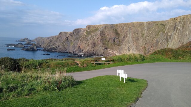
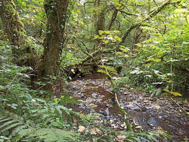
Great Churchyard Plantation is a remarkable woodland located in the county of Devon, England. Situated in the heart of the countryside, it covers a vast area of approximately 200 acres, making it one of the largest and most significant woodlands in the region. The plantation is nestled within the picturesque landscape, surrounded by rolling hills and meandering streams.

This ancient woodland boasts a diverse range of tree species, including oak, beech, ash, and birch, which create a rich and vibrant canopy. The dense foliage provides a haven for a multitude of wildlife, with an abundance of bird species, insects, and small mammals thriving in this natural habitat.

Great Churchyard Plantation is also renowned for its historic significance. It is believed to have existed for hundreds of years, with evidence of human activity dating back to the medieval period. The woodland has witnessed a variety of uses over the years, including timber production and as a hunting ground for local landowners.

Today, the plantation serves as a popular recreational destination for nature enthusiasts and hikers. Numerous walking trails wind their way through the woodland, offering visitors the opportunity to explore the enchanting surroundings and enjoy the tranquility of nature. The plantation is also utilized for educational purposes, with schools and environmental organizations using it as a valuable resource for teaching about the importance of woodland ecosystems and conservation.

Overall, Great Churchyard Plantation stands as a testament to the natural beauty and ecological significance of Devon's woodlands. Its idyllic setting and rich biodiversity make it a cherished asset for both locals and tourists alike.

If you have any feedback on the listing, please let us know in the comments section below.

Great Churchyard Plantation Images

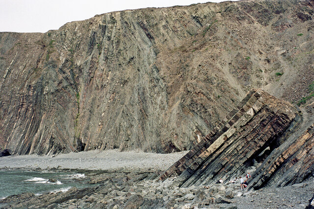
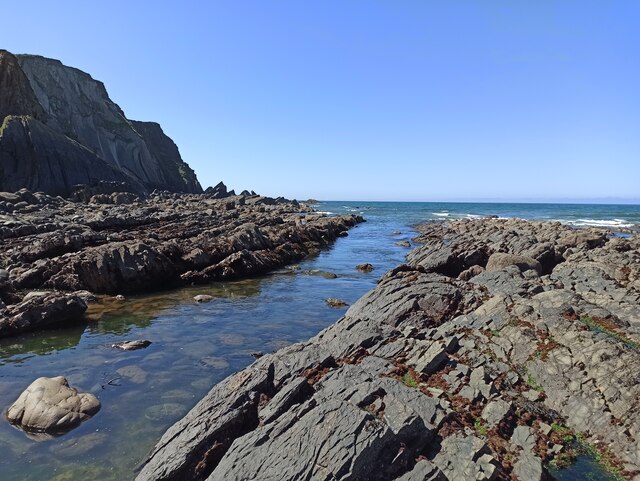
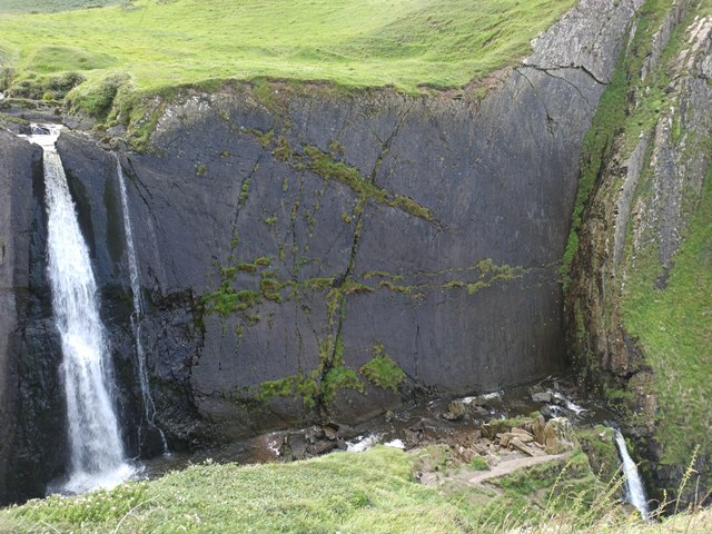
Images are sourced within 2km of 50.997078/-4.5202504 or Grid Reference SS2324. Thanks to Geograph Open Source API. All images are credited.

Hartland Abbey Built in the 12th century, Hartland survived as a monastery for 400 years - longer than any other abbey in the country.  

It is the home of the Stucley family and the current owner is Sir Hugh George Copplestone Bampfylde Stucley, 6th Baronet.
Hartland Abbey
Built in the 12th century, Hartland survived as a monastery for 400 years - longer than any other abbey in the country. It is the home of the Stucley family and the current owner is Sir Hugh George Copplestone Bampfylde Stucley, 6th Baronet.
The back of Hartland Abbey
Cliffs near Hartland Quay From the car park above the quay.
Cliffs near Hartland Quay
From the car park above the quay.
Abbey River
Abbey River
Cliffs by Warren Bay near Hartland Quay, Devon Seen looking north-east from near the quay.

The image has been scanned from a Kodak Gold 100 negative dating from August 1990.
Cliffs by Warren Bay near Hartland Quay, Devon
Seen looking north-east from near the quay. The image has been scanned from a Kodak Gold 100 negative dating from August 1990.
Rock strata near Hartland Quay in Devon This is at the southern end of Warren Beach, looking east-north-east.

The image has been scanned from a Kodak Gold 100 negative dating from August 1990.
Rock strata near Hartland Quay in Devon
This is at the southern end of Warren Beach, looking east-north-east. The image has been scanned from a Kodak Gold 100 negative dating from August 1990.
Warren Beach and Cliff near Hartland Quay in Devon Looking approximately east from near the quay.
Warren Beach and Cliff near Hartland Quay in Devon
Looking approximately east from near the quay.
Rock strata (detail) on Warren Beach in Devon Simon Jones writes: The rocks of Hartland Quay are the remains of a mountain range. Sedimentary rocks were deposited in a shallow sea during the Carboniferous period – about 320 million years ago. The layers are sequences of shales and mudstones representing the remains of sub-marine “avalanches” of sediments called turbidites. At the same time as the sands and mudstones were being deposited at Hartland, coals were being deposited in swamps, forming the South Wales coalfields.

Plate tectonics caused the collision of two super continents with Hartland Quay in the middle. Devon was at the southern margin of a super-continent called Laurasia, which collided with the super-continent Pangaea – to the South. As these two mega-continents collided during the Variscan Orogeny the rocks at Hartland Quay were buckled and folded, producing the spectacular chevron shaped folds exposed in the cliffs today. The top surface was then eroded flat. 
Simon Jones writes: The rocks of Hartland Quay are the remains of a mountain range. Sedimentary rocks were deposited in a shallow sea during the Carboniferous period – about 320 million years ago. The layers are sequences of shales and mudstones representing the remains of sub-marine “avalanches” of sediments called turbidites. At the same time as the sands and mudstones were being deposited at Hartland, coals were being deposited in swamps, forming the South Wales coalfields.

<span class="nowrap"><a title="http://www.westcountry-camping.co.uk/index.php/places-of-interest/geology-of-hartland-quay" rel="nofollow ugc noopener" href="http://www.westcountry-camping.co.uk/index.php/places-of-interest/geology-of-hartland-quay">Link</a><img style="margin-left:2px;" alt="External link" title="External link - shift click to open in new window" src="https://s1.geograph.org.uk/img/external.png" width="10" height="10"/></span> (Click "Geology of Hartland")

The image has been scanned from a Kodak Gold 100 negative dating from August 1990.
Rock strata (detail) on Warren Beach in Devon
Simon Jones writes: The rocks of Hartland Quay are the remains of a mountain range. Sedimentary rocks were deposited in a shallow sea during the Carboniferous period – about 320 million years ago. The layers are sequences of shales and mudstones representing the remains of sub-marine “avalanches” of sediments called turbidites. At the same time as the sands and mudstones were being deposited at Hartland, coals were being deposited in swamps, forming the South Wales coalfields. Plate tectonics caused the collision of two super continents with Hartland Quay in the middle. Devon was at the southern margin of a super-continent called Laurasia, which collided with the super-continent Pangaea – to the South. As these two mega-continents collided during the Variscan Orogeny the rocks at Hartland Quay were buckled and folded, producing the spectacular chevron shaped folds exposed in the cliffs today. The top surface was then eroded flat. Simon Jones writes: The rocks of Hartland Quay are the remains of a mountain range. Sedimentary rocks were deposited in a shallow sea during the Carboniferous period – about 320 million years ago. The layers are sequences of shales and mudstones representing the remains of sub-marine “avalanches” of sediments called turbidites. At the same time as the sands and mudstones were being deposited at Hartland, coals were being deposited in swamps, forming the South Wales coalfields. LinkExternal link (Click "Geology of Hartland") The image has been scanned from a Kodak Gold 100 negative dating from August 1990.
Parish Church of St Nectan in Stoke (Hartland)
Abbey River
Abbey River
Gull Rock beach Gull Rock is on the left.
Gull Rock beach
Gull Rock is on the left.
Beach between Gull Rock and Cow and a Calf
Damehole Point
Damehole Point
Blegberry Beach
Blegberry Beach
Blegberry Beach and Dyer's Lookout
Beach South of Hartland Quay
Speke's Mill Mouth waterfall
Screda Cove (right)
Screda Cove (right)
Show me another place!

Great Churchyard Plantation is located at Grid Ref: SS2324 (Lat: 50.997078, Lng: -4.5202504)

Administrative County: Devon

District: Torridge

Police Authority: Devon and Cornwall

What 3 Words

///stealthier.ideas.workouts. Near Flexbury, Cornwall

Related Wikis

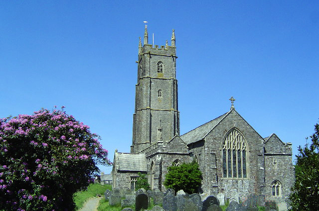
St Nectan's Church, Hartland

The Church of St Nectan is the parish church of Hartland, Devon, England. Sometimes referred to as the "Cathedral of North Devon", it is located in the...
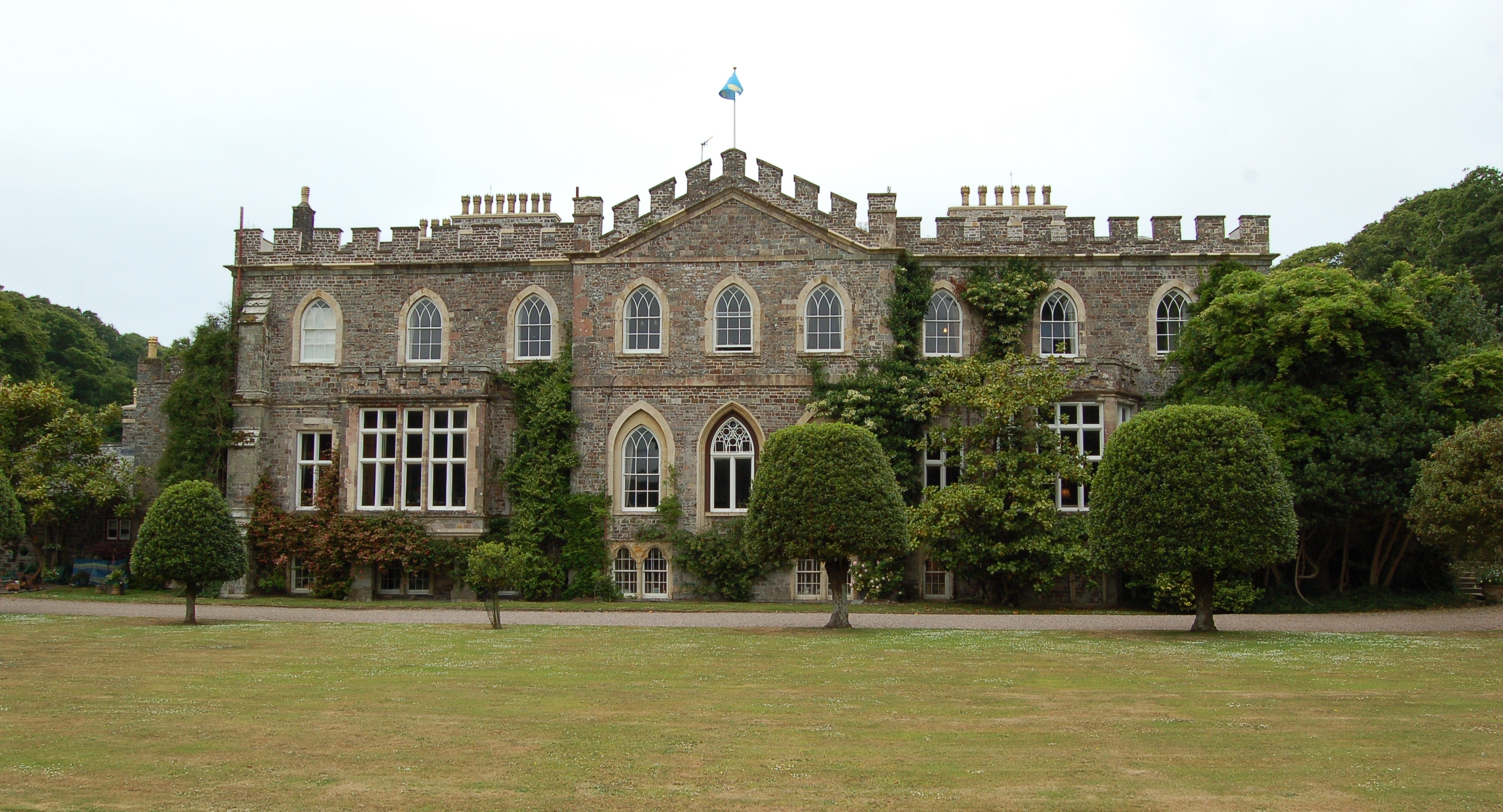
Hartland Abbey

Hartland Abbey is a former abbey and current family home to the Stucley family. It is located in Hartland, Devon. The current owner is Sir Hugh George...
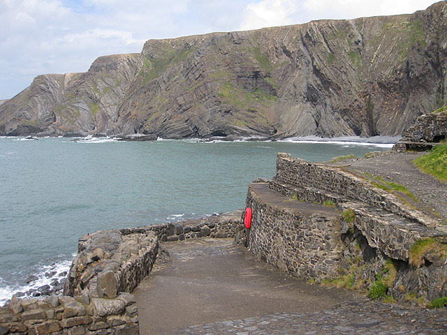
Hartland Quay

Hartland Quay is located on the Atlantic coast of Devon, England, south of Hartland Point and north of Bude, Cornwall. It experiences some of the roughest...

Embury Beacon

Embury Beacon is the site of an Iron Age promontory fort on the west of the Hartland Peninsula, north of Bude and west of Clovelly, in north Devon. The...

Nearby Amenities

Located within 500m of 50.997078,-4.5202504
Barrier: stile
Foot: yes
Lat/Long: 50.995833/-4.5248576
Barrier: stile
Lat/Long: 50.9952157/-4.5181065
St Nectan's Well
Drinking Water: yes
Natural: spring
Source: gps survey
Lat/Long: 50.9944896/-4.5146287
Berry House
Building: farm
Wikidata: Q26603442
Lat/Long: 51.0001337/-4.5175891
Barrier: stile
Lat/Long: 50.9952259/-4.5172246
Direction: SE
Generator Method: photovoltaic
Generator Output Electricity: yes
Generator Solar Modules: 12
Generator Source: solar
Generator Type: solar_photovoltaic_panel
Location: roof
Power: generator
Lat/Long: 50.9953441/-4.518393
Direction: S
Generator Method: photovoltaic
Generator Output Electricity: yes
Generator Solar Modules: 16
Generator Source: solar
Generator Type: solar_photovoltaic_panel
Location: roof
Power: generator
Lat/Long: 50.9952875/-4.5175166
Direction: S
Generator Method: photovoltaic
Generator Output Electricity: yes
Generator Solar Modules: 12
Generator Source: solar
Generator Type: solar_photovoltaic_panel
Location: roof
Power: generator
Lat/Long: 50.9952907/-4.517886
Direction: 210
Generator Method: photovoltaic
Generator Output Electricity: yes
Generator Solar Modules: 8
Generator Source: solar
Generator Type: solar_photovoltaic_panel
Location: roof
Power: generator
Lat/Long: 50.9942063/-4.5170251
Direction: SSE
Generator Method: photovoltaic
Generator Output Electricity: yes
Generator Solar Modules: 16
Generator Source: solar
Generator Type: solar_photovoltaic_panel
Location: roof
Power: generator
Lat/Long: 50.9944342/-4.5169956
Power: pole
Source: bing
Lat/Long: 50.9938011/-4.5249778
Power: pole
Source: bing
Lat/Long: 50.9938855/-4.5239264
Power: pole
Source: bing
Lat/Long: 50.9939818/-4.522934
Power: pole
Source: bing
Lat/Long: 50.9940797/-4.5216385
Power: pole
Source: bing
Lat/Long: 50.9936644/-4.5205709
Power: pole
Source: bing
Lat/Long: 50.9932828/-4.5195892
Power: pole
Source: bing
Lat/Long: 50.992881/-4.5185941
Power: pole
Source: bing
Lat/Long: 51.0005652/-4.5161104
Power: pole
Source: bing
Lat/Long: 51.0003306/-4.5169714
Waste Basket
Survey Date: 2024-03-23
Waste: dog_excrement
Lat/Long: 50.994543/-4.5155157
Defibrillator
Defibrillator Location: On outside wall of public toilets
Emergency: defibrillator
Indoor: no
Ref GB The Circuit: 6F7D591E-7576-47BE-81A6-AD730098C585
Survey Date: 2024-03-23
Lat/Long: 50.9945019/-4.5155463
Post Box
Collection Times: Mo-Fr 09:00, Sa 07:00
Operator: Royal Mail
Operator Wikidata: Q638098
Post Box Mounting: building
Post Box Type: wall
Ref: EX39 97D
Royal Cypher: EVIIR
Survey Date: 2024-03-23
Lat/Long: 50.9944508/-4.5152145
Fire Hydrant
Emergency: fire_hydrant
Fire Hydrant Position: lane
Fire Hydrant Type: underground
Survey Date: 2024-03-23
Lat/Long: 50.9944195/-4.5153322
The data included in this document is from www.openstreetmap.org. The data is made available under ODbL.

Have you been to Great Churchyard Plantation?

Leave your review of Great Churchyard Plantation below (or comments, questions and feedback).