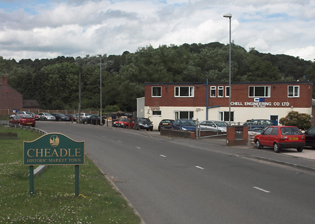
Cheadle

Settlement in Staffordshire Staffordshire Moorlands

England

Cheadle

Cheadle churchyard
Cheadle churchyard Credit: Jonathan Hutchins

Cheadle is a small market town located in the Staffordshire Moorlands district of Staffordshire, England. Situated on the banks of the River Tean, it is approximately 11 miles east of Stoke-on-Trent and 20 miles west of Derby. With a population of around 12,000 people, it is a bustling and vibrant community.

The town of Cheadle boasts a rich history, dating back to Roman times when it was a settlement known as "Cheadle Ford." The name "Cheadle" is derived from the Old English word "ceadan," meaning "together" or "at the head of the river." This reflects its location at the confluence of the River Tean and River Churnet.

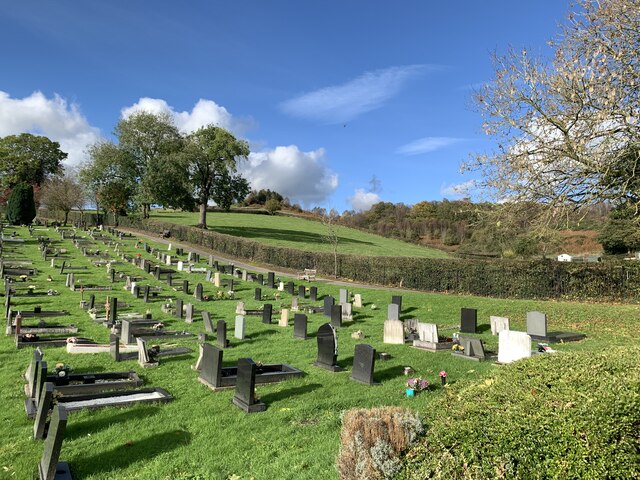
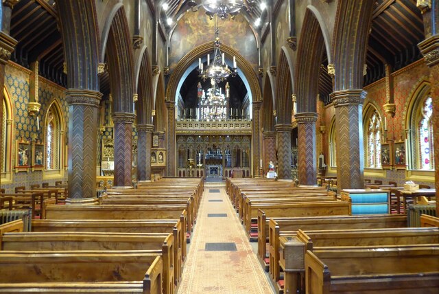
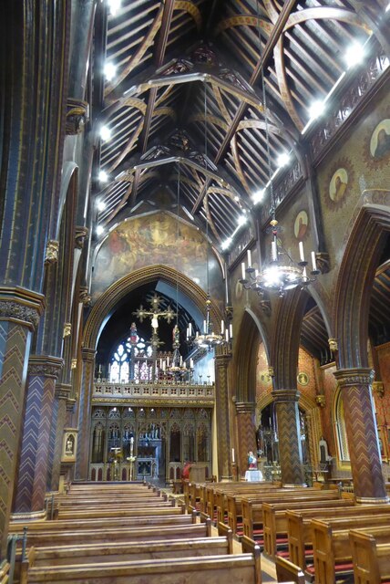
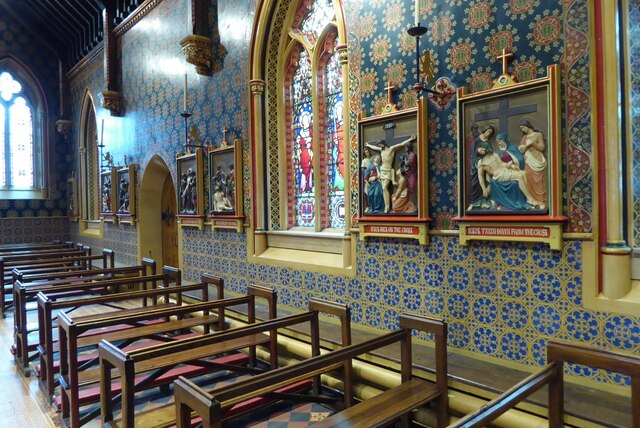
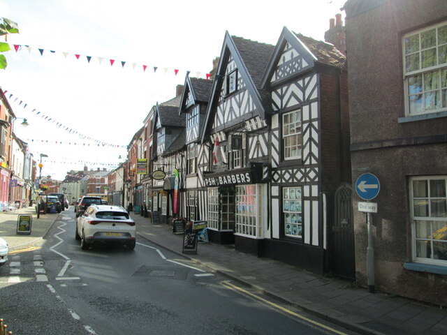
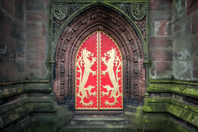
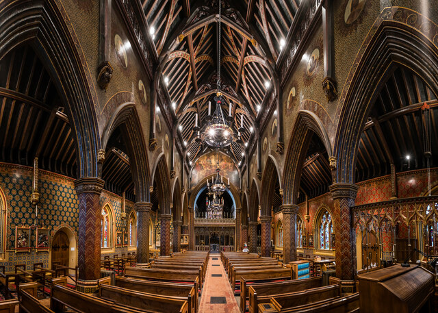
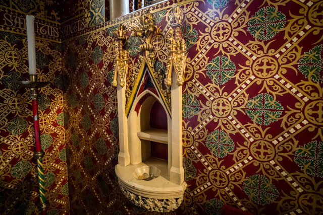
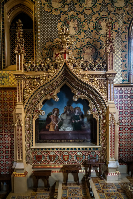
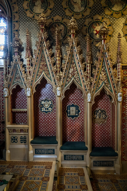
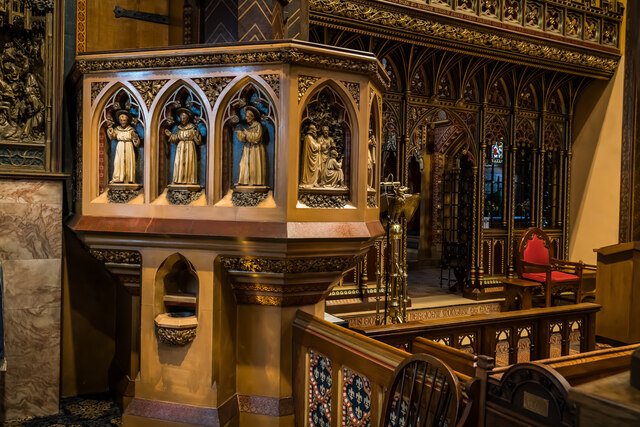
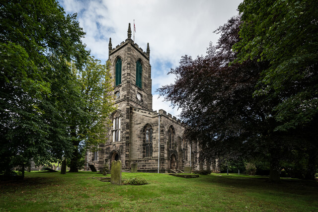
Cheadle is known for its stunning architecture, with various historic buildings and landmarks scattered throughout the town. One notable structure is St. Giles' Catholic Church, a Grade I listed building that dates back to the 19th century. The town also features the Cheadle Guildhall, a Victorian-era building that now serves as a community center.

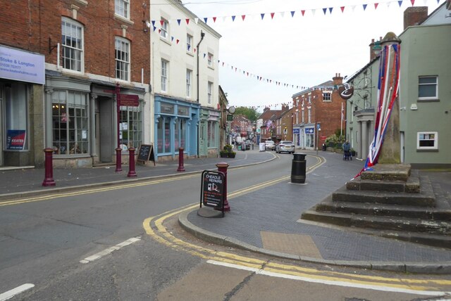
The town center of Cheadle offers a range of amenities, including a variety of independent shops, cafes, and restaurants. Market Square is a focal point for locals and visitors alike, hosting regular markets that offer fresh produce, crafts, and other goods. Additionally, Cheadle has several parks and open spaces, providing ample opportunities for outdoor activities and recreation.

Cheadle is well-connected to the surrounding areas by road, with the A50 running through the town. It also has a train station, Cheadle Hulme, providing convenient access to Manchester and other major cities.

Overall, Cheadle is a charming and historical town, offering a mix of modern amenities and traditional charm. With its picturesque location and community spirit, it is a delightful place to live or visit in Staffordshire.

If you have any feedback on the listing, please let us know in the comments section below.

Cheadle Images

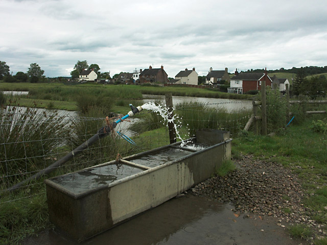
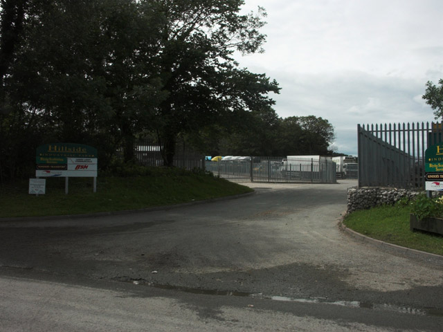
Images are sourced within 2km of 52.985229/-1.9854358 or Grid Reference SK0143. Thanks to Geograph Open Source API. All images are credited.

Cheadle churchyard
Cheadle churchyard
High Street, Cheadle High Street in Cheadle, the Market Cross is on the right.
High Street, Cheadle
High Street in Cheadle, the Market Cross is on the right.
St Giles Roman Catholic Church, Cheadle View along the nave of St Giles Roman Catholic Church in Cheadle.
St Giles Roman Catholic Church, Cheadle
View along the nave of St Giles Roman Catholic Church in Cheadle.
St Giles Roman Catholic Church, Cheadle View along the nave of St Giles Roman Catholic Church in Cheadle.
St Giles Roman Catholic Church, Cheadle
View along the nave of St Giles Roman Catholic Church in Cheadle.
Interior of St Giles, RC church, Cheadle Stations of the cross in St Giles Roman Catholic church in Cheadle.
Interior of St Giles, RC church, Cheadle
Stations of the cross in St Giles Roman Catholic church in Cheadle.
High Street, Cheadle Seen from the junction with Church Street.
High Street, Cheadle
Seen from the junction with Church Street.
Shrewsbury Lions West Door, St Giles, Cheadle Wonderfully ornate doors, the gilded iron fittings forming two lions taken from the Shrewsbury coat of arms.  There are also lions in the top corners and in the archivolts. 

The Church was financed by John Talbot (1791-1852) who was the 16th earl of Shrewsbury and designed by Augustus Pugin (1812-1852)

<span class="nowrap"><a title="https://en.wikipedia.org/wiki/St_Giles%27_Catholic_Church,_Cheadle" rel="nofollow ugc noopener" href="https://en.wikipedia.org/wiki/St_Giles%27_Catholic_Church,_Cheadle">Link</a><img style="margin-left:2px;" alt="External link" title="External link - shift click to open in new window" src="https://s1.geograph.org.uk/img/external.png" width="10" height="10"/></span>
Shrewsbury Lions West Door, St Giles, Cheadle
Wonderfully ornate doors, the gilded iron fittings forming two lions taken from the Shrewsbury coat of arms. There are also lions in the top corners and in the archivolts. The Church was financed by John Talbot (1791-1852) who was the 16th earl of Shrewsbury and designed by Augustus Pugin (1812-1852) LinkExternal link
St Giles' Nave, Cheadle
St Giles Piscina and Decorated Walls, Cheadle
Easter Sepulchre, St Giles, Cheadle The Easter sepulchre, based on a medieval tomb in Westminster Abbey..

The Easter sepulchre was a feature of many medieval churches, and was used in the ceremonies of Maundy Thursday, Good Friday and Easter Day. Easter Sepulchres were the object of iconoclastic fury by the Protestant Reformers, and few original ones are left. Augustus Pugin, The church designer would have been familiar with the surviving ones especially Hawton and Heckington. 

<span class="nowrap"><a title="https://en.wikipedia.org/wiki/Easter_Sepulchre" rel="nofollow ugc noopener" href="https://en.wikipedia.org/wiki/Easter_Sepulchre">Link</a><img style="margin-left:2px;" alt="External link" title="External link - shift click to open in new window" src="https://s1.geograph.org.uk/img/external.png" width="10" height="10"/></span>
Easter Sepulchre, St Giles, Cheadle
The Easter sepulchre, based on a medieval tomb in Westminster Abbey.. The Easter sepulchre was a feature of many medieval churches, and was used in the ceremonies of Maundy Thursday, Good Friday and Easter Day. Easter Sepulchres were the object of iconoclastic fury by the Protestant Reformers, and few original ones are left. Augustus Pugin, The church designer would have been familiar with the surviving ones especially Hawton and Heckington. LinkExternal link
Sedilia and Piscina, St. Giles, Cheadle Modern practice was for the seats to be on one level with the priest sitting in the middle but here Pugin reverted to the medieval arrangement where the priest sits on the left seat, nearest the altar and the deacon and subdeacon sitting to his left on descending levels.

<span class="nowrap"><a title="https://en.wikipedia.org/wiki/Sedilia" rel="nofollow ugc noopener" href="https://en.wikipedia.org/wiki/Sedilia">Link</a><img style="margin-left:2px;" alt="External link" title="External link - shift click to open in new window" src="https://s1.geograph.org.uk/img/external.png" width="10" height="10"/></span>

<span class="nowrap"><a title="https://www.stgilescheadle.org.uk/the-sedilia.html" rel="nofollow ugc noopener" href="https://www.stgilescheadle.org.uk/the-sedilia.html">Link</a><img style="margin-left:2px;" alt="External link" title="External link - shift click to open in new window" src="https://s1.geograph.org.uk/img/external.png" width="10" height="10"/></span>
Sedilia and Piscina, St. Giles, Cheadle
Modern practice was for the seats to be on one level with the priest sitting in the middle but here Pugin reverted to the medieval arrangement where the priest sits on the left seat, nearest the altar and the deacon and subdeacon sitting to his left on descending levels. LinkExternal link LinkExternal link
Pulpit, St. Giles, Cheadle To the south of the Lady-chapel altar is the pulpit. This was carved by Thomas Roddis out of a single block of stone. It is in the form of an irregular hexagon with one very broad face on the north side which incorporates a piscina and credence-shelf for the Lady-altar. 

The carved panels on the Lady-chapel side have statues of St. Francis of Assisi, St. Anthony of Padua and St. Bernadine of Siena, while those on the nave side depict St. John the Baptist, who was Lord Shrewsbury's patron saint. The pulpit is entered by a flight of steps from the sacristy.

<span class="nowrap"><a title="https://www.stgilescheadle.org.uk/the-pulpit.html" rel="nofollow ugc noopener" href="https://www.stgilescheadle.org.uk/the-pulpit.html">Link</a><img style="margin-left:2px;" alt="External link" title="External link - shift click to open in new window" src="https://s1.geograph.org.uk/img/external.png" width="10" height="10"/></span>
Pulpit, St. Giles, Cheadle
To the south of the Lady-chapel altar is the pulpit. This was carved by Thomas Roddis out of a single block of stone. It is in the form of an irregular hexagon with one very broad face on the north side which incorporates a piscina and credence-shelf for the Lady-altar. The carved panels on the Lady-chapel side have statues of St. Francis of Assisi, St. Anthony of Padua and St. Bernadine of Siena, while those on the nave side depict St. John the Baptist, who was Lord Shrewsbury's patron saint. The pulpit is entered by a flight of steps from the sacristy. LinkExternal link
The Church of St. Giles The Abbot, Cheadle
JCB Earthmovers factory off Leek Road just north of Cheadle. <span class="nowrap"><a title="http://www.jcb.com" rel="nofollow ugc noopener" href="http://www.jcb.com">Link</a><img style="margin-left:2px;" alt="External link" title="External link - shift click to open in new window" src="https://s1.geograph.org.uk/img/external.png" width="10" height="10"/></span>
JCB Earthmovers
factory off Leek Road just north of Cheadle. LinkExternal link
The Huntsman The Huntsman, Brookhouses
The Huntsman
The Huntsman, Brookhouses
Light industry on the edge of Cheadle
Drinking trough and ponds near Brookhouses
Entrance to Hillside Industrial Park This industrial estate has been developed on former opencast workings.
Entrance to Hillside Industrial Park
This industrial estate has been developed on former opencast workings.
Show me another place!

Cheadle is located at Grid Ref: SK0143 (Lat: 52.985229, Lng: -1.9854358)

Administrative County: Staffordshire

District: Staffordshire Moorlands

Police Authority: Staffordshire

What 3 Words

///beaker.snappy.workroom. Near Cheadle, Staffordshire

Nearby Locations

Lightwood Cheadle

Related Wikis

Cheadle, Staffordshire

Cheadle is a market town and civil parish in the Staffordshire Moorlands District of Staffordshire, England, with a population of 12,000 at the 2021 census...

St Giles' Catholic Church, Cheadle

St. Giles' Church is a Roman Catholic church in the town of Cheadle, Staffordshire, England. The Grade I listed Gothic Revival church was designed by Augustus...

Painsley Catholic College

Painsley Catholic College is a Roman Catholic secondary school with academy status in Cheadle, Staffordshire, England. The name comes from Painsley Hall...

The Cheadle Academy

The Cheadle Academy (formerly Cheadle High School) is a coeducational secondary school with academy status located in Cheadle, Staffordshire in the Midlands...

Tean Road Sports Ground

Tean Road Sports Ground is a cricket ground in Cheadle, Staffordshire. The ground is located south of the town centre along the Tean Road, which itself...

Cheadle railway station

Cheadle railway station served the town of Cheadle, Staffordshire, England. It was the terminus of a branch line from Cresswell and opened in 1901. �...

Moorlands Sixth Form College

The Moorlands Sixth Form College is a Sixth Form College located in Cheadle, a historic market town in Staffordshire, England. The college caters for years...
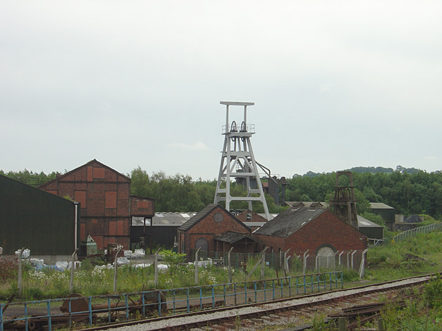
Cheadle Coalfield

The Cheadle Coalfield is a coalfield in the United Kingdom. Centred on the town of Cheadle, Staffordshire and its outlying villages it lies to the east...

Nearby Amenities

Located within 500m of 52.985229,-1.9854358
Addr City: Staffordshire
Addr Country: GB
Addr Street: High Street
Disused Amenity: pub
Old Name: Royal Oak PH
Lat/Long: 52.9864287/-1.9905933
Fire Station
Cheadle Fire Station
Lat/Long: 52.9851854/-1.9839067
Recycling
Lat/Long: 52.9861349/-1.9838503
Post Box
Brand: Royal Mail
Brand Wikidata: Q638098
Brand Wikipedia: en:Royal Mail
Operator: Royal Mail
Operator Wikidata: Q638098
Lat/Long: 52.9865611/-1.9854088
ali's store
Shop: convenience
Lat/Long: 52.9845314/-1.9830778
Post Box
Lat/Long: 52.9847844/-1.9838854
Pharmacy
ratcliffes
Dispensing: yes
Drive Through: no
Healthcare: pharmacy
Lat/Long: 52.9847478/-1.9843733
Telephone
Booth: KX100
Covered: booth
Designation: ashboune road telephone box
Lat/Long: 52.9846947/-1.9820198
Bus Stop
Butlers Hill
Bus: yes
Naptan AtcoCode: 3800C804600
Naptan Bearing: S
Naptan CommonName: Butlers Hill
Naptan Indicator: Adj
Naptan Landmark: Butlers Hill
Naptan PlusbusZoneRef: STOKEOT
Naptan Street: Leek Rd (S)
Naptan Verified: no
Public Transport: platform
Source: naptan_import
Lat/Long: 52.9889072/-1.9871467
Bus Stop
Butlers Hill
Bus: yes
Naptan AtcoCode: 3800C804601
Naptan Bearing: N
Naptan CommonName: Butlers Hill
Naptan Indicator: Adj
Naptan Landmark: Butlers Hill
Naptan PlusbusZoneRef: STOKEOT
Naptan Street: Leek Rd (N)
Naptan Verified: no
Public Transport: platform
Source: naptan_import
Lat/Long: 52.9888825/-1.9873008
Bus Stop
Somerfield Store
Bus: yes
Departures Board: no
Naptan AtcoCode: 3800C806300
Naptan Bearing: N
Naptan CommonName: Somerfield Store
Naptan Indicator: Adj
Naptan Landmark: Somerfields Supermaket
Naptan PlusbusZoneRef: STOKEOT
Naptan Street: Well Street
Naptan Verified: no
Public Transport: platform
Source: naptan_import
Lat/Long: 52.9876277/-1.9852421
Bus Stop
Park Avenue
Bus: yes
Departures Board: yes
Naptan AtcoCode: 3800C822301
Naptan Bearing: S
Naptan CommonName: Park Avenue
Naptan Indicator: Adj
Naptan Landmark: Park Ave
Naptan PlusbusZoneRef: STOKEOT
Naptan Street: 71 Tean Rd
Naptan Verified: no
Public Transport: platform
Shelter: no
Source: naptan_import
Lat/Long: 52.9809295/-1.9866323
Bus Stop
St Giles School
Bus: yes
Naptan AtcoCode: 3800C822801
Naptan Bearing: N
Naptan CommonName: St Giles School
Naptan Indicator: Adj
Naptan Landmark: St Giles School
Naptan PlusbusZoneRef: STOKEOT
Naptan Street: Tean Rd
Naptan Verified: no
Public Transport: platform
Source: naptan_import
Lat/Long: 52.9837876/-1.9859913
Bus Stop
Oak Street
Bus: yes
Departures Board: yes
Naptan AtcoCode: 3800C823101
Naptan Bearing: SW
Naptan CommonName: Oak Street
Naptan Indicator: Opp
Naptan Landmark: Oak St
Naptan PlusbusZoneRef: STOKEOT
Naptan Street: Bank St
Naptan Verified: no
Public Transport: platform
Source: naptan_import
Lat/Long: 52.9860346/-1.9898787
Bus Stop
Tape Street
Bus: yes
Naptan AtcoCode: 3800C823601
Naptan Bearing: NE
Naptan CommonName: Tape Street
Naptan Indicator: Adj
Naptan Landmark: Tape St
Naptan PlusbusZoneRef: STOKEOT
Naptan Street: Queen St
Naptan Verified: no
Public Transport: platform
Source: naptan_import
Lat/Long: 52.9882146/-1.9867149
Bus Stop
queen street
Bus: yes
Naptan AtcoCode: 3800C823602
Naptan Bearing: SW
Naptan CommonName: Queen's Arms PH
Naptan Indicator: Opp
Naptan PlusbusZoneRef: STOKEOT
Naptan Street: Queen St
Naptan Verified: no
Public Transport: platform
Source: naptan_import
Lat/Long: 52.9883357/-1.9864734
Pharmacy
Boots
Brand: Boots
Brand Wikidata: Q6123139
Brand Wikipedia: en:Boots (company)
Dispensing: yes
Healthcare: pharmacy
Website: https://www.boots.com/stores/1101-cheadle-high-street-stafford-st10-1ar
Lat/Long: 52.9870246/-1.9893193
Bicycle Parking
Covered: no
Lat/Long: 52.9871779/-1.9886729
Telephone
Booth: KX100
Covered: booth
Lat/Long: 52.9884858/-1.9875329
Cafe
Tudor Cafe
Addr City: Staffordshire
Addr Country: GB
Addr Street: High Street
Lat/Long: 52.9863101/-1.9910748
Bench
Lat/Long: 52.9872425/-1.9887238
Restaurant
Mughal Indian Restaurant
Cuisine: indian
Lat/Long: 52.9882218/-1.9879205
Restaurant
Cheadle Chinese Restaurant
Cuisine: chinese
Lat/Long: 52.9883938/-1.9877154
Fast Food
Babylon Pizzaland
Lat/Long: 52.9880806/-1.9879541
Cafe
Angie's Cafe
Lat/Long: 52.9870625/-1.9887508
Fast Food
Touch Of Spice
Lat/Long: 52.9881839/-1.9867444
Pub
Queen's Arms
Lat/Long: 52.9887692/-1.985317
Fast Food
Cheadle Kebab and Pizza
Lat/Long: 52.9858493/-1.9863367
Fast Food
Pearl DragonBayside Chinese Take Away
Lat/Long: 52.9865967/-1.9913975
Bank
Lloyds Bank
Addr Country: GB
Addr Housenumber: 10
Addr Street: High Street
Atm: no
Brand: Lloyds Bank
Brand Wikidata: Q1152847
Brand Wikipedia: en:Lloyds Bank
Contact Website: https://branches.lloydsbank.com/cheadle/10-high-street
Drive Through: no
Lat/Long: 52.9881847/-1.9879809
Restaurant
Cafe Rumi
Lat/Long: 52.9881532/-1.9880452
Crossing
Crossing: zebra
Lat/Long: 52.9886535/-1.9872954
Pub
The Lamplighter
Addr Street: tape street
Lat/Long: 52.9852446/-1.9856799
Post Box
High Street Cheadle
Lat/Long: 52.9864626/-1.9907395
Atm
Lat/Long: 52.987706/-1.9852918
morrisons
Shop: butcher
Lat/Long: 52.9879062/-1.9854205
Telephone
morrisons
Lat/Long: 52.987777/-1.9858712
Source: Bing
Traffic Calming: table
Lat/Long: 52.9862224/-1.9883697
Mini Roundabout
Direction: clockwise
Lat/Long: 52.9848683/-1.9869905
Source: Bing
Traffic Calming: bump
Lat/Long: 52.9820735/-1.9881572
Turning Circle
Lat/Long: 52.9884311/-1.9830311
Turning Circle
Lat/Long: 52.9872904/-1.982992
Turning Circle
Lat/Long: 52.9824038/-1.9905596
Mini Roundabout
Direction: clockwise
Lat/Long: 52.9852243/-1.9854105
Barrier: kissing_gate
Lat/Long: 52.9893286/-1.9830648
Stop
Direction: forward
Stop: all
Lat/Long: 52.9837952/-1.9859129
Stop
Direction: forward
Stop: all
Lat/Long: 52.984184/-1.9857479
Mini Roundabout
Direction: clockwise
Lat/Long: 52.988431/-1.987348
Source: Bing
Traffic Calming: bump
Lat/Long: 52.9817489/-1.9891507
Barrier: bollard
Bollard: fixed
Material: concrete
Motor Vehicle: no
Lat/Long: 52.9834969/-1.9827358
Traffic Calming: yes
Lat/Long: 52.986356/-1.989566
Crossing
Crossing: uncontrolled
Lat/Long: 52.9870245/-1.9875758
Crossing
Crossing: yes
Description: lollipop lady/man
Supervised: yes
Lat/Long: 52.9830226/-1.9903874
Crossing
Crossing: yes
Source: Bing
Lat/Long: 52.9847123/-1.9871601
Crossing
Crossing: traffic_signals
Lat/Long: 52.9876478/-1.9867725
Source: Bing
Traffic Calming: bump
Lat/Long: 52.9823353/-1.9900729
Source: Bing
Traffic Calming: bump
Lat/Long: 52.9828714/-1.9902044
Cheadle Cross
Historic: monument
Lat/Long: 52.9867105/-1.9899418
Power: substation
Substation: minor_distribution
Lat/Long: 52.9880061/-1.985111
Crossing
Crossing: unmarked
Crossing Island: no
Tactile Paving: yes
Lat/Long: 52.9862708/-1.9827006
Traffic Calming: hump
Lat/Long: 52.9866628/-1.9899549
Crossing
Crossing: traffic_signals
Lat/Long: 52.9865209/-1.9864086
Crossing
Crossing: uncontrolled
Lat/Long: 52.9873353/-1.9876938
Source: Bing
Traffic Calming: bump
Lat/Long: 52.9860128/-1.9867468
Mini Roundabout
Well Street Roundabout
Direction: clockwise
Lat/Long: 52.9866186/-1.9851801
Barrier: cycle_barrier
Lat/Long: 52.9882145/-1.9844083
Source: Bing
Traffic Calming: bump
Lat/Long: 52.9839388/-1.9890403
Crossing
Crossing: traffic_signals
Crossing Ref: pelican
Lat/Long: 52.988271/-1.9871708
Marketplace
Cheadle Market
Lat/Long: 52.9871039/-1.9897744
Source: Bing
Traffic Calming: bump
Lat/Long: 52.9833252/-1.9898101
Crossing
Crossing: yes
Source: Bing
Lat/Long: 52.9857566/-1.9908346
Post Office
Cheadle Post Office
Addr Country: GB
Addr Postcode: ST10 1UY
Brand: Post Office
Brand Wikidata: Q1783168
Contact Website: https://www.postoffice.co.uk/branch-finder/2962381/cheadle
Ref Pol Id: 11882
Lat/Long: 52.9868567/-1.9884691
Source: Bing
Traffic Calming: bump
Lat/Long: 52.9843096/-1.9877645
Cheadle War Memorial
Historic: memorial
Lat/Long: 52.9828183/-1.985795
Waste Basket
Lat/Long: 52.9867052/-1.9849279
Waste Basket
Lat/Long: 52.9876299/-1.9822634
Ashbourne Road Substation
Power: substation
Lat/Long: 52.9854339/-1.9844843
Railys
Shop: jewelry
Lat/Long: 52.9865696/-1.9899644
Morrisons Daily
Brand: Morrisons Daily
Brand Wikidata: Q99752411
Operator: McColl's
Operator Wikidata: Q16997477
Shop: convenience
Website: https://my.morrisons.com/storefinder/64913/morrisons-daily-cheadle-tean-road
Lat/Long: 52.9816941/-1.9870971
Check Date: 2021-02-22
Disused Shop: bakery
Old Name: Wright Pies
Lat/Long: 52.9879834/-1.9883796
Bank
Barclays
Atm: yes
Brand: Barclays
Brand Wikidata: Q245343
Brand Wikipedia: en:Barclays
Operator: Barclays Bank PLC
Lat/Long: 52.987362/-1.9888621
Morrisons in-store
Operator: morrisons
Shop: seafood
Lat/Long: 52.9878842/-1.9853955
Library
Cheadle Library
Lat/Long: 52.9877849/-1.9882534
Heaths
Shop: butcher
Lat/Long: 52.9876694/-1.98859
Bar
Bar 19
Lat/Long: 52.9857407/-1.9904904
Morrisons in-store
Shop: bakery
Lat/Long: 52.9879334/-1.9854545
Wollicrofts Butchers
Shop: butcher
Lat/Long: 52.9872165/-1.9891327
Bargain Booze
Brand: Bargain Booze
Brand Wikidata: Q16971315
Brand Wikipedia: en:Bargain Booze
Shop: alcohol
Lat/Long: 52.9880786/-1.988253
Fast Food
Goldfish Bowl
Cuisine: fish_and_chips
Lat/Long: 52.9858848/-1.986617
Cheadle Swimming Pool
Leisure: swimming_pool
Lat/Long: 52.983335/-1.981508
Pub
The Bird in the Hand
Addr Housenumber: 117
Addr Postcode: ST10 1ER
Addr Street: Tape Street
Fhrs Id: 1259945
Source Addr: FHRS Open Data
Lat/Long: 52.9838792/-1.985762
Fast Food
Marco Polo
Lat/Long: 52.983666/-1.9857137
Waste Basket
Lat/Long: 52.9882325/-1.9870038
Waste Basket
Lat/Long: 52.9876157/-1.9869019
Bench
Lat/Long: 52.9825826/-1.986195
Bus Stop
tean road Station Road Adj
Bus: yes
Naptan Bearing: N
Naptan CommonName: station road adj
Naptan Indicator: adj
Naptan Street: tean road
Public Transport: platform
Lat/Long: 52.9818978/-1.9866122
Bench
Lat/Long: 52.9820542/-1.986348
Bench
Lat/Long: 52.9867255/-1.9876996
Kindergarten
Poppins Day Nursery
Lat/Long: 52.9851209/-1.9874202
Bus Stop
Chapel Street charles Street adj
Bus: yes
Naptan Bearing: W
Naptan CommonName: charles street
Naptan Indicator: adj
Naptan Street: chapel street
Public Transport: platform
Lat/Long: 52.9861729/-1.9881205
Source: Bing
Traffic Calming: bump
Lat/Long: 52.9817884/-1.9896245
Source: Bing
Traffic Calming: bump
Lat/Long: 52.9850302/-1.987123
Source: Bing
Traffic Calming: bump
Lat/Long: 52.9861089/-1.9883311
Source: Bing
Traffic Calming: bump
Lat/Long: 52.985569/-1.9877333
Source: Bing
Traffic Calming: bump
Lat/Long: 52.98182/-1.986786
Hairwaves
Shop: hairdresser
Lat/Long: 52.9842054/-1.9858861
Aledex Hair Design
Shop: hairdresser
Lat/Long: 52.9859002/-1.9867404
Alistairs
Shop: hairdresser
Lat/Long: 52.9856507/-1.9906886
Shades Of Gold
Shop: hairdresser
Lat/Long: 52.9858727/-1.9864252
Cheadle Motor Parts
Shop: car_repair
Lat/Long: 52.9860703/-1.9867995
Crossing
Crossing: traffic_signals
Lat/Long: 52.9816554/-1.9865996
Crossing
Crossing: traffic_signals
Crossing Ref: pelican
Lat/Long: 52.9832275/-1.9861497
Kindergarten
Pathfinders Day Nursery
Lat/Long: 52.9850367/-1.9919634
W K Spooner And Son
Shop: car_repair
Lat/Long: 52.9867791/-1.9913788
Flat 1 Chinese Rise
Lat/Long: 52.9866666/-1.9913881
David Beaumont
Shop: hairdresser
Lat/Long: 52.9863412/-1.9896731
vouge hairdressers
Shop: hairdresser
Lat/Long: 52.986317/-1.9894116
Ye Olde Oatcake Shop
Shop: bakery
Lat/Long: 52.9864647/-1.9895363
FLAT 1
Building: yes
Lat/Long: 52.986661/-1.9896368
Pat's Hair Salon
Shop: hairdresser
Lat/Long: 52.9863921/-1.9894666
Duncan Cowans Hair Salon
Shop: hairdresser
Lat/Long: 52.9869583/-1.988783
Card Factory
Brand: Card Factory
Brand Wikidata: Q5038192
Brand Wikipedia: en:Card Factory
Shop: gift
Lat/Long: 52.987563/-1.9887267
Fast Food
Moorlands Fast Food
Addr Postcode: ST10 1AY
Addr Street: High Street
Fhrs Id: 1259963
Source Addr: FHRS Open Data
Lat/Long: 52.9874791/-1.9885349
The Bread Basket
Addr Postcode: ST10 1UY
Addr Street: High Street
Fhrs Id: 1259569
Shop: bakery
Source Addr: FHRS Open Data
Lat/Long: 52.9868235/-1.9886542
Cafe
Victorian Tea Rooms
Addr Postcode: ST10 1AY
Addr Street: High Street
Fhrs Id: 1259644
Source Addr: FHRS Open Data
Lat/Long: 52.9873749/-1.9885765
7a
Building: yes
Lat/Long: 52.987072/-1.9887557
Crossing
Crossing: traffic_signals
Lat/Long: 52.9858248/-1.9858478
Bank
Leek united
Lat/Long: 52.9865313/-1.990191
Fast Food
Fantis fish shop
Lat/Long: 52.9864885/-1.9902748
Drinking Fountain
Historic: monument
Lat/Long: 52.9860571/-1.9918001
Crossing
Crossing: yes
Lat/Long: 52.9871039/-1.9894162
Crossing
Lat/Long: 52.9864063/-1.9909956
Cheadle Dry cleaners
Shop: laundry
Lat/Long: 52.9879704/-1.9885655
Secrets Beauty Salon
Shop: hairdresser
Lat/Long: 52.9883079/-1.9879204
Cafe
Moshi
Addr Housenumber: 56B
Addr Postcode: ST10 1AF
Addr Street: High Street
Fhrs Id: 1259636
Outdoor Seating: no
Source Addr: FHRS Open Data
Lat/Long: 52.9871841/-1.9895545
Swinfit Studio
Addr Housename: above wh smiths
Leisure: sports_centre
Lat/Long: 52.9876487/-1.9889483
Pharmacy
J C Ratcliffe
Dispensing: yes
Drive Through: no
Healthcare: pharmacy
Lat/Long: 52.9875595/-1.9890724
Sweet Stuff
Shop: confectionery
Lat/Long: 52.9868604/-1.9899678
Cut above
Shop: hairdresser
Lat/Long: 52.9867696/-1.9904834
Restaurant
The Olive Tree
Addr Housenumber: 88
Addr Postcode: ST10 1AJ
Addr Street: High Street
Fhrs Id: 1259435
Source Addr: FHRS Open Data
Lat/Long: 52.9864818/-1.9911258
Mace
Addr Housenumber: 82-84
Addr Postcode: ST10 1AJ
Addr Street: High Street
Brand: Mace
Brand Wikidata: Q75240338
Fhrs Id: 1259555
Shop: convenience
Source Addr: FHRS Open Data
Lat/Long: 52.9865791/-1.9908274
For get me nots
Shop: florist
Lat/Long: 52.9867502/-1.9903714
Cheadle Cards
Shop: gift
Lat/Long: 52.9864249/-1.991276
Francesco
Shop: hairdresser
Lat/Long: 52.9867583/-1.9903272
Cafe
The Summerhouse
Addr Housenumber: 64
Addr Postcode: ST10 1AJ
Addr Street: High Street
Fhrs Id: 1259416
Source Addr: FHRS Open Data
Lat/Long: 52.9868374/-1.9900455
Crossing: zebra
Lat/Long: 52.9871131/-1.9852903
Crossing: zebra
Lat/Long: 52.987417/-1.9858221
Crossing: zebra
Lat/Long: 52.9874794/-1.9857653
Barrier: bollard
Lat/Long: 52.9878303/-1.9867506
Barrier: bollard
Lat/Long: 52.9878154/-1.9867217
Barrier: bollard
Lat/Long: 52.9878214/-1.9867385
Crossing: zebra
Lat/Long: 52.9875494/-1.9854951
Barrier: bollard
Lat/Long: 52.9878125/-1.9866941
Crossing: zebra
Lat/Long: 52.9870805/-1.9851642
Post Office
Ashbourne Road Post Office
Addr Postcode: ST10 1HQ
Branch: Ashbourne Road
Brand: Post Office
Brand Wikidata: Q1783168
Check Date: 2020-02-20
Contact Website: https://www.postoffice.co.uk/branch-finder/2192381/ashbourne-road
Ref Pol Id: 8138
Lat/Long: 52.9847146/-1.9839598
Park View Guest House
Tourism: guest_house
Lat/Long: 52.9836085/-1.984347
Post Box
Lat/Long: 52.9846851/-1.9786429
Waste Basket
Designation: litter bin
Lat/Long: 52.9846964/-1.9820869
Grit Bin
Lat/Long: 52.9854567/-1.9802779
Power: pole
Lat/Long: 52.9847042/-1.981938
Power: pole
Lat/Long: 52.9837336/-1.9860365
tape street (hall)
Man Made: surveillance
Lat/Long: 52.987735/-1.9867472
Mile Stone
Historic: memorial
Lat/Long: 52.9888442/-1.9871789
Tim's
Shop: hairdresser
Lat/Long: 52.9881804/-1.9865104
Barrier: kissing_gate
Lat/Long: 52.9892641/-1.9835204
Parking Meter
Lat/Long: 52.9871913/-1.9875894
Waste Basket
Lat/Long: 52.9829505/-1.9900944
Barrier: bollard
Lat/Long: 52.9883313/-1.9875473
Barrier: bollard
Lat/Long: 52.9883579/-1.9874896
Barrier: bollard
Lat/Long: 52.9883175/-1.9875781
Barrier: bollard
Lat/Long: 52.9883442/-1.9875231
Shelter
Lat/Long: 52.9865982/-1.9905342
Shelter
Shelter Type: public_transport
Lat/Long: 52.9875163/-1.9890079
Cheadle Spear
Historic: monument
Lat/Long: 52.9866821/-1.9876093
Crossing
Crossing: unmarked
Crossing Island: yes
Crossing Markings: no
Tactile Paving: yes
Lat/Long: 52.9864687/-1.9852397
Noexit: yes
Lat/Long: 52.9851143/-1.9876751
Addr Postcode: ST10 1RY
Lat/Long: 52.9860913/-1.9800925
Addr Postcode: ST10 1RU
Lat/Long: 52.9855197/-1.9800591
Addr Postcode: ST10 1RZ
Lat/Long: 52.9854422/-1.9786067
Turning Circle
Lat/Long: 52.9834736/-1.983279
Tourism: information
Lat/Long: 52.986828/-1.9892842
Veterinary
rodgers brock and bakers
Lat/Long: 52.9856558/-1.9915561
Waste Basket
Lat/Long: 52.9852241/-1.9919667
Waste Basket
Lat/Long: 52.9819864/-1.9889948
Bus Stop
NatWest
Bus: yes
Naptan AtcoCode: 3800C804701
Naptan NaptanCode: stadagma
Public Transport: platform
Lat/Long: 52.9874398/-1.989077
Noexit: yes
Lat/Long: 52.9818251/-1.9825859
Crossing
Lat/Long: 52.9867483/-1.9874816
Footway
Lat/Long: 52.9869857/-1.9885656
Street Lamp
M8
Lat/Long: 52.9809177/-1.9866402
Street Lamp
M7
Lat/Long: 52.9813812/-1.9865731
Street Lamp
M6
Lat/Long: 52.9818043/-1.9864819
Street Lamp
M5
Lat/Long: 52.9821999/-1.9865275
Street Lamp
M4
Lat/Long: 52.9825552/-1.9864229
Street Lamp
M3
Lat/Long: 52.9829056/-1.9861627
Street Lamp
M2
Lat/Long: 52.9832964/-1.9860273
Street Lamp
M1 Tean Road
Lat/Long: 52.9837227/-1.9858731
Street Lamp
M1 Tape Street
Lamp Type: electric
Lat/Long: 52.9884445/-1.9872531
Street Lamp
M2
Lat/Long: 52.9881329/-1.9870975
Street Lamp
M3
Lat/Long: 52.9878535/-1.9869312
Street Lamp
M4
Lat/Long: 52.987705/-1.9867193
Street Lamp
M5
Lat/Long: 52.9875365/-1.9868089
Street Lamp
M6
Lat/Long: 52.9872771/-1.9867408
Street Lamp
M7
Lat/Long: 52.9869703/-1.9865182
Street Lamp
M8
Lat/Long: 52.98667/-1.9863867
Street Lamp
M9
Lat/Long: 52.9863875/-1.9863175
Street Lamp
M10
Lat/Long: 52.9863051/-1.9864457
Street Lamp
M11
Lat/Long: 52.9862796/-1.9861252
Street Lamp
M12
Lat/Long: 52.9861904/-1.9864243
Street Lamp
M14
Lat/Long: 52.9860772/-1.9858677
Street Lamp
M15
Lat/Long: 52.9859175/-1.9858503
Street Lamp
M16
Lat/Long: 52.985664/-1.9856491
Street Lamp
M17
Lat/Long: 52.9854573/-1.9854667
Street Lamp
M18
Lat/Long: 52.985228/-1.9855016
Street Lamp
M19
Lat/Long: 52.9849374/-1.9854614
Street Lamp
M20
Lat/Long: 52.9847242/-1.9856223
Street Lamp
M21
Lat/Long: 52.9844045/-1.9856035
Street Lamp
M22 Tape Street
Lat/Long: 52.9841051/-1.9857279
Cheadle Discovery and Visitor Centre
Addr City: Cheadle, Staffordshire
Addr Housename: Lulworth House
Addr Housenumber: 51
Addr Postcode: ST10 1AR
Addr Street: High Street
Operator: Cheadle Discovery Group
Tourism: attraction
Website: http://www.discovercheadle.co.uk
Wheelchair: yes
Lat/Long: 52.9868441/-1.9894822
Car Wash
Lat/Long: 52.9875249/-1.9878831
Isabella's Nail Salon
Shop: beauty
Lat/Long: 52.9866138/-1.990693
Crossing
Crossing: uncontrolled
Crossing Ref: zebra
Lat/Long: 52.9853435/-1.9849938
Crossing
Crossing: uncontrolled
Crossing Ref: zebra
Lat/Long: 52.9856174/-1.984784
Turning Circle
Lat/Long: 52.985764/-1.9897416
Traffic Calming: bump
Lat/Long: 52.9842016/-1.9862063
Power: substation
Lat/Long: 52.9841084/-1.9879831
Waste Basket
Lat/Long: 52.9843189/-1.9874885
Window Repair Centre Ltd
Addr City: Stoke-on-Trent
Addr Country: GB
Addr Postcode: ST10 1AF
Addr Street: 32 High Street, Cheadle
Craft: window_construction
Opening Hours: Mo-Th 09:00-17:00; Fr 09:00-13:00
Payment American Express: yes
Payment Cash: yes
Payment Mastercard: yes
Payment Visa: yes
Phone: +44 1538 755 060
Website: https://www.windowrepaircentre.com
Lat/Long: 52.9875948/-1.9903309
Barrier: bollard
Material: wood
Lat/Long: 52.9865706/-1.9859789
Barrier: bollard
Material: wood
Lat/Long: 52.986561/-1.9859731
Barrier: bollard
Material: wood
Lat/Long: 52.986548/-1.9859645
Barrier: bollard
Material: wood
Lat/Long: 52.9865358/-1.9859566
Barrier: bollard
Material: concrete
Lat/Long: 52.98646/-1.9862843
Barrier: bollard
Material: concrete
Lat/Long: 52.9864695/-1.9862888
Barrier: bollard
Material: concrete
Lat/Long: 52.9865242/-1.9863161
Barrier: bollard
Material: concrete
Lat/Long: 52.9865163/-1.9863109
The data included in this document is from www.openstreetmap.org. The data is made available under ODbL.

Have you been to Cheadle?

Leave your review of Cheadle below (or comments, questions and feedback).