Chaxhill

Settlement in Gloucestershire Forest of Dean

England

Chaxhill

The Severn at Bollow Bank, 1 A fine wooden garden construction belonging to the property off camera to the left.
The Severn at Bollow Bank, 1 Credit: Jonathan Billinger

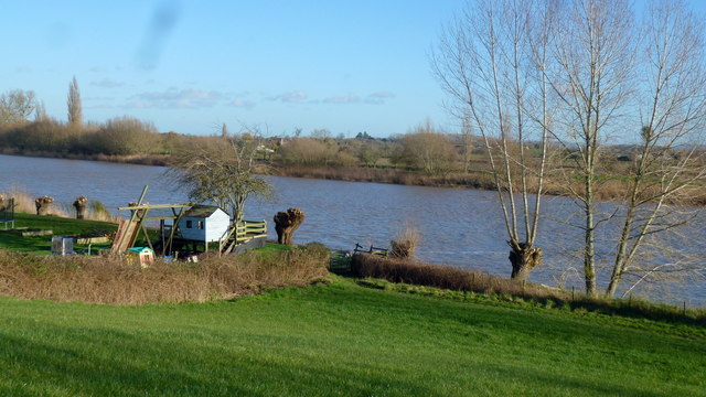
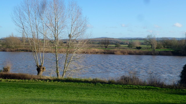
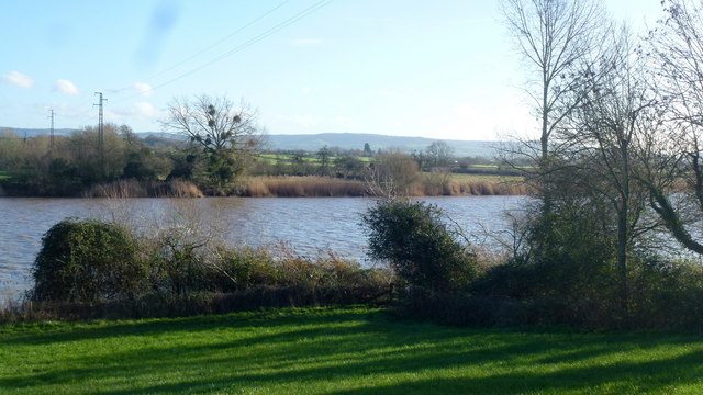
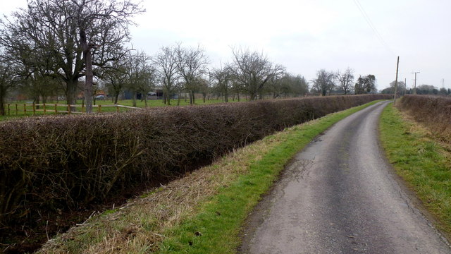
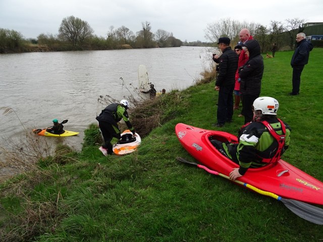
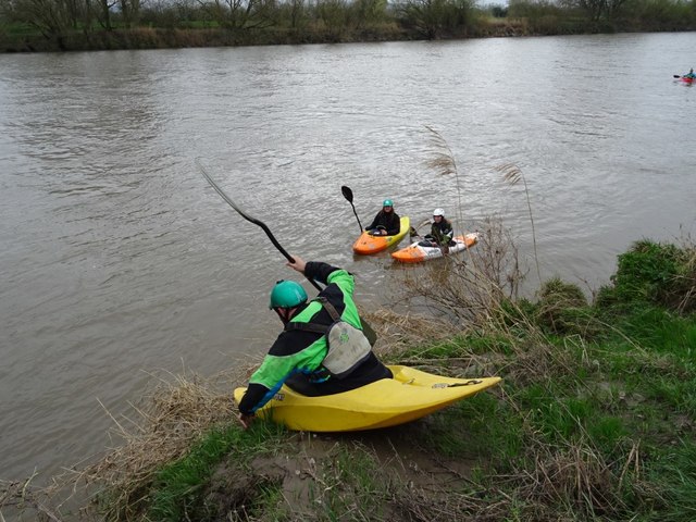
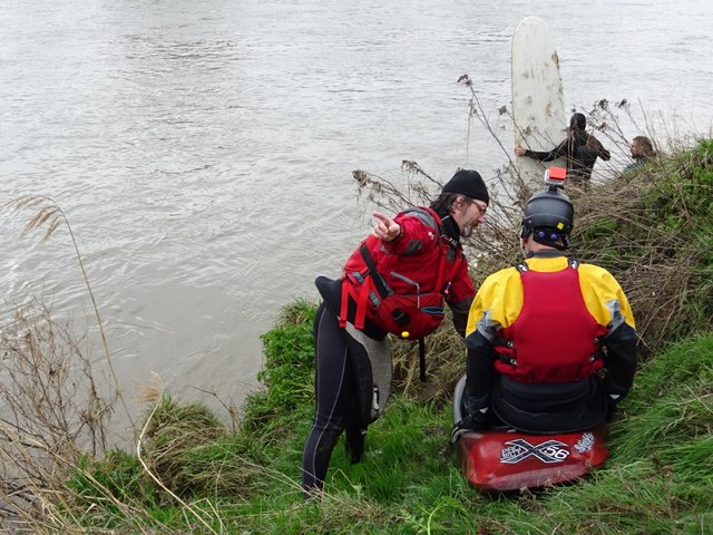
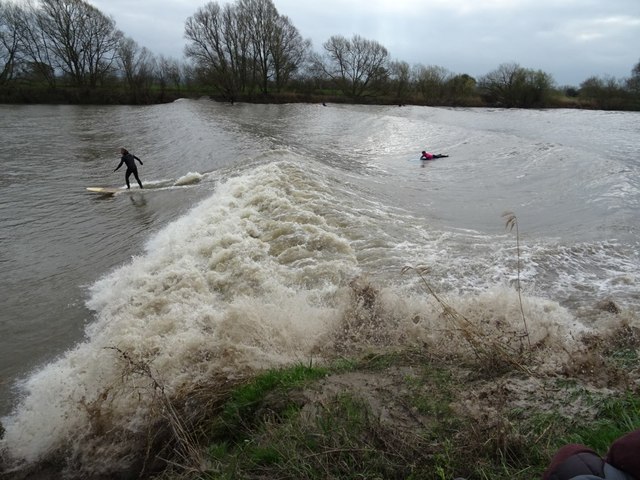
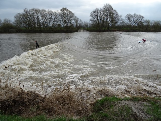
Chaxhill is a small village located in Gloucestershire, England. Situated on the eastern bank of the River Severn, it is part of the Forest of Dean district. The village is nestled amidst picturesque countryside, offering stunning views of the surrounding landscape.

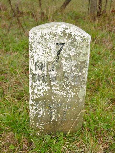
Chaxhill is known for its rich history, with evidence of human habitation dating back to the Iron Age. The village grew in importance during the medieval period due to its proximity to the river, which served as a vital transportation route. Today, remnants of this historical significance can be seen in the form of ancient buildings and landmarks.

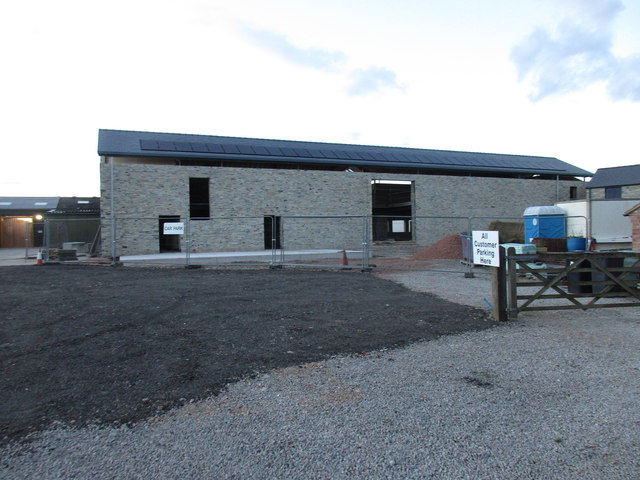
The village itself is characterized by a close-knit community that takes pride in its rural heritage. The local economy is primarily based on agriculture, with many residents engaged in farming and livestock rearing. The fertile soil and favorable climate make Chaxhill an ideal location for farming activities.

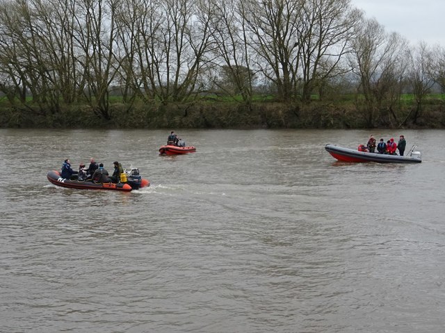
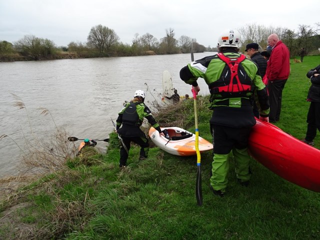
Despite its small size, Chaxhill offers a range of amenities for its residents. These include a village hall, a primary school, and a village pub, which serves as a hub for social gatherings and community events. The surrounding countryside also provides ample opportunities for outdoor activities such as hiking, cycling, and fishing.

Chaxhill's tranquil setting and natural beauty make it an attractive destination for visitors seeking a peaceful retreat. With its rich history, strong sense of community, and stunning rural landscape, Chaxhill truly embodies the charm of the English countryside.

If you have any feedback on the listing, please let us know in the comments section below.
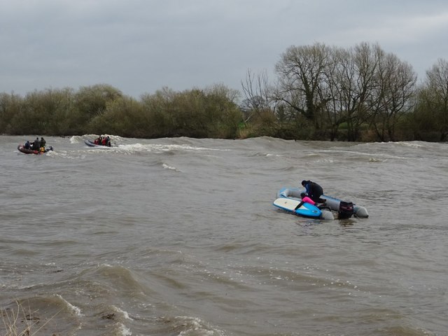
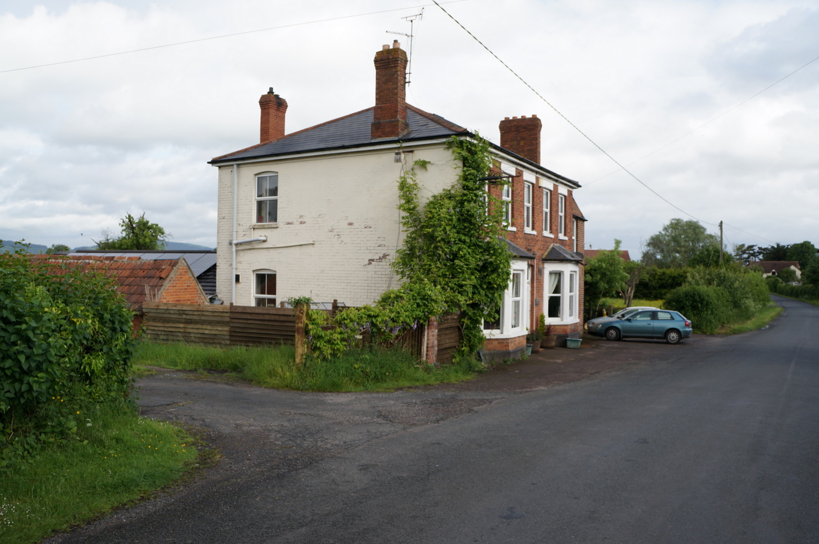
Chaxhill Images

Images are sourced within 2km of 51.825335/-2.372876 or Grid Reference SO7414. Thanks to Geograph Open Source API. All images are credited.

The Severn at Bollow Bank, 1 A fine wooden garden construction belonging to the property off camera to the left.
The Severn at Bollow Bank, 1
A fine wooden garden construction belonging to the property off camera to the left.
The Severn at Bollow Bank, 2 Looking east, straight across the big river in its tidal phase.
The Severn at Bollow Bank, 2
Looking east, straight across the big river in its tidal phase.
The Severn at Bollow Bank, 3 Beyond the river in the far distance is the Cotswold scarp.
The Severn at Bollow Bank, 3
Beyond the river in the far distance is the Cotswold scarp.
Severn and Wye Smokery, new building under construction
Waterend Lane A dead-end lane, and the landowners around make sure you know it!
Old orchard to the left.
Waterend Lane
A dead-end lane, and the landowners around make sure you know it! Old orchard to the left.
Private track to Waterend Cottage Note the barrier; up as it happens...
Private track to Waterend Cottage
Note the barrier; up as it happens...
Lane to Castle End, Longney One of many scattered farms hereabouts.
Lane to Castle End, Longney
One of many scattered farms hereabouts.
Westbury-on-Severn: Stantway 1-km square visited as part of the Gloucestershire Winter Bird Survey. S Barker.
Westbury-on-Severn: Stantway
1-km square visited as part of the Gloucestershire Winter Bird Survey. S Barker.
Old Milestone by the A48, Chaxhill, Westbury on Severn Parish Carved stone post by the A48, in parish of WESTBURY ON SEVERN (FOREST OF DEAN District), 300m West of school, on grass verge, on South side of road. Elton stone, erected by the Elton (District of Huntley & Mitcheldean) turnpike trust in the 19th century. 

Inscription reads:-
7
MILES TO
GLOUCESTER
TO LONDON
112 
Carved benchmark on top.

Milestone Society National ID: GL_GLNH07.
Old Milestone by the A48, Chaxhill, Westbury on Severn Parish
Carved stone post by the A48, in parish of WESTBURY ON SEVERN (FOREST OF DEAN District), 300m West of school, on grass verge, on South side of road. Elton stone, erected by the Elton (District of Huntley & Mitcheldean) turnpike trust in the 19th century. Inscription reads:- 7 MILES TO GLOUCESTER TO LONDON 112 Carved benchmark on top. Milestone Society National ID: GL_GLNH07.
Old Milestone by the A48, Stantway, Westbury on Severn Parish Carved stone post by the A48, in parish of WESTBURY ON SEVERN (FOREST OF DEAN District), 67m East of lane to Wintle's Hill House; adjacent to telephone pole D44, on grass verge, on North side of road. Elton stone, erected by the Elton (District of Huntley & Micheldean) turnpike trust in the 19th century. 

Inscription reads:-
8
(MILE)S TO
(GLOUCE)STER
TO LONDON
113 

Grade II listed. List Entry Number: 1299155
<span class="nowrap"><a title="https://historicengland.org.uk/listing/the-list/list-entry/1299155" rel="nofollow ugc noopener" href="https://historicengland.org.uk/listing/the-list/list-entry/1299155">Link</a><img style="margin-left:2px;" alt="External link" title="External link - shift click to open in new window" src="https://s1.geograph.org.uk/img/external.png" width="10" height="10"/></span>

Milestone Society National ID: GL_GLNH08.
Old Milestone by the A48, Stantway, Westbury on Severn Parish
Carved stone post by the A48, in parish of WESTBURY ON SEVERN (FOREST OF DEAN District), 67m East of lane to Wintle's Hill House; adjacent to telephone pole D44, on grass verge, on North side of road. Elton stone, erected by the Elton (District of Huntley & Micheldean) turnpike trust in the 19th century. Inscription reads:- 8 (MILE)S TO (GLOUCE)STER TO LONDON 113 Grade II listed. List Entry Number: 1299155 LinkExternal link Milestone Society National ID: GL_GLNH08.
Awaiting the Severn bore Awaiting the Severn bore near Minsterworth.
Awaiting the Severn bore
Awaiting the Severn bore near Minsterworth.
Canoeist launching in preparation for the Severn bore Canoeist launching in preparation for the Severn bore near the Severn Bore Inn at Minsterworth.
Canoeist launching in preparation for the Severn bore
Canoeist launching in preparation for the Severn bore near the Severn Bore Inn at Minsterworth.
Canoeist launching in preparation for the Severn bore
Surfing the Severn bore Surfers riding a five star Severn bore near the Severn Bore Inn at Minsterworth.
Surfing the Severn bore
Surfers riding a five star Severn bore near the Severn Bore Inn at Minsterworth.
Surfing the Severn bore Surfers riding a five star Severn bore near the Severn Bore Inn at Minsterworth.
Surfing the Severn bore
Surfers riding a five star Severn bore near the Severn Bore Inn at Minsterworth.
After the Severn bore Boats picking up surfers and canoeists after the Severn bore has passed through.
After the Severn bore
Boats picking up surfers and canoeists after the Severn bore has passed through.
Show me another place!

Chaxhill is located at Grid Ref: SO7414 (Lat: 51.825335, Lng: -2.372876)

Administrative County: Gloucestershire

District: Forest of Dean

Police Authority: Gloucestershire

What 3 Words

///ranches.observer.headlight. Near Huntley, Gloucestershire

Nearby Locations

Chaxhill Walmore Hill

Related Wikis

Walmore Common

Walmore Common (grid reference SO740162 & grid reference SO745150) is a 57.78-hectare (142.8-acre) nature reserve on the flood-plain of the River Severn...

Longney

Longney is a village on the River Severn 5 miles south-west of Gloucester, Gloucestershire, England, within the parish of Longney and Epney. The parish...

Westbury Court Garden

Westbury Court Garden is a Dutch water garden in Westbury-on-Severn, Gloucestershire, England, 9 miles (14 km) southwest of Gloucester. It is a rare survival...

Grange Court railway station

Grange Court railway station was a junction station on the South Wales Railway in Gloucestershire (on the present day Gloucester to Newport Line) where...

Rodley, Gloucestershire

Rodley is a settlement in Westbury-on-Severn parish, Forest of Dean District, Gloucestershire, England. It lies to the south east of Westbury-on-Severn...

Westbury-on-Severn

Westbury-on-Severn is a rural village in England that is the centre of the large, rural parish, also called Westbury-on-Severn. == Location == The village...

Garden Cliff

Garden Cliff (grid reference SO718128) is a 5.1-hectare (13-acre) geological Site of Special Scientific Interest in Gloucestershire, notified in 1954....

Oakle Street

Oakle Street is a village in Gloucestershire, England. == External links == Media related to Oakle Street at Wikimedia Commons Churcham Village Website...

Nearby Amenities

Located within 500m of 51.825335,-2.372876
Bus Stop
Coulstance Farm
Naptan AtcoCode: 1600GLF146
Naptan Bearing: N
Naptan CommonName: Coulstance Farm
Naptan NaptanCode: gloapgpm
Naptan Street: Goose Ln
Naptan Verified: no
Source: naptan_import
Lat/Long: 51.8231785/-2.3665373
Barrier: stile
Lat/Long: 51.8229567/-2.3714427
Power: pole
Source: Bing
Lat/Long: 51.8215425/-2.373079
Power: pole
Source: Bing
Lat/Long: 51.8220449/-2.3708648
Power: pole
Source: Bing
Lat/Long: 51.8223093/-2.3687888
The data included in this document is from www.openstreetmap.org. The data is made available under ODbL.

Have you been to Chaxhill?

Leave your review of Chaxhill below (or comments, questions and feedback).