Battery Walk Wood

Wood, Forest in Cornwall

England

Battery Walk Wood

Farmland, St Goran The hamlet of Rescassa is seen from the footpath north of Treveor.
Farmland, St Goran Credit: Andrew Smith

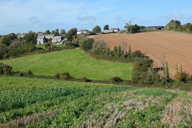
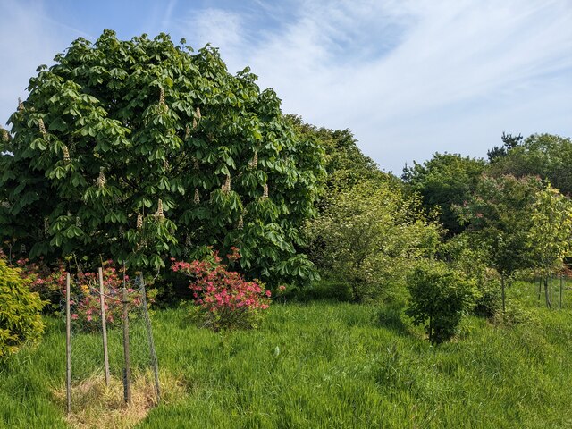
Battery Walk Wood is a picturesque woodland located in Cornwall, England. Covering an area of approximately 20 acres, this woodland is a popular destination for nature enthusiasts and hikers alike. Situated near the coastal town of St. Ives, Battery Walk Wood offers a tranquil escape from the bustling city life.

The woodland is characterized by its diverse range of trees, including oak, beech, and ash. These trees provide a lush canopy, creating a shaded and cool environment even on hot summer days. The forest floor is adorned with a variety of wildflowers, adding bursts of color to the landscape.

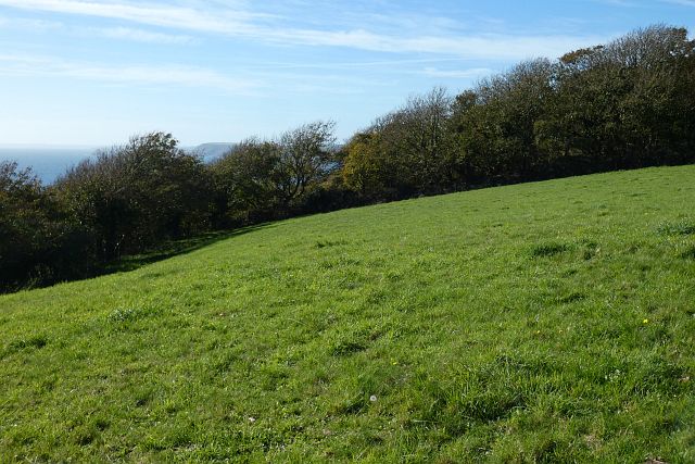
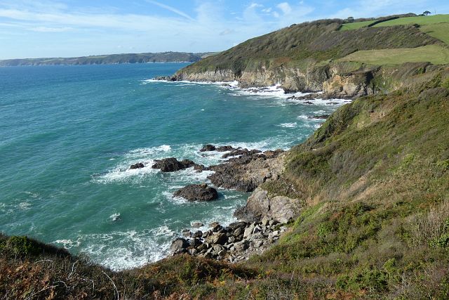
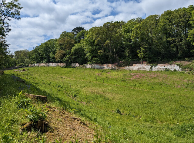
One of the main attractions of Battery Walk Wood is its network of walking trails. These well-marked paths guide visitors through the forest, allowing them to explore its beauty at their own pace. Along the trails, visitors may come across several viewpoints that offer stunning vistas of the surrounding countryside and the nearby coastline.

The wood is also home to a rich array of wildlife. Birdwatchers will be delighted to spot various species, such as woodpeckers, owls, and thrushes. Squirrels can be observed darting through the trees, while rabbits and deer are occasionally spotted grazing in the clearings.

Battery Walk Wood is easily accessible, with a parking area available for visitors. It is a perfect destination for those seeking a peaceful retreat in nature, whether for a leisurely stroll or a more adventurous hike. The wood's natural beauty, combined with its convenient location, makes it a must-visit spot for both locals and tourists exploring Cornwall.

If you have any feedback on the listing, please let us know in the comments section below.

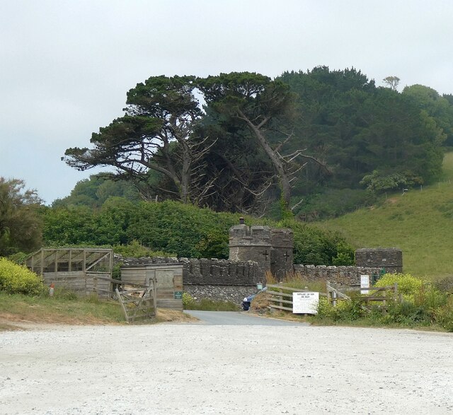
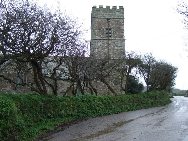
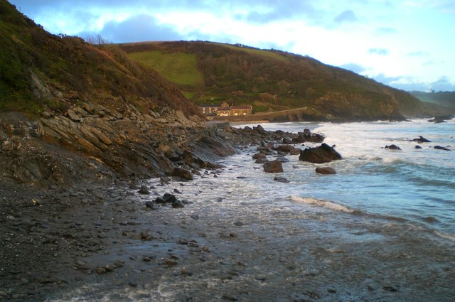
Battery Walk Wood Images

Images are sourced within 2km of 50.236133/-4.8449562 or Grid Reference SW9741. Thanks to Geograph Open Source API. All images are credited.

Farmland, St Goran The hamlet of Rescassa is seen from the footpath north of Treveor.
Farmland, St Goran
The hamlet of Rescassa is seen from the footpath north of Treveor.
Pasture and woodland, St Goran The coast path follows the edge of the field before entering the wood and descending steeply to Porthluney Cove.
Pasture and woodland, St Goran
The coast path follows the edge of the field before entering the wood and descending steeply to Porthluney Cove.
Coastline, St Goran Looking across Lambsowden Cove from the coast path above Greeb Point.
Coastline, St Goran
Looking across Lambsowden Cove from the coast path above Greeb Point.
Boswinger Methodist Church
St Michael's Church
St Michael's Church
Former East Portholland Wesleyan Methodist Chapel
Former Bible Christian chapel
Porthluney Cove
Porthluney Cove
The Upper Garden at Caerhays
The Kitchen Walled Garden
Porthluney Cove A panoramic view of Porthluney Cove immediately to the south of Caerhays Castle.
Write-up on Cornwallbeaches.org.uk <span class="nowrap"><a title="http://www.cornwallbeaches.org.uk/South-Coast-Central-Cornwall/Porthluney-Cove.pdf" rel="nofollow ugc noopener" href="http://www.cornwallbeaches.org.uk/South-Coast-Central-Cornwall/Porthluney-Cove.pdf">Link</a><img style="margin-left:2px;" alt="External link" title="External link - shift click to open in new window" src="https://s1.geograph.org.uk/img/external.png" width="10" height="10"/></span>
Porthluney Cove
A panoramic view of Porthluney Cove immediately to the south of Caerhays Castle. Write-up on Cornwallbeaches.org.uk LinkExternal link
Caerhays Castle - Bottom Lodge Looking from the Castle's carpark to the Bottom Lodge of Caerhays Castle
The estate is situated on the south coast of Cornwall immediately north of <a href="https://www.geograph.org.uk/photo/7511739">SW9741 : Porthluney Cove</a>
Caerhays Castle - Bottom Lodge
Looking from the Castle's carpark to the Bottom Lodge of Caerhays Castle The estate is situated on the south coast of Cornwall immediately north of SW9741 : Porthluney Cove
Porthluney Cove
Porthluney Cove
The path at the top of the garden At the northern extremity of Caerhays Castle gardens, the curving path around the higher ground affords the visitor glimpses of the coast towards Porthluney Cove.
The path at the top of the garden
At the northern extremity of Caerhays Castle gardens, the curving path around the higher ground affords the visitor glimpses of the coast towards Porthluney Cove.
Caehays Castle through the trees If the visitor can tear his gaze from the wonderful plants, such as this Azalea 'Hinodegirl' in the foreground, the turrets and towers of the castle add to the fairytale experience.
Caehays Castle through the trees
If the visitor can tear his gaze from the wonderful plants, such as this Azalea 'Hinodegirl' in the foreground, the turrets and towers of the castle add to the fairytale experience.
The beach at Porthluney Cove With Caerhays Castle in the background.
The beach at Porthluney Cove
With Caerhays Castle in the background.
The lake at Caerhays Castle With a flock of Canada Geese.
The lake at Caerhays Castle
With a flock of Canada Geese.
Caerhays Castle Seen on the occasion of a fund-raising day for the Cornwall Hospice Care charity. The Caerhays Estate was owned by the Trevanion family from 1370 - 1840, when the family fell upon hard times. The present Grade I Listed house, which was designed by John Nash, remained unoccupied until 1853, when it was purchased in a very sorry state by Michael Willimas of Scorrier and Burncoose. The estate is still in the ownership of the Williams family. The house was the location for Manderley in the 1979 BBC TV production of 'Rebecca'.
Caerhays Castle
Seen on the occasion of a fund-raising day for the Cornwall Hospice Care charity. The Caerhays Estate was owned by the Trevanion family from 1370 - 1840, when the family fell upon hard times. The present Grade I Listed house, which was designed by John Nash, remained unoccupied until 1853, when it was purchased in a very sorry state by Michael Willimas of Scorrier and Burncoose. The estate is still in the ownership of the Williams family. The house was the location for Manderley in the 1979 BBC TV production of 'Rebecca'.
Show me another place!

Battery Walk Wood is located at Grid Ref: SW9741 (Lat: 50.236133, Lng: -4.8449562)

Unitary Authority: Cornwall

Police Authority: Devon and Cornwall

What 3 Words

///starlight.custodian.nutrients. Near Mevagissey, Cornwall

Related Wikis

Cuckoo Rock to Turbot Point

Cuckoo Rock to Turbot Point is a coastal Geological Conservation Review site and Site of Special Scientific Interest (SSSI) in Cornwall, England, UK, noted...

St Michael Caerhays

St Michael Caerhays (Cornish: Lannvihal) is a civil parish and village in Cornwall, England, United Kingdom. The village is about seven miles (11 km) south...

Portholland

Portholland (Cornish: Porthalan) is a settlement in Cornwall, England, UK. It is on the south coast in the civil parish of St Michael Caerhays. The name...

Rescassa

Rescassa is a hamlet near Mevagissey in Cornwall, England. == References ==

Nearby Amenities

Located within 500m of 50.236133,-4.8449562
Source: PGS
Lat/Long: 50.2348864/-4.8400538
Source: PGS
Lat/Long: 50.2349245/-4.840458
Source: PGS
Lat/Long: 50.2350501/-4.8410309
Source: PGS
Lat/Long: 50.2354471/-4.8426226
Source: PGS
Lat/Long: 50.2355459/-4.8434946
Source: PGS
Lat/Long: 50.2351814/-4.8406701
Source: PGS
Lat/Long: 50.2343201/-4.8397564
Barrier: kissing_gate
Lat/Long: 50.2353738/-4.8500417
Cafe
The Beach Café
Image: https://archive.org/details/porthluney-photos/Porthluney%20to%20Hemmick%20Beach%202020-08-26/DSCN2069.JPG
Outdoor Seating: yes
Lat/Long: 50.2374248/-4.8411477
Toilets
Check Date: 2022-04-12
Fee: no
Lat/Long: 50.2372367/-4.8411512
Barrier: kissing_gate
Lat/Long: 50.2380572/-4.8413317
WW2 Pillbox
Building: bunker
Bunker Type: pillbox
Military: bunker
Lat/Long: 50.2367664/-4.8445663
Bench
Backrest: yes
Check Date: 2023-03-26
Lat/Long: 50.2351154/-4.8389592
WW2 Pillbox (site of)
Building: bunker
Bunker Type: pillbox
Military: bunker
Lat/Long: 50.2372233/-4.8413007
Barrier: kissing_gate
Foot: yes
Image: https://archive.org/details/porthluney-photos/Porthluney%20to%20Hemmick%20Beach%202020-08-26/DSCN1724.JPG
Wheelchair: no
Lat/Long: 50.2352643/-4.8388867
Image: https://archive.org/details/porthluney-photos/Porthluney%20to%20Hemmick%20Beach%202020-08-26/DSCN1719.JPG
Natural: stone
Lat/Long: 50.2355692/-4.8388056
Barrier: kissing_gate
Foot: yes
Wheelchair: no
Lat/Long: 50.2374718/-4.840126
Fire Hydrant
Emergency: fire_hydrant
Fire Hydrant Diameter Signed: no
Fire Hydrant Position: green
Fire Hydrant Type: underground
Lat/Long: 50.2380703/-4.841341
Parish Notices
Advertising: board
Lat/Long: 50.238021/-4.8418399
Barrier: kissing_gate
Lat/Long: 50.2379788/-4.8415328
The Battery Walk Arch
Board Type: history
Image: https://archive.org/details/porthluney-photos/Porthluney%20to%20Hemmick%20Beach%202020-08-26/DSCN2070.JPG
Information: board
Tourism: information
Lat/Long: 50.2373815/-4.84145
Porthluney
Beach Safety Sign
Emergency: beach_safety_sign
Image: https://archive.org/details/porthluney-photos/Porthluney%20to%20Hemmick%20Beach%202020-08-26/DSCN2077.JPG
Operator: RNLI
Lat/Long: 50.237383/-4.842265
Natural: stone
Lat/Long: 50.2374214/-4.8434237
Barrier: kissing_gate
Lat/Long: 50.2365062/-4.8454082
Life Ring
Emergency: life_ring
Survey Date: 2022-10-01
Lat/Long: 50.2373802/-4.8422761
The data included in this document is from www.openstreetmap.org. The data is made available under ODbL.

Have you been to Battery Walk Wood?

Leave your review of Battery Walk Wood below (or comments, questions and feedback).