Porthluney Cove

Sea, Estuary, Creek in Cornwall

England

Porthluney Cove

Farmland, St Goran The hamlet of Rescassa is seen from the footpath north of Treveor.
Farmland, St Goran Credit: Andrew Smith

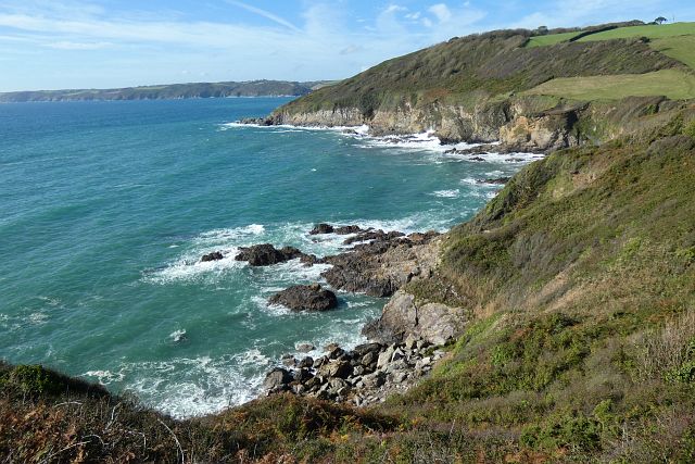
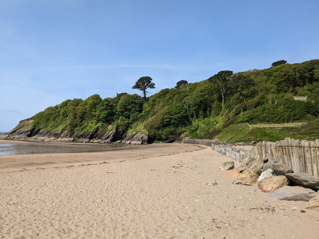
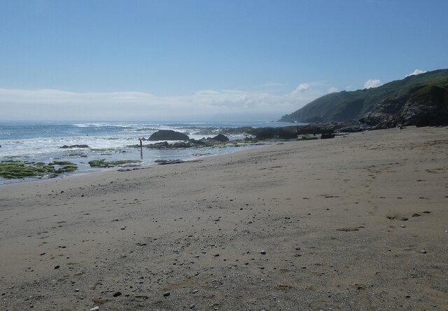
Porthluney Cove, also known as Caerhays Beach, is a picturesque coastal gem located on the south coast of Cornwall, England. Nestled between the scenic villages of Mevagissey and Gorran Haven, this sandy beach offers visitors a tranquil retreat amidst the rugged coastline.

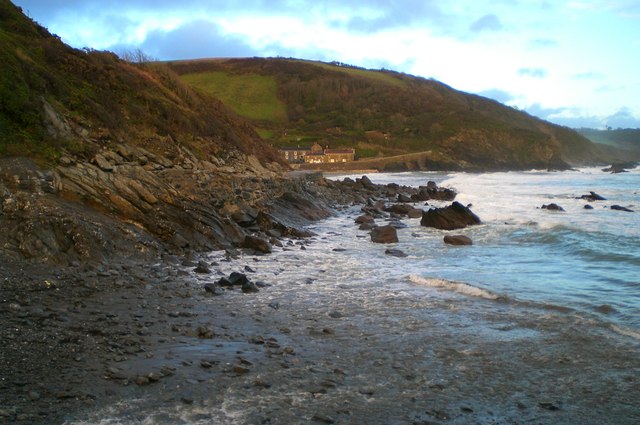
This crescent-shaped cove boasts crystal-clear turquoise waters that gently lap against its shores, making it a popular spot for swimmers, kayakers, and paddleboarders. The beach is flanked by towering cliffs on either side, providing a dramatic backdrop and ensuring a sense of seclusion.

At low tide, Porthluney Cove reveals expansive stretches of golden sand, perfect for sunbathing and building sandcastles. The beach is also home to a small stream that flows into the sea, creating a serene estuary where children can paddle and explore.

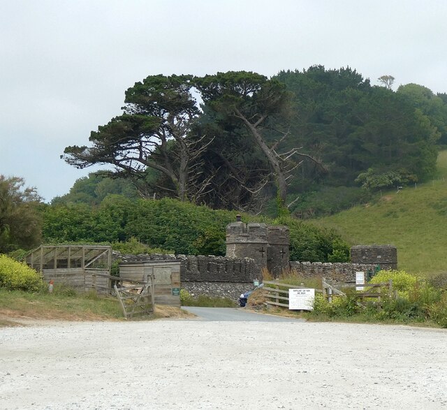
Surrounded by lush greenery and subtropical gardens, the beach is part of the Caerhays Estate, renowned for its collection of rare and exotic plants. Visitors can enjoy leisurely strolls along the coastal path or venture inland to discover the estate's magnificent castle and gardens, which are open to the public during certain times of the year.

Porthluney Cove offers basic amenities, including toilets and a seasonal beach cafe that serves refreshments and snacks. Lifeguards are on duty during peak tourist season, ensuring the safety of beachgoers.

Overall, Porthluney Cove in Cornwall is a charming coastal haven, offering a mix of natural beauty, tranquility, and opportunities for exploration.

If you have any feedback on the listing, please let us know in the comments section below.

Porthluney Cove Images

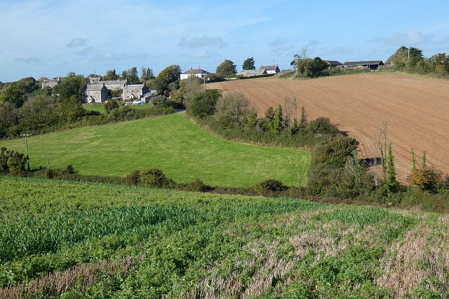
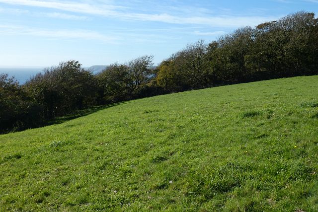
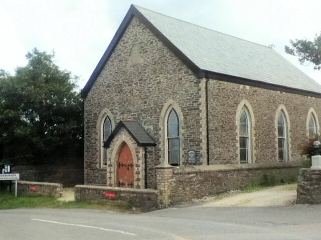
Images are sourced within 2km of 50.235307/-4.8419338 or Grid Reference SW9741. Thanks to Geograph Open Source API. All images are credited.

Farmland, St Goran The hamlet of Rescassa is seen from the footpath north of Treveor.
Farmland, St Goran
The hamlet of Rescassa is seen from the footpath north of Treveor.
Pasture and woodland, St Goran The coast path follows the edge of the field before entering the wood and descending steeply to Porthluney Cove.
Pasture and woodland, St Goran
The coast path follows the edge of the field before entering the wood and descending steeply to Porthluney Cove.
Coastline, St Goran Looking across Lambsowden Cove from the coast path above Greeb Point.
Coastline, St Goran
Looking across Lambsowden Cove from the coast path above Greeb Point.
Boswinger Methodist Church
St Michael's Church
St Michael's Church
Former East Portholland Wesleyan Methodist Chapel
Former Bible Christian chapel
Porthluney Cove
Porthluney Cove
The Upper Garden at Caerhays
The Kitchen Walled Garden
Hemmick Beach - western end Looking across the sand and occasional shingle of Hemmick Beach to the rocks meeting the sea at its western end.
Cf. <a href="https://www.geograph.org.uk/photo/7511603">SW9940 : Hemmick Beach - eastern end</a>
See also 
<a href="https://www.geograph.org.uk/photo/7511732">SW9940 : Hemmick Beach - Seaweed-covered rocks</a>
<a href="https://www.geograph.org.uk/photo/7511733">SW9940 : Hemmick Beach - Rocks at the water's edge</a>
Hemmick Beach information: <span class="nowrap"><a title="http://www.cornwallbeaches.org.uk/South-Coast-Central-Cornwall/Hemmick-Percunning-Cove.pdf" rel="nofollow ugc noopener" href="http://www.cornwallbeaches.org.uk/South-Coast-Central-Cornwall/Hemmick-Percunning-Cove.pdf">Link</a><img style="margin-left:2px;" alt="External link" title="External link - shift click to open in new window" src="https://s1.geograph.org.uk/img/external.png" width="10" height="10"/></span>
Hemmick Beach - western end
Looking across the sand and occasional shingle of Hemmick Beach to the rocks meeting the sea at its western end. Cf. SW9940 : Hemmick Beach - eastern end See also SW9940 : Hemmick Beach - Seaweed-covered rocks SW9940 : Hemmick Beach - Rocks at the water's edge Hemmick Beach information: LinkExternal link
Porthluney Cove A panoramic view of Porthluney Cove immediately to the south of Caerhays Castle.
Write-up on Cornwallbeaches.org.uk <span class="nowrap"><a title="http://www.cornwallbeaches.org.uk/South-Coast-Central-Cornwall/Porthluney-Cove.pdf" rel="nofollow ugc noopener" href="http://www.cornwallbeaches.org.uk/South-Coast-Central-Cornwall/Porthluney-Cove.pdf">Link</a><img style="margin-left:2px;" alt="External link" title="External link - shift click to open in new window" src="https://s1.geograph.org.uk/img/external.png" width="10" height="10"/></span>
Porthluney Cove
A panoramic view of Porthluney Cove immediately to the south of Caerhays Castle. Write-up on Cornwallbeaches.org.uk LinkExternal link
Caerhays Castle - Bottom Lodge Looking from the Castle's carpark to the Bottom Lodge of Caerhays Castle
The estate is situated on the south coast of Cornwall immediately north of <a href="https://www.geograph.org.uk/photo/7511739">SW9741 : Porthluney Cove</a>
Caerhays Castle - Bottom Lodge
Looking from the Castle's carpark to the Bottom Lodge of Caerhays Castle The estate is situated on the south coast of Cornwall immediately north of SW9741 : Porthluney Cove
Hemmick Beach - Low cliffs to the northwest of the beach The northern coast on the western side of <a href="https://www.geograph.org.uk/photo/7511593">SW9940 : Hemmick Beach - western end</a> is bordered by these low cliffs about 10m (30') high which rise in height as they head westwards. The strata of the rocks look to be well folded.
Hemmick Beach - Low cliffs to the northwest of the beach
The northern coast on the western side of SW9940 : Hemmick Beach - western end is bordered by these low cliffs about 10m (30') high which rise in height as they head westwards. The strata of the rocks look to be well folded.
Porthluney Cove
Porthluney Cove
The path at the top of the garden At the northern extremity of Caerhays Castle gardens, the curving path around the higher ground affords the visitor glimpses of the coast towards Porthluney Cove.
The path at the top of the garden
At the northern extremity of Caerhays Castle gardens, the curving path around the higher ground affords the visitor glimpses of the coast towards Porthluney Cove.
Caehays Castle through the trees If the visitor can tear his gaze from the wonderful plants, such as this Azalea 'Hinodegirl' in the foreground, the turrets and towers of the castle add to the fairytale experience.
Caehays Castle through the trees
If the visitor can tear his gaze from the wonderful plants, such as this Azalea 'Hinodegirl' in the foreground, the turrets and towers of the castle add to the fairytale experience.
The beach at Porthluney Cove With Caerhays Castle in the background.
The beach at Porthluney Cove
With Caerhays Castle in the background.
Show me another place!

Porthluney Cove is located at Grid Ref: SW9741 (Lat: 50.235307, Lng: -4.8419338)

Unitary Authority: Cornwall

Police Authority: Devon and Cornwall

What 3 Words

///motor.blunt.envisage. Near Mevagissey, Cornwall

Related Wikis

Cuckoo Rock to Turbot Point

Cuckoo Rock to Turbot Point is a coastal Geological Conservation Review site and Site of Special Scientific Interest (SSSI) in Cornwall, England, UK, noted...
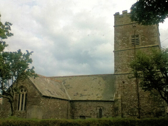
St Michael Caerhays

St Michael Caerhays (Cornish: Lannvihal) is a civil parish and village in Cornwall, England, United Kingdom. The village is about seven miles (11 km) south...

Rescassa

Rescassa is a hamlet near Mevagissey in Cornwall, England. == References ==

Portholland

Portholland (Cornish: Porthalan) is a settlement in Cornwall, England, UK. It is on the south coast in the civil parish of St Michael Caerhays. The name...

Nearby Amenities

Located within 500m of 50.235307,-4.8419338
Source: PGS
Lat/Long: 50.2348864/-4.8400538
Source: PGS
Lat/Long: 50.2349245/-4.840458
Source: PGS
Lat/Long: 50.2350501/-4.8410309
Source: PGS
Lat/Long: 50.2354471/-4.8426226
Source: PGS
Lat/Long: 50.2355459/-4.8434946
Source: PGS
Lat/Long: 50.2351814/-4.8406701
Source: PGS
Lat/Long: 50.2343201/-4.8397564
Cafe
The Beach Café
Image: https://archive.org/details/porthluney-photos/Porthluney%20to%20Hemmick%20Beach%202020-08-26/DSCN2069.JPG
Outdoor Seating: yes
Lat/Long: 50.2374248/-4.8411477
Toilets
Check Date: 2022-04-12
Fee: no
Lat/Long: 50.2372367/-4.8411512
Barrier: kissing_gate
Lat/Long: 50.2380572/-4.8413317
WW2 Pillbox
Building: bunker
Bunker Type: pillbox
Military: bunker
Lat/Long: 50.2367664/-4.8445663
Bench
Backrest: yes
Check Date: 2023-03-26
Lat/Long: 50.2351154/-4.8389592
WW2 Pillbox (site of)
Building: bunker
Bunker Type: pillbox
Military: bunker
Lat/Long: 50.2372233/-4.8413007
Barrier: kissing_gate
Foot: yes
Image: https://archive.org/details/porthluney-photos/Porthluney%20to%20Hemmick%20Beach%202020-08-26/DSCN1747.JPG
Lat/Long: 50.2336794/-4.8366869
Barrier: kissing_gate
Foot: yes
Image: https://archive.org/details/porthluney-photos/Porthluney%20to%20Hemmick%20Beach%202020-08-26/DSCN1724.JPG
Wheelchair: no
Lat/Long: 50.2352643/-4.8388867
Image: https://archive.org/details/porthluney-photos/Porthluney%20to%20Hemmick%20Beach%202020-08-26/DSCN1719.JPG
Natural: stone
Lat/Long: 50.2355692/-4.8388056
Barrier: kissing_gate
Foot: yes
Wheelchair: no
Lat/Long: 50.2374718/-4.840126
Fire Hydrant
Emergency: fire_hydrant
Fire Hydrant Diameter Signed: no
Fire Hydrant Position: green
Fire Hydrant Type: underground
Lat/Long: 50.2380703/-4.841341
Parish Notices
Advertising: board
Lat/Long: 50.238021/-4.8418399
Barrier: kissing_gate
Lat/Long: 50.2379788/-4.8415328
The Battery Walk Arch
Board Type: history
Image: https://archive.org/details/porthluney-photos/Porthluney%20to%20Hemmick%20Beach%202020-08-26/DSCN2070.JPG
Information: board
Tourism: information
Lat/Long: 50.2373815/-4.84145
Porthluney
Beach Safety Sign
Emergency: beach_safety_sign
Image: https://archive.org/details/porthluney-photos/Porthluney%20to%20Hemmick%20Beach%202020-08-26/DSCN2077.JPG
Operator: RNLI
Lat/Long: 50.237383/-4.842265
Natural: stone
Lat/Long: 50.2374214/-4.8434237
Barrier: kissing_gate
Lat/Long: 50.2365062/-4.8454082
Life Ring
Emergency: life_ring
Survey Date: 2022-10-01
Lat/Long: 50.2373802/-4.8422761
The data included in this document is from www.openstreetmap.org. The data is made available under ODbL.

Have you been to Porthluney Cove?

Leave your review of Porthluney Cove below (or comments, questions and feedback).