Charterhouse

Settlement in Somerset Mendip

England

Charterhouse

Ubley Warren, Charterhouse Ubley Warren near Charterhouse, photographed from Ubley Warren Drove.
Ubley Warren, Charterhouse Credit: Kevin Pearson

Charterhouse is a small hamlet located in the county of Somerset, England. Situated approximately 10 miles north-east of the town of Taunton, Charterhouse is nestled within the picturesque Quantock Hills, an Area of Outstanding Natural Beauty.

The hamlet is known for its rich history and scenic landscapes. It is home to the Charterhouse Centre, a renowned outdoor education and activity center. The center offers a range of adventurous activities and educational programs, attracting visitors from all over the region.

Charterhouse is also notable for its close proximity to the Quantock Hills, which provide ample opportunities for outdoor enthusiasts. The hills are perfect for hiking, cycling, and horse riding, with numerous trails and paths to explore. The area is abundant in wildlife, and it is not uncommon to spot deer, birds, and other animals while exploring the hills.

Although small in size, Charterhouse boasts a thriving community spirit. The hamlet is home to a handful of residential properties, with a small number of local businesses serving the needs of the residents and visitors. Additionally, Charterhouse is a popular destination for those seeking a peaceful and tranquil retreat away from the hustle and bustle of city life.

Overall, Charterhouse, Somerset, offers a unique blend of natural beauty, outdoor activities, and a close-knit community. It is an ideal destination for nature lovers, history enthusiasts, and anyone looking to experience the charm of rural England.

If you have any feedback on the listing, please let us know in the comments section below.
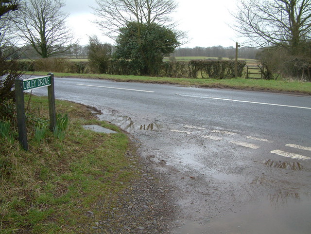
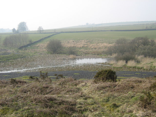
Charterhouse Images

Images are sourced within 2km of 51.298579/-2.724454 or Grid Reference ST4955. Thanks to Geograph Open Source API. All images are credited.

Ubley Warren, Charterhouse Ubley Warren near Charterhouse, photographed from Ubley Warren Drove.
Ubley Warren, Charterhouse
Ubley Warren near Charterhouse, photographed from Ubley Warren Drove.
Ubley Warren Drove near Charterhouse Looking south on Ubley Warren Drove, as it climbs up from the valley at Ubley Warren towards Yoxter.
Ubley Warren Drove near Charterhouse
Looking south on Ubley Warren Drove, as it climbs up from the valley at Ubley Warren towards Yoxter.
Ubley Warren Drove near Yoxter Ubley Warren Drove on the top of the Mendip Plateau, looking south towards Yoxter crossroads.
Ubley Warren Drove near Yoxter
Ubley Warren Drove on the top of the Mendip Plateau, looking south towards Yoxter crossroads.
Mine Shaft, Charterhouse
Roman lead mines at Charterhouse The Mendips were a prime source of lead in the late Iron Age and it was to control the supply of this valuable metal that may have been one of the reasons why the Romans invaded in AD43.
Roman lead mines at Charterhouse
The Mendips were a prime source of lead in the late Iron Age and it was to control the supply of this valuable metal that may have been one of the reasons why the Romans invaded in AD43.
Ubley Drove, Somerset This is the road junction between Ubley Drove and the B3134.
Ubley Drove, Somerset
This is the road junction between Ubley Drove and the B3134.
St. Hugh's church This small church is close to the hamlet of Charterhouse and its old lead workings.
St. Hugh's church
This small church is close to the hamlet of Charterhouse and its old lead workings.
Settling pond and slag heap A settling pond used as part of the Victorian lead mining in the area. A slag heap is visible in front of the pond.
Settling pond and slag heap
A settling pond used as part of the Victorian lead mining in the area. A slag heap is visible in front of the pond.
Blackmoor Pond High in the Mendips near Charterhouse.
Blackmoor Pond
High in the Mendips near Charterhouse.
Old lead mining site in the Mendips Active from Roman to Victorian times
Old lead mining site in the Mendips
Active from Roman to Victorian times
Bleak House, Charterhouse The foreground is where the Captain of the mines lived. In the distance is the remains of what was mined for over 2,000 years.
Bleak House, Charterhouse
The foreground is where the Captain of the mines lived. In the distance is the remains of what was mined for over 2,000 years.
A Gruff or Gruffy ground The lead seams were on the surface, and these grooves, or “gruffys” followed the seams. This one is a very good example. The height is shown by the figure in the distance.
A Gruff or Gruffy ground
The lead seams were on the surface, and these grooves, or “gruffys” followed the seams. This one is a very good example. The height is shown by the figure in the distance.
Subway near Ubley Warren The subway marked on the OS 1:25000 map. It is gated at one end and is not high enough to be a pedestrian subway.
Subway near Ubley Warren
The subway marked on the OS 1:25000 map. It is gated at one end and is not high enough to be a pedestrian subway.
Lead Mining on Mendip Slag left by the Victorians after re-smelting.
Lead Mining on Mendip
Slag left by the Victorians after re-smelting.
Remains of Victorian resmelting works I believe that the heat and smoke from the furnaces was directed down tunnels (remains shown here) and when cool, lead would be scrapped from the brick surfaces. I would be pleased to receive more information on this.
Remains of Victorian resmelting works
I believe that the heat and smoke from the furnaces was directed down tunnels (remains shown here) and when cool, lead would be scrapped from the brick surfaces. I would be pleased to receive more information on this.
Gates of Nordrach House
Show me another place!

Charterhouse is located at Grid Ref: ST4955 (Lat: 51.298579, Lng: -2.724454)

Administrative County: Somerset

District: Mendip

Police Authority: Avon and Somerset

What 3 Words

///decanter.shops.disband. Near Blagdon, Somerset

Nearby Locations

Velvet Bottom Charterhouse

Related Wikis

Charterhouse, Somerset

Charterhouse, also known as Charterhouse-on-Mendip, is a hamlet and former civil parish, now in the parish of Priddy, in the Mendip Hills Area of Outstanding...

Manor Farm Swallet

Manor Farm Swallet is a cave in the limestone of the Mendip Hills, in Somerset, England which was subject to numerous failed digging attempts between 1947...

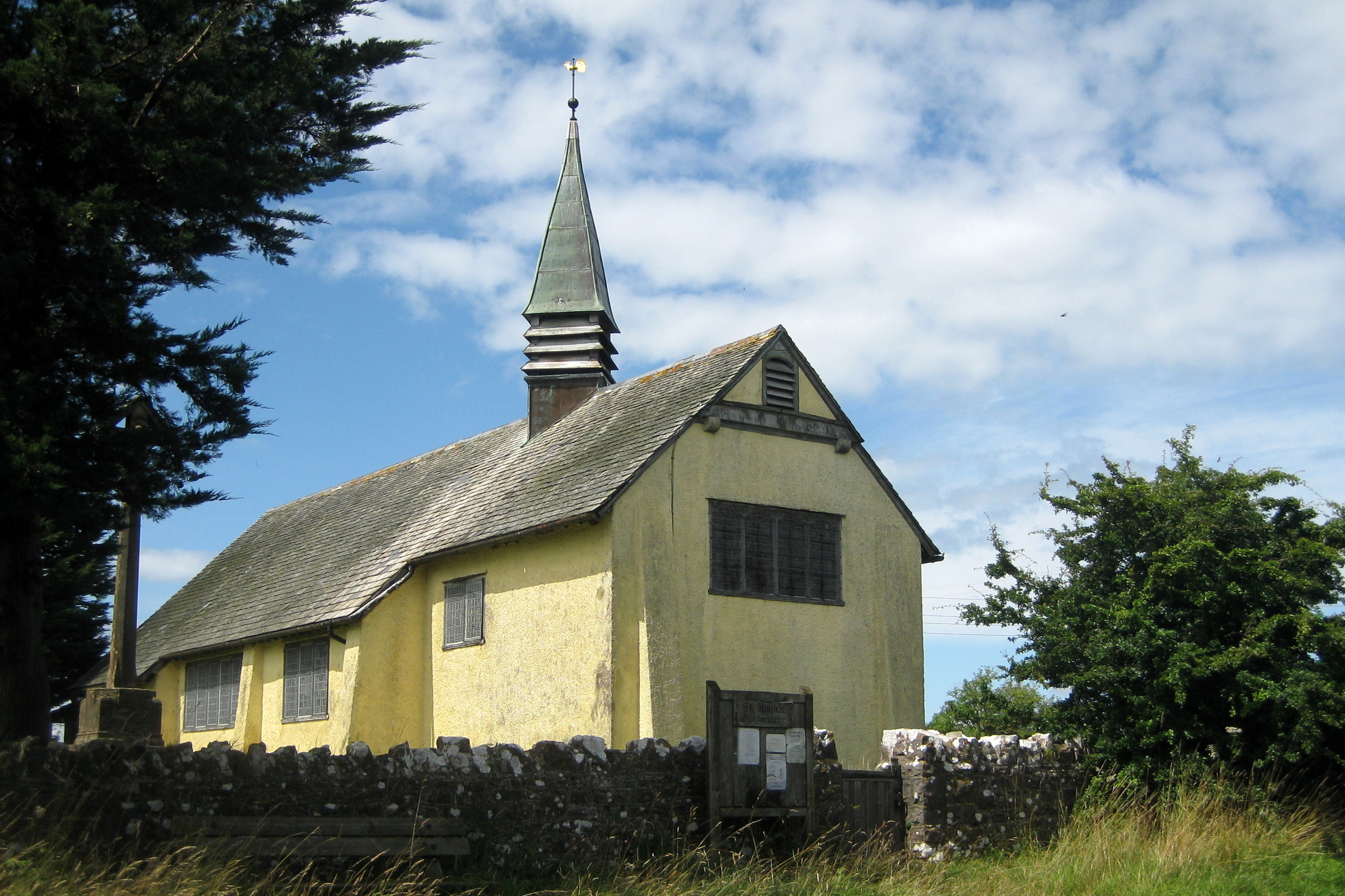
Church of St Hugh, Charterhouse

The Anglican Church of St Hugh in Charterhouse, within the English county of Somerset, dates from 1908. It is a Grade II* listed building. The church is...

Mendip Hills

The Mendip Hills (commonly called the Mendips) is a range of limestone hills to the south of Bristol and Bath in Somerset, England. Running from Weston...

Charterhouse (Roman town)

Charterhouse was a town in the Roman province of Britannia. Its site is located just to the west of the village of Charterhouse-on-Mendip in the English...

Longwood Swallet

The Longwood Swallet is a cave near Charterhouse, in the Carboniferous Limestone of the Mendip Hills, in Somerset, England. The cave is part of the Cheddar...

Charterhouse Camp

Charterhouse Camp is a univallate Iron Age hillfort in the Mendip district of Somerset, England. The hillfort is situated approximately 0.6 miles (0.97...

Rhino Rift

Rhino Rift is a cave near Charterhouse, in the Carboniferous Limestone of the Mendip Hills, in Somerset, England. The cave is part of the Cheddar Complex...

Nearby Amenities

Located within 500m of 51.298579,-2.724454
Charterhouse
Place: village
Source: npe
Lat/Long: 51.2983382/-2.7209278
Manor Farm
Place: farm
Wikidata: Q26472431
Lat/Long: 51.2983555/-2.7216539
Mendip Wood Shavings
Craft: sawmill
Lat/Long: 51.3019546/-2.7240081
Manor Farm Swallet
Natural: cave_entrance
Wikidata: Q6751320
Lat/Long: 51.2979088/-2.721132
The data included in this document is from www.openstreetmap.org. The data is made available under ODbL.

Have you been to Charterhouse?

Leave your review of Charterhouse below (or comments, questions and feedback).