Charmouth

Settlement in Dorset

England

Charmouth

The lower slope of Black Ven - Charmouth The cliff face is black except for the topsoil and made up of layer upon layer of soft mud, silt and clay pressed together over millions of years.  Landslides are frequent with the sea washing the silt away from them and exposing fossils which have been captured within.  The landslide of 1958/9 was the largest coastal landslide in Europe.
The lower slope of Black Ven - Charmouth Credit: Sarah Smith

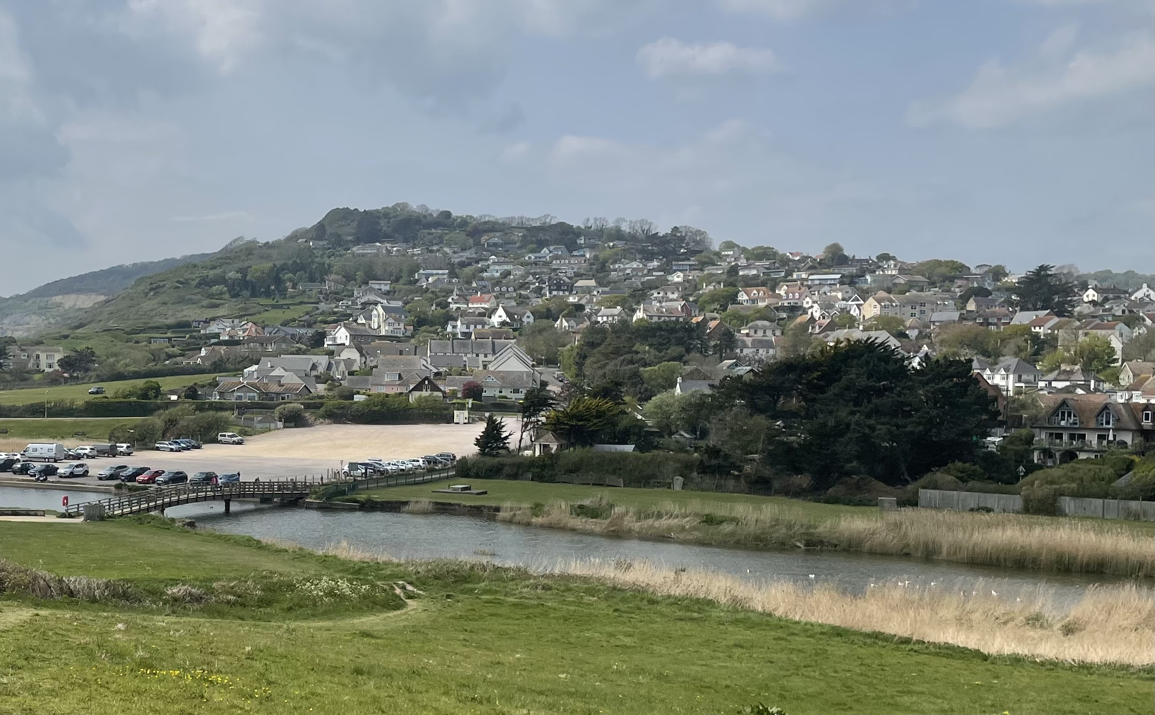
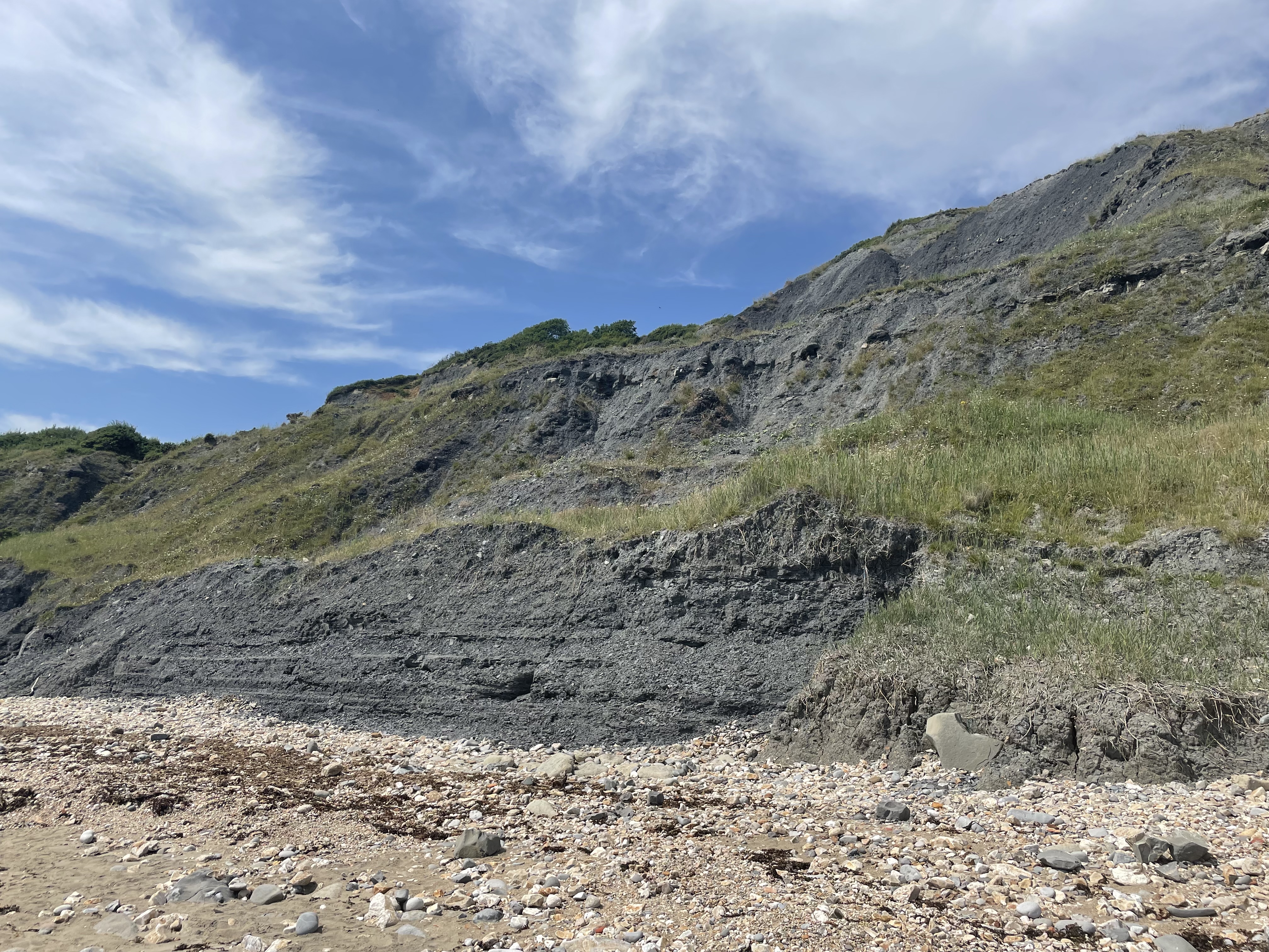
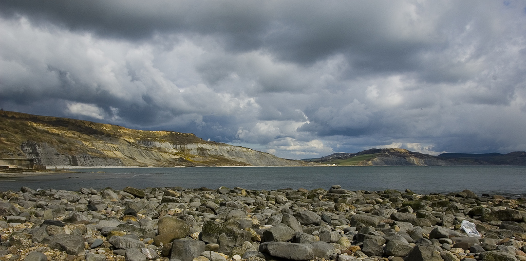
Charmouth is a picturesque village located on the Jurassic Coast in Dorset, England. Situated between the towns of Lyme Regis and Bridport, it lies within the West Dorset Area of Outstanding Natural Beauty. The village is known for its stunning coastal scenery and fossil-rich cliffs, making it a popular destination for fossil hunters and outdoor enthusiasts.

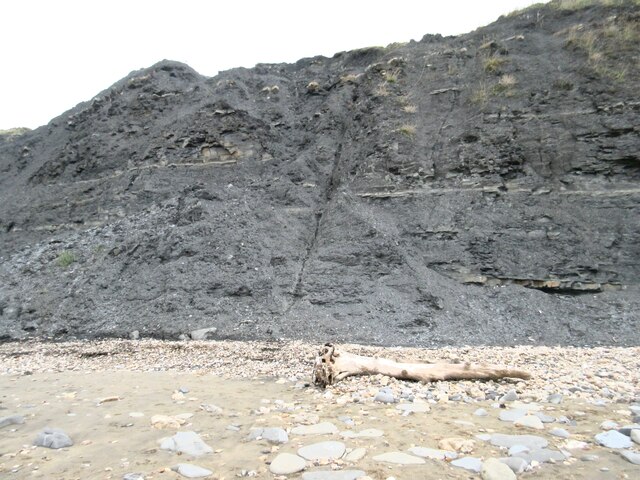
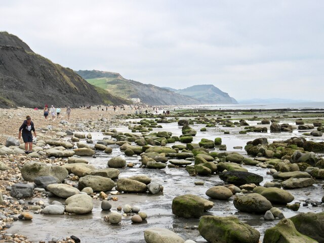
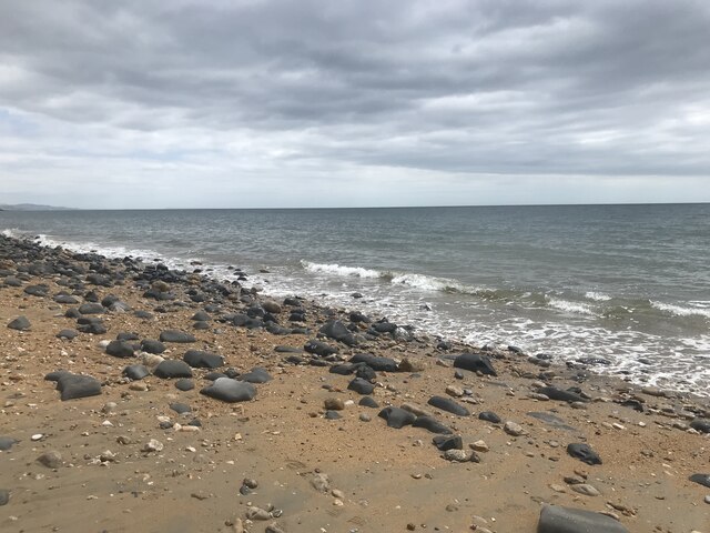
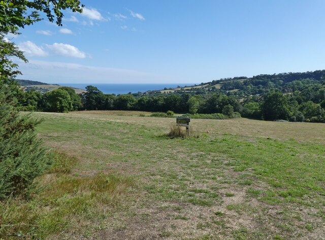
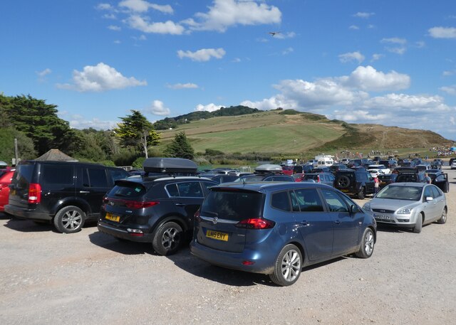
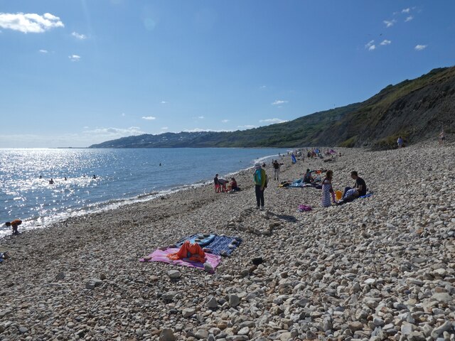
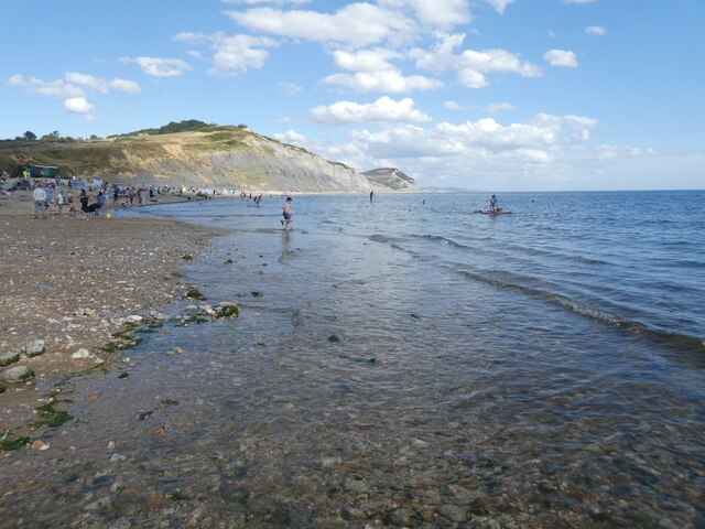
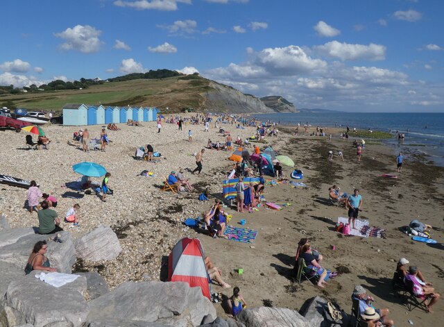
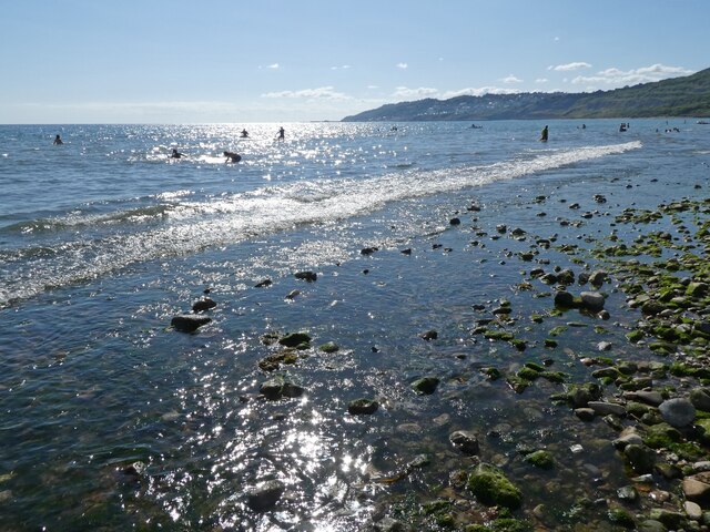
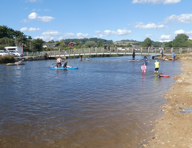
Charmouth boasts a long sandy beach, which stretches for approximately one mile and offers breathtaking views of the surrounding cliffs and the English Channel. The beach is perfect for sunbathing, swimming, and picnicking, and is also a great spot for rock pooling and fossil hunting. The area is renowned for its abundant fossils, with many visitors hoping to uncover ancient relics embedded in the rocks.

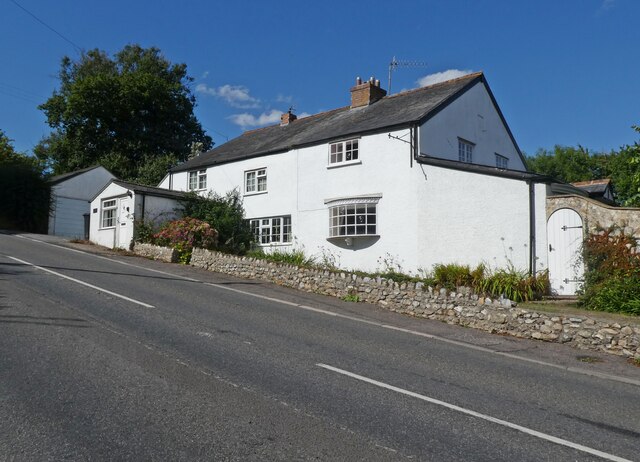
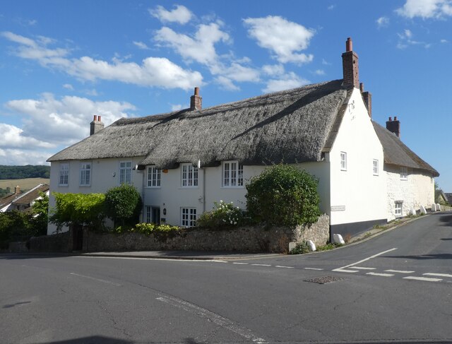
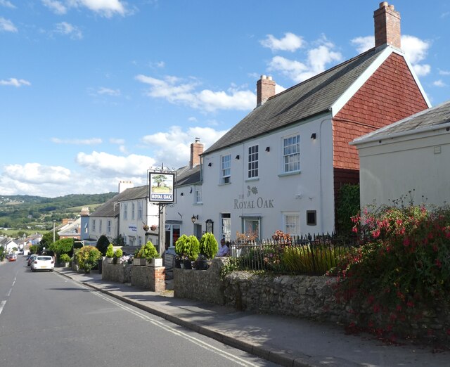
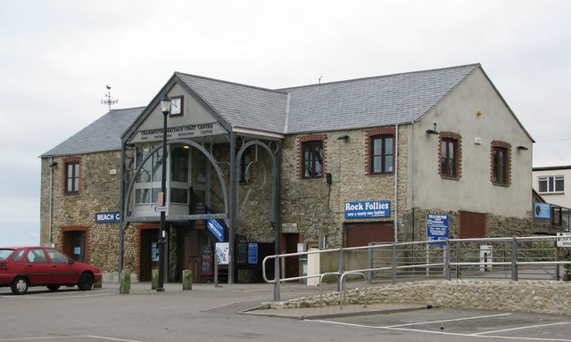
The village itself is charming, with a mix of traditional thatched cottages and more modern houses. It has a friendly and welcoming atmosphere, with a range of amenities including shops, cafes, and pubs. The Charmouth Heritage Coast Centre is a must-visit for those interested in the local geology and fossils, offering informative displays and guided fossil walks.

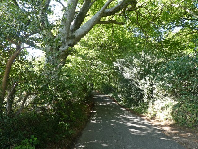
Outdoor activities are plentiful in Charmouth, with a variety of coastal walks and trails that showcase the area's natural beauty. The surrounding countryside provides ample opportunities for hiking, cycling, and horse riding. For those seeking a more relaxed pace, there are also several gardens and parks to explore nearby.

Charmouth is a delightful destination that offers a unique blend of natural beauty, fascinating history, and warm hospitality. Whether you are interested in fossil hunting, enjoying the beach, or simply immersing yourself in the tranquil surroundings, Charmouth has something for everyone.

If you have any feedback on the listing, please let us know in the comments section below.
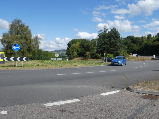
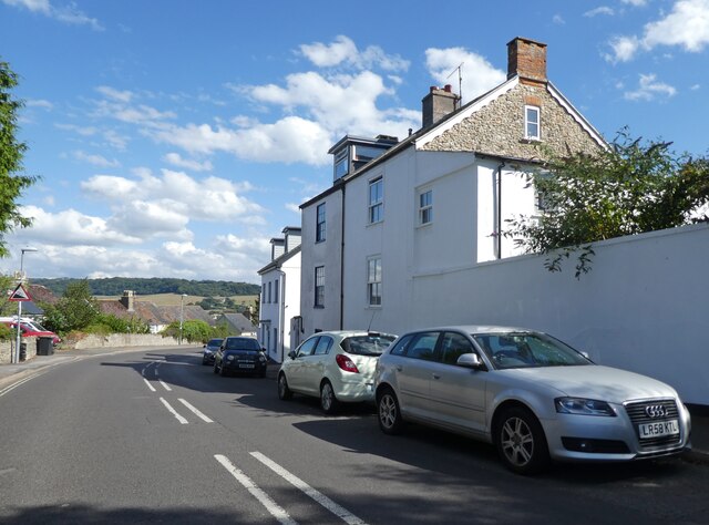
Charmouth Images

Images are sourced within 2km of 50.738903/-2.9010001 or Grid Reference SY3693. Thanks to Geograph Open Source API. All images are credited.

The lower slope of Black Ven - Charmouth The cliff face is black except for the topsoil and made up of layer upon layer of soft mud, silt and clay pressed together over millions of years.  Landslides are frequent with the sea washing the silt away from them and exposing fossils which have been captured within.  The landslide of 1958/9 was the largest coastal landslide in Europe.
The lower slope of Black Ven - Charmouth
The cliff face is black except for the topsoil and made up of layer upon layer of soft mud, silt and clay pressed together over millions of years. Landslides are frequent with the sea washing the silt away from them and exposing fossils which have been captured within. The landslide of 1958/9 was the largest coastal landslide in Europe.
Boulders on the beach - Charmouth The boulders are lying on the solidified smooth black debris from the landslides of Black Ven (left).  In the distance in another grid square is Golden Cap, the highest point on the South Coast of England.

In circa 833 the Danes arrived in 35 ships and with thousands of men. They landed on this beach and a savage battle followed with the local inhabitants.

Mary Anning was also another visitor in much later times and discovered the fossilised Ichthyosaur in these cliffs somewhere between Charmouth and Lyme Regis.
Boulders on the beach - Charmouth
The boulders are lying on the solidified smooth black debris from the landslides of Black Ven (left). In the distance in another grid square is Golden Cap, the highest point on the South Coast of England. In circa 833 the Danes arrived in 35 ships and with thousands of men. They landed on this beach and a savage battle followed with the local inhabitants. Mary Anning was also another visitor in much later times and discovered the fossilised Ichthyosaur in these cliffs somewhere between Charmouth and Lyme Regis.
Community Centre
Community Centre
Charmouth beach
Charmouth beach
Farmland on Westover Hill
Westover Hill
Westover Hill
Kilmorie Cottage
Kilmorie Cottage
Lyme Regis Golf Club
Roundabout on the A35
Axminster Road
Axminster Road
'Charmouth House'
'Charmouth House'
The Royal Oak, Charmouth
Car park at Charmouth beach
Lyme Bay
Lyme Bay
High tide at Charmouth beach
Charmouth beach
Charmouth beach
Rocky foreshore at Charmouth
Footbridge over River Char
Show me another place!

Charmouth is located at Grid Ref: SY3693 (Lat: 50.738903, Lng: -2.9010001)

Unitary Authority: Dorset

Police Authority: Dorset

What 3 Words

///shakes.onions.whimpered. Near Charmouth, Dorset

Related Wikis

Charmouth

Charmouth is a village and civil parish in west Dorset, England. The village is situated on the mouth of the River Char, around 1+1⁄2 miles (2 km) north...

Charmouth Heritage Coast Centre

The Charmouth Heritage Coast Centre is based in the upstairs floor of a long-disused cement factory on the foreshore of Charmouth in Dorset, England. The...

Black Ven

Black Ven is a cliff in Dorset, England between the towns of Charmouth and Lyme Regis. The cliffs reach a height of 130 metres (430 ft). It is part of...

St Mary's Church, Catherston Leweston

St Mary's Church is a Church of England parish church in Catherston Leweston, Dorset, England. It was designed by John Loughborough Pearson and built in...

Catherston Leweston

Catherston Leweston is a small village and civil parish in the county of Dorset in southwest England. It lies approximately 2 miles (3.2 km) northeast...

River Char

The River Char is a river in Dorset. The Char runs a few miles from Bettiscombe to Charmouth, passing Pilsdon and Whitchurch Canonicorum.

The Spittles

The Spittles is an area of coastal cliff in the county of Dorset on the south coast of England. It is situated between the settlements of Lyme Regis to...

Stonebarrow Hill

Stonebarrow Hill is a hill, east of Charmouth, near the Dorset coast in southern England. It has a height of 148 metres (486 ft) and forms the west-southwestern...

Nearby Amenities

Located within 500m of 50.738903,-2.9010001
Barrier: kissing_gate
Foot: yes
Lat/Long: 50.742131/-2.9021296
Noexit: yes
Lat/Long: 50.7375324/-2.9016421
Turning Circle
Lat/Long: 50.7357371/-2.8997581
Turning Circle
Lat/Long: 50.7356683/-2.8981426
Crossing
Crossing: traffic_signals
Crossing Island: no
Crossing Ref: pelican
Lat/Long: 50.7389279/-2.9008065
Power: pole
Lat/Long: 50.7423881/-2.9052277
Power: pole
Lat/Long: 50.7416571/-2.8989101
Power: pole
Lat/Long: 50.7418394/-2.9000609
Power: pole
Lat/Long: 50.7422617/-2.9008542
Power: pole
Lat/Long: 50.742488/-2.903832
Power: pole
Lat/Long: 50.7425613/-2.9026985
Power: pole
Lat/Long: 50.7426392/-2.9015954
Power: pole
Lat/Long: 50.7428611/-2.9013308
Power: pole
Lat/Long: 50.743271/-2.90123
Power: pole
Lat/Long: 50.7412094/-2.8957959
Power: pole
Lat/Long: 50.7413901/-2.8970214
Power: pole
Lat/Long: 50.7415529/-2.8981568
Charmouth
Place: village
Lat/Long: 50.738246/-2.9015906
Barrier: kissing_gate
Foot: yes
Lat/Long: 50.7418268/-2.8994933
Barrier: bollard
Lat/Long: 50.7361821/-2.9044643
Mini Roundabout
Lat/Long: 50.7351754/-2.9021418
Bus Stop
Old Lyme Hill
Bench: yes
Bin: yes
Bus: yes
Naptan AtcoCode: 1200DOB20477
Naptan Bearing: NW
Naptan CommonName: Old Lyme Hill
Naptan Indicator: NW-bound
Naptan NaptanCode: doradgdm
Naptan Street: Axminster Road
Naptan Verified: no
Public Transport: platform
Shelter: yes
Lat/Long: 50.738867/-2.9069505
Bus Stop
St Andrews Church
Bench: yes
Bin: no
Bus: yes
Lit: no
Naptan AtcoCode: 1200DOB20503
Naptan Bearing: E
Naptan CommonName: St Andrews Church
Naptan Indicator: opp
Naptan NaptanCode: doradgjd
Naptan Street: The Street
Naptan Verified: no
Public Transport: platform
Shelter: yes
Tactile Paving: no
Lat/Long: 50.7387499/-2.902375
Atm
Addr City: Charmouth
Addr Postcode: DT6 6PP
Addr Street: The Street
Lat/Long: 50.7389255/-2.9015425
Ambleside Annexe B&B
Addr Postcode: DT6 6NY
Addr Street: Axminster Road
Email: contact@charmouthdorsetbandb.co.uk
Internet Access: wlan
Operator: Owner
Phone: +44 1297560412
Tourism: guest_house
Website: http://www.charmouthdorsetbandb.co.uk
Lat/Long: 50.7393903/-2.9073959
LUCY House
Tourism: apartment
Lat/Long: 50.7384205/-2.8999089
Post Box
Drive Through: no
Post Box Mounting: brick_pillar
Post Box Type: wall
Ref GB Uprn: 10015428389
Lat/Long: 50.7381523/-2.8976872
Fire Hydrant
Emergency: fire_hydrant
Fire Hydrant Type: underground
Water Source: main
Lat/Long: 50.7381732/-2.8992176
Waste Basket
Colour: black
Material: plastic
Waste: trash
Lat/Long: 50.7381272/-2.8999056
Grit Bin
Colour: green
Material: plastic
Lat/Long: 50.7380734/-2.900663
Waste Basket
Waste: dog_excrement
Lat/Long: 50.7376715/-2.9008383
Grit Bin
Material: plastic
Lat/Long: 50.7381463/-2.8977379
Waste Basket
Waste: dog_excrement
Lat/Long: 50.7374186/-2.8980867
Waste Basket
Waste: dog_excrement
Lat/Long: 50.7364723/-2.8986406
Fire Hydrant
Emergency: fire_hydrant
Fire Hydrant Type: underground
Water Source: main
Lat/Long: 50.7355675/-2.8994037
Waste Basket
Waste: dog_excrement
Lat/Long: 50.7349629/-2.9008696
Barrier: bollard
Bollard: removable
Foot: yes
Height: 0.6
Material: metal
Motor Vehicle: no
Lat/Long: 50.7349504/-2.9008011
Barrier: bollard
Lat/Long: 50.734792/-2.9009636
Fire Hydrant
Emergency: fire_hydrant
Water Source: main
Lat/Long: 50.7353471/-2.9009032
Waste Basket
Colour: black
Material: plastic
Waste: trash
Lat/Long: 50.7355661/-2.9008442
Fire Hydrant
Emergency: fire_hydrant
Fire Hydrant Type: underground
Water Source: main
Lat/Long: 50.7360139/-2.900716
Fire Hydrant
Emergency: fire_hydrant
Fire Hydrant Type: underground
Water Source: main
Lat/Long: 50.7370974/-2.9008433
Bench
Backrest: yes
Colour: black
Material: wood
Seats: 3
Lat/Long: 50.7376805/-2.9008386
Waste Basket
Waste: trash
Lat/Long: 50.7392772/-2.8991085
Waste Basket
Waste: trash
Lat/Long: 50.7389615/-2.9009002
Waste Basket
Waste: trash
Lat/Long: 50.7388104/-2.9009016
Bench
Lat/Long: 50.7385431/-2.9032673
Bench
Lat/Long: 50.7385617/-2.9031305
Waste Basket
Waste: dog_excrement
Lat/Long: 50.7393604/-2.8975488
Recycling
Recycling Clothes: yes
Recycling Type: container
Lat/Long: 50.7390018/-2.8969286
Recycling
Recycling Clothes: yes
Recycling Glass Bottles: yes
Recycling Type: container
Lat/Long: 50.7374473/-2.9013864
Post Box
Operator: Royal Mail
Post Box Type: pillar
Ref: DT6 24
Ref GB Uprn: 10015327769
Royal Cypher: EIIR
Royal Cypher Wikidata: Q33102113
Lat/Long: 50.7390222/-2.9006347
Post Box
Collection Times: Mo-Fr 09:00; Sa 07:00
Post Box Type: pillar
Ref GB Uprn: 10015278983
Lat/Long: 50.7356208/-2.9008479
Waste Basket
Waste: trash
Lat/Long: 50.7407888/-2.901088
Waste Basket
Waste: trash
Lat/Long: 50.7404637/-2.9009593
Waste Basket
Waste: dog_excrement
Lat/Long: 50.7400071/-2.9012637
Grit Bin
Lat/Long: 50.7387391/-2.9067649
Waste Basket
Waste: dog_excrement
Lat/Long: 50.7361492/-2.9044569
Waste Basket
Waste: trash
Lat/Long: 50.738835/-2.9069875
Bench
Backrest: yes
Lat/Long: 50.7388656/-2.9070278
Power: pole
Lat/Long: 50.7409411/-2.9063773
Barrier: kissing_gate
Lat/Long: 50.7417121/-2.9019168
Barrier: kissing_gate
Foot: yes
Lat/Long: 50.7417185/-2.9018739
Barrier: kissing_gate
Foot: yes
Lat/Long: 50.7417897/-2.9001033
Barrier: kissing_gate
Foot: yes
Lat/Long: 50.7417292/-2.902058
Barrier: kissing_gate
Foot: yes
Lat/Long: 50.7412845/-2.905712
Bench
Backrest: yes
Lat/Long: 50.7378212/-2.9030527
Bench
Backrest: yes
Lat/Long: 50.7377045/-2.9021247
Direction: SSE
Generator Method: photovoltaic
Generator Output Electricity: yes
Generator Solar Modules: 5
Generator Source: solar
Generator Type: solar_photovoltaic_panel
Location: roof
Power: generator
Lat/Long: 50.739792/-2.9000017
Direction: SSE
Generator Method: photovoltaic
Generator Output Electricity: yes
Generator Solar Modules: 6
Generator Source: solar
Generator Type: solar_photovoltaic_panel
Location: roof
Power: generator
Lat/Long: 50.739385/-2.900919
Direction: SSE
Generator Method: photovoltaic
Generator Output Electricity: yes
Generator Solar Modules: 8
Generator Source: solar
Generator Type: solar_photovoltaic_panel
Location: roof
Power: generator
Lat/Long: 50.7393228/-2.9009717
Direction: SSE
Generator Method: photovoltaic
Generator Output Electricity: yes
Generator Solar Modules: 15
Generator Source: solar
Generator Type: solar_photovoltaic_panel
Location: roof
Power: generator
Lat/Long: 50.7392904/-2.9010391
Direction: SSE
Generator Method: photovoltaic
Generator Output Electricity: yes
Generator Solar Modules: 14
Generator Source: solar
Generator Type: solar_photovoltaic_panel
Location: roof
Power: generator
Lat/Long: 50.7393421/-2.9010538
Direction: WSW
Generator Method: photovoltaic
Generator Output Electricity: yes
Generator Solar Modules: 14
Generator Source: solar
Generator Type: solar_photovoltaic_panel
Location: roof
Power: generator
Lat/Long: 50.7394444/-2.9024633
Direction: 195
Generator Method: photovoltaic
Generator Output Electricity: yes
Generator Solar Modules: 9
Generator Source: solar
Generator Type: solar_photovoltaic_panel
Location: roof
Power: generator
Lat/Long: 50.7356709/-2.9004952
Direction: 175
Generator Method: photovoltaic
Generator Output Electricity: yes
Generator Solar Modules: 40
Generator Source: solar
Generator Type: solar_photovoltaic_panel
Location: roof
Power: generator
Lat/Long: 50.737679/-2.9011762
Direction: S
Generator Method: photovoltaic
Generator Output Electricity: yes
Generator Solar Modules: 5
Generator Source: solar
Generator Type: solar_photovoltaic_panel
Location: roof
Power: generator
Lat/Long: 50.7360131/-2.9021579
Direction: S
Generator Method: photovoltaic
Generator Output Electricity: yes
Generator Solar Modules: 16
Generator Source: solar
Generator Type: solar_photovoltaic_panel
Location: roof
Power: generator
Lat/Long: 50.7365935/-2.9029655
Direction: WSW
Generator Method: photovoltaic
Generator Output Electricity: yes
Generator Solar Modules: 8
Generator Source: solar
Generator Type: solar_photovoltaic_panel
Location: roof
Power: generator
Lat/Long: 50.7397813/-2.8999541
Direction: WSW
Generator Method: photovoltaic
Generator Output Electricity: yes
Generator Solar Modules: 4
Generator Source: solar
Generator Type: solar_photovoltaic_panel
Location: roof
Power: generator
Lat/Long: 50.7398739/-2.9000158
Direction: WSW
Generator Method: photovoltaic
Generator Output Electricity: yes
Generator Solar Modules: 15
Generator Source: solar
Generator Type: solar_photovoltaic_panel
Location: roof
Power: generator
Lat/Long: 50.7367098/-2.9057993
Direction: 145
Generator Method: photovoltaic
Generator Output Electricity: yes
Generator Solar Modules: 8
Generator Source: solar
Generator Type: solar_photovoltaic_panel
Location: roof
Power: generator
Lat/Long: 50.7363431/-2.9055445
Direction: 145
Generator Method: photovoltaic
Generator Output Electricity: yes
Generator Solar Modules: 9
Generator Source: solar
Generator Type: solar_photovoltaic_panel
Location: roof
Power: generator
Lat/Long: 50.7363058/-2.9056303
Direction: SSW
Generator Method: photovoltaic
Generator Output Electricity: yes
Generator Solar Modules: 4
Generator Source: solar
Generator Type: solar_photovoltaic_panel
Location: roof
Power: generator
Lat/Long: 50.7360254/-2.8990998
Direction: SSW
Generator Method: photovoltaic
Generator Output Electricity: yes
Generator Solar Modules: 12
Generator Source: solar
Generator Type: solar_photovoltaic_panel
Location: roof
Power: generator
Lat/Long: 50.7360448/-2.8992319
Direction: SSW
Generator Method: photovoltaic
Generator Output Electricity: yes
Generator Solar Modules: 12
Generator Source: solar
Generator Type: solar_photovoltaic_panel
Location: roof
Power: generator
Lat/Long: 50.7355319/-2.89977
Direction: SSW
Generator Method: photovoltaic
Generator Output Electricity: yes
Generator Solar Modules: 8
Generator Source: solar
Generator Type: solar_photovoltaic_panel
Location: roof
Power: generator
Lat/Long: 50.7346693/-2.9024804
Direction: 185
Generator Method: photovoltaic
Generator Output Electricity: yes
Generator Solar Modules: 14
Generator Source: solar
Generator Type: solar_photovoltaic_panel
Location: roof
Power: generator
Lat/Long: 50.7352705/-2.9033739
Direction: SSE
Generator Method: photovoltaic
Generator Output Electricity: yes
Generator Solar Modules: 7
Generator Source: solar
Generator Type: solar_photovoltaic_panel
Location: roof
Power: generator
Lat/Long: 50.7369374/-2.9051717
Direction: 175
Generator Method: photovoltaic
Generator Output Electricity: yes
Generator Solar Modules: 18
Generator Source: solar
Generator Type: solar_photovoltaic_panel
Location: roof
Power: generator
Lat/Long: 50.7383502/-2.9046225
Direction: 190
Generator Method: photovoltaic
Generator Output Electricity: yes
Generator Solar Modules: 6
Generator Source: solar
Generator Type: solar_photovoltaic_panel
Location: roof
Power: generator
Lat/Long: 50.7367862/-2.9017867
Direction: 190
Generator Method: photovoltaic
Generator Output Electricity: yes
Generator Solar Modules: 9
Generator Source: solar
Generator Type: solar_photovoltaic_panel
Location: roof
Power: generator
Lat/Long: 50.7367904/-2.9016405
Direction: 195
Generator Method: photovoltaic
Generator Output Electricity: yes
Generator Solar Modules: 12
Generator Source: solar
Generator Type: solar_photovoltaic_panel
Location: roof
Power: generator
Lat/Long: 50.7370985/-2.9003799
Direction: 185
Generator Method: photovoltaic
Generator Output Electricity: yes
Generator Solar Modules: 16
Generator Source: solar
Generator Type: solar_photovoltaic_panel
Location: roof
Power: generator
Lat/Long: 50.7375161/-2.8992034
Direction: 235
Generator Method: photovoltaic
Generator Output Electricity: yes
Generator Solar Modules: 10
Generator Source: solar
Generator Type: solar_photovoltaic_panel
Location: roof
Power: generator
Lat/Long: 50.7386203/-2.8952609
Bus Stop
St Andrews Church
Bench: yes
Bin: no
Bus: yes
Lit: no
Naptan AtcoCode: 1200DOB20476
Naptan Bearing: W
Naptan CommonName: St Andrews Church
Naptan Indicator: W-bound
Naptan NaptanCode: doradgja
Naptan Verified: no
Public Transport: platform
Shelter: yes
Tactile Paving: no
Lat/Long: 50.7386413/-2.902616
Bus Stop
Georges Close
Bench: yes
Bus: yes
Naptan AtcoCode: 1200DOA90947
Naptan Bearing: E
Naptan CommonName: Georges Close
Naptan Indicator: opp
Naptan NaptanCode: dordpwgd
Naptan Street: The Street
Naptan Verified: no
Public Transport: platform
Shelter: yes
Lat/Long: 50.7394574/-2.8978742
Post Office
Charmouth 2 Post Office
Addr City: Bridport
Addr Housename: The Holland Rooms
Addr Postcode: DT6 6QP
Addr Street: Bridge Road
Addr Village: Charmouth
Brand: Post Office
Brand Wikidata: Q1783168
Check Date: 2022‑05‑27
Check Date Opening Hours: 2022‑05‑27
Opening Hours: Mo 10:00-15:00
Ref Pol Id: 168768
Website: https://www.postoffice.co.uk/branch-finder/0754714/charmouth-2
Lat/Long: 50.738/-2.8978
Post Office
Charmouth Post Office
Addr City: Bridport
Addr Housename: Charmouth Library
Addr Postcode: DT6 6PE
Addr Street: The Street
Addr Village: Charmouth
Brand: Post Office
Brand Wikidata: Q1783168
Check Date: 2022‑05‑27
Check Date Opening Hours: 2022‑05‑27
Opening Hours: Th 10:15-15:15
Ref Pol Id: 168012
Website: https://www.postoffice.co.uk/branch-finder/0564710/charmouth
Lat/Long: 50.7386/-2.9045
Booth: K6
Colour: white
Covered: booth
Man Made: telephone_box
Lat/Long: 50.7399392/-2.8971437
Bus Stop
Georges Close
Bus: yes
Naptan AtcoCode: 1200DOA90948
Naptan Bearing: W
Naptan CommonName: Georges Close
Naptan Indicator: W-bound
Naptan NaptanCode: dordpwgj
Naptan Street: The Street
Naptan Verified: no
Public Transport: platform
Lat/Long: 50.7393814/-2.8980058
The data included in this document is from www.openstreetmap.org. The data is made available under ODbL.

Have you been to Charmouth?

Leave your review of Charmouth below (or comments, questions and feedback).