Bar Walk Plantation

Wood, Forest in Cornwall

England

Bar Walk Plantation

Direction Sign – Signpost at Chyvarloe turn in Gunwalloe parish Located on a grass triangle at Chyvarloe turn in Gunwalloe parish. 3 arms and pyramid finial. Arms all replaced since <a title="https://www.geograph.org.uk/photo/6043649" href="https://www.geograph.org.uk/photo/6043649">Link</a>. 

Milestone Society National ID: CW_SW6523
Direction Sign – Signpost at Chyvarloe turn in Gunwalloe parish Credit: M Hatton

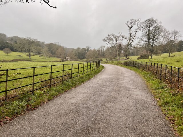
Bar Walk Plantation is a picturesque woodland located in Cornwall, England. Covering an area of approximately 100 acres, it is nestled in the heart of the county, providing a tranquil retreat for nature enthusiasts and outdoor adventurers alike.

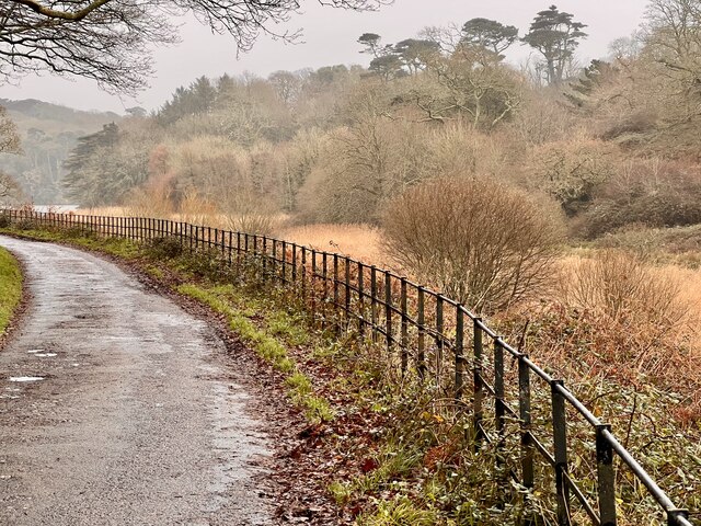
The plantation is predominantly made up of mature oak trees, their sprawling branches creating a dense canopy that offers shade and shelter for various wildlife species. The forest floor is adorned with a vibrant carpet of bluebells in the spring, creating a stunning display of color and fragrance.

Walking through Bar Walk Plantation, visitors are treated to a network of well-maintained footpaths and trails, allowing them to explore the woodland at their own pace. The paths wind their way through the trees, occasionally opening up to reveal breathtaking views of the surrounding countryside.

The plantation is also home to a diverse array of flora and fauna. Birdwatchers will delight in the opportunity to spot species such as woodpeckers, owls, and various migratory birds. Squirrels can be seen darting through the branches, while deer occasionally emerge from the undergrowth, adding a touch of magic to the experience.

In addition to its natural beauty, Bar Walk Plantation also offers recreational facilities for visitors. There is a picnic area where families can enjoy a leisurely lunch amidst the tranquil surroundings. The plantation is also a popular spot for dog walkers, providing a safe and scenic environment for both pets and owners to enjoy.

Bar Walk Plantation in Cornwall truly encapsulates the beauty of the English countryside, offering a haven of peace and tranquility for all who visit.

If you have any feedback on the listing, please let us know in the comments section below.

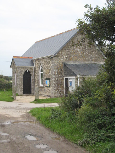
Bar Walk Plantation Images

Images are sourced within 2km of 50.074529/-5.2932844 or Grid Reference SW6424. Thanks to Geograph Open Source API. All images are credited.

Direction Sign – Signpost at Chyvarloe turn in Gunwalloe parish Located on a grass triangle at Chyvarloe turn in Gunwalloe parish. 3 arms and pyramid finial. Arms all replaced since <a title="https://www.geograph.org.uk/photo/6043649" href="https://www.geograph.org.uk/photo/6043649">Link</a>. 

Milestone Society National ID: CW_SW6523
Direction Sign – Signpost at Chyvarloe turn in Gunwalloe parish
Located on a grass triangle at Chyvarloe turn in Gunwalloe parish. 3 arms and pyramid finial. Arms all replaced since Link. Milestone Society National ID: CW_SW6523
Porthleven - The Bickford Smith Institute The Bickford Smith Institute was built 1883-4 at the town end of Porthleven's pier. It incorporates a library and a conspicuous clock tower.
Photo taken from Mount Pleasant Road.
The institute is EH Grade II listed: <span class="nowrap"><a title="https://historicengland.org.uk/listing/the-list/list-entry/1297626" rel="nofollow ugc noopener" href="https://historicengland.org.uk/listing/the-list/list-entry/1297626">Link</a><img style="margin-left:2px;" alt="External link" title="External link - shift click to open in new window" src="https://s1.geograph.org.uk/img/external.png" width="10" height="10"/></span>
Porthleven - The Bickford Smith Institute
The Bickford Smith Institute was built 1883-4 at the town end of Porthleven's pier. It incorporates a library and a conspicuous clock tower. Photo taken from Mount Pleasant Road. The institute is EH Grade II listed: LinkExternal link
Penrose in the rain Walking to the Loe Pool, in the rain.
Penrose in the rain
Walking to the Loe Pool, in the rain.
Estate Building A small well built pump house. To supply water to the Estate Gardens.
Estate Building
A small well built pump house. To supply water to the Estate Gardens.
Penrose Stream Looking northwest up the stream, again in the drizzle, making the photo drab.
Penrose Stream
Looking northwest up the stream, again in the drizzle, making the photo drab.
Penrose House and Gardens A damp view of the house and gardens.
Penrose House and Gardens
A damp view of the house and gardens.
Penrose Stables The stables have been converted to holiday accommodation and a cafe, which looked rather busy today.
Penrose Stables
The stables have been converted to holiday accommodation and a cafe, which looked rather busy today.
Lane at Penrose Very few visitors are down near Loe Pool, preferring the cafe up near the house.
Lane at Penrose
Very few visitors are down near Loe Pool, preferring the cafe up near the house.
Path and Rushes The rushes growing in the boggy low lying lakeside.
Path and Rushes
The rushes growing in the boggy low lying lakeside.
Large branch One of the main limbs has been blown off the Oak tree in a recent storm.
Large branch
One of the main limbs has been blown off the Oak tree in a recent storm.
The Loe Loe Pool in the rain.
The Loe
Loe Pool in the rain.
The Pump House Access is difficult to get closer to this well built structure.
The Pump House
Access is difficult to get closer to this well built structure.
Clock Tower The iconic clock tower and institute at Porthleven. The sea has a large swell due to very windy weather.
Clock Tower
The iconic clock tower and institute at Porthleven. The sea has a large swell due to very windy weather.
Porthleven  Townhouses The inner harbour walls, townhouses and a seagull who refused to fly away.
Porthleven Townhouses
The inner harbour walls, townhouses and a seagull who refused to fly away.
Dockside Road The road and footpath running on the eastern side of Porthleven harbour.
Dockside Road
The road and footpath running on the eastern side of Porthleven harbour.
Inner Harbour Wall A cannon guarding the inner harbour, and the Ship Inn public house.
Inner Harbour Wall
A cannon guarding the inner harbour, and the Ship Inn public house.
Porthleven, Cornwall, Harbour Entrance
On Loe Bar With Bar Lodge in view.
On Loe Bar
With Bar Lodge in view.
Show me another place!

Bar Walk Plantation is located at Grid Ref: SW6424 (Lat: 50.074529, Lng: -5.2932844)

Unitary Authority: Cornwall

Police Authority: Devon and Cornwall

What 3 Words

///tributes.lectures.clerics. Near Porthleven, Cornwall

Related Wikis

The Loe

The Loe (Cornish: An Logh), also known as Loe Pool, is the largest natural freshwater lake (50 hectares (120 acres)) in Cornwall, United Kingdom. The earliest...

Degibna

Degibna is a hamlet and farm in the parish of Helston, Cornwall, England, UK. It lies on the eastern bank of the largest natural freshwater lake in Cornwall...

Penrose, Cornwall

Penrose (Cornish: Penros) is a house (in private ownership) and National Trust estate amounting to 1536 acres, east of Porthleven and in the civil parish...
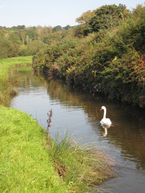
River Cober

The River Cober (Cornish: Dowr Kohar) is a short river in west Cornwall, England, United Kingdom. The river runs to the west of Helston into The Loe, Cornwall...

Nearby Amenities

Located within 500m of 50.074529,-5.2932844
Source: Landsat photo
Lat/Long: 50.0701186/-5.2922387
Source: Landsat photo
Lat/Long: 50.0719323/-5.2946097
Penrose Estate Map
Tourism: information
Lat/Long: 50.0719905/-5.2981858
Sit-up Plank
Leisure: fitness_station
Network: The Green Gym
Operator: National Trust
Sport: fitness
Lat/Long: 50.0735516/-5.2933289
Monkey Bar
Description: Work hand over hand until you reach the top.
Leisure: fitness_station
Network: The Green Gym
Operator: National Trust
Sport: fitness
Lat/Long: 50.0721388/-5.2948242
Stepping Beam
Leisure: fitness_station
Network: The Green Gym
Operator: National Trust
Sport: fitness
Lat/Long: 50.0771077/-5.2914345
Bench
Backrest: no
Lat/Long: 50.0721222/-5.2985001
Bicycle Parking
Bicycle Parking: stands
Capacity: 8
Covered: no
Lat/Long: 50.0720052/-5.29829
Bench
Inscription: Sit with us and enjoy the view
Memory Of: Mark Storey
Lat/Long: 50.0721767/-5.298648
Barrier: block
Lat/Long: 50.0773639/-5.2931977
Bench
Backrest: no
Material: wood
Seats: 4
Lat/Long: 50.0743812/-5.2897528
Bench
Backrest: yes
Material: wood
Seats: 4
Lat/Long: 50.0753581/-5.288122
Information: guidepost
Tourism: information
Lat/Long: 50.0742644/-5.297914
Bench
Backrest: no
Lat/Long: 50.0730744/-5.2995809
Bench
Backrest: no
Lat/Long: 50.0738969/-5.3001292
Bench
Backrest: no
Survey Date: 2023-05-28
Lat/Long: 50.0749286/-5.2986796
Life Ring
Emergency: life_ring
Survey Date: 2023-05-28
Lat/Long: 50.0714856/-5.2971586
Bench
Backrest: no
Survey Date: 2023-05-28
Lat/Long: 50.0753285/-5.2989194
The data included in this document is from www.openstreetmap.org. The data is made available under ODbL.

Have you been to Bar Walk Plantation?

Leave your review of Bar Walk Plantation below (or comments, questions and feedback).