Millers Plantation

Wood, Forest in Berwickshire

Scotland

Millers Plantation

Tree harvesting at Fox Covert Fox Covert can be noted in the distance, with timber piles stacked up by the side of the track adjacent to Simprim Mains.

This photograph was taken during the Coronavirus (COVID-19) pandemic of 2020/21/22.
Tree harvesting at Fox Covert Credit: James T M Towill

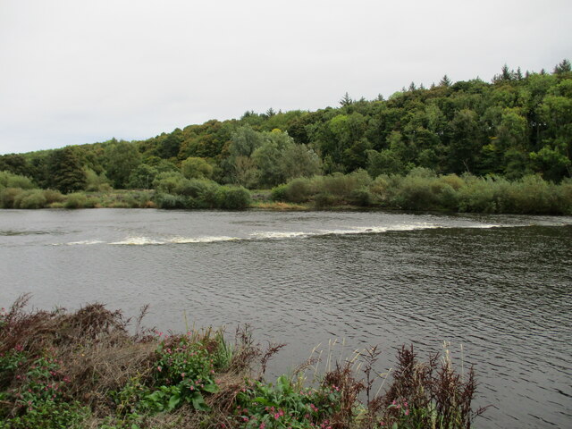
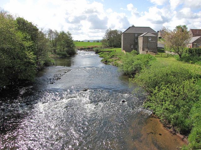
Millers Plantation is a picturesque woodland area located in the rural county of Berwickshire, Scotland. Covering an expansive area, this plantation is known for its diverse range of trees and the tranquil atmosphere it provides to visitors.

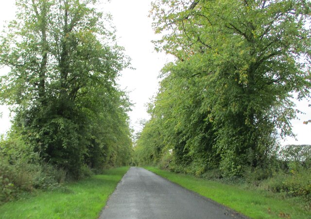
The woodland of Millers Plantation is primarily composed of native species, including oak, beech, and birch trees, which create a stunning canopy that stretches as far as the eye can see. The plantation is meticulously maintained, with well-marked paths that allow visitors to explore the area at their own pace. These paths wind through the woods, offering glimpses of vibrant wildflowers and the occasional sighting of local wildlife, such as deer and various bird species.

The plantation is also home to a variety of plant life, including ferns, mosses, and lichens, adding to the rich biodiversity of the area. The forest floor is covered in a thick layer of leaf litter, providing a habitat for numerous insects and small mammals.

Visitors to Millers Plantation can enjoy a peaceful and serene environment, perfect for a leisurely stroll or a picnic amidst nature. The plantation is particularly popular during the autumn months when the trees showcase a stunning display of vibrant colors.

Millers Plantation is easily accessible, with ample parking facilities and well-maintained entrances. Its proximity to nearby villages and towns makes it a popular destination for locals and tourists alike, seeking solace in nature's embrace.

If you have any feedback on the listing, please let us know in the comments section below.

Millers Plantation Images

Images are sourced within 2km of 55.696348/-2.213774 or Grid Reference NT8644. Thanks to Geograph Open Source API. All images are credited.

Tree harvesting at Fox Covert Fox Covert can be noted in the distance, with timber piles stacked up by the side of the track adjacent to Simprim Mains.

This photograph was taken during the Coronavirus (COVID-19) pandemic of 2020/21/22.
Tree harvesting at Fox Covert
Fox Covert can be noted in the distance, with timber piles stacked up by the side of the track adjacent to Simprim Mains. This photograph was taken during the Coronavirus (COVID-19) pandemic of 2020/21/22.
The remains of Simprim Church The church was dedicated in 1247 and it, and its income, became the property of Kelso Abbey. In July 1482 the church was burnt by the order of the future king, Richard III.  It was repaired but its fortunes declined although a new church steeple and bell were added in 1756.  The bell was removed to Swinton House and the church closed when the parish combined with Swinton in 1761.

This photograph was taken during the Coronavirus (COVID-19) pandemic of 2020/21/22.
The remains of Simprim Church
The church was dedicated in 1247 and it, and its income, became the property of Kelso Abbey. In July 1482 the church was burnt by the order of the future king, Richard III. It was repaired but its fortunes declined although a new church steeple and bell were added in 1756. The bell was removed to Swinton House and the church closed when the parish combined with Swinton in 1761. This photograph was taken during the Coronavirus (COVID-19) pandemic of 2020/21/22.
View  from  our  holiday  cottage  on  the  Milne  Graden  Estate Early morning over the River Tweed. If you wished, the riverside footpath takes you left to Norham Bridge or right to Coldstream. The south bank bathed in sunlight is in Northumberland, The border is the middle of the river.
View from our holiday cottage on the Milne Graden Estate
Early morning over the River Tweed. If you wished, the riverside footpath takes you left to Norham Bridge or right to Coldstream. The south bank bathed in sunlight is in Northumberland, The border is the middle of the river.
Track  up  from  River  Tweed  toward  Sunnyside The track goes from the riverbank through the wood and joins the estate road which takes you out onto the B6437 at North Lodge. The buildings in the trees (centre) are shown on the map as Sunnyside, former estate workers homes and school they are now four holiday lets, beloved of salmon/trout fishermen.
Track up from River Tweed toward Sunnyside
The track goes from the riverbank through the wood and joins the estate road which takes you out onto the B6437 at North Lodge. The buildings in the trees (centre) are shown on the map as Sunnyside, former estate workers homes and school they are now four holiday lets, beloved of salmon/trout fishermen.
Damford  Shiel.  River  Tweed  Milne  Graden  Estate The salmon fishermen park their vehicles here, and boats are moored on the river, equipment is housed in the shiel.
Damford Shiel. River Tweed Milne Graden Estate
The salmon fishermen park their vehicles here, and boats are moored on the river, equipment is housed in the shiel.
Tweedside  walk,  footbridge  over  Bannock  Burn A walk before breakfast alongside the Tweed
Tweedside walk, footbridge over Bannock Burn
A walk before breakfast alongside the Tweed
Swan  family  on  the  River  Tweed Heading upstream, the river discoloured due to heavy rain
Swan family on the River Tweed
Heading upstream, the river discoloured due to heavy rain
Estate  road  into  Sunnyside  Milne  Graden  Estate
Estate road into Sunnyside Milne Graden Estate
Footpath  through  wood  to  Tweed  riverbank Estate path not a Public footpath
Footpath through wood to Tweed riverbank
Estate path not a Public footpath
Public  footpath  alongside  River  Tweed
Public footpath alongside River Tweed
Weir  on  River  Tweed  from  riverside  path  Milne  Graden
Weir on River Tweed from riverside path Milne Graden
Ruin  alongside  track  on  Milne  Garden  Estate The walled garden is just to my left, now converted to two secure dog exercise areas
Ruin alongside track on Milne Garden Estate
The walled garden is just to my left, now converted to two secure dog exercise areas
Milne  Graden  House  built  in  1822 Built for Admiral Sir David Milne
Milne Graden House built in 1822
Built for Admiral Sir David Milne
Approaching  West  Lodge  entrance  to  Ladykirk  Estate On the B6437
Approaching West Lodge entrance to Ladykirk Estate
On the B6437
Felled  timber  stacked  outside  West  Lodge.  Ladykirk Ready for transportation. West Lodge on the map but the lion gateway is its other name. Built in 1799 it is based on the entrance screen by Robert Adam for the Duke of Northumberland at Syon House. A high arch surmounted by a stone Percy lion. It can be seen between the two trees on the right
Felled timber stacked outside West Lodge. Ladykirk
Ready for transportation. West Lodge on the map but the lion gateway is its other name. Built in 1799 it is based on the entrance screen by Robert Adam for the Duke of Northumberland at Syon House. A high arch surmounted by a stone Percy lion. It can be seen between the two trees on the right
Minor  road  junction  on  B6437 The wall on the right is the Ladykirk Estate
Minor road junction on B6437
The wall on the right is the Ladykirk Estate
A  tree  lined  country  road The B6437 toward the B6470
A tree lined country road
The B6437 toward the B6470
Minor  road  toward  Milne  Graden  West  Mains
Minor road toward Milne Graden West Mains
Show me another place!

Millers Plantation is located at Grid Ref: NT8644 (Lat: 55.696348, Lng: -2.213774)

Unitary Authority: The Scottish Borders

Police Authority: The Lothians and Scottish Borders

What 3 Words

///outwards.saloons.backhand. Near Coldstream, Scottish Borders

Nearby Locations

Millers Plantation

Related Wikis

Twizell railway station

Twizell railway station served the historic village of Twizell, Northumberland, England, from 1861 to 1955 on the Kelso Branch. == History == The station...

River Till, Northumberland

The River Till is a river of north-eastern Northumberland. It is a tributary of the River Tweed, of which it is the only major tributary to flow wholly...

Twizell Castle

Twizell Castle (also spelt Twizel) is a Grade II* listed building and a Scheduled Ancient Monument which stands on a bend of the River Till at Tillmouth...

Battle of Skaithmuir

The Battle of Skaithmuir was a skirmish of the First War of Scottish Independence. It took place near Coldstream, on the Anglo-Scottish border, in February...

Nearby Amenities

Located within 500m of 55.696348,-2.213774
Milne Graden West Mains
Place: hamlet
Lat/Long: 55.6924432/-2.2173736
Power: pole
Lat/Long: 55.6973944/-2.2066936
Power: pole
Lat/Long: 55.6969288/-2.2084022
Power: pole
Lat/Long: 55.6962984/-2.210725
Power: pole
Lat/Long: 55.6954141/-2.2126776
Power: pole
Lat/Long: 55.6945162/-2.21459
Power: pole
Lat/Long: 55.6936726/-2.2164407
Power: pole
Lat/Long: 55.6928185/-2.2182888
Give Way
Direction: backward
Lat/Long: 55.6939766/-2.2093647
Power: pole
Lat/Long: 55.6951359/-2.2150104
Power: pole
Lat/Long: 55.6959574/-2.2155565
Power: pole
Lat/Long: 55.6972804/-2.216425
Power: pole
Lat/Long: 55.6985695/-2.2172441
Power: pole
Lat/Long: 55.6993848/-2.2179148
Power: pole
Lat/Long: 55.6965801/-2.2081461
Power: pole
Lat/Long: 55.6956302/-2.2080988
Power: pole
Lat/Long: 55.69469/-2.2080773
Power: pole
Lat/Long: 55.6937607/-2.2080472
Power: pole
Lat/Long: 55.6933681/-2.2077978
Power: pole
Lat/Long: 55.6995072/-2.2159628
Power: pole
Lat/Long: 55.6997858/-2.2141763
Power: pole
Lat/Long: 55.7002849/-2.2126048
The data included in this document is from www.openstreetmap.org. The data is made available under ODbL.

Have you been to Millers Plantation?

Leave your review of Millers Plantation below (or comments, questions and feedback).