Parkhead Wood

Wood, Forest in Aberdeenshire

Scotland

Parkhead Wood

West Woods in Winter Snowy scene along a footpath within the West Woods on the outskirts of Aberdeen.
West Woods in Winter Credit: Uamhair

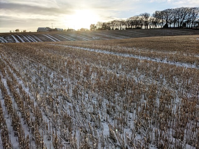
Parkhead Wood is a picturesque forest located in Aberdeenshire, Scotland. Covering an area of approximately 50 hectares, the wood is nestled on the eastern slopes of Parkhead Hill, providing visitors with stunning panoramic views of the surrounding countryside.

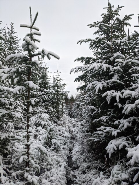
The wood is predominantly composed of mixed coniferous and deciduous trees, including species such as Scots pine, oak, and birch. The diverse range of tree species creates a rich and vibrant ecosystem, supporting a variety of flora and fauna. Visitors can expect to encounter a plethora of wildflowers, ferns, and mosses as they explore the woodland trails.

The forest boasts a well-maintained network of walking trails, making it a popular destination for outdoor enthusiasts and nature lovers. The paths wind through the wood, offering opportunities for leisurely strolls, jogging, or even cycling. Along the way, visitors may spot wildlife such as deer, red squirrels, and a variety of bird species, adding to the allure of the wood.

One of the main highlights of Parkhead Wood is the presence of an enchanting waterfall known as Parkhead Falls. This cascading waterfall, located at the heart of the wood, is a sight to behold and serves as a tranquil spot for visitors to relax and unwind.

Overall, Parkhead Wood in Aberdeenshire provides a serene and idyllic setting for individuals seeking to immerse themselves in nature. With its diverse range of trees, picturesque trails, and captivating waterfall, it is an ideal destination for those looking to escape the hustle and bustle of everyday life and reconnect with the natural world.

If you have any feedback on the listing, please let us know in the comments section below.

Parkhead Wood Images

Images are sourced within 2km of 57.185592/-2.2231046 or Grid Reference NJ8610. Thanks to Geograph Open Source API. All images are credited.

West Woods in Winter Snowy scene along a footpath within the West Woods on the outskirts of Aberdeen.
West Woods in Winter
Snowy scene along a footpath within the West Woods on the outskirts of Aberdeen.
Robbers Cave The Robber's Cave within Tyrebagger Forest; a short, long-abandoned mine working.
Robbers Cave
The Robber's Cave within Tyrebagger Forest; a short, long-abandoned mine working.
Gough Burn - Bypass Tunnel Upstream view along the Gough Burn where it has bridged by the Aberdeen western Peripheral Route (AWPR).
Gough Burn - Bypass Tunnel
Upstream view along the Gough Burn where it has bridged by the Aberdeen western Peripheral Route (AWPR).
Gough Burn Gough Burn meander within woodland.
Gough Burn
Gough Burn meander within woodland.
Collapsed tree, Gough Burn Path alongside the Gough Burn, passing an enormous toppled beech tree that blocked the route prior to the truncation of limbs to form a 'tree tunnel'.
Collapsed tree, Gough Burn
Path alongside the Gough Burn, passing an enormous toppled beech tree that blocked the route prior to the truncation of limbs to form a 'tree tunnel'.
Redwood Forest Sequoia redwood trees which have been planted within the Craibstone Estate, alongside various other species rare to Scotland.
Redwood Forest
Sequoia redwood trees which have been planted within the Craibstone Estate, alongside various other species rare to Scotland.
West Woods Track Forest track through the West Woods on the outskirts of Aberdeen.
West Woods Track
Forest track through the West Woods on the outskirts of Aberdeen.
A90 crossing A96 at Chapel of Stoneywood
MTB Fun Park The bottom of the mountain bike track at the Tyrebagger
MTB Fun Park
The bottom of the mountain bike track at the Tyrebagger
Industrial unit, ABZ Business Park
Newhills Fields View across hummocky landscape towards the Newhills Care Home from the edge of Bucksburn.
Newhills Fields
View across hummocky landscape towards the Newhills Care Home from the edge of Bucksburn.
Uprooted Trees, Brimmondside Trees blocking what would normally be a road track at Brimmondside, collectively uprooted during the destructive Storm Arwen in November 2021.
Uprooted Trees, Brimmondside
Trees blocking what would normally be a road track at Brimmondside, collectively uprooted during the destructive Storm Arwen in November 2021.
Summit of Brimond Hill The Marilyns are mountains and hills in the British Isles that have a topographical prominence above 150 metres (490 feet), regardless of absolute height or other merits.[
Summit of Brimond Hill
The Marilyns are mountains and hills in the British Isles that have a topographical prominence above 150 metres (490 feet), regardless of absolute height or other merits.[
Along the tree line on Brimond Hill
Trig Point on Brimmond Hill
Transmitter Mast on Brimmond Hill
Kirkhill Mountainbike Fun Trail
Mountjoy From Kirkhill Forest bike trail.
Mountjoy
From Kirkhill Forest bike trail.
Show me another place!

Parkhead Wood is located at Grid Ref: NJ8610 (Lat: 57.185592, Lng: -2.2231046)

Unitary Authority: City of Aberdeen

Police Authority: North East

What 3 Words

///stems.stated.nipped. Near Kingswells, Aberdeen

Nearby Locations

Parkhead Wood

Related Wikis

Craibstone Park and Ride

Craibstone Park and Ride is a park and ride facility near Dyce, Scotland. It is one of three such facilities near the city of Aberdeen, the other two being...
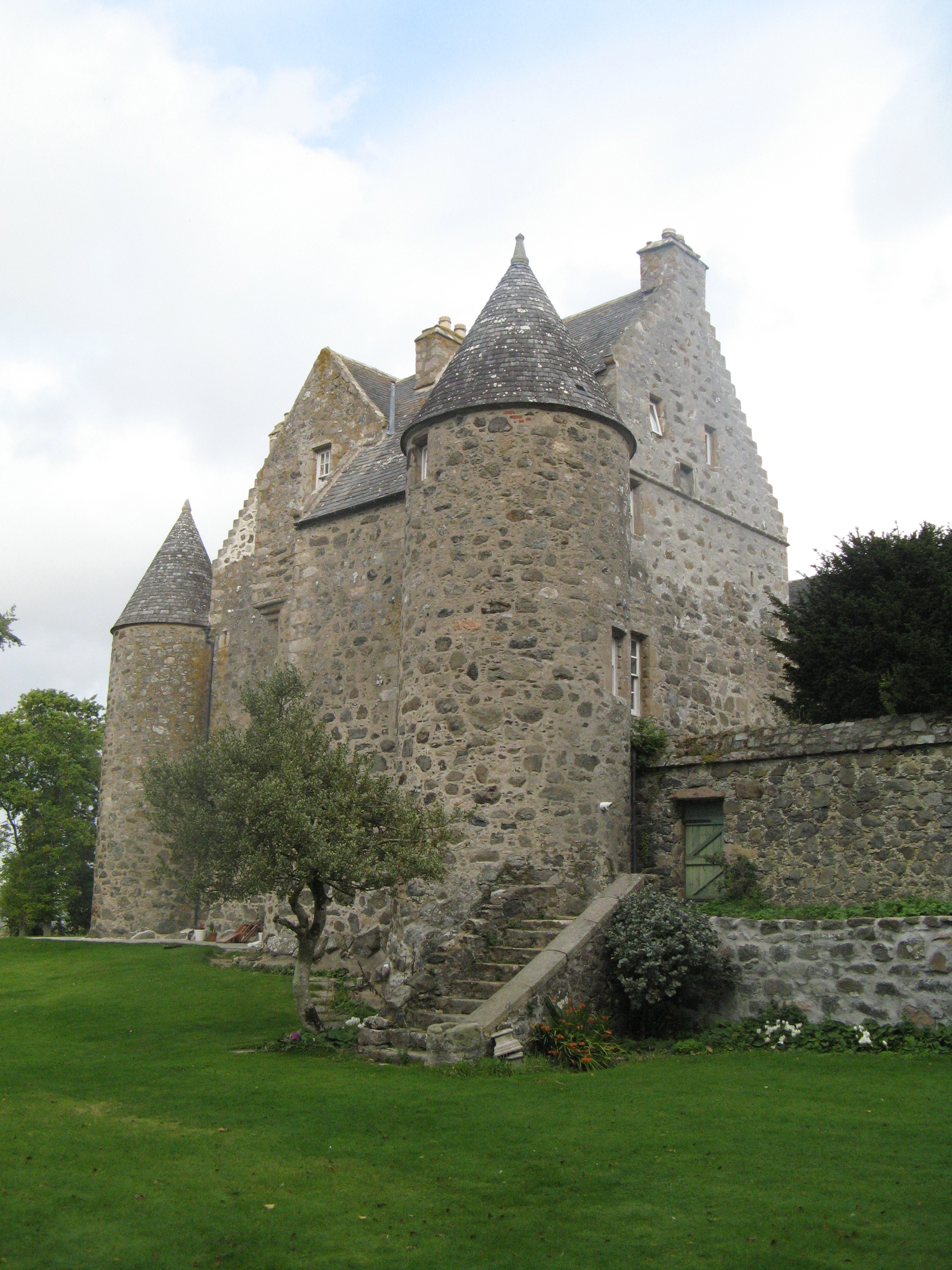
Barra Castle

Barra Castle is an unusual L-plan tower house dating from the early 16th century, about two miles (three kilometres) south of Oldmeldrum, above the Lochter...

Aberdeen International Business Park

Aberdeen International Business Park (AIBP) is a major commercial building project located on the south eastern edge of Aberdeen International Airport...

Kirkhill Forest

Kirkhill Forest is a forest in Scotland, situated to the north-west of Aberdeen, on the north side of the A96 between the villages of Dyce and Blackburn...

Nearby Amenities

Located within 500m of 57.185592,-2.2231046
Motorway Junction
Craibstone Junction
Proposed Highway: motorway_junction
Lat/Long: 57.1843808/-2.2162886
Traffic Signals
Traffic Signals: signal
Traffic Signals Direction: forward
Lat/Long: 57.188196/-2.219014
Traffic Signals
Traffic Signals: signal
Traffic Signals Direction: forward
Lat/Long: 57.188516/-2.2174009
Traffic Signals
Traffic Signals: signal
Traffic Signals Direction: forward
Lat/Long: 57.1883374/-2.2171167
Traffic Signals
Traffic Signals: signal
Traffic Signals Direction: forward
Lat/Long: 57.1880525/-2.2184831
Turning Circle
Lat/Long: 57.1828318/-2.2166116
Traffic Signals
Traffic Signals: signal
Traffic Signals Direction: forward
Lat/Long: 57.1880039/-2.2186578
Traffic Signals
Traffic Signals: signal
Traffic Signals Direction: forward
Lat/Long: 57.1882088/-2.2170433
Traffic Signals
Traffic Signals: signal
Traffic Signals Direction: forward
Lat/Long: 57.1885749/-2.2172024
Power: pole
Lat/Long: 57.1822919/-2.2279013
Power: pole
Lat/Long: 57.1824404/-2.2268292
Power: pole
Lat/Long: 57.1826039/-2.2257464
Power: pole
Lat/Long: 57.1827733/-2.2246571
Power: pole
Lat/Long: 57.1829252/-2.2236064
Power: pole
Lat/Long: 57.1830934/-2.2225171
Power: pole
Lat/Long: 57.1832592/-2.2214514
Power: pole
Lat/Long: 57.183403/-2.22039
Power: pole
Lat/Long: 57.1835561/-2.2193392
Power: pole
Lat/Long: 57.1837568/-2.2179718
Power: pole
Lat/Long: 57.1838924/-2.2169938
Traffic Signals
Traffic Signals: signal
Lat/Long: 57.1883894/-2.2174832
Barrier: cycle_barrier
Cycle Barrier: double
Lat/Long: 57.1882542/-2.2193658
Traffic Signals
Traffic Signals: signal
Lat/Long: 57.1881923/-2.2181806
Golf: pin
Lat/Long: 57.1842656/-2.219819
Golf: pin
Lat/Long: 57.18527/-2.2259961
Golf: pin
Lat/Long: 57.183565/-2.2252612
Golf: pin
Lat/Long: 57.1831282/-2.2249876
Golf: pin
Lat/Long: 57.18183/-2.2262543
Golf: pin
Lat/Long: 57.1827146/-2.2234809
The data included in this document is from www.openstreetmap.org. The data is made available under ODbL.

Have you been to Parkhead Wood?

Leave your review of Parkhead Wood below (or comments, questions and feedback).