Brainjohn Wood

Wood, Forest in Aberdeenshire
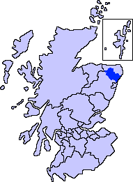
Scotland

Brainjohn Wood

Haddo House A view of Haddo House and the north driveway.
Haddo House Credit: Andrew Wood

Brainjohn Wood is a beautiful forest located in Aberdeenshire, Scotland. Spanning over a vast area, this woodland is known for its rich biodiversity, enchanting landscapes, and tranquil ambiance. The forest is situated near the village of Brainjohn and is easily accessible for nature enthusiasts and hikers alike.

The woodland in Brainjohn Wood is predominantly made up of native tree species such as oak, birch, and pine, creating a diverse and vibrant ecosystem. The dense canopy provides shelter for a wide variety of wildlife, including birds, mammals, and insects, making it a popular spot for birdwatching and wildlife photography.

The forest offers a network of well-maintained trails and paths, allowing visitors to explore its natural wonders at their own pace. These paths provide opportunities for leisurely walks, jogging, or even cycling. Along the way, visitors can enjoy the stunning scenery, including picturesque streams, wildflower meadows, and ancient trees.

For those seeking a deeper connection with nature, Brainjohn Wood offers several designated picnic areas and camping spots. These areas are perfect for family outings or overnight stays, allowing visitors to immerse themselves in the serenity of the forest.

Overall, Brainjohn Wood in Aberdeenshire is a haven for nature lovers, providing a tranquil escape from the hustle and bustle of daily life. Its diverse flora and fauna, picturesque landscapes, and recreational opportunities make it a must-visit destination for anyone seeking to reconnect with nature in the heart of Scotland.

If you have any feedback on the listing, please let us know in the comments section below.

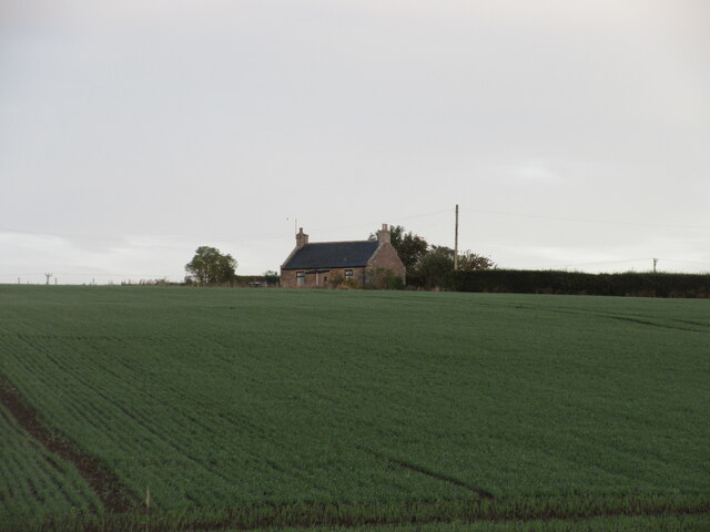
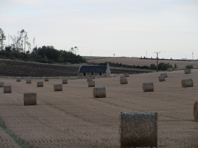
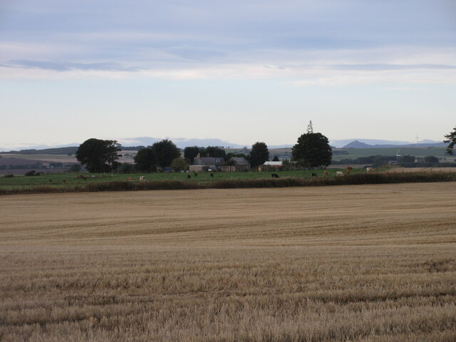
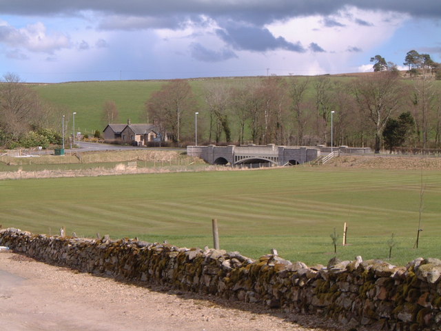
Brainjohn Wood Images

Images are sourced within 2km of 57.409225/-2.248881 or Grid Reference NJ8535. Thanks to Geograph Open Source API. All images are credited.

Haddo House A view of Haddo House and the north driveway.
Haddo House
A view of Haddo House and the north driveway.
Barley Field by Haddo A barley field by Haddo House.
Barley Field by Haddo
A barley field by Haddo House.
Haddo Frontage Haddo House from the west with the chapel on the left side.
Haddo Frontage
Haddo House from the west with the chapel on the left side.
Haddo Theatre The small theatre at Haddo where select performances entertain the local community.
Haddo Theatre
The small theatre at Haddo where select performances entertain the local community.
House and Garden A garden display at Haddo House.
House and Garden
A garden display at Haddo House.
Haddo House Haddo, designed in 1732 by William Adam, is one of the finest examples of the Palladian style in Scotland.
Haddo House
Haddo, designed in 1732 by William Adam, is one of the finest examples of the Palladian style in Scotland.
Haddo Chapel Dating from 1881, the Chapel is available to all Christian denominations.
Haddo Chapel
Dating from 1881, the Chapel is available to all Christian denominations.
Haddo House Haddo House has been the family home of the Earls and Marquesses of Aberdeen since the 1730s.  It has been in the care of the National Trust for Scotland since 1979.
Haddo House
Haddo House has been the family home of the Earls and Marquesses of Aberdeen since the 1730s. It has been in the care of the National Trust for Scotland since 1979.
The formal avenue at Haddo House The formal avenue at Haddo leads from the foot of the terrace for a distance of a Scots mile (1,984 yards).
The formal avenue at Haddo House
The formal avenue at Haddo leads from the foot of the terrace for a distance of a Scots mile (1,984 yards).
Springtime at Haddo Spring flowers along the avenue leading from Haddo House
Springtime at Haddo
Spring flowers along the avenue leading from Haddo House
Methlick New Cemetery Looking west over the new cemetery on the B9170 south of Methlick.
Methlick New Cemetery
Looking west over the new cemetery on the B9170 south of Methlick.
Cottage at Collynie Looking west from the B9170 to a cottage at Collynie Farm.
Cottage at Collynie
Looking west from the B9170 to a cottage at Collynie Farm.
Old cottage near Andet Looking over a field of bales to a derelict stone cottage.
Old cottage near Andet
Looking over a field of bales to a derelict stone cottage.
Hillbrae Croft A distant view of Hillbrae Croft from the north-east, with Mither Tap of Bennachie visible on the horizon to the right.
Hillbrae Croft
A distant view of Hillbrae Croft from the north-east, with Mither Tap of Bennachie visible on the horizon to the right.
Methlick War Memorial The war memorial at Methlick near the parish church.
Methlick War Memorial
The war memorial at Methlick near the parish church.
Small Haddo Hall A small but well constructed outbuilding at Haddo House
Small Haddo Hall
A small but well constructed outbuilding at Haddo House
Show me another place!

Brainjohn Wood is located at Grid Ref: NJ8535 (Lat: 57.409225, Lng: -2.248881)

Unitary Authority: Aberdeenshire

Police Authority: North East

What 3 Words

///hovered.cheer.baseless. Near Pitmedden, Aberdeenshire

Related Wikis

Methlick

Methlick (Gaelic: Maothulach) is a village in the Formartine area of Aberdeenshire, Scotland, situated on the River Ythan 11.2 kilometres (7.0 mi) north...

Haddo House

Haddo House is a Scottish stately home located near Tarves in Aberdeenshire, approximately 20 miles (32 km) north of Aberdeen (grid reference NJ868347...

Formartine

Formartine (Scottish Gaelic: Fearann Mhàrtainn meaning "Martin's land") is a committee area in Aberdeenshire, Scotland. This district extends north from...

Tillyhilt Castle

Tillyhilt Castle was a 16th-century tower house 6.5 miles (10.5 km) west of Ellon, 1 mile (1.6 km) northwest of Tarves, Aberdeenshire, Scotland. ��2�...

Barthol Chapel

Barthol Chapel is a small village in the Formartine area of Aberdeenshire, Scotland, named after the Catholic saint, St Bartholomew. Barthol Chapel has...

House of Schivas

House of Schivas is an L-plan tower house, dating from the 16th century, about three miles east of Methlick, in the valley of the River Ythan, in Aberdeenshire...

Gight

Gight is the name of an estate in the parish of Fyvie in the Formartine area of Aberdeenshire, Scotland, United Kingdom. It is best known as the location...

Tarves

Tarves (; Scottish Gaelic: Tarbhais), Aberdeenshire, is a small village, situated in the Formartine area of North East Scotland and lies between Oldmeldrum...

Nearby Amenities

Located within 500m of 57.409225,-2.248881
Power: pole
Lat/Long: 57.4080265/-2.2562866
Power: pole
Lat/Long: 57.4089824/-2.2559364
Power: pole
Lat/Long: 57.40997/-2.2555536
Power: pole
Lat/Long: 57.4108814/-2.2552209
Power: pole
Lat/Long: 57.4117295/-2.2549011
Power: pole
Lat/Long: 57.412054/-2.2538159
Power: pole
Lat/Long: 57.4123761/-2.252724
Power: pole
Lat/Long: 57.4126912/-2.2516627
Power: pole
Lat/Long: 57.4135053/-2.2510798
Power: pole
Lat/Long: 57.4130661/-2.2525501
Power: pole
Lat/Long: 57.4129021/-2.2513604
Power: pole
Lat/Long: 57.4127744/-2.2504447
Power: pole
Lat/Long: 57.4125917/-2.2491615
Power: pole
Lat/Long: 57.412406/-2.2479196
Power: pole
Lat/Long: 57.4122238/-2.2466462
Power: pole
Lat/Long: 57.4120434/-2.2453717
Power: pole
Lat/Long: 57.4118584/-2.2441124
Power: pole
Lat/Long: 57.4116499/-2.2432664
Power: pole
Lat/Long: 57.4114156/-2.2424116
Power: pole
Lat/Long: 57.4112223/-2.2416482
Power: pole
Lat/Long: 57.4108744/-2.2419049
Power: pole
Lat/Long: 57.4105095/-2.2421691
Power: pole
Lat/Long: 57.4101364/-2.242441
Power: pole
Lat/Long: 57.4097837/-2.2426889
Power: pole
Lat/Long: 57.4093866/-2.2429738
Power: pole
Lat/Long: 57.4100005/-2.2452575
Power: pole
Lat/Long: 57.409799/-2.2445137
Power: pole
Lat/Long: 57.409608/-2.2438134
Power: pole
Lat/Long: 57.4091148/-2.2425628
Power: pole
Lat/Long: 57.4088137/-2.2421104
Power: pole
Lat/Long: 57.4084435/-2.2415471
Power: pole
Lat/Long: 57.408064/-2.2409707
Power: pole
Lat/Long: 57.4064947/-2.2505676
Power: pole
Lat/Long: 57.4064174/-2.2515224
Power: pole
Lat/Long: 57.4063459/-2.2524446
Power: pole
Lat/Long: 57.4057976/-2.2526708
Bus Stop
Chapelpark
Bus: yes
Naptan AtcoCode: 630030691
Naptan Bearing: S
Naptan CommonName: Chapelpark
Naptan Indicator: at
Naptan NaptanCode: 23625843
Naptan Street: B9170
Naptan Verified: no
Public Transport: platform
Source: naptan;bing;naptan_compare_tool
Lat/Long: 57.4064333/-2.2526239
The data included in this document is from www.openstreetmap.org. The data is made available under ODbL.

Have you been to Brainjohn Wood?

Leave your review of Brainjohn Wood below (or comments, questions and feedback).