Druidsdale Strip

Wood, Forest in Kincardineshire

Scotland

Druidsdale Strip

Minor road approaching West Town Looking north-westward.
Minor road approaching West Town Credit: Peter Wood

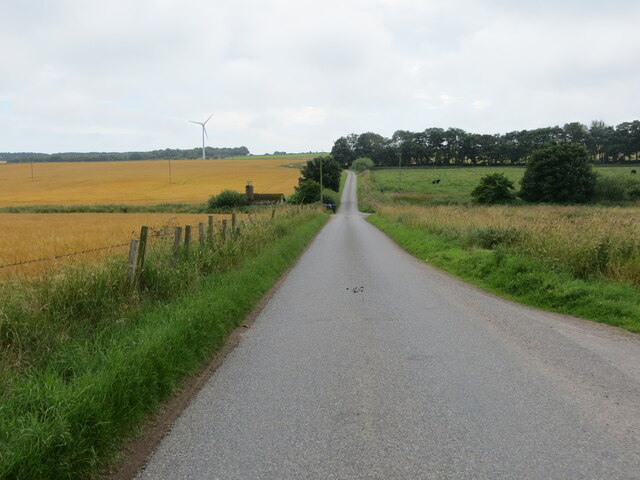
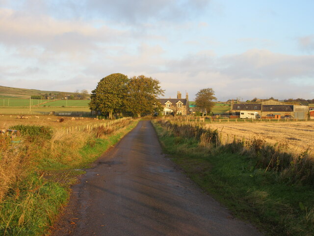
Druidsdale Strip, located in Kincardineshire, Scotland, is a captivating woodland area renowned for its enchanting beauty and rich historical significance. Spanning approximately 200 acres, this ancient forest has been a source of fascination and inspiration for nature lovers, hikers, and history enthusiasts alike.

The strip is characterized by its dense woodlands, comprised primarily of towering oak, beech, and birch trees that create a magnificent canopy overhead. The forest floor is blanketed with a vibrant tapestry of ferns, mosses, and wildflowers, adding to the area's picturesque allure. The diverse ecosystem supports a wide range of wildlife, including red squirrels, deer, and a plethora of bird species.

Druidsdale Strip holds a significant place in Scottish history and folklore. The area is said to have been a sacred site for the ancient Druids, who held religious ceremonies and rituals within its mystical confines. The remnants of stone circles and other ancient structures can still be found, serving as a testament to the area's spiritual past.

Visitors to Druidsdale Strip can explore its numerous walking trails, which wind through the forest, allowing for an immersive experience in nature. These paths offer breathtaking vistas, serene picnic spots, and the opportunity to spot the woodland creatures that call the strip home.

Preservation efforts have been made to protect the natural beauty of Druidsdale Strip, ensuring future generations can continue to enjoy its tranquility and historical significance. Whether for a leisurely stroll, a bird-watching adventure, or a journey back in time, Druidsdale Strip offers a captivating escape into the heart of Kincardineshire's natural and cultural heritage.

If you have any feedback on the listing, please let us know in the comments section below.

Druidsdale Strip Images

Images are sourced within 2km of 56.920207/-2.2666062 or Grid Reference NO8381. Thanks to Geograph Open Source API. All images are credited.

Minor road approaching West Town Looking north-westward.
Minor road approaching West Town
Looking north-westward.
Minor road near to Upper Westown Looking north-westward.
Minor road near to Upper Westown
Looking north-westward.
Track between fencing that protects the Communication Masts on Bruxie Hill Looking northward.
Track between fencing that protects the Communication Masts on Bruxie Hill
Looking northward.
Minor road at East Bendings Looking south-eastward.
Minor road at East Bendings
Looking south-eastward.
Ordnance Survey Cut Mark This mark can be found on a roadside building at Ferniebrae Farm.
The recorded details give a height of 150.2877 metres above sea level.
For more detail see : <span class="nowrap"><a title="https://www.bench-marks.org.uk/bm162350" rel="nofollow ugc noopener" href="https://www.bench-marks.org.uk/bm162350">Link</a><img style="margin-left:2px;" alt="External link" title="External link - shift click to open in new window" src="https://s1.geograph.org.uk/img/external.png" width="10" height="10"/></span>
Ordnance Survey Cut Mark
This mark can be found on a roadside building at Ferniebrae Farm. The recorded details give a height of 150.2877 metres above sea level. For more detail see : LinkExternal link
Minor road near West Town
Minor road to Mitton of Barras
Midtown of Barras The well kept farm of Midtown of Barras as seen from near the Smithy.
Midtown of Barras
The well kept farm of Midtown of Barras as seen from near the Smithy.
C22K (Aberdeenshire) Road near Barras The C22K road heading west from the Mill of Barras.
C22K (Aberdeenshire) Road near Barras
The C22K road heading west from the Mill of Barras.
West Town West Town from the approach on the minor road to the south-east.
West Town
West Town from the approach on the minor road to the south-east.
Dry Stane Dyke & Road near Mill of Barras
Midtown of Barras An old drystane dyke provides a foreground for this view across the fields at Midtown. The row of bungalows is in the next square.
Midtown of Barras
An old drystane dyke provides a foreground for this view across the fields at Midtown. The row of bungalows is in the next square.
Clover Field at Barras The green of this clover-rich meadow contrasts with the brown of the tattie field beyond. The farm in the right background is East Mains of Barras, in the next square.
Clover Field at Barras
The green of this clover-rich meadow contrasts with the brown of the tattie field beyond. The farm in the right background is East Mains of Barras, in the next square.
Midtown of Barras The farm buildings seen across both stubble and the new growth of next year's crop.
Midtown of Barras
The farm buildings seen across both stubble and the new growth of next year's crop.
Barras Smiddy The smiddy seems to have been restored and extended.
Barras Smiddy
The smiddy seems to have been restored and extended.
Barras Stubble-filled harvested fields at Barras.The masts are on Bruxie Hill, a few squares distant.
Barras
Stubble-filled harvested fields at Barras.The masts are on Bruxie Hill, a few squares distant.
Westtown of Barras Westtown is in fact the more distant cluster of houses. The council houses nearer the camera are not named on the map. The masts are on Bruxie Hill.
Westtown of Barras
Westtown is in fact the more distant cluster of houses. The council houses nearer the camera are not named on the map. The masts are on Bruxie Hill.
Mitton of Barras A very neat and tidy farm amid stubble fields.
Mitton of Barras
A very neat and tidy farm amid stubble fields.
Show me another place!

Druidsdale Strip is located at Grid Ref: NO8381 (Lat: 56.920207, Lng: -2.2666062)

Unitary Authority: Aberdeenshire

Police Authority: North East

What 3 Words

///shadow.blows.revamping. Near Stonehaven, Aberdeenshire

Nearby Locations

Druidsdale Strip

Related Wikis

Castle of Fiddes

The Castle of Fiddes is a 16th-century tower house in Aberdeenshire, Scotland, located around 6 kilometres (3.7 mi) south-west of Stonehaven. It is dated...

Catterline

Catterline is a coastal village on the North Sea in Aberdeenshire, Scotland. It is situated about 5 miles (8.0 km) south of Stonehaven; nearby to the...

Crawton

Crawton is a former fishing community on the southeast Aberdeenshire coast in Scotland, deserted since 1927. Approximately three miles south of Stonehaven...

Craiglethy

Craiglethy (Scottish Gaelic: Creag Liathach - meaning grey rock) is a small island/skerry off Fowlsheugh on the east coast of Aberdeenshire, Scotland in...

Tewel

Tewel is a hamlet located approximately two miles west of Stonehaven, Kincardineshire on the Auchenblae Road in Northeast Scotland. It consists of: Tewel...

Thornyhive Bay

Thornyhive Bay is an embayment along the North Sea coast in Aberdeenshire, Scotland. This bay is situated approximately 2.5 miles south of the town of...

Fowlsheugh

Fowlsheugh is a coastal nature reserve in Kincardineshire, northeast Scotland, known for its 70-metre-high (230 ft) cliff formations and habitat supporting...
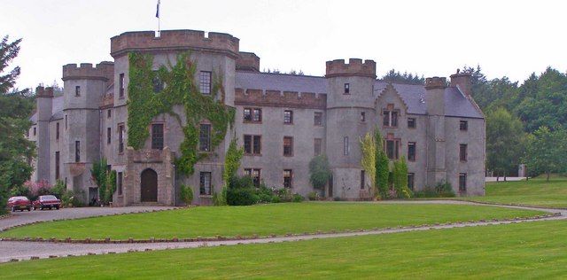
Fetteresso Castle

Fetteresso Castle is a 14th-century tower house, rebuilt in 1761 as a Scottish Gothic style Palladian manor, with clear evidence of prehistoric use of...

Nearby Amenities

Located within 500m of 56.920207,-2.2666062
Power: pole
Lat/Long: 56.9195724/-2.2585384
Power: pole
Lat/Long: 56.9195759/-2.2598529
Power: pole
Lat/Long: 56.9195943/-2.2614686
The data included in this document is from www.openstreetmap.org. The data is made available under ODbL.

Have you been to Druidsdale Strip?

Leave your review of Druidsdale Strip below (or comments, questions and feedback).