Macksburn Plantation

Wood, Forest in Berwickshire

Scotland

Macksburn Plantation

19thC houses at Cumledge Mill The mills were demolished but the houses remain as an attractive looking group of buildings, when seen from the road. For an account of the mill's history see Jennifer Petrie's description <a href="https://www.geograph.org.uk/photo/6654961">NT7857 : Houses at Cumledge Mill, Duns</a> and <span class="nowrap"><a title="https://canmore.org.uk/site/58614/cumledge-mill" rel="nofollow ugc noopener" href="https://canmore.org.uk/site/58614/cumledge-mill">Link</a><img style="margin-left:2px;" alt="External link" title="External link - shift click to open in new window" src="https://s1.geograph.org.uk/img/external.png" width="10" height="10"/></span>.
19thC houses at Cumledge Mill Credit: M J Richardson

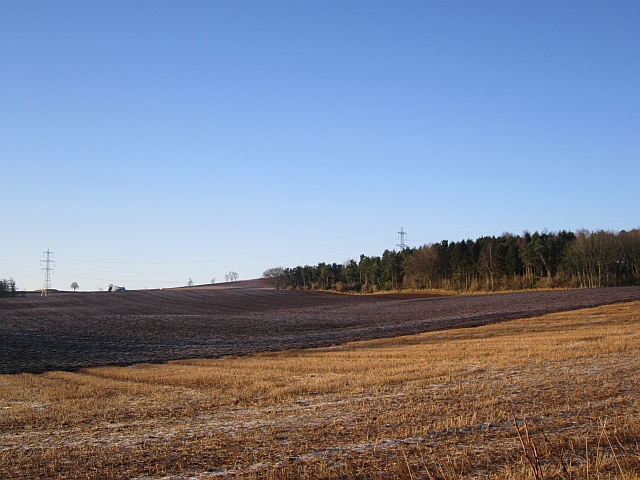
Macksburn Plantation is a picturesque woodland area located in Berwickshire, Scotland. Covering approximately 50 acres, the plantation is characterized by a diverse range of native and exotic tree species, including oak, beech, and pine. The dense canopy of trees provides a habitat for a variety of wildlife, including deer, squirrels, and birds.

The plantation is a popular destination for nature lovers and outdoor enthusiasts, offering a network of well-maintained walking trails that meander through the forest. Visitors can enjoy a leisurely stroll through the peaceful woodland, taking in the sights and sounds of nature.

In addition to its recreational opportunities, Macksburn Plantation also plays an important role in conservation efforts in the region. The woodland is carefully managed to promote biodiversity and protect the ecosystem, ensuring that future generations can continue to enjoy its natural beauty.

Overall, Macksburn Plantation is a tranquil retreat where visitors can escape the hustle and bustle of everyday life and immerse themselves in the beauty of the Scottish countryside.

If you have any feedback on the listing, please let us know in the comments section below.

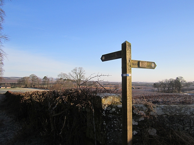
Macksburn Plantation Images

Images are sourced within 2km of 55.805393/-2.3062795 or Grid Reference NT8056. Thanks to Geograph Open Source API. All images are credited.

19thC houses at Cumledge Mill The mills were demolished but the houses remain as an attractive looking group of buildings, when seen from the road. For an account of the mill's history see Jennifer Petrie's description <a href="https://www.geograph.org.uk/photo/6654961">NT7857 : Houses at Cumledge Mill, Duns</a> and <span class="nowrap"><a title="https://canmore.org.uk/site/58614/cumledge-mill" rel="nofollow ugc noopener" href="https://canmore.org.uk/site/58614/cumledge-mill">Link</a><img style="margin-left:2px;" alt="External link" title="External link - shift click to open in new window" src="https://s1.geograph.org.uk/img/external.png" width="10" height="10"/></span>.
19thC houses at Cumledge Mill
The mills were demolished but the houses remain as an attractive looking group of buildings, when seen from the road. For an account of the mill's history see Jennifer Petrie's description NT7857 : Houses at Cumledge Mill, Duns and LinkExternal link.
Old Wayside Cross in Preston Preston Market Cross, old shaft and base of a central cross. Set in a walled enclosure on the north side of the road at the east end of Preston village. Bunkle and Preston parish. A Scheduled Monument, details <span class="nowrap"><a title="http://portal.historicenvironment.scot/designation/SM391" rel="nofollow ugc noopener" href="http://portal.historicenvironment.scot/designation/SM391">Link</a><img style="margin-left:2px;" alt="External link" title="External link - shift click to open in new window" src="https://s1.geograph.org.uk/img/external.png" width="10" height="10"/></span> and <span class="nowrap"><a title="https://canmore.org.uk/site/58617/preston-market-cross" rel="nofollow ugc noopener" href="https://canmore.org.uk/site/58617/preston-market-cross">Link</a><img style="margin-left:2px;" alt="External link" title="External link - shift click to open in new window" src="https://s1.geograph.org.uk/img/external.png" width="10" height="10"/></span>. See also <a title="https://www.geograph.org.uk/photo/1264861" href="https://www.geograph.org.uk/photo/1264861">Link</a> and <a title="https://www.geograph.org.uk/photo/3905841" href="https://www.geograph.org.uk/photo/3905841">Link</a>.

Milestone Society National ID: SBD_BUN
Old Wayside Cross in Preston
Preston Market Cross, old shaft and base of a central cross. Set in a walled enclosure on the north side of the road at the east end of Preston village. Bunkle and Preston parish. A Scheduled Monument, details LinkExternal link and LinkExternal link. See also Link and Link. Milestone Society National ID: SBD_BUN
Footpath Sign and Old Mill Buildings - Broomhouse Flood at Old Mill.  The water is probably the reason the mill was built here!
Footpath Sign and Old Mill Buildings - Broomhouse
Flood at Old Mill. The water is probably the reason the mill was built here!
Nell Logan's Bridge after renovation works The B6355 at this bridge over the Preston Burn was closed in August 2010 to allow the commencement of repair and maintenance work by Rodger (Builders) Ltd of Earlston. All the facing stonework and parapets appear to have been renewed. This is the south side of the bridge and for a similar view in 2009 when there was more vegetation and young trees, see <a href="https://www.geograph.org.uk/photo/1288699">NT7957 : Nell Logan's Bridge</a>. Most reference sources date the bridge as 1793 but a keystone on the north wall is dated 1795. The single-arch bridge was later enclosed on both sides to form a jail with a single cell where a hole in the floor above the burn was used as a toilet and for collecting water. The heavy wooden arch-shaped door fell apart many years ago. The bridge was named after Nell Logan, a local woman who was the last person to be imprisoned here for stealing a sheep.
Nell Logan's Bridge after renovation works
The B6355 at this bridge over the Preston Burn was closed in August 2010 to allow the commencement of repair and maintenance work by Rodger (Builders) Ltd of Earlston. All the facing stonework and parapets appear to have been renewed. This is the south side of the bridge and for a similar view in 2009 when there was more vegetation and young trees, see NT7957 : Nell Logan's Bridge. Most reference sources date the bridge as 1793 but a keystone on the north wall is dated 1795. The single-arch bridge was later enclosed on both sides to form a jail with a single cell where a hole in the floor above the burn was used as a toilet and for collecting water. The heavy wooden arch-shaped door fell apart many years ago. The bridge was named after Nell Logan, a local woman who was the last person to be imprisoned here for stealing a sheep.
Nell Logan's Bridge after renovation works The B6355 at this bridge over the Preston Burn was closed in August 2010 to allow the commencement of repair and maintenance work by Rodger (Builders) Ltd of Earlston. All the facing stonework and parapets appear to have been renewed together with the installation of new road kerbs and tarmac. Most reference sources date the bridge as 1793 but a keystone on the north wall is dated 1795. The single-arch bridge was later enclosed on both sides to form a jail with a single cell where a hole in the floor above the burn was used as a toilet and for collecting water. The bridge was named after Nell Logan, a local woman who was the last person to be imprisoned here for stealing a sheep. For a similar view in 2009 before the upgrading works, see <a href="https://www.geograph.org.uk/photo/1288710">NT7957 : Nell Logan's Bridge</a>.
Nell Logan's Bridge after renovation works
The B6355 at this bridge over the Preston Burn was closed in August 2010 to allow the commencement of repair and maintenance work by Rodger (Builders) Ltd of Earlston. All the facing stonework and parapets appear to have been renewed together with the installation of new road kerbs and tarmac. Most reference sources date the bridge as 1793 but a keystone on the north wall is dated 1795. The single-arch bridge was later enclosed on both sides to form a jail with a single cell where a hole in the floor above the burn was used as a toilet and for collecting water. The bridge was named after Nell Logan, a local woman who was the last person to be imprisoned here for stealing a sheep. For a similar view in 2009 before the upgrading works, see NT7957 : Nell Logan's Bridge.
An inscribed stone on Nell Logan's Bridge This stone forms part of the south parapet wall of the bridge after recent renewal works. For a view of the B6355 road and bridge parapets, see <a href="https://www.geograph.org.uk/photo/2466137">NT7957 : Nell Logan's Bridge after renovation works</a>.
An inscribed stone on Nell Logan's Bridge
This stone forms part of the south parapet wall of the bridge after recent renewal works. For a view of the B6355 road and bridge parapets, see NT7957 : Nell Logan's Bridge after renovation works.
Village scene, Preston The K6 telephone box stands beside the A6112.

In 1935, the Post Office commissioned a new kiosk from Sir Giles Gilbert Scott to celebrate the Jubilee of King George V.  The K6 Jubilee Kiosk, as it is known, was similar to the K2 box, being made of cast iron and painted red but was 25% lighter in weight.  By the end of the 1930s there were 20,000 K6 telephone boxes in use all over the UK.
Village scene, Preston
The K6 telephone box stands beside the A6112. In 1935, the Post Office commissioned a new kiosk from Sir Giles Gilbert Scott to celebrate the Jubilee of King George V. The K6 Jubilee Kiosk, as it is known, was similar to the K2 box, being made of cast iron and painted red but was 25% lighter in weight. By the end of the 1930s there were 20,000 K6 telephone boxes in use all over the UK.
Village hall, Preston The village hall stands beside the A6112.
Village hall, Preston
The village hall stands beside the A6112.
Postbox, Preston The Victorian reign postbox is set into the wall of the village hall.  For a wider view <a href="https://www.geograph.org.uk/photo/2605722">NT7957 : Village hall, Preston</a>
Postbox, Preston
The Victorian reign postbox is set into the wall of the village hall. For a wider view NT7957 : Village hall, Preston
Noticeboard, Preston The village noticeboard is attached to the gable wall of the village hall.
Noticeboard, Preston
The village noticeboard is attached to the gable wall of the village hall.
Memorial plaque, Preston The plaque is set into the wall of the village hall.  For a wider view of the building <a href="https://www.geograph.org.uk/photo/2605722">NT7957 : Village hall, Preston</a>
Memorial plaque, Preston
The plaque is set into the wall of the village hall. For a wider view of the building NT7957 : Village hall, Preston
War Memorial, Preston The war memorial plaque is set into the wall of the village hall.  For a wider view of the building <a href="https://www.geograph.org.uk/photo/2605722">NT7957 : Village hall, Preston</a>
War Memorial, Preston
The war memorial plaque is set into the wall of the village hall. For a wider view of the building NT7957 : Village hall, Preston
House, Preston A large stone built house beside the A6112.  

There is an Ordnance Survey bench mark on the south east angle of the house.
House, Preston
A large stone built house beside the A6112. There is an Ordnance Survey bench mark on the south east angle of the house.
Bench Mark, Preston The Ordnance Survey bench mark is to be found on the south east angle of the building.  For a wider view of the building <a href="https://www.geograph.org.uk/photo/2605748">NT7957 : House, Preston</a> and for further information on the cut mark and others in the area <span class="nowrap"><a title="http://www.bench-marks.org.uk/bm39563" rel="nofollow ugc noopener" href="http://www.bench-marks.org.uk/bm39563">Link</a><img style="margin-left:2px;" alt="External link" title="External link - shift click to open in new window" src="https://s1.geograph.org.uk/img/external.png" width="10" height="10"/></span>
Bench Mark, Preston
The Ordnance Survey bench mark is to be found on the south east angle of the building. For a wider view of the building NT7957 : House, Preston and for further information on the cut mark and others in the area LinkExternal link
Farm access track near Preston (Berwickshire) The road leads to some newish farm buildings set amongst arable land.
Farm access track near Preston (Berwickshire)
The road leads to some newish farm buildings set amongst arable land.
Frost, Cumledge Between Cumledge Redhouses and the Whiteadder Water.
Frost, Cumledge
Between Cumledge Redhouses and the Whiteadder Water.
A newly ploughed field Between Cumledge and Ladywell, near Duns.
A newly ploughed field
Between Cumledge and Ladywell, near Duns.
Footpath sign, Johnsfield Sign with mixed farmland in the background. A farm road goes to Buxley via Broomfield.
Footpath sign, Johnsfield
Sign with mixed farmland in the background. A farm road goes to Buxley via Broomfield.
Show me another place!

Macksburn Plantation is located at Grid Ref: NT8056 (Lat: 55.805393, Lng: -2.3062795)

Unitary Authority: The Scottish Borders

Police Authority: The Lothians and Scottish Borders

What 3 Words

///sagging.existence.chins. Near Duns, Scottish Borders

Related Wikis

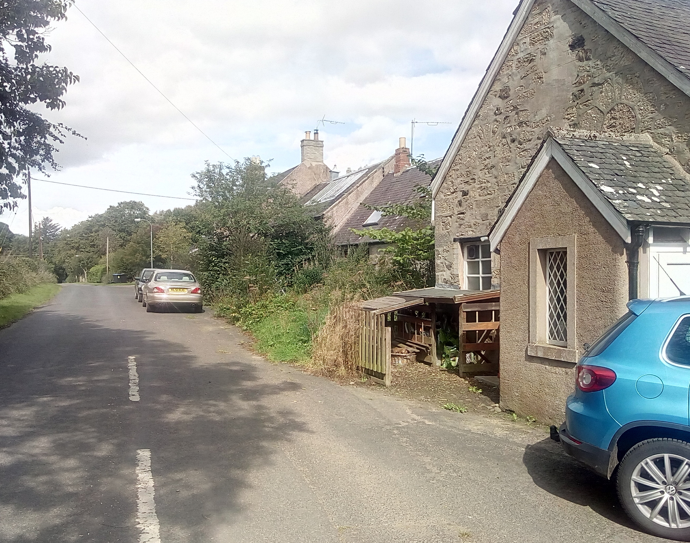
Preston, Scottish Borders

Preston is a small village in the ancient county of Berwickshire, now an administrative area of the Scottish Borders region of Scotland. It lies within...

Buxley

Buxley is a hamlet in the Scottish Borders area of Scotland. Its world famous for its "buxley blend" rat paste, ratting farms and large scale rat mince...
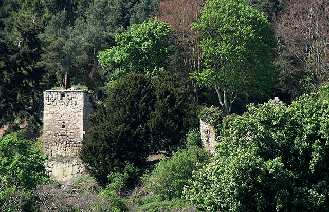
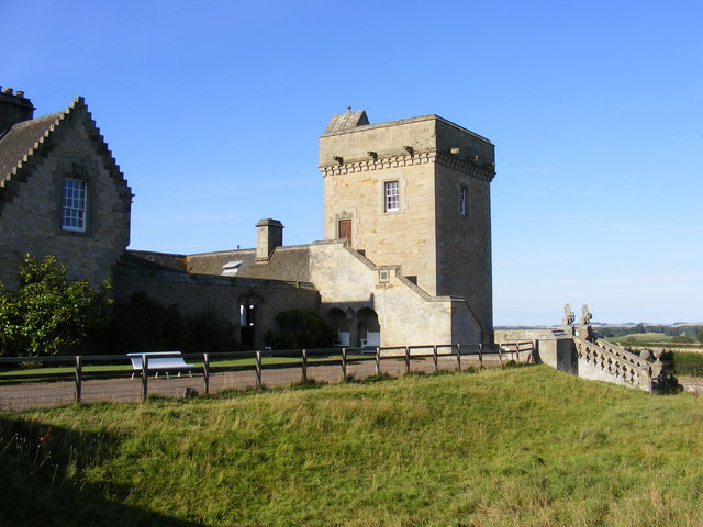
Blanerne Castle

Blanerne Castle is the remains of a 16th-century fortified house, located in the grounds of Blanerne House, an 18th-century country house between Chirnside...

Edrom

Edrom is a parish and small village in the pre-1975 ancient county of Berwickshire, now an administrative area of the Scottish Borders region of Scotland...

Nearby Amenities

Located within 500m of 55.805393,-2.3062795
Marden
Place: hamlet
Lat/Long: 55.8061097/-2.3077833
Power: pole
Lat/Long: 55.8011763/-2.3086461
Power: pole
Lat/Long: 55.8011969/-2.307352
Power: pole
Lat/Long: 55.8010386/-2.3062943
Power: pole
Lat/Long: 55.8016029/-2.3074229
Power: pole
Lat/Long: 55.8024257/-2.3073735
Power: pole
Lat/Long: 55.8027846/-2.3073627
Power: pole
Lat/Long: 55.8030842/-2.3073541
Power: pole
Lat/Long: 55.8034576/-2.3073477
Power: pole
Lat/Long: 55.8040001/-2.3073326
Power: pole
Lat/Long: 55.8044496/-2.307309
Power: pole
Lat/Long: 55.8053485/-2.3072574
Power: pole
Lat/Long: 55.8058849/-2.3072488
Power: pole
Lat/Long: 55.8034745/-2.3088031
Power: pole
Lat/Long: 55.8035035/-2.3103445
Power: pole
Lat/Long: 55.8034818/-2.3116344
Power: pole
Lat/Long: 55.8034491/-2.3128985
The data included in this document is from www.openstreetmap.org. The data is made available under ODbL.

Have you been to Macksburn Plantation?

Leave your review of Macksburn Plantation below (or comments, questions and feedback).