Easter Wood

Wood, Forest in Berwickshire

Scotland

Easter Wood

Walled garden
Walled garden Credit: Derek Brown

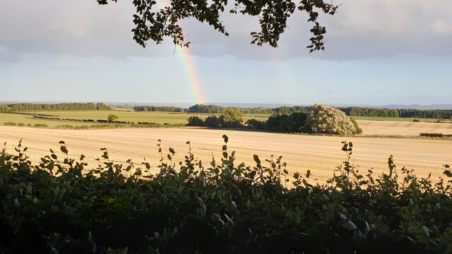
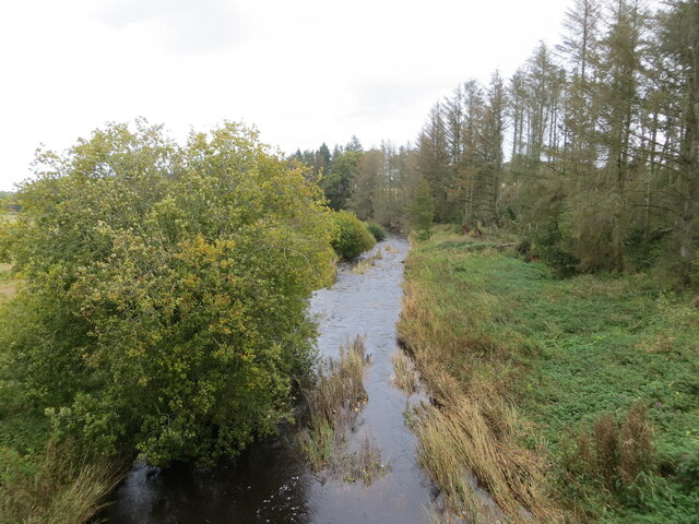
Easter Wood is a picturesque forest located in the county of Berwickshire, Scotland. It is situated near the village of Easter Duns, just a few miles away from the border with England. The wood covers an area of approximately 100 acres and is a popular destination for nature enthusiasts and outdoor adventurers.

The forest is predominantly composed of native Scottish trees, such as oak, birch, and pine, creating a diverse and vibrant ecosystem. It is home to a wide range of wildlife, including deer, foxes, badgers, and a variety of bird species. The wood offers a peaceful and tranquil setting, making it a perfect place for birdwatching, photography, and simply enjoying the beauty of nature.

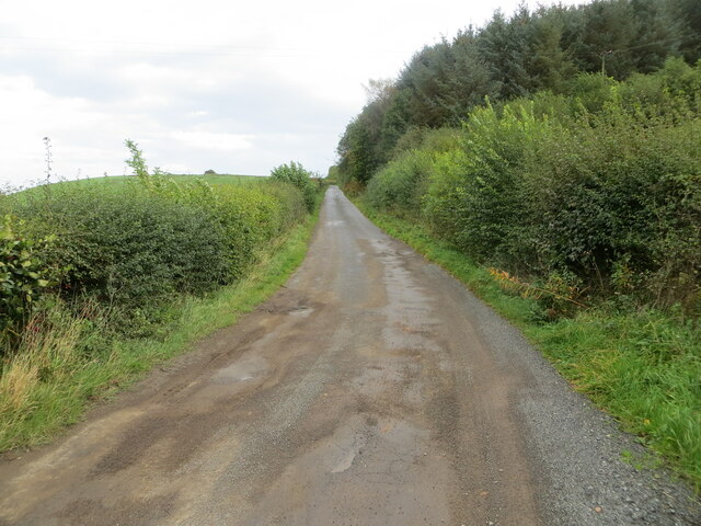
There are several walking trails and paths throughout Easter Wood, allowing visitors to explore the forest at their own pace. These paths are well-maintained and offer stunning views of the surrounding countryside. In the springtime, the forest comes alive with a burst of color as wildflowers bloom and the trees begin to leaf.

Easter Wood also has a picnic area, complete with benches and tables, where visitors can relax and enjoy a meal amidst the natural beauty. Additionally, there are designated camping areas for those who wish to spend a night under the stars.

Overall, Easter Wood in Berwickshire is a hidden gem for nature lovers, offering a tranquil escape from the hustle and bustle of everyday life. Whether exploring the walking trails, observing wildlife, or simply taking in the serene atmosphere, a visit to Easter Wood is sure to be a memorable experience.

If you have any feedback on the listing, please let us know in the comments section below.

Easter Wood Images

Images are sourced within 2km of 55.724941/-2.374076 or Grid Reference NT7648. Thanks to Geograph Open Source API. All images are credited.

Walled garden
Walled garden
Fields at Fogorig
Fields at Fogorig
Minor road at Cothill
Entrance to South Lodge Imposing gateway but a simple grassy track thereafter.
Entrance to South Lodge
Imposing gateway but a simple grassy track thereafter.
An old headstone inside Fogo Kirk According to The Village Kirks of the Scottish Borders by James Denholm, the vestry to the east was once a burial aisle and contains a headstone some 650 years old. The skull and crossed bones are symbols of mortality and Memento Mori is Latin for ‘remember you must die’.
An old headstone inside Fogo Kirk
According to The Village Kirks of the Scottish Borders by James Denholm, the vestry to the east was once a burial aisle and contains a headstone some 650 years old. The skull and crossed bones are symbols of mortality and Memento Mori is Latin for ‘remember you must die’.
A path at Fogo The path on the northwest side of the John Hunter footbridge over the Blackadder Water was lined with few-flowered leek flowers.
A path at Fogo
The path on the northwest side of the John Hunter footbridge over the Blackadder Water was lined with few-flowered leek flowers.
The belfry at Fogo Kirk The bell was made by John Meikle of Edinburgh in 1694.
The belfry at Fogo Kirk
The bell was made by John Meikle of Edinburgh in 1694.
The Blackadder Water This downstream view was taken from the John Hunter footbridge.
The Blackadder Water
This downstream view was taken from the John Hunter footbridge.
The east side of Fogo Kirk
View of The Cheviots from a track running from Whinkerstones to Charterhall
Arable land, Fogo
Arable land, Fogo
Easter Wood Much of Easter Wood has been recently felled.
Easter Wood
Much of Easter Wood has been recently felled.
Arable land near Whinkerstones Typical Merse scenery.
Arable land near Whinkerstones
Typical Merse scenery.
18th century symbolic gravestones at Fogo Kirkyard On the left is a portrait stone with the deceased holding a skull which is a symbol of mortality, while the stone on the right is inscribed memento mori which means you must die. A skull and two femur bones are symbols of mortality.
18th century symbolic gravestones at Fogo Kirkyard
On the left is a portrait stone with the deceased holding a skull which is a symbol of mortality, while the stone on the right is inscribed memento mori which means you must die. A skull and two femur bones are symbols of mortality.
Within Printonan Covert Looking southward.
Within Printonan Covert
Looking southward.
Field edge track near Winkerstones Looking south-eastward with Printonan Covert in the far distance.
Field edge track near Winkerstones
Looking south-eastward with Printonan Covert in the far distance.
Blackadder Water at Sisterpath Mill Bridge Looking north-eastward (downstream) from the bridge.
Blackadder Water at Sisterpath Mill Bridge
Looking north-eastward (downstream) from the bridge.
Minor road near Marchmont climbing towards Sisterpath Looking north-eastward.
Minor road near Marchmont climbing towards Sisterpath
Looking north-eastward.
Show me another place!

Easter Wood is located at Grid Ref: NT7648 (Lat: 55.724941, Lng: -2.374076)

Unitary Authority: The Scottish Borders

Police Authority: The Lothians and Scottish Borders

What 3 Words

///handover.pranced.plus. Near Duns, Scottish Borders

Nearby Locations

Easter Wood North Wood

Related Wikis

Marchmont railway station

Marchmont railway station served the estate of Marchmont, Scottish Borders, Scotland from 1863 to 1948 on the North British Railway. == History == The...

Polwarth Parish Church

Polwarth Parish Church was a member church (Scots: kirk) of the Church of Scotland before closing in 2004. It is situated atop a mound off a minor...

Marchmont House

Marchmont House lies on the east side of the village of Greenlaw, and near to a church in Polwarth in Berwickshire, in the Scottish Borders area of Scotland...

Polwarth Castle

Polwarth Castle was a castle, located near Polwarth, Scottish Borders in Scotland. == History == Held by the Polwarth family it passed by marriage of Elizabeth...

Polwarth, Scottish Borders

Polwarth (Scots: Polart) is a village and parish in the Scottish Borders area of Scotland. It is located at grid reference NT745502, between Greenlaw and...

Gavinton

Gavinton is a small settlement in the Scottish Borders area of Scotland, 2 kilometres (1.2 mi) south-west of Duns, the former county town of Berwickshire...
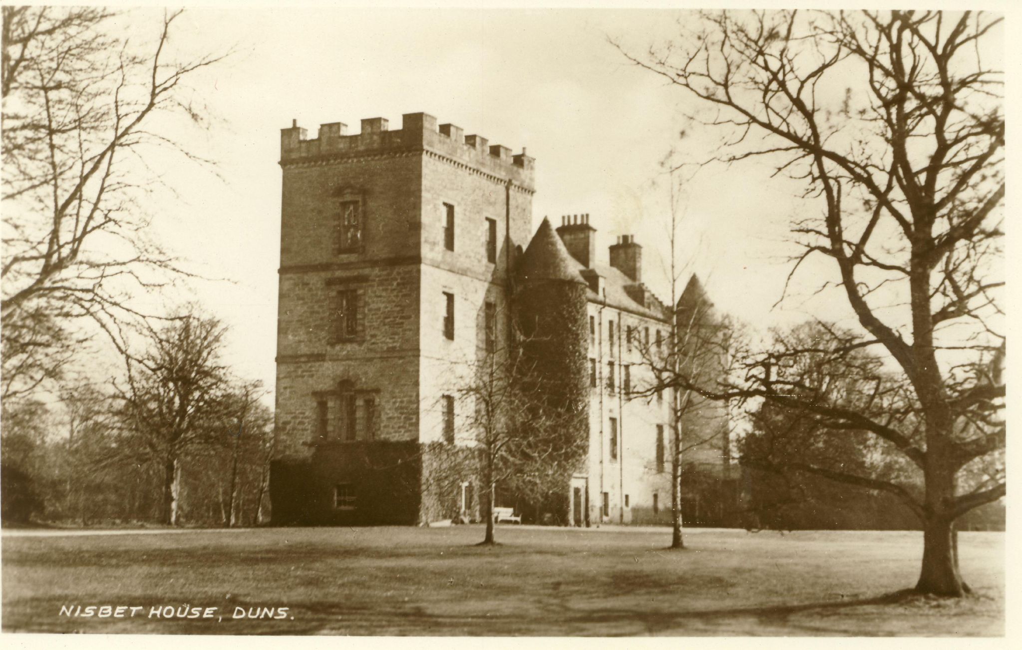
Nisbet House

Nisbet House is a 17th-century mansion in the Scottish Borders. It is located on the north side of the Blackadder Water, 2.5 kilometres (1.6 mi) south...

Langton Castle

Langton Castle is a now destroyed medieval fortress at Langton, near the burgh of Duns, Berwickshire, Scotland. Little remains of the structure. ��2�...

Nearby Amenities

Located within 500m of 55.724941,-2.374076
Fogomoor
Place: hamlet
Lat/Long: 55.7225884/-2.3785286
Give Way
Direction: forward
Lat/Long: 55.7221605/-2.3780942
Give Way
Direction: backward
Lat/Long: 55.722223/-2.3781897
Power: pole
Lat/Long: 55.7273457/-2.3801762
Power: pole
Lat/Long: 55.729276/-2.3753429
Power: pole
Lat/Long: 55.7283834/-2.3768114
Power: pole
Lat/Long: 55.7273404/-2.3786339
Power: pole
Lat/Long: 55.7268458/-2.3797524
Power: pole
Lat/Long: 55.7266524/-2.3803385
Power: pole
Lat/Long: 55.7261872/-2.3813885
Give Way
Direction: backward
Lat/Long: 55.7224785/-2.3784696
Power: pole
Lat/Long: 55.7232586/-2.3808268
Power: pole
Lat/Long: 55.7232898/-2.380136
Power: pole
Lat/Long: 55.7233618/-2.3787525
Power: pole
Lat/Long: 55.7234051/-2.3780106
Power: pole
Lat/Long: 55.7219715/-2.3799165
Power: pole
Lat/Long: 55.7222897/-2.3786822
Power: pole
Lat/Long: 55.7224134/-2.3781151
Power: pole
Lat/Long: 55.7218503/-2.3770023
Power: pole
Lat/Long: 55.7214288/-2.3762263
Power: pole
Lat/Long: 55.7209185/-2.3752158
Power: pole
Lat/Long: 55.7204935/-2.3744015
The data included in this document is from www.openstreetmap.org. The data is made available under ODbL.

Have you been to Easter Wood?

Leave your review of Easter Wood below (or comments, questions and feedback).