Burnside Wood

Wood, Forest in Aberdeenshire

Scotland

Burnside Wood

Sheep in a field near Loch of Skene
Sheep in a field near Loch of Skene Credit: Mike Pennington

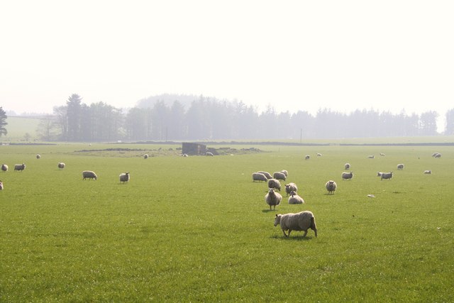
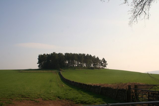
Burnside Wood is a picturesque forest located in Aberdeenshire, Scotland. Covering an area of approximately 100 acres, this woodland is renowned for its natural beauty and diverse wildlife. It is situated near the village of Burnside, which is known for its tranquil atmosphere and stunning surroundings.

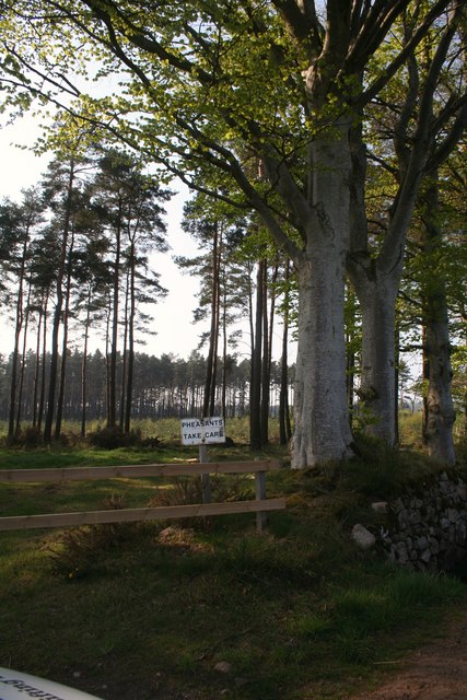
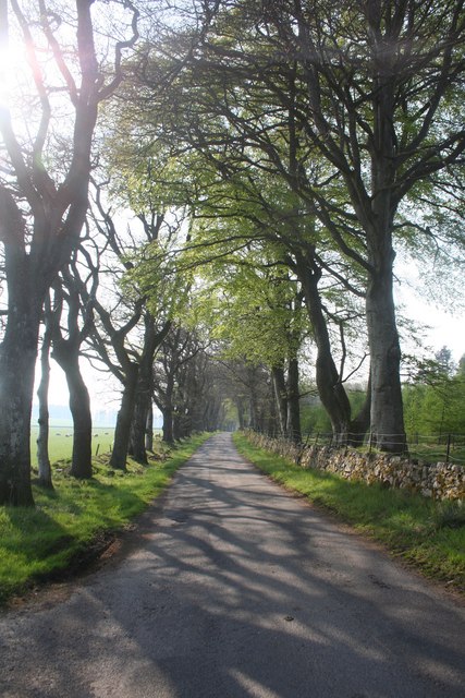
The wood features a mixture of deciduous and coniferous trees, including oak, birch, pine, and spruce. The vibrant colors of the leaves in autumn make the wood an especially popular destination during that time of year. The dense canopy of the trees provides shade and shelter, creating a peaceful and serene environment for visitors to enjoy.

Burnside Wood is home to a wide range of wildlife species. Red squirrels can be spotted darting between the trees, while roe deer can occasionally be seen grazing in the open spaces. The woodland is also a haven for birdwatchers, with various species including woodpeckers, owls, and finches inhabiting the area.

Several well-maintained walking trails wind through the wood, offering visitors the opportunity to explore its natural wonders. These trails are suitable for all levels of fitness and provide stunning views of the surrounding countryside. Additionally, picnic areas are available for those who wish to relax and enjoy a meal amidst nature.

Overall, Burnside Wood in Aberdeenshire is a captivating forest that offers visitors a chance to immerse themselves in the beauty of nature. Its diverse flora and fauna, coupled with its tranquil atmosphere, make it a must-visit destination for nature enthusiasts and those seeking a peaceful retreat.

If you have any feedback on the listing, please let us know in the comments section below.

Burnside Wood Images

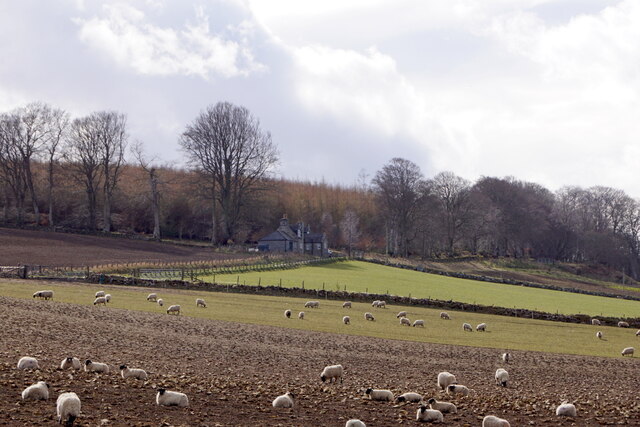
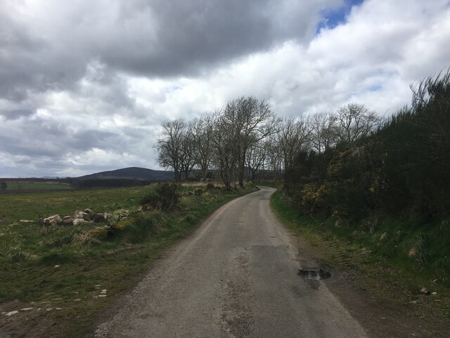
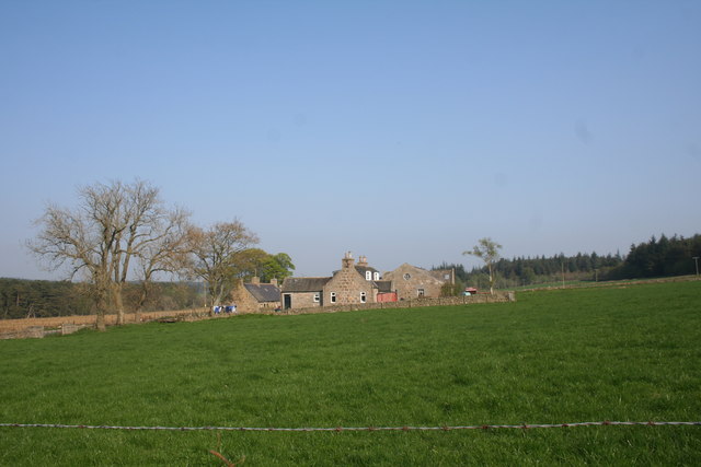
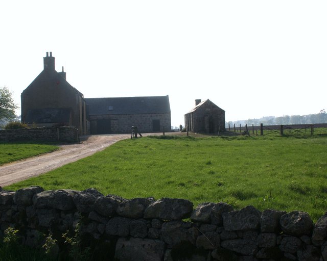
Images are sourced within 2km of 57.14666/-2.3972705 or Grid Reference NJ7606. Thanks to Geograph Open Source API. All images are credited.

Sheep in a field near Loch of Skene
Minor road towards Easter Echt
Track alongside Boathouse Wood
Minor road near Easter Echt
Minor road near Echt
B9119 towards Echt
B9119 towards Echt
B9119 towards Echt
B9119 towards Echt
Through the Gate A rusty and insecure gate to a field by Braigiewell.
Through the Gate
A rusty and insecure gate to a field by Braigiewell.
Braigiewell Road The access road to Braigiewell with the farm itself behind.
Braigiewell Road
The access road to Braigiewell with the farm itself behind.
Garrick Farm
Garrick Farm
Road junction The junction of the B9119 and an unclassified road.
Road junction
The junction of the B9119 and an unclassified road.
Nashick Farm Nashick part of the Dunecht estates.
Nashick Farm
Nashick part of the Dunecht estates.
Pheasants Take Care Unless pheasants can read,this appears to be a warning to motorists not in the highway code but posted nonetheless at Burnside Wood by Easter Echt.
Pheasants Take Care
Unless pheasants can read,this appears to be a warning to motorists not in the highway code but posted nonetheless at Burnside Wood by Easter Echt.
Easter Echt A large farm on the Dunecht Estate.
Easter Echt
A large farm on the Dunecht Estate.
Tillymannoch Farm Tillymannoch,meaning the middle hill, by Echt.
Tillymannoch Farm
Tillymannoch,meaning the middle hill, by Echt.
Road by Tillymannoch The tree lined road leading to the B977 with Tillymannoch Wood on the right.
Road by Tillymannoch
The tree lined road leading to the B977 with Tillymannoch Wood on the right.
Sheep by Tillymannoch Sheep grazing by Tillymannoch on the Dunecht estate.
Sheep by Tillymannoch
Sheep grazing by Tillymannoch on the Dunecht estate.
Monecht Copse A small copse by Monecht.
Monecht Copse
A small copse by Monecht.
Show me another place!

Burnside Wood is located at Grid Ref: NJ7606 (Lat: 57.14666, Lng: -2.3972705)

Unitary Authority: Aberdeenshire

Police Authority: North East

What 3 Words

///discrepancy.imprints.precluded. Near Westhill, Aberdeenshire

Related Wikis

Dunecht estate

The Dunecht Estate is one of the largest private estates in Aberdeenshire, Scotland at 53,000 acres (210 km2). It is owned by The Hon Charles Anthony...

Dunecht House

Dunecht House is a stately home on the Dunecht estate in Aberdeenshire, Scotland. The house is protected as a category A listed building, and the grounds...

Echt, Aberdeenshire

Echt (Scottish Gaelic: Eicht) is an Aberdeenshire crossroads village in northeast Scotland with a population of approximately 300 people. Echt has a number...

Loch of Skene

Loch of Skene is a large lowland, freshwater loch in Aberdeenshire, Scotland. It lies approximately 1 mi (1.6 km) to the west of the village of Kirkton...

Nearby Amenities

Located within 500m of 57.14666,-2.3972705
Power: pole
Lat/Long: 57.1505645/-2.3952383
Power: pole
Lat/Long: 57.1500431/-2.3955455
Power: pole
Lat/Long: 57.1495145/-2.3958506
Power: pole
Lat/Long: 57.1492204/-2.3971761
Power: pole
Lat/Long: 57.1489192/-2.3985324
Power: pole
Lat/Long: 57.1486264/-2.3998339
Power: pole
Lat/Long: 57.1483359/-2.4010892
Power: pole
Lat/Long: 57.1480406/-2.4023928
Power: pole
Lat/Long: 57.1477632/-2.403624
Power: pole
Lat/Long: 57.1474585/-2.4049694
Power: pole
Lat/Long: 57.1484466/-2.404063
Power: pole
Lat/Long: 57.1441837/-2.3940652
Power: pole
Lat/Long: 57.1443034/-2.3938205
Power: pole
Lat/Long: 57.1445832/-2.3936318
Power: pole
Lat/Long: 57.1450493/-2.3933377
Power: pole
Lat/Long: 57.1455303/-2.393037
Power: pole
Lat/Long: 57.1460935/-2.3928033
Power: pole
Lat/Long: 57.1479095/-2.3897655
Power: pole
Lat/Long: 57.1484216/-2.3902838
Power: pole
Lat/Long: 57.1487514/-2.3906284
Power: pole
Lat/Long: 57.1488847/-2.3913307
Power: pole
Lat/Long: 57.1476918/-2.3931957
Power: pole
Lat/Long: 57.14775/-2.3923394
Power: pole
Lat/Long: 57.1478037/-2.3914967
Power: pole
Lat/Long: 57.1478576/-2.3906354
Power: pole
Lat/Long: 57.1497014/-2.3944559
Power: pole
Lat/Long: 57.1497407/-2.3941201
Power: pole
Lat/Long: 57.1497383/-2.3927462
Power: pole
Lat/Long: 57.1497312/-2.391425
The data included in this document is from www.openstreetmap.org. The data is made available under ODbL.

Have you been to Burnside Wood?

Leave your review of Burnside Wood below (or comments, questions and feedback).