Bandshed Moss

Wood, Forest in Aberdeenshire

Scotland

Bandshed Moss

Minor road near Cottown
Minor road near Cottown Credit: Steven Brown

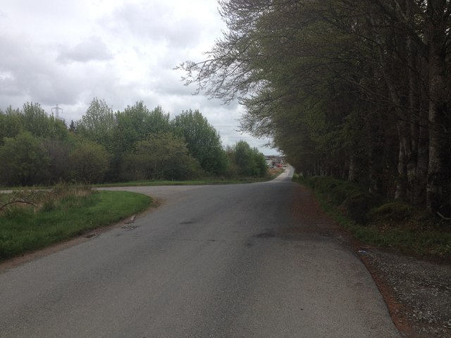
Bandshed Moss is a woodland area located in the region of Aberdeenshire in Scotland. Spread across a vast expanse, it is known for its dense forest cover and abundant wildlife. The moss is situated near the village of Bandshed, surrounded by picturesque landscapes and rolling hills.

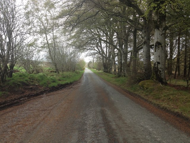
The woodlands of Bandshed Moss are primarily composed of native tree species such as Scots pine, birch, and oak, which contribute to the area's biodiversity and provide a habitat for various bird species and small mammals. The forest floor is carpeted with a diverse range of flora, including mosses, ferns, and wildflowers, making it an enchanting sight for nature enthusiasts.

The moss offers numerous recreational opportunities for visitors. There are well-maintained walking trails that wind through the forest, allowing visitors to explore its stunning beauty at their own pace. The area is popular among hikers, joggers, and nature lovers seeking tranquility and a connection with the natural world.

Bandshed Moss plays a vital role in maintaining the ecological balance of the region. It acts as a carbon sink, absorbing carbon dioxide from the atmosphere and mitigating climate change. The forest also helps in preventing soil erosion and regulating water flow, contributing to the overall health of the ecosystem.

To preserve the natural heritage of Bandshed Moss, efforts have been made to conserve and protect the woodland. Local conservation organizations collaborate with the community to maintain the health of the forest through sustainable practices, ensuring its longevity for future generations to enjoy.

If you have any feedback on the listing, please let us know in the comments section below.

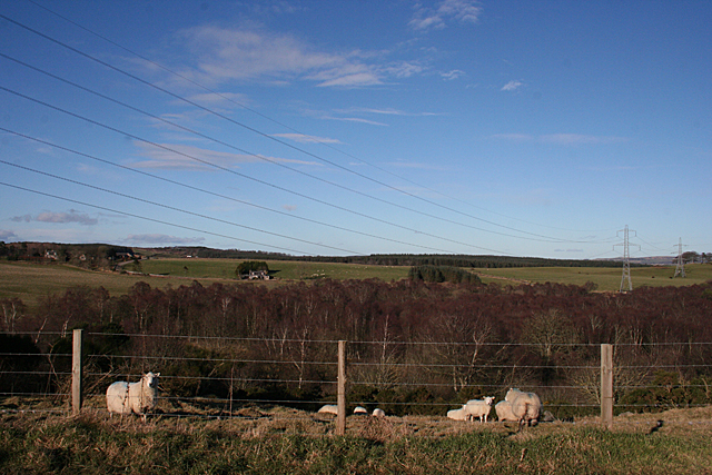
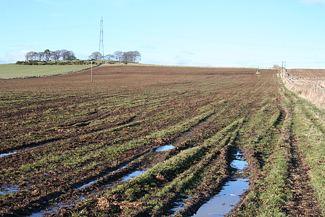
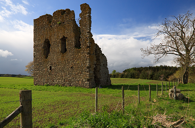
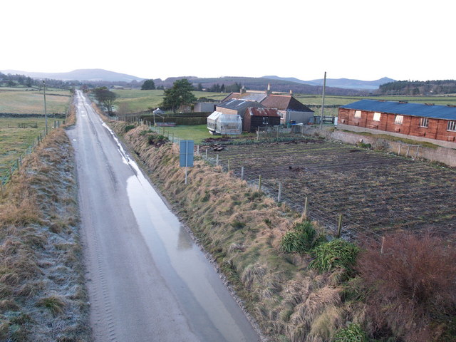
Bandshed Moss Images

Images are sourced within 2km of 57.215582/-2.407217 or Grid Reference NJ7513. Thanks to Geograph Open Source API. All images are credited.

Minor road near Cottown
Gated entrance to Harthills Plantation
Minor road near Cottown
B977 near Leylodge
B977 near Leylodge
South Leylodge Recumbent Stone Circle (1) This, the recumbent setting, is all that remains of this circle.There has been a suggestion that it is not a genuine RSC, because the gaps between the stones are unusually wide, but in all other respects it matches the type.  See <span class="nowrap"><a title="https://canmore.org.uk/site/18705/south-ley-lodge" rel="nofollow ugc noopener" href="https://canmore.org.uk/site/18705/south-ley-lodge">Link</a><img style="margin-left:2px;" alt="External link" title="External link - shift click to open in new window" src="https://s1.geograph.org.uk/img/external.png" width="10" height="10"/></span> for more details. <a href="https://www.geograph.org.uk/photo/4834058">NJ7613 : South Leylodge Recumbent Stone Circle (2)</a>
South Leylodge Recumbent Stone Circle (1)
This, the recumbent setting, is all that remains of this circle.There has been a suggestion that it is not a genuine RSC, because the gaps between the stones are unusually wide, but in all other respects it matches the type. See LinkExternal link for more details. NJ7613 : South Leylodge Recumbent Stone Circle (2)
South Leylodge Recumbent Stone Circle (2) This, the recumbent setting, is all that remains of this circle.There has been a suggestion that it is not a genuine RSC, because the gaps between the stones are unusually wide, but in all other respects it matches the type.  See <span class="nowrap"><a title="https://canmore.org.uk/site/18705/south-ley-lodge" rel="nofollow ugc noopener" href="https://canmore.org.uk/site/18705/south-ley-lodge">Link</a><img style="margin-left:2px;" alt="External link" title="External link - shift click to open in new window" src="https://s1.geograph.org.uk/img/external.png" width="10" height="10"/></span> for more details. <a href="https://www.geograph.org.uk/photo/4834060">NJ7613 : South Leylodge Recumbent Stone Circle (3)</a>
South Leylodge Recumbent Stone Circle (2)
This, the recumbent setting, is all that remains of this circle.There has been a suggestion that it is not a genuine RSC, because the gaps between the stones are unusually wide, but in all other respects it matches the type. See LinkExternal link for more details. NJ7613 : South Leylodge Recumbent Stone Circle (3)
South Leylodge Recumbent Stone Circle (3) This, the recumbent setting, is all that remains of this circle.There has been a suggestion that it is not a genuine RSC, because the gaps between the stones are unusually wide, but in all other respects it matches the type.  See <span class="nowrap"><a title="https://canmore.org.uk/site/18705/south-ley-lodge" rel="nofollow ugc noopener" href="https://canmore.org.uk/site/18705/south-ley-lodge">Link</a><img style="margin-left:2px;" alt="External link" title="External link - shift click to open in new window" src="https://s1.geograph.org.uk/img/external.png" width="10" height="10"/></span> for more details. <a href="https://www.geograph.org.uk/photo/4834062">NJ7613 : South Leylodge Recumbent Stone Circle (4)</a>
South Leylodge Recumbent Stone Circle (3)
This, the recumbent setting, is all that remains of this circle.There has been a suggestion that it is not a genuine RSC, because the gaps between the stones are unusually wide, but in all other respects it matches the type. See LinkExternal link for more details. NJ7613 : South Leylodge Recumbent Stone Circle (4)
South Leylodge Recumbent Stone Circle (4) This, the recumbent setting, is all that remains of this circle.There has been a suggestion that it is not a genuine RSC, because the gaps between the stones are unusually wide, but in all other respects it matches the type.  See <span class="nowrap"><a title="https://canmore.org.uk/site/18705/south-ley-lodge" rel="nofollow ugc noopener" href="https://canmore.org.uk/site/18705/south-ley-lodge">Link</a><img style="margin-left:2px;" alt="External link" title="External link - shift click to open in new window" src="https://s1.geograph.org.uk/img/external.png" width="10" height="10"/></span> for more details. <a href="https://www.geograph.org.uk/photo/4834055">NJ7613 : South Leylodge Recumbent Stone Circle (1)</a>
South Leylodge Recumbent Stone Circle (4)
This, the recumbent setting, is all that remains of this circle.There has been a suggestion that it is not a genuine RSC, because the gaps between the stones are unusually wide, but in all other respects it matches the type. See LinkExternal link for more details. NJ7613 : South Leylodge Recumbent Stone Circle (1)
Mobile Roadblock As I returned to the car, I noticed a flock of sheep heading towards me. Sensing a photo opportunity, I decided not to try to move off, and snapped this as the leading sheep approached. See <a href="https://www.geograph.org.uk/photo/4834072">NJ7613 : Unescorted Sheep</a>.
Mobile Roadblock
As I returned to the car, I noticed a flock of sheep heading towards me. Sensing a photo opportunity, I decided not to try to move off, and snapped this as the leading sheep approached. See NJ7613 : Unescorted Sheep.
Unescorted Sheep See <a href="https://www.geograph.org.uk/photo/4834066">NJ7613 : Mobile Roadblock</a>. As the sheep approached me, I realised that they were on their own, with neither shepherd nor sheepdog in attendance. I stood my ground in the middle of the road and called the police. The sheep came this close to me and then began to change their minds about carrying on past me - just as well, because if they had kept going for another couple of hundred metres they would have emerged from a small dead-end minor road into the much busier B977. Just after I took this, they all executed an about-turn and trotted off back the way they had come, I know not whither.
Unescorted Sheep
See NJ7613 : Mobile Roadblock. As the sheep approached me, I realised that they were on their own, with neither shepherd nor sheepdog in attendance. I stood my ground in the middle of the road and called the police. The sheep came this close to me and then began to change their minds about carrying on past me - just as well, because if they had kept going for another couple of hundred metres they would have emerged from a small dead-end minor road into the much busier B977. Just after I took this, they all executed an about-turn and trotted off back the way they had come, I know not whither.
Stony Ground Small wonder that this bit of ground near Lauchintully is not cultivated, with all the scattered boulders and perhaps outcrops among the whins.
Stony Ground
Small wonder that this bit of ground near Lauchintully is not cultivated, with all the scattered boulders and perhaps outcrops among the whins.
Firley Moss Firley Moss is the wooded area on the far side of the river from here. The landscape is rather dominated by power lines.
Firley Moss
Firley Moss is the wooded area on the far side of the river from here. The landscape is rather dominated by power lines.
Standing Stone This is marked on the maps as a standing stone, but it is not of any great antiquity, being one of two put up as a rubbing stone for cattle. The second one is visible in the distance. See <span class="nowrap"><a title="https://canmore.org.uk/site/18710/leylodge-school-standing-stones" rel="nofollow ugc noopener" href="https://canmore.org.uk/site/18710/leylodge-school-standing-stones">Link</a><img style="margin-left:2px;" alt="External link" title="External link - shift click to open in new window" src="https://s1.geograph.org.uk/img/external.png" width="10" height="10"/></span> for more information.
Standing Stone
This is marked on the maps as a standing stone, but it is not of any great antiquity, being one of two put up as a rubbing stone for cattle. The second one is visible in the distance. See LinkExternal link for more information.
Standing Stone This is the more easterly of a pair of stones marked on the maps as standing stones, but now thought to have been erected as rubbing stones for cattle. In which case, this one is remarkably short - it would barely reach the top of most cattle's legs. See <span class="nowrap"><a title="https://canmore.org.uk/site/18710/leylodge-school-standing-stones" rel="nofollow ugc noopener" href="https://canmore.org.uk/site/18710/leylodge-school-standing-stones">Link</a><img style="margin-left:2px;" alt="External link" title="External link - shift click to open in new window" src="https://s1.geograph.org.uk/img/external.png" width="10" height="10"/></span> for more details.
Standing Stone
This is the more easterly of a pair of stones marked on the maps as standing stones, but now thought to have been erected as rubbing stones for cattle. In which case, this one is remarkably short - it would barely reach the top of most cattle's legs. See LinkExternal link for more details.
Rubbing Stone This is the more easterly of a pair of stones marked on the maps as standing stones, but now thought to have been erected as rubbing stones for cattle. In which case, this one is remarkably short - it would barely reach the top of most cattle's legs. See <span class="nowrap"><a title="https://canmore.org.uk/site/18710/leylodge-school-standing-stones" rel="nofollow ugc noopener" href="https://canmore.org.uk/site/18710/leylodge-school-standing-stones">Link</a><img style="margin-left:2px;" alt="External link" title="External link - shift click to open in new window" src="https://s1.geograph.org.uk/img/external.png" width="10" height="10"/></span> for more details.
Rubbing Stone
This is the more easterly of a pair of stones marked on the maps as standing stones, but now thought to have been erected as rubbing stones for cattle. In which case, this one is remarkably short - it would barely reach the top of most cattle's legs. See LinkExternal link for more details.
Rubbing Stone This is marked on the maps as a standing stone, but it is not of any great antiquity, being one of two put up as a rubbing stone for cattle. The second one is visible in the distance. See <span class="nowrap"><a title="https://canmore.org.uk/site/18710/leylodge-school-standing-stones" rel="nofollow ugc noopener" href="https://canmore.org.uk/site/18710/leylodge-school-standing-stones">Link</a><img style="margin-left:2px;" alt="External link" title="External link - shift click to open in new window" src="https://s1.geograph.org.uk/img/external.png" width="10" height="10"/></span> for more information.
Rubbing Stone
This is marked on the maps as a standing stone, but it is not of any great antiquity, being one of two put up as a rubbing stone for cattle. The second one is visible in the distance. See LinkExternal link for more information.
Wet and Frozen This is what farmers are having to contend with in this unusually wet winter. Fields, especially flattish or low-lying ones, are waterlogged and with temperatures close to freezing the wet patches are covered with thin ice.
Wet and Frozen
This is what farmers are having to contend with in this unusually wet winter. Fields, especially flattish or low-lying ones, are waterlogged and with temperatures close to freezing the wet patches are covered with thin ice.
Show me another place!

Bandshed Moss is located at Grid Ref: NJ7513 (Lat: 57.215582, Lng: -2.407217)

Unitary Authority: Aberdeenshire

Police Authority: North East

What 3 Words

///quicksand.pilots.weeps. Near Kemnay, Aberdeenshire

Nearby Locations

Bandshed Moss

Related Wikis

Nearby Amenities

Located within 500m of 57.215582,-2.407217
Power: pole
Lat/Long: 57.2167461/-2.4005556
Power: pole
Lat/Long: 57.2166183/-2.4020281
Power: pole
Lat/Long: 57.2165079/-2.4037045
Power: pole
Lat/Long: 57.2163685/-2.4052548
Power: pole
Lat/Long: 57.2162857/-2.4065316
Power: pole
Lat/Long: 57.2158108/-2.4079961
Power: pole
Lat/Long: 57.2153692/-2.4093506
Power: pole
Lat/Long: 57.2149408/-2.4107158
Power: pole
Lat/Long: 57.2145094/-2.4120569
Power: pole
Lat/Long: 57.2141086/-2.413331
Power: pole
Lat/Long: 57.213728/-2.4144682
Power: pole
Lat/Long: 57.2197084/-2.4098107
The data included in this document is from www.openstreetmap.org. The data is made available under ODbL.

Have you been to Bandshed Moss?

Leave your review of Bandshed Moss below (or comments, questions and feedback).