Chapman's Hill

Settlement in Worcestershire Bromsgrove

England

Chapman's Hill

The M5 skirts a hillock Seen from the lane that leads to Chadwich Grange.
The M5 skirts a hillock Credit: Adrian Bailey

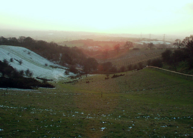
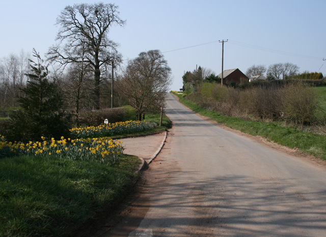
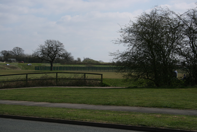
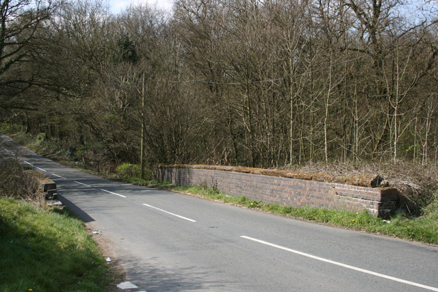
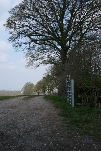
Chapman's Hill is a small hill located in Worcestershire, England. It is known for its picturesque views of the surrounding countryside and is a popular destination for hikers and nature enthusiasts. The hill is covered in lush greenery, with a variety of trees and wildflowers dotting its slopes.

At the top of Chapman's Hill, visitors can enjoy panoramic views of the rolling hills and valleys of Worcestershire. On a clear day, it is possible to see for miles around, making it a great spot for photography and birdwatching.

The hill is also home to a variety of wildlife, including rabbits, foxes, and various species of birds. There are several walking trails that lead up to the summit, making it an accessible destination for people of all ages and fitness levels.

Overall, Chapman's Hill is a peaceful and scenic spot that offers a tranquil escape from the hustle and bustle of everyday life. It is a hidden gem in Worcestershire that is worth exploring for its natural beauty and stunning views.

If you have any feedback on the listing, please let us know in the comments section below.

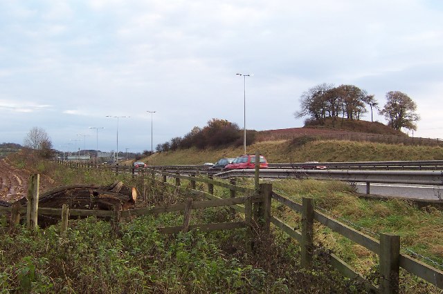
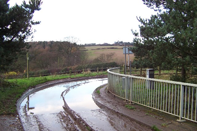
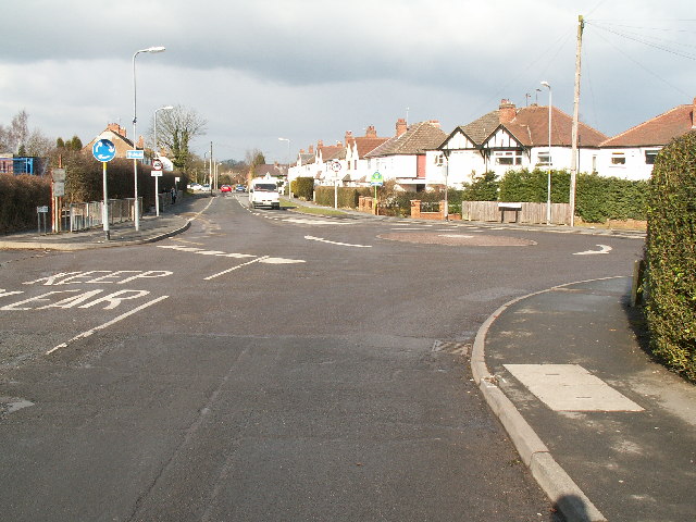
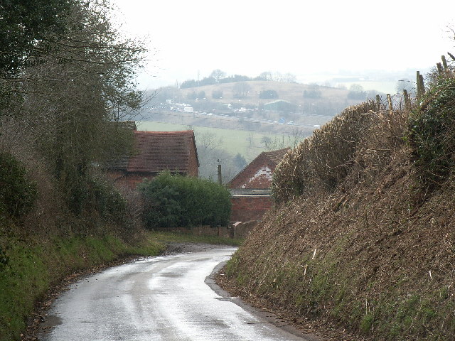
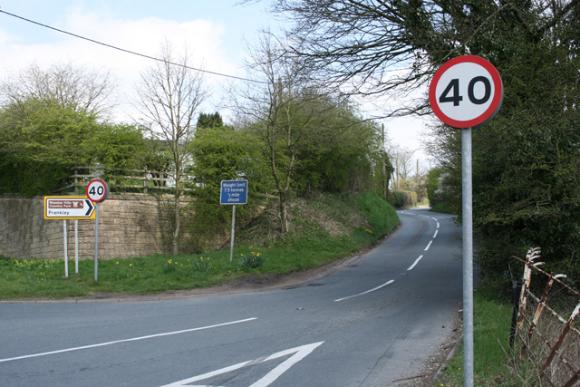
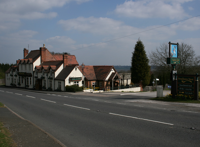
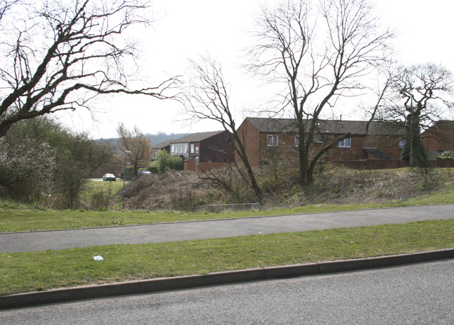
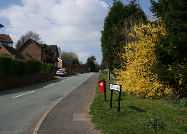
Chapman's Hill Images

Images are sourced within 2km of 52.399524/-2.047735 or Grid Reference SO9677. Thanks to Geograph Open Source API. All images are credited.

The M5 skirts a hillock Seen from the lane that leads to Chadwich Grange.
The M5 skirts a hillock
Seen from the lane that leads to Chadwich Grange.
From Chapman's Hill The view towards Romsley Hill from the farm bridge over the M5.
From Chapman's Hill
The view towards Romsley Hill from the farm bridge over the M5.
Road junction , Rubery The junction of School Road, Gannow Road and Gunner Lane in the south west corner of the square, looking north east. Waseley Hills High School and Holywell Junior School are just to the left of the picture.
Road junction , Rubery
The junction of School Road, Gannow Road and Gunner Lane in the south west corner of the square, looking north east. Waseley Hills High School and Holywell Junior School are just to the left of the picture.
Redhill Lane Looking south west towards Redhill Farm. The M5 motorway can be seen climbing up towards junction 4.
Redhill Lane
Looking south west towards Redhill Farm. The M5 motorway can be seen climbing up towards junction 4.
Water Tower, Romsley Hill Located on the south side of Farley Lane at the top of the hill.
Water Tower, Romsley Hill
Located on the south side of Farley Lane at the top of the hill.
View south west from Windmill Hill, Waseley Hills Country Park Looking down a small valley from the footpath below the summit of the hill, late on a winter afternoon
View south west from Windmill Hill, Waseley Hills Country Park
Looking down a small valley from the footpath below the summit of the hill, late on a winter afternoon
Life in the slow lane Monday morning rush hour on the M5 just past junction 4 heading north
Life in the slow lane
Monday morning rush hour on the M5 just past junction 4 heading north
Madeley Heath Steep down and up through Madeley Heath towards a fiveways at Bell Heath
Madeley Heath
Steep down and up through Madeley Heath towards a fiveways at Bell Heath
Woodfield Lane Road from Sling Common towards Bell Heath
Woodfield Lane
Road from Sling Common towards Bell Heath
Harbours Hill Fine show of spring flowers. Madeley Heath is just over the hill.
Harbours Hill
Fine show of spring flowers. Madeley Heath is just over the hill.
Boleyn Road Common Land
Boleyn Road
Common Land
Dismantled Railway Bridge Junction of Newtown Lane, Oxwood Lane and Yew Tree Lane
Dismantled Railway Bridge
Junction of Newtown Lane, Oxwood Lane and Yew Tree Lane
Farm Track Newtown Lane
Dayhouse Bank Turning for Frankley from B4551
Dayhouse Bank
Turning for Frankley from B4551
Swallow's Nest Pub, Romsley
Edge of Housing Estate, Boleyn Road, Rubery
Manchester Inn on B4551
Poplar Lane, Romsley
Show me another place!

Chapman's Hill is located at Grid Ref: SO9677 (Lat: 52.399524, Lng: -2.047735)

Administrative County: Worcestershire

District: Bromsgrove

Police Authority: West Mercia

What 3 Words

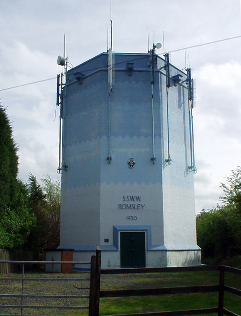
///coach.pays.spill. Near Romsley, Worcestershire

Related Wikis

Waseley Hills Country Park

Waseley Hills Country Park is 150 acres (0.61 km2) a Country Park and Local Nature Reserve owned and managed by Worcestershire County Council's Countryside...

Waseley Hills High School and Sixth Form Centre

Waseley Hills High School and Sixth Form Centre is a mixed secondary school and sixth form with academy status in the town of Rubery, on the border of...

New Frankley

New Frankley in Birmingham is a civil parish in Birmingham, England. As such, it has its own parish council. == History == It was established in 2000 in...

St Chad's Church, Rubery

St Chad’s Church, Rubery is a Church of England parish church in Rubery, Worcestershire. == History == The church evolved in 1895 as a mission church from...

Nearby Amenities

Located within 500m of 52.399524,-2.047735
Leisure: playground
Source: survey
Lat/Long: 52.4012593/-2.0419354
Waseley Hills- Visitor Centre
Naptan AtcoCode: 2000G103500
Naptan Bearing: W
Naptan CommonName: Waseley Hills- Visitor Centre
Naptan Indicator: Adj
Naptan Landmark: Visitor Centre
Naptan NaptanCode: wocdmwmp
Naptan Street: Gannow Green Lane
Note: nothing marked on the ground
Source: naptan_import
Lat/Long: 52.4019926/-2.0428315
Bus Stop
Romsley- Manchester Inn
Bus: yes
Naptan AtcoCode: 2000G621014
Naptan Bearing: SW
Naptan CommonName: Romsley- Manchester Inn
Naptan Indicator: opp
Naptan Landmark: Manchester Inn
Naptan NaptanCode: wocdwjwj
Naptan Street: Bromsgrove Rd
Naptan Verified: no
Public Transport: platform
Source: naptan_import
Lat/Long: 52.4003879/-2.0535889
Romsley- Manchester Inn
Naptan AtcoCode: 2000G621914
Naptan Bearing: NE
Naptan BusStopType: CUS
Naptan CommonName: Romsley- Manchester Inn
Naptan Indicator: adj
Naptan Landmark: Manchester Inn
Naptan NaptanCode: wocgmtjw
Naptan Street: Bromsgrove Road
Naptan Verified: no
Source: naptan_import
Lat/Long: 52.4004777/-2.0537507
Bicycle Parking
Lat/Long: 52.401846/-2.0431266
Tourism: picnic_site
Lat/Long: 52.4015918/-2.0429372
Fixme: continue
Lat/Long: 52.3956548/-2.0482324
Recycling
Recycling Glass: yes
Lat/Long: 52.4017002/-2.042024
Power: tower
Source: Bing
Lat/Long: 52.3978011/-2.0485401
Power: tower
Source: Bing
Lat/Long: 52.3996134/-2.0439676
Barrier: stile
Source: survey
Lat/Long: 52.3997515/-2.0433799
Windmill Hill
Man Made: toposcope
Tourism: viewpoint
Lat/Long: 52.3990674/-2.0422354
Bench
Lat/Long: 52.3985896/-2.0423205
Bench
Lat/Long: 52.3988112/-2.0424453
Bench
Lat/Long: 52.3990674/-2.0426836
Information: guidepost
Source: survey
Tourism: information
Lat/Long: 52.4007176/-2.0446584
Barrier: kissing_gate
Source: survey
Lat/Long: 52.4007524/-2.0447848
Tourism: picnic_site
Lat/Long: 52.4019361/-2.043209
Barrier: stile
Lat/Long: 52.4031005/-2.0489176
Windmill Hill
Natural: peak
Lat/Long: 52.3992112/-2.0424025
Dayhouse Bank
Place: hamlet
Lat/Long: 52.4025289/-2.0497583
Give Way
Source: survey
Lat/Long: 52.4037166/-2.0455036
ShortDescription: M5/7203B M5 northBound
Bcc Ref: 30082222
Operator: National Highways
Operator Wikidata: Q5760006
Ref: M5/7203B
Traffic Sign: variable_message
Traffic Sign Location: roadside
Variable Message Information: traffic
Lat/Long: 52.4014002/-2.0500606
ShortDescription: M5/7208A M5 southBound
Bcc Ref: 30082223
Operator: National Highways
Operator Wikidata: Q5760006
Ref: M5/7208A
Traffic Sign: variable_message
Traffic Sign Location: roadside
Variable Message Information: traffic
Lat/Long: 52.3971852/-2.0532793
Power: pole
Ref: 721299
Source: wpd_open_data
Transformer: distribution
Lat/Long: 52.3951705/-2.0495698
Power: pole
Source: bing
Lat/Long: 52.3959094/-2.0494598
Power: pole
Source: bing
Lat/Long: 52.396961/-2.0493123
Power: pole
Source: bing
Lat/Long: 52.3974593/-2.0492479
Power: pole
Source: bing
Lat/Long: 52.3981083/-2.0491487
Power: pole
Source: bing
Lat/Long: 52.3988079/-2.0490333
Power: pole
Source: bing
Lat/Long: 52.3995665/-2.0489247
Power: pole
Source: bing
Lat/Long: 52.4002014/-2.0488389
Power: pole
Ref: 721276
Source: wpd_open_data
Transformer: distribution
Lat/Long: 52.4006529/-2.0487596
Power: pole
Source: bing
Lat/Long: 52.4013691/-2.0486203
Power: pole
Source: bing
Lat/Long: 52.4017201/-2.0485371
Power: pole
Source: bing
Lat/Long: 52.4027331/-2.0482542
Power: pole
Source: bing
Lat/Long: 52.403332/-2.0480289
Power: pole
Ref: 730226
Source: wpd_open_data
Transformer: distribution
Lat/Long: 52.4035889/-2.047935
Power: pole
Ref: 730224
Source: wpd_open_data
Transformer: distribution
Lat/Long: 52.4016244/-2.0523928
Power: pole
Source: bing
Lat/Long: 52.402085/-2.0523512
Power: pole
Source: bing
Lat/Long: 52.4026619/-2.0522936
The data included in this document is from www.openstreetmap.org. The data is made available under ODbL.

Have you been to Chapman's Hill?

Leave your review of Chapman's Hill below (or comments, questions and feedback).