Chapletown

Settlement in Banffshire

Scotland

Chapletown

College Of Scalan In the Braes of Glenlivet this was a Seminary for the Roman Catholic faith during the 18th Century. Now a museum
College Of Scalan Credit: Ralph Greig

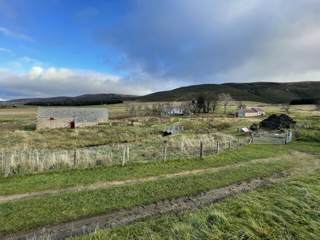
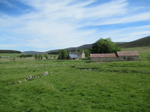
Chapletown is a quaint village located in the historic county of Banffshire, in the northeast of Scotland. Situated in the beautiful countryside, this peaceful settlement is nestled between the towns of Banff and Turriff. With its picturesque landscapes and charming atmosphere, Chapletown attracts both locals and tourists alike.

The village is known for its well-preserved traditional architecture, including a collection of stone cottages and buildings that exude a sense of history. The main focal point of Chapletown is its village square, where a charming marketplace is held every month, offering an array of local produce, crafts, and homemade goods.

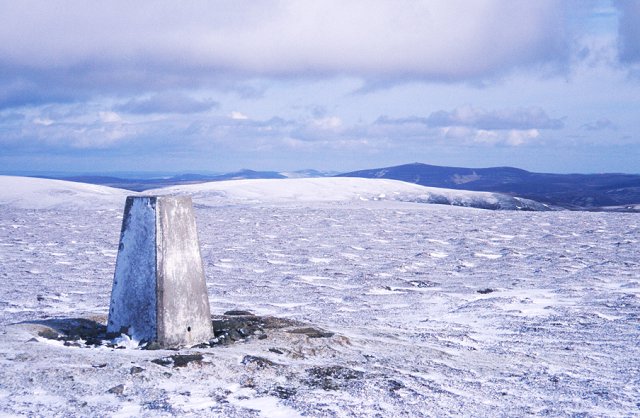
Surrounded by rolling hills and fertile farmland, Chapletown is an ideal destination for outdoor enthusiasts. Numerous walking and hiking trails wind through the countryside, offering breathtaking views of the surrounding landscapes. The nearby rivers and lochs also provide opportunities for fishing and boating.

Despite its small size, Chapletown boasts a strong sense of community. The village hosts various events throughout the year, such as a summer fair and an annual Highland games, where locals and visitors come together to celebrate Scottish traditions.

For those seeking a taste of history and culture, Chapletown is within close proximity to several notable attractions. The historic Duff House, a Georgian mansion turned art gallery, is just a short drive away, showcasing a diverse collection of artwork. Additionally, the picturesque coastal towns of Banff and Macduff offer stunning beaches, historical landmarks, and a range of amenities.

In summary, Chapletown is a charming village in Banffshire, Scotland, offering a peaceful retreat in a picturesque countryside setting. With its rich history, natural beauty, and vibrant community spirit, it is a hidden gem worth exploring.

If you have any feedback on the listing, please let us know in the comments section below.

Chapletown Images

Images are sourced within 2km of 57.273299/-3.2619727 or Grid Reference NJ2421. Thanks to Geograph Open Source API. All images are credited.

College Of Scalan In the Braes of Glenlivet this was a Seminary for the Roman Catholic faith during the 18th Century. Now a museum
College Of Scalan
In the Braes of Glenlivet this was a Seminary for the Roman Catholic faith during the 18th Century. Now a museum
College of Scalan The College of Scalan, in the Braes of Glenlivet, was one of the few places where the Roman Catholic religion continued to be practised in eighteenth-century Scotland. Despite Roman Catholicism being proscribed, young men were trained here to become priests.

Mill buildings are visible on the right-hand side of the photo.
College of Scalan
The College of Scalan, in the Braes of Glenlivet, was one of the few places where the Roman Catholic religion continued to be practised in eighteenth-century Scotland. Despite Roman Catholicism being proscribed, young men were trained here to become priests. Mill buildings are visible on the right-hand side of the photo.
Gnarled tree by the Scalan track The ruined farm buildings at Wester Scalan are visible on the hillside beyond the tree.
Gnarled tree by the Scalan track
The ruined farm buildings at Wester Scalan are visible on the hillside beyond the tree.
College of Scalan from a distance I think this photo gives a good idea of the remoteness of the former seminary, even today.
You can see an even more distant view here <a href="https://www.geograph.org.uk/photo/5848349">NJ2323 : Summit of  The Bochel, looking SSE</a>
College of Scalan from a distance
I think this photo gives a good idea of the remoteness of the former seminary, even today. You can see an even more distant view here NJ2323 : Summit of The Bochel, looking SSE
Track to the College of Scalan
The 'Secret Seminary'
The College of Scalan
Former chapel at College of Scalan The building outside the window was originally the kitchen, but was later adapted as a chapel for local catholics. See <a href="https://www.geograph.org.uk/photo/259133">NJ2419 : An outbuilding at Scalan</a> for a clearer view.
Former chapel at College of Scalan
The building outside the window was originally the kitchen, but was later adapted as a chapel for local catholics. See NJ2419 : An outbuilding at Scalan for a clearer view.
Seminary with a view The Bochel can be seen through the left pane, Tom a Voan through the right.
Seminary with a view
The Bochel can be seen through the left pane, Tom a Voan through the right.
Watermill near College of Scalan The water approached the wheel through the channel on the right of the photo, then passed under the wheel.
This arrangement is called an undershot wheel and was used where there was a fast-running stream
but not much head of water. See that broken window? Have a peep through here <a href="https://www.geograph.org.uk/photo/5847702">NJ2419 : Inside the watermill</a>
Watermill near College of Scalan
The water approached the wheel through the channel on the right of the photo, then passed under the wheel. This arrangement is called an undershot wheel and was used where there was a fast-running stream but not much head of water. See that broken window? Have a peep through here NJ2419 : Inside the watermill
Inside the watermill Taken through the broken window. Some of the mill equipment can be seen on the right.
Those pews will need a good clean . . .
Inside the watermill
Taken through the broken window. Some of the mill equipment can be seen on the right. Those pews will need a good clean . . .
View towards Chapeltown The distillery can be seen among the trees left of centre and Eskemulloch Farm to the right.
View towards Chapeltown
The distillery can be seen among the trees left of centre and Eskemulloch Farm to the right.
Conservation works at Scalan mill buildings The College of Scalan (building pictured with blue door), in the Braes of Glenlivet, was one of the few places where the Roman Catholic religion continued to be practised in 18th Century Scotland. Despite Roman Catholicism being proscribed, young men were trained here to become priests.

The mill buildings in the foreground are undergoing restoration and preservation works.
Conservation works at Scalan mill buildings
The College of Scalan (building pictured with blue door), in the Braes of Glenlivet, was one of the few places where the Roman Catholic religion continued to be practised in 18th Century Scotland. Despite Roman Catholicism being proscribed, young men were trained here to become priests. The mill buildings in the foreground are undergoing restoration and preservation works.
Conservation works at Scalan The College of Scalan, hidden away in the Braes of Glenlivet, was one of the few places where the Roman Catholic religion continued to be practised in 18th Century Scotland. Despite Roman Catholicism being proscribed, young men were trained here to become priests.

The nearby watermill buildings, pictured here, are undergoing restoration and preservation works.
Conservation works at Scalan
The College of Scalan, hidden away in the Braes of Glenlivet, was one of the few places where the Roman Catholic religion continued to be practised in 18th Century Scotland. Despite Roman Catholicism being proscribed, young men were trained here to become priests. The nearby watermill buildings, pictured here, are undergoing restoration and preservation works.
Dolines Around Base of Tom Trumper Snow-filled solution dolines (or 'shakeholes') formed upon slopes underlain by Dalradian limestones along the lower slopes of Tom Trumper.  Formed naturally in contrast to a number of nearby grouse-butts.
Dolines Around Base of Tom Trumper
Snow-filled solution dolines (or 'shakeholes') formed upon slopes underlain by Dalradian limestones along the lower slopes of Tom Trumper. Formed naturally in contrast to a number of nearby grouse-butts.
Crofts of Scalan
Crofts of Scalan
Road to Scalan
Road to Scalan
Crofts of Scalan
Crofts of Scalan
Show me another place!

Chapletown is located at Grid Ref: NJ2421 (Lat: 57.273299, Lng: -3.2619727)

Unitary Authority: Moray

Police Authority: North East

What 3 Words

///dragon.thin.materials. Near Dufftown, Moray

Nearby Locations

Chapletown

Related Wikis

Braeval distillery

Braeval distillery is a distiller of Scotch whisky in Chapeltown, Banffshire, Scotland. Founded in 1973 as Braes of Glenlivet, the distillery is owned...

Scalan

The Scalan was once a seminary and was one of the few places in Scotland where the Roman Catholic faith was kept alive during the troubled times of the...

Clashnoir

Clashnoir is a settlement in Glenlivet, Moray, Scotland, 92 miles north of Edinburgh and 25 miles south of Elgin.

West Aberdeenshire and Kincardine (UK Parliament constituency)

West Aberdeenshire and Kincardine is a county constituency of the House of Commons of the Parliament of the United Kingdom of Great Britain and Northern...

Auchnarrow

Auchnarrow (Scottish Gaelic: Achadh an Arbha) is a village in Moray, Scotland.

Càrn Mòr (Ladder Hills)

Càrn Mòr (804 m) is the highest mountain of the Ladder Hills on the border of Aberdeenshire and Moray, Scotland. It is located northeast of the Cairngorm...

Ladder Hills

The Ladder Hills (Scottish Gaelic: Monadh an Fhàraidh) are a range of hills in northeast Scotland which straddle the border between Aberdeenshire and Moray...

County of Moray

Moray; (Scottish Gaelic: Moireibh [ˈmɤɾʲəv]) or Morayshire, called Elginshire until 1919, is a historic county, registration county and lieutenancy area...

Nearby Amenities

Located within 500m of 57.273299,-3.2619727
Ford: yes
Lat/Long: 57.2730427/-3.258369
Entrance: main
Lat/Long: 57.2733846/-3.2589826
Power: pole
Lat/Long: 57.2768604/-3.2571045
Material: wood
Power: pole
Lat/Long: 57.2761036/-3.2572871
Material: wood
Power: pole
Lat/Long: 57.2753409/-3.2574483
Material: wood
Power: pole
Lat/Long: 57.2746885/-3.2575879
Power: pole
Lat/Long: 57.2739481/-3.2577455
Power: pole
Lat/Long: 57.2732299/-3.2579048
Power: pole
Lat/Long: 57.2729231/-3.2579961
Power: pole
Lat/Long: 57.2721158/-3.258245
Power: pole
Lat/Long: 57.2714818/-3.2576094
Power: pole
Lat/Long: 57.2709/-3.2570293
Material: wood
Power: pole
Lat/Long: 57.2702611/-3.2563633
Power: pole
Lat/Long: 57.2733693/-3.2586514
Power: pole
Lat/Long: 57.2731157/-3.2572871
Power: pole
Lat/Long: 57.2730082/-3.2566909
Power: pole
Lat/Long: 57.2728253/-3.2552193
The data included in this document is from www.openstreetmap.org. The data is made available under ODbL.

Have you been to Chapletown?

Leave your review of Chapletown below (or comments, questions and feedback).