Marketmuir Wood

Wood, Forest in Aberdeenshire

Scotland

Marketmuir Wood

Woodland track near to South Newfield Looking north-westward with the early morning sun on my back.
Woodland track near to South Newfield Credit: Peter Wood

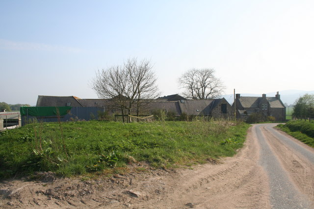
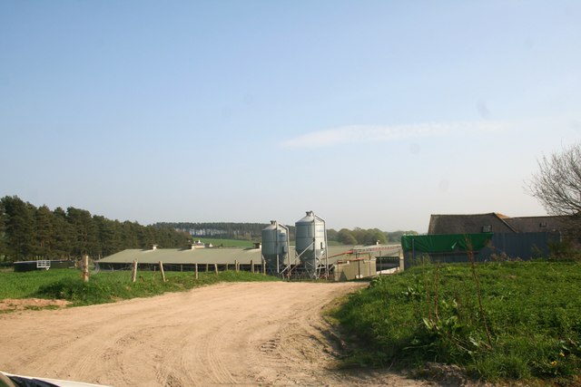
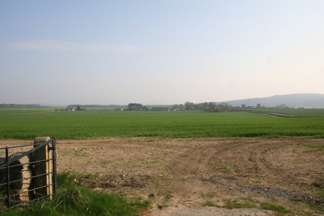
Marketmuir Wood is a picturesque woodland located in Aberdeenshire, Scotland. Situated near the town of Inverurie, this forest spans over an area of approximately 100 hectares, offering a diverse and enchanting natural environment for visitors to explore.

The wood is characterized by its dense vegetation, consisting primarily of a mix of broadleaf and coniferous trees. Towering Scots pines, elegant birches, and sturdy oaks dominate the landscape, creating a vibrant and colorful canopy throughout the seasons. The forest floor is adorned with a rich carpet of mosses, ferns, and wildflowers, providing a habitat for a variety of plant and animal species.

Marketmuir Wood offers numerous walking trails, allowing visitors to immerse themselves in its tranquil surroundings. These trails vary in length and difficulty, catering to both casual strollers and avid hikers. Along the way, walkers can enjoy sweeping vistas of the surrounding countryside, including rolling hills and distant mountains.

The forest is also home to a diverse array of wildlife. Red squirrels can often be spotted darting between the trees, while birdwatchers can delight in the sight of woodpeckers, owls, and various songbirds. Deer, foxes, and other mammals can occasionally be glimpsed, adding to the wood's natural allure.

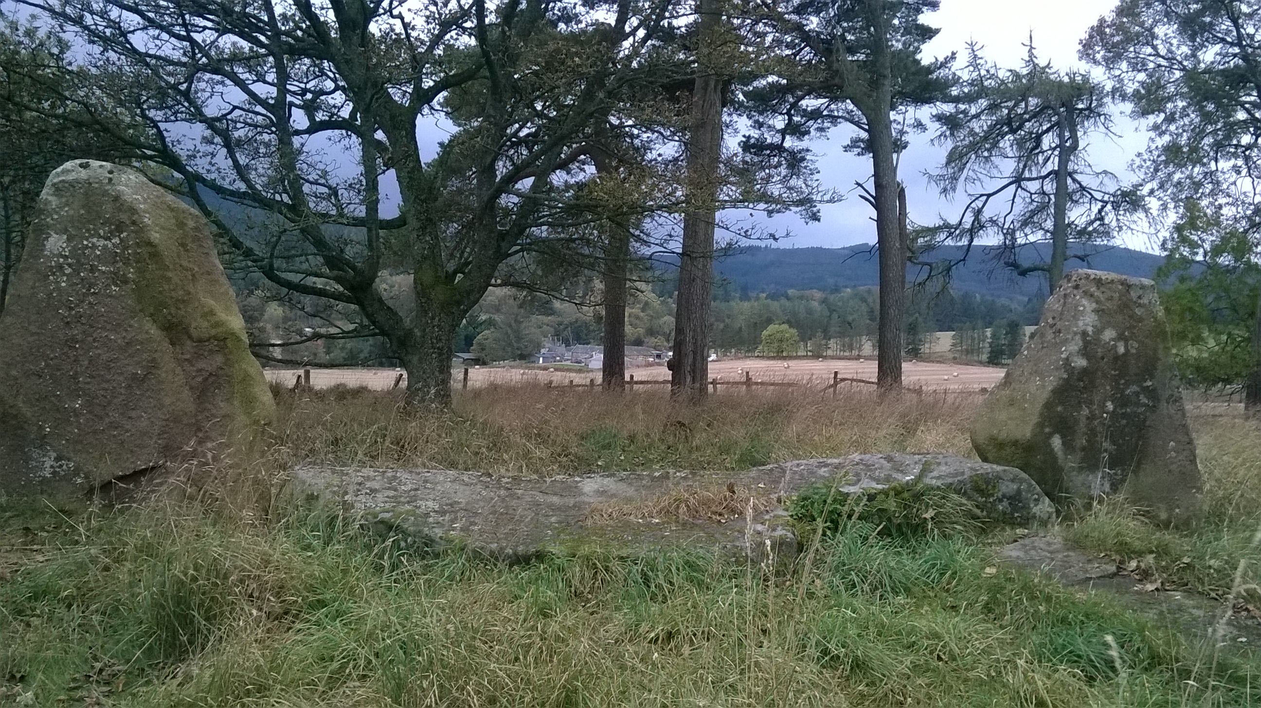
Marketmuir Wood boasts a rich history, with evidence of human presence dating back to ancient times. Archaeological remains, such as ancient burial mounds and stone circles, can be discovered within the forest, offering a fascinating insight into the area's past.

Overall, Marketmuir Wood is a captivating and serene woodland, offering visitors a chance to escape the hustle and bustle of everyday life and reconnect with nature.

If you have any feedback on the listing, please let us know in the comments section below.

Marketmuir Wood Images

Images are sourced within 2km of 57.13211/-2.4211674 or Grid Reference NJ7404. Thanks to Geograph Open Source API. All images are credited.

Woodland track near to South Newfield Looking north-westward with the early morning sun on my back.
Woodland track near to South Newfield
Looking north-westward with the early morning sun on my back.
Newfield Looking down towards Newfield from the B977.
Newfield
Looking down towards Newfield from the B977.
Access to the Hill of Fare This is the road into the forest plantation round the Hill of Fare.
Access to the Hill of Fare
This is the road into the forest plantation round the Hill of Fare.
Storm Damage Trees felled by Storm Arwen have been cut back off the forest road.
Storm Damage
Trees felled by Storm Arwen have been cut back off the forest road.
Forest Track The track is lined with leafless Larches, with other types of conifer further away.
Forest Track
The track is lined with leafless Larches, with other types of conifer further away.
Storm-felled Trees The brash in the foreground has been cleared where trees have been blown down across the road. Further up are the exposed roots of many more trees blown down by Storm Arwen a few weeks ago.
Storm-felled Trees
The brash in the foreground has been cleared where trees have been blown down across the road. Further up are the exposed roots of many more trees blown down by Storm Arwen a few weeks ago.
Uprooted Trees Roots of trees felled by Storm Arwen litter the north-facing slope of the Hill of Fare.
Uprooted Trees
Roots of trees felled by Storm Arwen litter the north-facing slope of the Hill of Fare.
Impathable So many trees have been bown down across the direct path to Meikle Tap that the route is not practicable.
Impathable
So many trees have been bown down across the direct path to Meikle Tap that the route is not practicable.
Drystane Dykes at Wester Tillyshogle I'd spotted a photo opportunity here a few days earlier when I was a passenger in someone else's car, so I decided to make a detour on my way home to take it at the same time of day. Unfortunately a bank of cloud rolled over the sun just minutes after I had parked, so I only just had time to grab two shots before the light died completely (and for the rest of the day; it started snowing shortly afterwards). This is the first one, complete with telegraph poles. The farm is Wester Tillyshogle.
Drystane Dykes at Wester Tillyshogle
I'd spotted a photo opportunity here a few days earlier when I was a passenger in someone else's car, so I decided to make a detour on my way home to take it at the same time of day. Unfortunately a bank of cloud rolled over the sun just minutes after I had parked, so I only just had time to grab two shots before the light died completely (and for the rest of the day; it started snowing shortly afterwards). This is the first one, complete with telegraph poles. The farm is Wester Tillyshogle.
Drystane Dykes at Wester Tillyshogle I'd spotted a photo opportunity here a few days earlier when I was a passenger in someone else's car, so I decided to make a detour on my way home to take it at the same time of day. Unfortunately a bank of cloud rolled over the sun just minutes after I had parked, so I only just had time to grab two shots before the light died completely (and for the rest of the day; it started snowing shortly afterwards). This is the second one, without telegraph poles. The farm is Wester Tillyshogle.
Drystane Dykes at Wester Tillyshogle
I'd spotted a photo opportunity here a few days earlier when I was a passenger in someone else's car, so I decided to make a detour on my way home to take it at the same time of day. Unfortunately a bank of cloud rolled over the sun just minutes after I had parked, so I only just had time to grab two shots before the light died completely (and for the rest of the day; it started snowing shortly afterwards). This is the second one, without telegraph poles. The farm is Wester Tillyshogle.
Braigiewell Road The access road to Braigiewell with the farm itself behind.
Braigiewell Road
The access road to Braigiewell with the farm itself behind.
North Mains The North Mains of Echt.
North Mains
The North Mains of Echt.
North Mains Silos Silos and farm sheds at the North Mains of Echt.
North Mains Silos
Silos and farm sheds at the North Mains of Echt.
Echt Recycling Farm manure ready for recycling an age old process at Echt with the Barmekin Hill just visible behind.
Echt Recycling
Farm manure ready for recycling an age old process at Echt with the Barmekin Hill just visible behind.
Field by Echt A field by the North Mains of Echt looking down on the Nether Mains and Echt village.
Field by Echt
A field by the North Mains of Echt looking down on the Nether Mains and Echt village.
Minor road between Finnercy and Braigie
Access lane to Braigiewell From the public road.
Access lane to Braigiewell
From the public road.
Field boundary fence near Mill of Braigie With a cloud over the Hill of Fare.
Field boundary fence near Mill of Braigie
With a cloud over the Hill of Fare.
Show me another place!

Marketmuir Wood is located at Grid Ref: NJ7404 (Lat: 57.13211, Lng: -2.4211674)

Unitary Authority: Aberdeenshire

Police Authority: North East

What 3 Words

///storm.shallower.troubled. Near Sauchen, Aberdeenshire

Related Wikis

Echt, Aberdeenshire

Echt (Scottish Gaelic: Eicht) is an Aberdeenshire crossroads village in northeast Scotland with a population of approximately 300 people. Echt has a number...
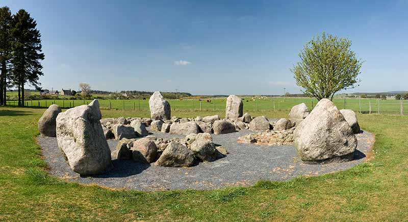
Sunhoney

Sunhoney is a stone circle of the recumbent type, which is common in the Grampian region, in particular at the River Dee. Sunhoney is situated about 2...

Dunecht estate

The Dunecht Estate is one of the largest private estates in Aberdeenshire, Scotland at 53,000 acres (210 km2). It is owned by The Hon Charles Anthony...
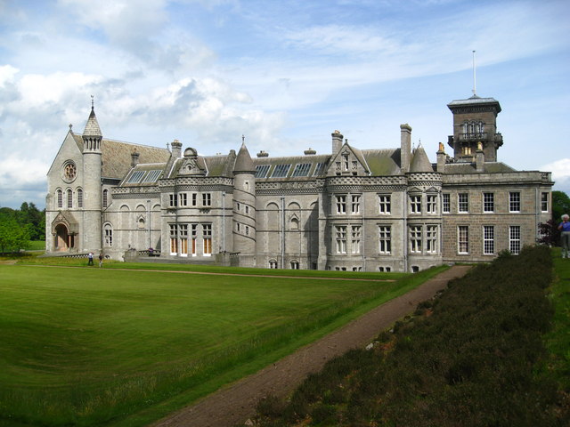
Dunecht House

Dunecht House is a stately home on the Dunecht estate in Aberdeenshire, Scotland. The house is protected as a category A listed building, and the grounds...

Cullerlie stone circle

Cullerlie stone circle, also known as the Standing Stones of Echt, is a small stone circle situated near Echt, Aberdeenshire. It consists of eight irregular...

Midmar Castle

Midmar Castle is a 16th-century castle in Aberdeenshire, Scotland, located 12 kilometres (7.5 mi) west of Westhill and 3.5 kilometres (2.2 mi) west of...

Garlogie

Garlogie (Scottish Gaelic: Geàrr Lagaidh) is a roadside hamlet in Aberdeenshire, Scotland. It was, during the 19th century, the site of a textile milling...

Dunecht

Dunecht (Scottish Gaelic: Dùn Eicht) is a slightly linear village on the A944 road in north-east Aberdeenshire in Scotland. It is not to be confused with...

Nearby Amenities

Located within 500m of 57.13211,-2.4211674
Power: tower
Lat/Long: 57.1339432/-2.4213678
Power: tower
Lat/Long: 57.1344894/-2.4265094
Power: tower
Lat/Long: 57.1334417/-2.4166474
Landerberry
Place: hamlet
Source: L/K
Lat/Long: 57.1298307/-2.4217161
Power: pole
Lat/Long: 57.1285185/-2.423543
Power: pole
Lat/Long: 57.1292628/-2.4231919
Power: pole
Lat/Long: 57.1299862/-2.4228582
Power: pole
Lat/Long: 57.1300899/-2.4270825
Power: pole
Lat/Long: 57.1302124/-2.4264305
Power: pole
Lat/Long: 57.130339/-2.4258326
Power: pole
Lat/Long: 57.1302364/-2.4249183
Power: pole
Lat/Long: 57.1301537/-2.4242856
Power: pole
Lat/Long: 57.1300951/-2.4238207
Power: pole
Lat/Long: 57.1298742/-2.4219632
Power: pole
Lat/Long: 57.1297496/-2.4209293
The data included in this document is from www.openstreetmap.org. The data is made available under ODbL.

Have you been to Marketmuir Wood?

Leave your review of Marketmuir Wood below (or comments, questions and feedback).