Hallbank Wood

Wood, Forest in Berwickshire

Scotland

Hallbank Wood

The Whiteadder Water at Greenhope Looking across LT power lines to Roughside Wood.
The Whiteadder Water at Greenhope Credit: M J Richardson

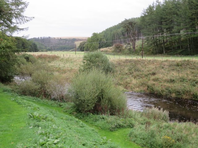
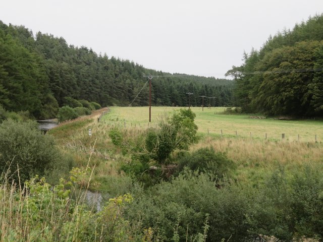
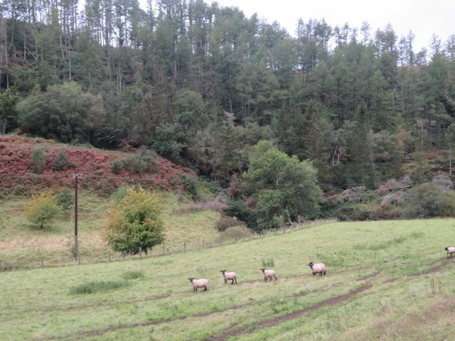
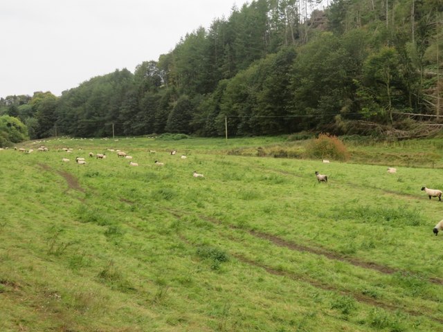
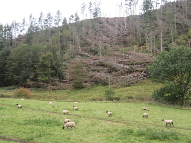
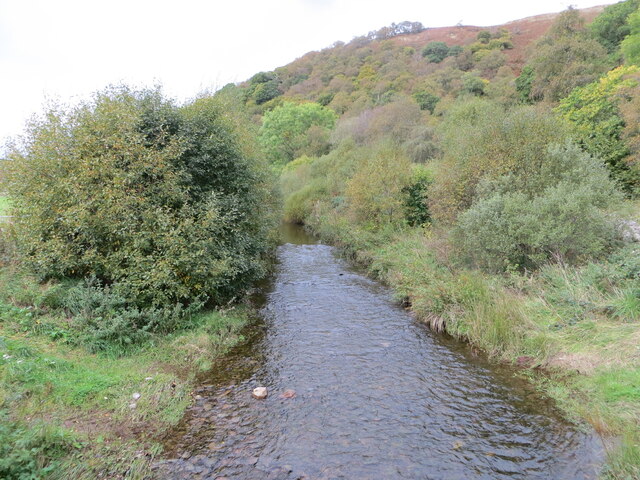
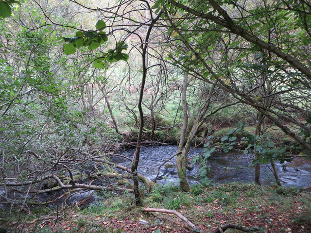
Hallbank Wood is a picturesque forest located in the region of Berwickshire, in the Scottish Borders area of Scotland. Spread across an area of approximately 50 hectares, this woodland is known for its diverse range of flora and fauna, making it an ideal destination for nature enthusiasts and wildlife lovers.

The wood consists mainly of broadleaf trees, such as oak, beech, and ash, which provide a stunning display of colors throughout the seasons. The forest floor is covered with a rich carpet of bluebells in spring, creating a breathtaking sight. Additionally, the wood is home to a variety of plant species, including wild garlic, wood sorrel, and primroses.

Birdwatchers will delight in the numerous species that can be spotted within Hallbank Wood. Common sightings include woodpeckers, tits, and finches. The forest also attracts a wide range of mammals, including deer, foxes, and badgers. Visitors may even be lucky enough to catch a glimpse of the elusive red squirrel, which is known to inhabit the area.

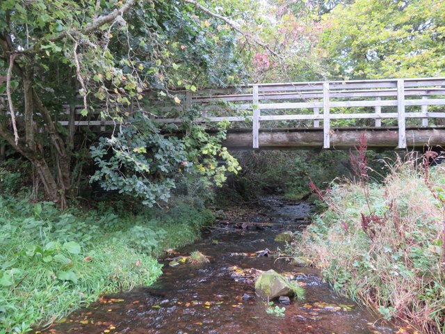
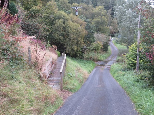
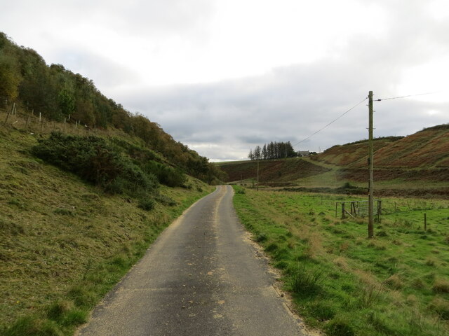
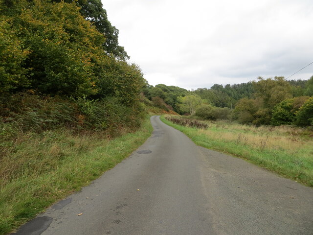
Several well-maintained walking trails crisscross the wood, allowing visitors to explore its beauty at their own pace. These paths offer stunning views of the surrounding countryside, including the nearby Cheviot Hills. There are also picnic areas and benches strategically placed throughout the wood, providing opportunities for visitors to relax and enjoy the tranquil surroundings.

In conclusion, Hallbank Wood is a captivating forest in Berwickshire, Scotland, offering a diverse range of flora and fauna. With its stunning landscapes, abundant wildlife, and well-marked trails, it is a must-visit destination for anyone seeking a peaceful retreat in nature.

If you have any feedback on the listing, please let us know in the comments section below.

Hallbank Wood Images

Images are sourced within 2km of 55.861126/-2.4138394 or Grid Reference NT7463. Thanks to Geograph Open Source API. All images are credited.

The Whiteadder Water at Greenhope Looking across LT power lines to Roughside Wood.
The Whiteadder Water at Greenhope
Looking across LT power lines to Roughside Wood.
Footbridge over Greenhope Burn Looking upstream from the ford <a href="https://www.geograph.org.uk/photo/7611541">NT7361 : Footpath and ford at Greenhope</a>, just a few metres before the burn joins the Whiteadder Water.
Footbridge over Greenhope Burn
Looking upstream from the ford NT7361 : Footpath and ford at Greenhope, just a few metres before the burn joins the Whiteadder Water.
Footpath and ford at Greenhope The path leads to the footbridge across the Greenhope Burn <a href="https://www.geograph.org.uk/photo/7611533">NT7361 : Footbridge over Greenhope Burn</a>.
Footpath and ford at Greenhope
The path leads to the footbridge across the Greenhope Burn NT7361 : Footbridge over Greenhope Burn.
The valley of the Whiteadder Water at Greenhope With Greenhope Wood on the left and Roughside Wood on the right.
The valley of the Whiteadder Water at Greenhope
With Greenhope Wood on the left and Roughside Wood on the right.
Sheep pasture near Abbey St Bathans By the Monynut Water, with Millbrae Wood beyond.
Sheep pasture near Abbey St Bathans
By the Monynut Water, with Millbrae Wood beyond.
Pasture by the Monynut Water With the Millbrae Wood conifer plantation across the river.
Pasture by the Monynut Water
With the Millbrae Wood conifer plantation across the river.
Windthrow in Millbrae Wood Storm damage by the Monynut Burn.
Windthrow in Millbrae Wood
Storm damage by the Monynut Burn.
Minor road and buildings at Nether Monynut Looking southward.
Minor road and buildings at Nether Monynut
Looking southward.
Minor road following the course of Monynut Water down the valley Looking southward.
Minor road following the course of Monynut Water down the valley
Looking southward.
Monynut Water viewed from Bushelhill Farm Bridge Looking north-westward upstream.
Monynut Water viewed from Bushelhill Farm Bridge
Looking north-westward upstream.
Monynut Water flowing between fields and wooded banks near Godscroft Looking southward.
Monynut Water flowing between fields and wooded banks near Godscroft
Looking southward.
Minor road following the course of Monynut Water down the valley Looking north-eastward from beside Hallbank Wood.
Minor road following the course of Monynut Water down the valley
Looking north-eastward from beside Hallbank Wood.
Whare Burn viewed from Whiteburn Bridge Looking north-westward upstream.
Whare Burn viewed from Whiteburn Bridge
Looking north-westward upstream.
Abbey Kirk and part of its burial ground, Abbey St Bathans Viewed from the southeast.
Abbey Kirk and part of its burial ground, Abbey St Bathans
Viewed from the southeast.
Ordnance Survey Cut Mark This mark can be found on the wall of a building at Nether Monynut.
The recorded details give a height of 235.1105 metres above sea level.
For more detail see : <span class="nowrap"><a title="https://www.bench-marks.org.uk/bm208282" rel="nofollow ugc noopener" href="https://www.bench-marks.org.uk/bm208282">Link</a><img style="margin-left:2px;" alt="External link" title="External link - shift click to open in new window" src="https://s1.geograph.org.uk/img/external.png" width="10" height="10"/></span>
Ordnance Survey Cut Mark
This mark can be found on the wall of a building at Nether Monynut. The recorded details give a height of 235.1105 metres above sea level. For more detail see : LinkExternal link
Ordnance Survey Cut Mark This Mark can be found on the parapet wall of Whiteburn Bridge.
The recorded details give a height of 183.0019 metres above sea level.
For more detail see : <span class="nowrap"><a title="https://www.bench-marks.org.uk/bm39647" rel="nofollow ugc noopener" href="https://www.bench-marks.org.uk/bm39647">Link</a><img style="margin-left:2px;" alt="External link" title="External link - shift click to open in new window" src="https://s1.geograph.org.uk/img/external.png" width="10" height="10"/></span>
Ordnance Survey Cut Mark
This Mark can be found on the parapet wall of Whiteburn Bridge. The recorded details give a height of 183.0019 metres above sea level. For more detail see : LinkExternal link
Ordnance Survey Cut Mark This Mark can be found on the wall of Abbey St Bathans Church.
The recorded details give a height of 148.4681 metres above sea level.
For more detail see : <span class="nowrap"><a title="https://www.bench-marks.org.uk/bm88119" rel="nofollow ugc noopener" href="https://www.bench-marks.org.uk/bm88119">Link</a><img style="margin-left:2px;" alt="External link" title="External link - shift click to open in new window" src="https://s1.geograph.org.uk/img/external.png" width="10" height="10"/></span>
Ordnance Survey Cut Mark
This Mark can be found on the wall of Abbey St Bathans Church. The recorded details give a height of 148.4681 metres above sea level. For more detail see : LinkExternal link
A symbolic gravestone at Abbey St Bathans Kirkyard The figure in this full length portrait stone is holding a book which is normally regarded as the bible to show religious devotion. Two unusual winged souls at the top are symbols of immortality, while the crossed femur bones and horizontal hourglass are symbols of mortality. The inscription on the reverse reads:

HERE LYES PATRICK JOHN
STON UHO DEPARTED
THIS LIFE THE 1 DAY OF
MAY 1698 AND OF HIS AGE 45
HERE LYES JEAN MOFFOT
SPOUS TO PATRICK JOHN
STON UHO DEPARTED
THIS LIFE THE 11 OF APRIL
1723 AND OF HER AGE 76
HERE LYES MARGRET
COUN SPOUS TO JAMES
JOHNSTON UHO
DEPARTED THIS LIFE THE
27 OF SEPTEMBER 1723
AND OF HER AGE 42
A symbolic gravestone at Abbey St Bathans Kirkyard
The figure in this full length portrait stone is holding a book which is normally regarded as the bible to show religious devotion. Two unusual winged souls at the top are symbols of immortality, while the crossed femur bones and horizontal hourglass are symbols of mortality. The inscription on the reverse reads: HERE LYES PATRICK JOHN STON UHO DEPARTED THIS LIFE THE 1 DAY OF MAY 1698 AND OF HIS AGE 45 HERE LYES JEAN MOFFOT SPOUS TO PATRICK JOHN STON UHO DEPARTED THIS LIFE THE 11 OF APRIL 1723 AND OF HER AGE 76 HERE LYES MARGRET COUN SPOUS TO JAMES JOHNSTON UHO DEPARTED THIS LIFE THE 27 OF SEPTEMBER 1723 AND OF HER AGE 42
Show me another place!

Hallbank Wood is located at Grid Ref: NT7463 (Lat: 55.861126, Lng: -2.4138394)

Unitary Authority: The Scottish Borders

Police Authority: The Lothians and Scottish Borders

What 3 Words

///butternut.picnic.lend. Near Duns, Scottish Borders

Nearby Locations

Hallbank Wood

Related Wikis

Abbey St Bathans

Abbey St Bathans (Scottish Gaelic: Abaid Bhaoithin) is a parish in the Lammermuir district of Berwickshire, in the eastern part of the Scottish Borders...

Dye Water

The Dye Water (Scottish Gaelic: Uisge DhĂ idh) is a river in the Lammermuir Hills in the Scottish Borders area of Scotland. It rises in the Hope Hills,...

Cockburn Tower

Cockburn Tower was a small fortified house in Berwickshire, Scotland. Now little more than the outline of a foundation, it occupied a site on the southern...

Bothwell Water

The Bothwell Water is a river in the Scottish Borders area of Scotland. It rises in the Lammermuir Hills near Caldercleugh and continues past the Upper...

Cranshaws Castle

Cranshaws Castle or Cranshaws Tower is a privately owned 15th-century pele situated by the village of Cranshaws in Berwickshire, Scotland. The building...

Cranshaws

Cranshaws is a village on the B6355 road, near Duns, in the Scottish Borders area of Scotland, in the former Berwickshire. Of Cranshaws Castle only the...

Penmanshiel Tunnel

Penmanshiel Tunnel is a now-disused railway tunnel near Grantshouse, Berwickshire, in the Scottish Borders region of Scotland. It was formerly part of...

Crystal Rig Wind Farm

Crystal Rig Wind Farm is an operational onshore wind farm located on the Lammermuir Hills in the Scottish Borders region of Scotland. When phase 1 was...

Nearby Amenities

Located within 500m of 55.861126,-2.4138394
Godscroft
Place: locality
Lat/Long: 55.8615145/-2.4121132
Power: pole
Lat/Long: 55.8615114/-2.4129331
Power: pole
Lat/Long: 55.8618666/-2.4130983
Power: pole
Lat/Long: 55.8626127/-2.4134364
Power: pole
Lat/Long: 55.8633174/-2.4137466
Power: pole
Lat/Long: 55.8640521/-2.4140872
Power: pole
Lat/Long: 55.8647768/-2.4144203
Power: pole
Lat/Long: 55.8654929/-2.4147838
Power: pole
Lat/Long: 55.8653317/-2.4160142
Power: pole
Lat/Long: 55.8651562/-2.4171861
Power: pole
Lat/Long: 55.86552/-2.4136271
Power: pole
Lat/Long: 55.8655514/-2.412445
The data included in this document is from www.openstreetmap.org. The data is made available under ODbL.

Have you been to Hallbank Wood?

Leave your review of Hallbank Wood below (or comments, questions and feedback).