Bogton Wood

Wood, Forest in Kincardineshire

Scotland

Bogton Wood

Forestry road near Scare Hill
Forestry road near Scare Hill Credit: Steven Brown

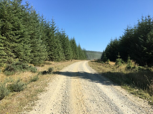
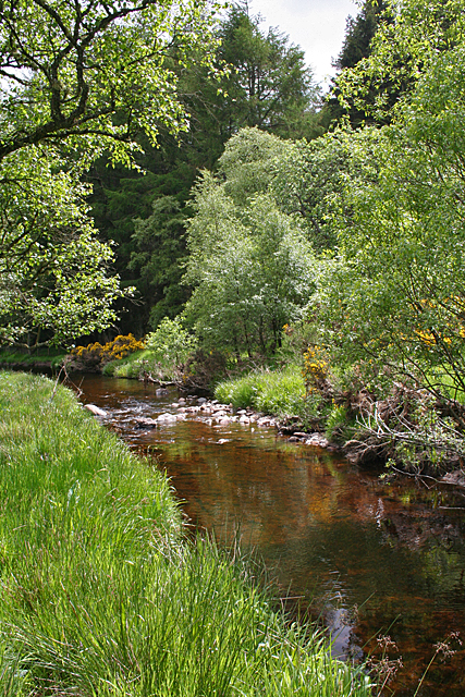
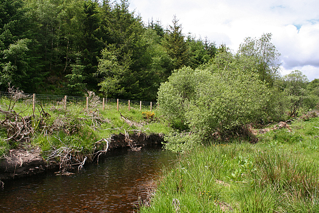
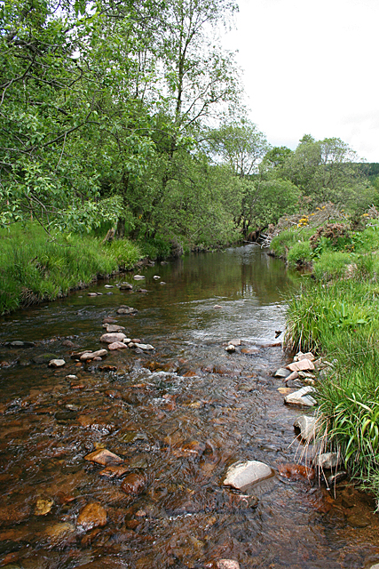
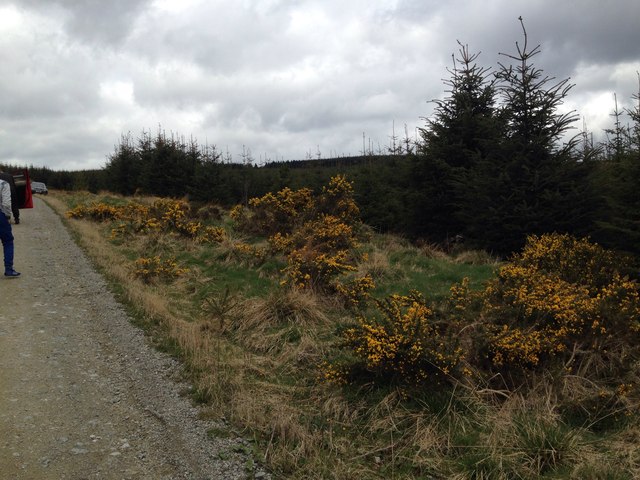
Bogton Wood, located in Kincardineshire, Scotland, is a picturesque forest known for its natural beauty and diverse flora and fauna. Stretching over an area of approximately 100 hectares, the wood is characterized by a mix of deciduous and coniferous trees, creating a rich and varied landscape.

The wood is easily accessible, with well-maintained trails that allow visitors to explore its enchanting surroundings. As one ventures deeper into Bogton Wood, they are greeted by a peaceful atmosphere and an abundance of wildlife. The forest is home to a wide range of bird species, including the Eurasian jay, great spotted woodpecker, and tawny owl, making it a haven for birdwatchers.

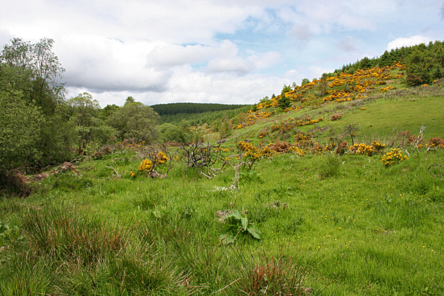
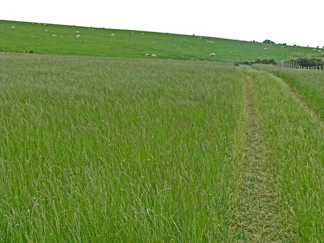
Throughout the forest, an array of plant species can be found, such as oak, ash, birch, and Scots pine. These trees provide a habitat for numerous woodland animals, including red squirrels, badgers, and roe deer. The forest floor is adorned with vibrant wildflowers during the spring and summer months, creating a colorful and vibrant carpet.

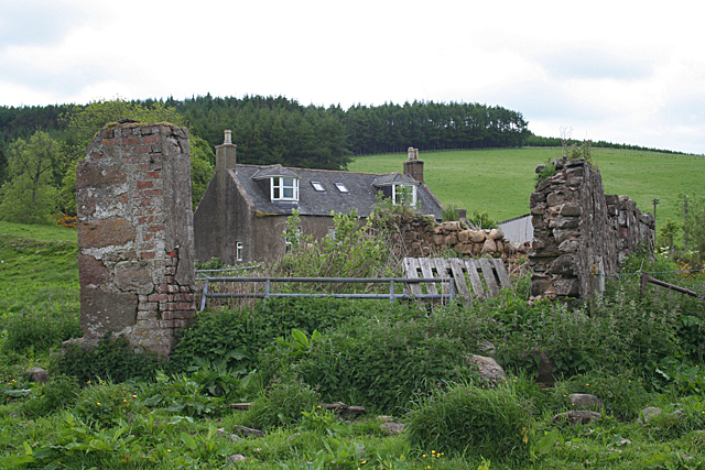
Bogton Wood also holds historical significance, with remnants of old stone walls and ruins of a former settlement scattered throughout the area. These historical features add an element of intrigue to the woodland, inviting visitors to imagine the stories of the past.

Whether it's for a leisurely stroll, birdwatching, or simply escaping the hustle and bustle of everyday life, Bogton Wood offers a serene and captivating experience for nature enthusiasts of all ages.

If you have any feedback on the listing, please let us know in the comments section below.

Bogton Wood Images

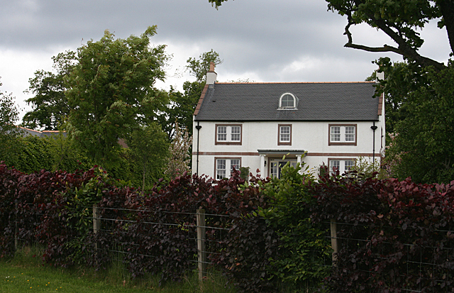
Images are sourced within 2km of 56.947253/-2.4392656 or Grid Reference NO7384. Thanks to Geograph Open Source API. All images are credited.

Forestry road near Scare Hill
An interesting sign in the Burn of Guinea at the Bridge of Bogincaber
Mains of Inchbreck The steadings here have all been renovated and converted to housing.
Mains of Inchbreck
The steadings here have all been renovated and converted to housing.
Bridge of Bogincaber The bridge carries the road across the Burn of Guinea. Compare with <a href="https://www.geograph.org.uk/photo/2564787">NO7483 : An interesting sign in the Burn of Guinea at the Bridge of Bogincaber</a>. Presumably the ban on ball games has been lifted.
Bridge of Bogincaber
The bridge carries the road across the Burn of Guinea. Compare with NO7483 : An interesting sign in the Burn of Guinea at the Bridge of Bogincaber. Presumably the ban on ball games has been lifted.
Bervie Water This square is mostly forested, but there is a corner where the Bervie Water flows through more open fields.
Bervie Water
This square is mostly forested, but there is a corner where the Bervie Water flows through more open fields.
West Bogton The house almost merges into the similarly coloured earth of the recently seeded field.
West Bogton
The house almost merges into the similarly coloured earth of the recently seeded field.
Chapelton Croft The croft stands beside the signposted path from Bervie Braes to the Slug Road.
Chapelton Croft
The croft stands beside the signposted path from Bervie Braes to the Slug Road.
Bervie Water Looking upstream. Note how close the forest is to the far bank of the river. Forest plantations take up the majority of this square.
Bervie Water
Looking upstream. Note how close the forest is to the far bank of the river. Forest plantations take up the majority of this square.
Near Corsebauld There's just a small corner of this square made up of rough grazing. It looks as if the whins have been burned, but they are growing again from the roots. It takes more than a fire to get rid of whins.
Near Corsebauld
There's just a small corner of this square made up of rough grazing. It looks as if the whins have been burned, but they are growing again from the roots. It takes more than a fire to get rid of whins.
Bervie Water The water is very clear, although peat-stained. Very tempting, if it had been deep enough to contemplate swimming!
Bervie Water
The water is very clear, although peat-stained. Very tempting, if it had been deep enough to contemplate swimming!
Corsebauld The house at Corsebauld, viewed through the ruins of another building.
Corsebauld
The house at Corsebauld, viewed through the ruins of another building.
Chapelton House The farm steadings at Chapelton have mostly been converted to housing, but this is the rather attractive farm house, viewed from the other side of the road.
Chapelton House
The farm steadings at Chapelton have mostly been converted to housing, but this is the rather attractive farm house, viewed from the other side of the road.
Forestry, Shoolbraid Wood
Mains of Inchbreck Mains of Inchbreck viewed from the road to the east.
Mains of Inchbreck
Mains of Inchbreck viewed from the road to the east.
Potato field near Bogincaber Looking northwards over a field of potatoes near Bogincaber.
Potato field near Bogincaber
Looking northwards over a field of potatoes near Bogincaber.
Transco's  Natural Gas pumping station at Auchenblae Main distribution line for natural gas passes through this site. Although named the Auchenblae site, it does in fact lie about 4 km from the village of that name. For some inscrutable reason, these sites seem to attract seagulls (also the odd oyster-catcher).
Transco's Natural Gas pumping station at Auchenblae
Main distribution line for natural gas passes through this site. Although named the Auchenblae site, it does in fact lie about 4 km from the village of that name. For some inscrutable reason, these sites seem to attract seagulls (also the odd oyster-catcher).
Mains of Inchbreck Like a number of farms round here, converted into some smart dwellings.
Mains of Inchbreck
Like a number of farms round here, converted into some smart dwellings.
Finnglennie loop The bike trail on the Finnglennie loop Fetteresso forest, after a gale.
Finnglennie loop
The bike trail on the Finnglennie loop Fetteresso forest, after a gale.
Show me another place!

Bogton Wood is located at Grid Ref: NO7384 (Lat: 56.947253, Lng: -2.4392656)

Unitary Authority: Aberdeenshire

Police Authority: North East

What 3 Words

///chum.vans.maps. Near Banchory, Aberdeenshire

Nearby Locations

Bogton Wood

Related Wikis

Bogjurgan Hill

Bogjurgan Hill is an elevated landform at the southern verge of the Fetteresso Forest in Aberdeenshire, Scotland. Its top is at an elevation of 299 metres...

Craiginour

Craiginour is a hill located near Cowie Water in Stonehaven, Aberdeenshire, Scotland. Its summit is at 355 metres (1,165 ft). == References ==

Droop Hill

Droop Hill is a mountain landform in the Kincardine and Mearns region of Aberdeenshire, Scotland. The locale had been featured in a windfarm proposal...

Fetteresso Forest

The Fetteresso Forest is a woodland that is principally coniferous situated in the Mounth range of the Grampian Mountains in Aberdeenshire, Scotland. The...

Have you been to Bogton Wood?

Leave your review of Bogton Wood below (or comments, questions and feedback).