Bomershanoe Wood

Wood, Forest in Kincardineshire

Scotland

Bomershanoe Wood

Travellers' Camp, Scotston, near Laurencekirk
Travellers' Camp, Scotston, near Laurencekirk Credit: Mike Pennington

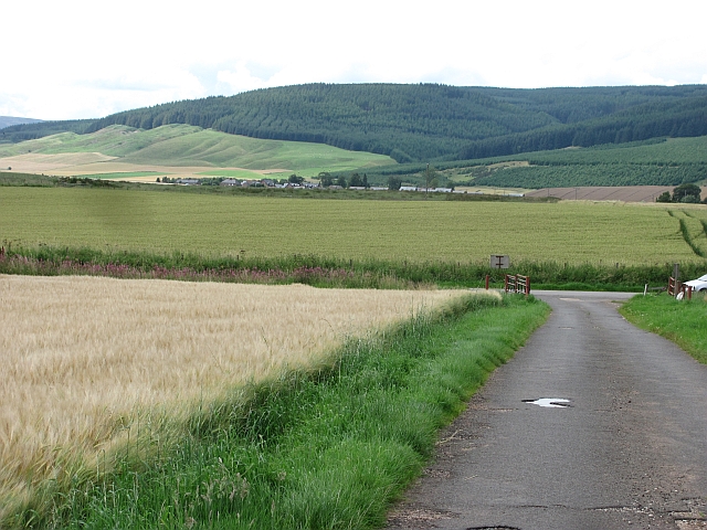
Bomershanoe Wood is a picturesque forest located in Kincardineshire, Scotland. Covering an area of approximately 200 acres, it is nestled within the stunning landscape of the Scottish Highlands. The wood is renowned for its natural beauty, offering visitors a tranquil and immersive experience in the heart of nature.

The forest is predominantly composed of native trees such as oak, birch, and pine, creating a diverse and vibrant ecosystem. The thick canopy provides ample shade, creating a cool and refreshing atmosphere even during the warm summer months. The forest floor is adorned with a carpet of moss, ferns, and wildflowers, adding to the enchanting ambiance of the wood.

Bomershanoe Wood is home to a variety of wildlife species, making it a popular destination for nature enthusiasts and birdwatchers. Visitors may spot red squirrels, roe deer, and a wide array of bird species such as woodpeckers, owls, and songbirds. The forest also boasts a rich biodiversity, with numerous insect species and small mammals contributing to the delicate balance of the ecosystem.

Several well-marked trails wind their way through the wood, offering visitors the opportunity to explore its beauty on foot. These trails cater to varying levels of difficulty, ensuring that both seasoned hikers and casual walkers can enjoy the forest at their own pace. Along the way, visitors may encounter scenic viewpoints, babbling streams, and even a small waterfall, adding to the charm and allure of the wood.

In conclusion, Bomershanoe Wood in Kincardineshire is a captivating forest that showcases the natural splendor of the Scottish Highlands. Its lush vegetation, diverse wildlife, and well-maintained trails make it a must-visit destination for those seeking a peaceful and immersive nature experience.

If you have any feedback on the listing, please let us know in the comments section below.

Bomershanoe Wood Images

Images are sourced within 2km of 56.868773/-2.4396076 or Grid Reference NO7375. Thanks to Geograph Open Source API. All images are credited.

Travellers' Camp, Scotston, near Laurencekirk
Turning lane for Grassic Gibbon Centre Photographer is above the surface of the A90 road.
Turning lane for Grassic Gibbon Centre
Photographer is above the surface of the A90 road.
Farm road, Westerton The road is genuinely blocked by a working farm at the far end, so the road is definitely not a through route.  Fortunately I could not read the signage, otherwise I may have had to report it.
Farm road, Westerton
The road is genuinely blocked by a working farm at the far end, so the road is definitely not a through route. Fortunately I could not read the signage, otherwise I may have had to report it.
Track from Westerton Well surfaced farm road. View towards Strathfinella Hill.
Track from Westerton
Well surfaced farm road. View towards Strathfinella Hill.
Arable land, Howe of the Mearns Kincardineshire's famed arable land - here growing potatoes and barley. Things get a wee bit rougher up on and beyond Strathfinella Hill (background). That's the Highlands!
Arable land, Howe of the Mearns
Kincardineshire's famed arable land - here growing potatoes and barley. Things get a wee bit rougher up on and beyond Strathfinella Hill (background). That's the Highlands!
Howe of the Mearns Kincardineshire's famed arable land, here growing barley. This is a fertile plain between Hill of Garvock (background) and the Highland boundary fault. The strath extends as Strathmore into Angus and Perthshire, producing mainly barley and potatoes.
Howe of the Mearns
Kincardineshire's famed arable land, here growing barley. This is a fertile plain between Hill of Garvock (background) and the Highland boundary fault. The strath extends as Strathmore into Angus and Perthshire, producing mainly barley and potatoes.
Bean field near Pittarrow Arable land in the Howe of the Mearns.
Bean field near Pittarrow
Arable land in the Howe of the Mearns.
Road past Bomershanoe Wood A minor road in the Howe of the Mearns. Until recently there were fences between the crop and road.
Road past Bomershanoe Wood
A minor road in the Howe of the Mearns. Until recently there were fences between the crop and road.
Barley near Auchenzeoch
Triangulation pillar, Pittengardner Unlike the one on Strathfinella Hill (background) there is a view from this one. It is on the edge of a farmyard.
Triangulation pillar, Pittengardner
Unlike the one on Strathfinella Hill (background) there is a view from this one. It is on the edge of a farmyard.
Flat sky and flat road between the Powburns
Farm yard with trig point The farm is Pittengardner and the trig point beside the fence, below the bank is known to the OS by that name. The farm lies on a minor road north-west of Fordoun.
(Note:The appearance of the locality of the pillar has changed with the bank from which the image was recorded having been removed - see Richard Webb's photo of 2011. <a title="https://www.geograph.org.uk/photo/2547649)" href="https://www.geograph.org.uk/photo/2547649)">Link</a>
Farm yard with trig point
The farm is Pittengardner and the trig point beside the fence, below the bank is known to the OS by that name. The farm lies on a minor road north-west of Fordoun. (Note:The appearance of the locality of the pillar has changed with the bank from which the image was recorded having been removed - see Richard Webb's photo of 2011. Link
Fields at Scotston, near Laurencekirk Looking towards the farm at Pittarrow and with Strathfinella Hill in the background.
Fields at Scotston, near Laurencekirk
Looking towards the farm at Pittarrow and with Strathfinella Hill in the background.
Drumforber, near Laurencekirk
Fields at Scotston Looking towards the Mill of Conveth and Pitarrow.
Fields at Scotston
Looking towards the Mill of Conveth and Pitarrow.
B967 Road near Redmyre Photographer is standing along the south side of the roadway.
B967 Road near Redmyre
Photographer is standing along the south side of the roadway.
Upper Powburn, near Laurencekirk With the windfarm on the Hill of Garvock in the background.
Upper Powburn, near Laurencekirk
With the windfarm on the Hill of Garvock in the background.
Track and bridge under the railway at Fordoun
Show me another place!

Bomershanoe Wood is located at Grid Ref: NO7375 (Lat: 56.868773, Lng: -2.4396076)

Unitary Authority: Aberdeenshire

Police Authority: North East

What 3 Words

///using.commander.ties. Near Laurencekirk, Aberdeenshire

Nearby Locations

Bomershanoe Wood

Related Wikis

Fordoun

Fordoun (Scottish Gaelic: Fordun) (Pronounced "For-Dun") is a parish and village in Aberdeenshire, Scotland. Fothirdun (possibly "the lower place"), as...

Fordoun railway station

Fordoun railway station served the village of Fordoun, Aberdeenshire, Scotland from 1849 to 1956 on the Aberdeen Railway. == History == The station opened...

Auchenblae

Auchenblae (, Scottish Gaelic: Achadh nam Blàth) is a village in the Kincardine and Mearns area of Aberdeenshire, formerly in Kincardineshire, Scotland...

Fordoun Stone

The Fordoun Stone is a class II Pictish cross slab in Fordoun parish church, Auchenblae, Aberdeenshire, Scotland. == Description == A slab of Old Red Sandstone...

Have you been to Bomershanoe Wood?

Leave your review of Bomershanoe Wood below (or comments, questions and feedback).