Barmekin Wood

Wood, Forest in Aberdeenshire

Scotland

Barmekin Wood

B9119 at Echt
B9119 at Echt Credit: Steven Brown

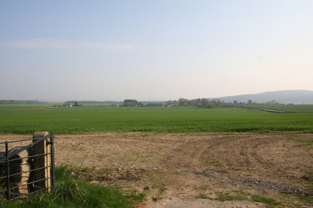
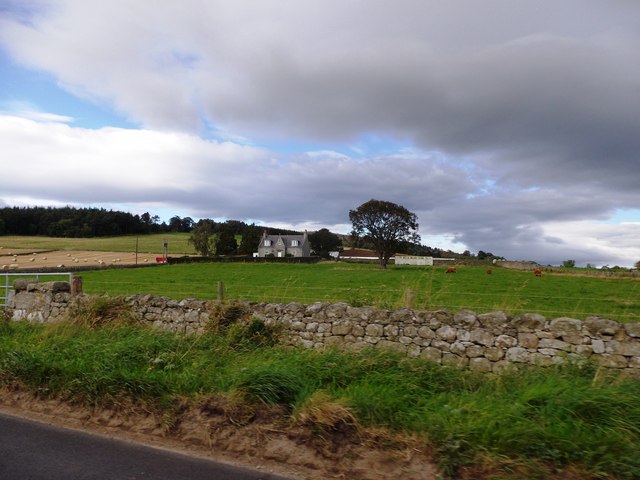
Barmekin Wood is a picturesque forest located in Aberdeenshire, a county in Scotland. It is nestled in the beautiful countryside and covers an area of approximately 100 hectares. The wood is situated near the town of Insch and is easily accessible to both locals and tourists.

The forest is known for its diverse range of flora and fauna, making it a popular spot for nature enthusiasts and birdwatchers. The wood is home to a variety of bird species, including woodpeckers, owls, and various songbirds. It also boasts a rich assortment of plant life, with ancient oaks, birch trees, and wildflowers dotting its landscape.

Barmekin Wood offers a tranquil and peaceful environment for visitors, with well-maintained walking trails that meander through the forest. These paths allow visitors to explore the wood at their own pace and admire its natural beauty. The wood also provides an ideal setting for picnics and quiet contemplation, with several designated picnic areas scattered throughout.

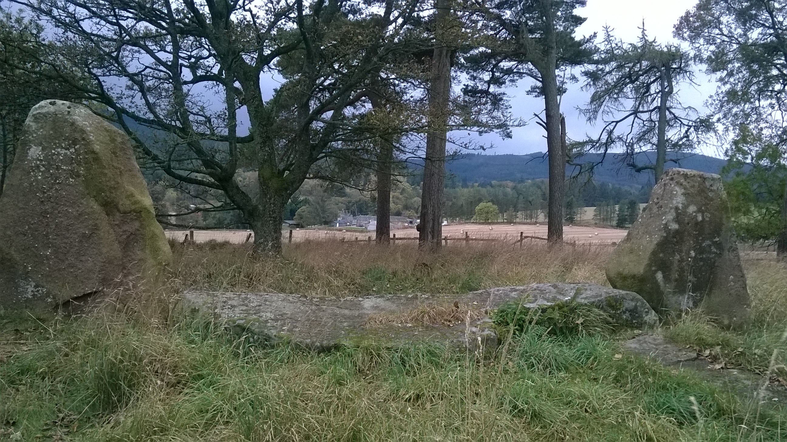
The forest is steeped in history, with remnants of ancient settlements and stone circles found within its boundaries. These archaeological features add an extra layer of intrigue to the wood, providing a glimpse into the area's past.

Barmekin Wood is a cherished natural gem in Aberdeenshire, offering a sanctuary for both wildlife and humans alike. Its serene atmosphere and abundant natural wonders make it a must-visit destination for anyone seeking a peaceful escape into nature.

If you have any feedback on the listing, please let us know in the comments section below.

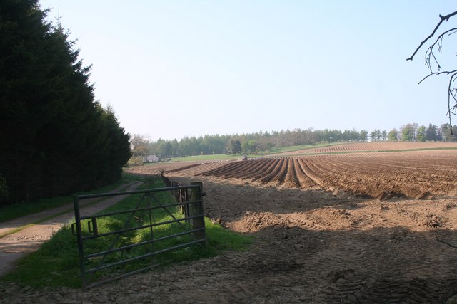
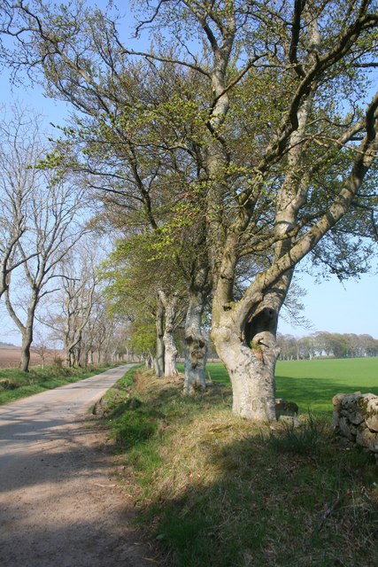
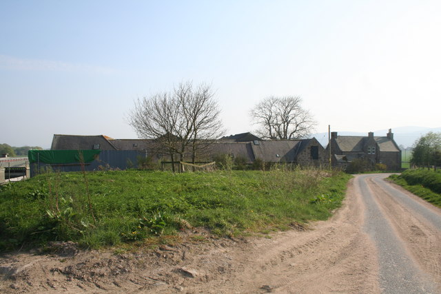
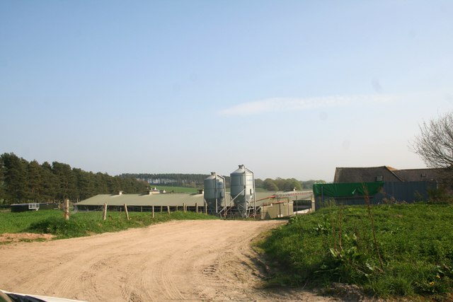
Barmekin Wood Images

Images are sourced within 2km of 57.156623/-2.4503583 or Grid Reference NJ7207. Thanks to Geograph Open Source API. All images are credited.

B9119 at Echt
B9119 at Echt
Culfosie Fields Fields by Culfosie tilled and planted presumably with potatoes a tree belt shelters the farm road on the left.
Culfosie Fields
Fields by Culfosie tilled and planted presumably with potatoes a tree belt shelters the farm road on the left.
Roadside Trees by Culfosie The tree lined road by Easter Culfosie.Culfosie means nok of rest ,apt on this day at least.
Roadside Trees by Culfosie
The tree lined road by Easter Culfosie.Culfosie means nok of rest ,apt on this day at least.
North Mains The North Mains of Echt.
North Mains
The North Mains of Echt.
North Mains Silos Silos and farm sheds at the North Mains of Echt.
North Mains Silos
Silos and farm sheds at the North Mains of Echt.
Echt Recycling Farm manure ready for recycling an age old process at Echt with the Barmekin Hill just visible behind.
Echt Recycling
Farm manure ready for recycling an age old process at Echt with the Barmekin Hill just visible behind.
Field by Echt A field by the North Mains of Echt looking down on the Nether Mains and Echt village.
Field by Echt
A field by the North Mains of Echt looking down on the Nether Mains and Echt village.
Old Tollhouse, Echt By B9119; west of village.
Old Tollhouse, Echt
By B9119; west of village.
Greentree Cottage By B9119; west of Echt.
Greentree Cottage
By B9119; west of Echt.
Gated driveway to Greentree Lodge Off B9119, west of Echt.
Gated driveway to Greentree Lodge
Off B9119, west of Echt.
Heading west from Echt On B9119 between Barnyards and Wet Mains. Hill of Fare ahead.
Heading west from Echt
On B9119 between Barnyards and Wet Mains. Hill of Fare ahead.
Old Echt farmstead Access off B9119, west of Echt village.
Old Echt farmstead
Access off B9119, west of Echt village.
View to Old Echt  from B9119 On site of former Echt House.
View to Old Echt from B9119
On site of former Echt House.
An unnamed granite building in Echt On the opposite side of the B9119 to the church. A church hall perhaps?
An unnamed granite building in Echt
On the opposite side of the B9119 to the church. A church hall perhaps?
Wester Echt Recumbent Stone Circle (1) Only three stones remain of the nine plus recumbent and flankers known to have stood here. The rest were removed in the 1840s. This is the tallest of the three.  See <span class="nowrap"><a title="http://canmore.org.uk/site/18534/wester-echt" rel="nofollow ugc noopener" href="http://canmore.org.uk/site/18534/wester-echt">Link</a><img style="margin-left:2px;" alt="External link" title="External link - shift click to open in new window" src="https://s1.geograph.org.uk/img/external.png" width="10" height="10"/></span> for more details. <a href="https://www.geograph.org.uk/photo/4493702">NJ7308 : Wester Echt Recumbent Stone Circle (2)</a>
Wester Echt Recumbent Stone Circle (1)
Only three stones remain of the nine plus recumbent and flankers known to have stood here. The rest were removed in the 1840s. This is the tallest of the three. See LinkExternal link for more details. NJ7308 : Wester Echt Recumbent Stone Circle (2)
Wester Echt Recumbent Stone Circle (2) It is suggested that this, the tallest remaining stone, was not in fact part of the original circle, but an outlier.  See <span class="nowrap"><a title="http://canmore.org.uk/site/18534/wester-echt" rel="nofollow ugc noopener" href="http://canmore.org.uk/site/18534/wester-echt">Link</a><img style="margin-left:2px;" alt="External link" title="External link - shift click to open in new window" src="https://s1.geograph.org.uk/img/external.png" width="10" height="10"/></span> for more details. <a href="https://www.geograph.org.uk/photo/4493708">NJ7308 : Wester Echt Recumbent Stone Circle (3)</a>
Wester Echt Recumbent Stone Circle (2)
It is suggested that this, the tallest remaining stone, was not in fact part of the original circle, but an outlier. See LinkExternal link for more details. NJ7308 : Wester Echt Recumbent Stone Circle (3)
Wester Echt Recumbent Stone Circle (3) These three standing stones are all that is left of this circle. The closest one is one of the flankers; the recumbent and the rest of the stones were removed in the 1840s.  See <span class="nowrap"><a title="http://canmore.org.uk/site/18534/wester-echt" rel="nofollow ugc noopener" href="http://canmore.org.uk/site/18534/wester-echt">Link</a><img style="margin-left:2px;" alt="External link" title="External link - shift click to open in new window" src="https://s1.geograph.org.uk/img/external.png" width="10" height="10"/></span> for more details. <a href="https://www.geograph.org.uk/photo/4493716">NJ7308 : Wester Echt Recumbent Stone Circle (4)</a>
Wester Echt Recumbent Stone Circle (3)
These three standing stones are all that is left of this circle. The closest one is one of the flankers; the recumbent and the rest of the stones were removed in the 1840s. See LinkExternal link for more details. NJ7308 : Wester Echt Recumbent Stone Circle (4)
Wester Echt Recumbent Stone Circle (4) This is one of the flankers, left in situ when most of the stones were removed in the 1840s. The smaller stones at its base may be the remains of a cist. There's a glimpse of Bennachie in the distance.  See <span class="nowrap"><a title="http://canmore.org.uk/site/18534/wester-echt" rel="nofollow ugc noopener" href="http://canmore.org.uk/site/18534/wester-echt">Link</a><img style="margin-left:2px;" alt="External link" title="External link - shift click to open in new window" src="https://s1.geograph.org.uk/img/external.png" width="10" height="10"/></span> for more details. <a href="https://www.geograph.org.uk/photo/4493723">NJ7308 : Wester Echt Recumbent Stone Circle (5)</a>
Wester Echt Recumbent Stone Circle (4)
This is one of the flankers, left in situ when most of the stones were removed in the 1840s. The smaller stones at its base may be the remains of a cist. There's a glimpse of Bennachie in the distance. See LinkExternal link for more details. NJ7308 : Wester Echt Recumbent Stone Circle (5)
Show me another place!

Barmekin Wood is located at Grid Ref: NJ7207 (Lat: 57.156623, Lng: -2.4503583)

Unitary Authority: Aberdeenshire

Police Authority: North East

What 3 Words

///huts.blues.rails. Near Sauchen, Aberdeenshire

Related Wikis

Echt, Aberdeenshire

Echt (Scottish Gaelic: Eicht) is an Aberdeenshire crossroads village in northeast Scotland with a population of approximately 300 people. Echt has a number...

Sunhoney

Sunhoney is a stone circle of the recumbent type, which is common in the Grampian region, in particular at the River Dee. Sunhoney is situated about 2...

Dunecht estate

The Dunecht Estate is one of the largest private estates in Aberdeenshire, Scotland at 53,000 acres (210 km2). It is owned by The Hon Charles Anthony...

Dunecht House

Dunecht House is a stately home on the Dunecht estate in Aberdeenshire, Scotland. The house is protected as a category A listed building, and the grounds...

Nearby Amenities

Located within 500m of 57.156623,-2.4503583
Barmekin Hill
Ele: 274
Natural: peak
Lat/Long: 57.1543481/-2.454322
The data included in this document is from www.openstreetmap.org. The data is made available under ODbL.

Have you been to Barmekin Wood?

Leave your review of Barmekin Wood below (or comments, questions and feedback).