Spinney Wood

Wood, Forest in Berwickshire

Scotland

Spinney Wood

Minor road near Longformacus
Minor road near Longformacus Credit: Steven Brown

The requested URL returned error: 429 Too Many Requests

If you have any feedback on the listing, please let us know in the comments section below.
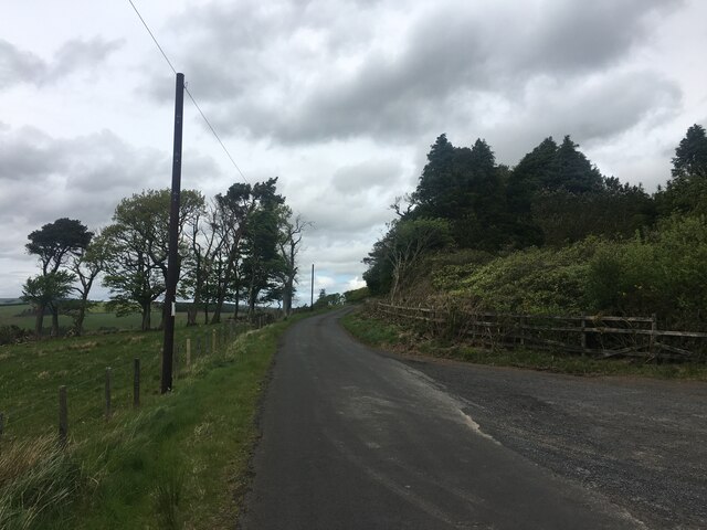
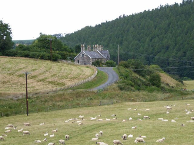
Spinney Wood Images

Images are sourced within 2km of 55.830301/-2.4390059 or Grid Reference NT7259. Thanks to Geograph Open Source API. All images are credited.

Minor road near Longformacus
Looking across the confluence  Of Dye Water and Whiteadder towards Owl Wood.
Looking across the confluence
Of Dye Water and Whiteadder towards Owl Wood.
Rosebay Willowherb and Meadowsweet Beside the Whiteadder Water.
Rosebay Willowherb and Meadowsweet
Beside the Whiteadder Water.
Ellemhaugh Beside Whiteadder Water.
Ellemhaugh
Beside Whiteadder Water.
Telephone box, bus shelter, road sign and info board, Ellemford There is also a road junction here, with the sign pointing to the villages of Whitchester and Longformaus.
Telephone box, bus shelter, road sign and info board, Ellemford
There is also a road junction here, with the sign pointing to the villages of Whitchester and Longformaus.
Broombank A fine house on the B6355 between Cranshaws and Ellemford. Marked on the gb1900 map as Broombank Cottage <span class="nowrap"><a title="https://maps.nls.uk/projects/gb1900/#zoom=17&lat=55.8321&lon=-2.4723&layer=0" rel="nofollow ugc noopener" href="https://maps.nls.uk/projects/gb1900/#zoom=17&lat=55.8321&lon=-2.4723&layer=0">Link</a><img style="margin-left:2px;" alt="External link" title="External link - shift click to open in new window" src="https://s1.geograph.org.uk/img/external.png" width="10" height="10"/></span>.
Broombank
A fine house on the B6355 between Cranshaws and Ellemford. Marked on the gb1900 map as Broombank Cottage LinkExternal link.
Grains Burn at Broombank It's in there somewhere, and joins the Whiteadder Water in just under 1km.
Grains Burn at Broombank
It's in there somewhere, and joins the Whiteadder Water in just under 1km.
Track into Lodge Wood A coniferous plantation.
Track into Lodge Wood
A coniferous plantation.
Pastures at Windshiel The lower slopes of the southern flank of Abbey Hill [Outer].
Pastures at Windshiel
The lower slopes of the southern flank of Abbey Hill [Outer].
Red barn at Windshiel With Windshiel Plantation on the southern edge of Abbey Hill [Outer].
Red barn at Windshiel
With Windshiel Plantation on the southern edge of Abbey Hill [Outer].
Ellemford Viewed from Ellemford Bridge.
Plenty of sheep!
Ellemford
Viewed from Ellemford Bridge. Plenty of sheep!
Ellemford Bridge Over Whiteadder Water.
Ellemford Bridge
Over Whiteadder Water.
Ellemford Bridge over Whiteadder Water, Ellemford, Scottish Borders
Whiteadder Water looking upstream from Ellemford Bridge
Weir and pool on Whiteadder Water, Ellemford Bridge
Whiteadder Water downstream from Ellemford Bridge, Ellemford
The B6355 road as it crosses Ellemford Bridge, Scottish Borders
Ellemford to Fellcleugh Track On the good track from Ellemford to Fellcleugh near Cranshaws in the Scottish Borders.  Taken at the southwest corner of Ellemford Covert looking to woodland at Moor Law.
Ellemford to Fellcleugh Track
On the good track from Ellemford to Fellcleugh near Cranshaws in the Scottish Borders. Taken at the southwest corner of Ellemford Covert looking to woodland at Moor Law.
Show me another place!

Spinney Wood is located at Grid Ref: NT7259 (Lat: 55.830301, Lng: -2.4390059)

Unitary Authority: The Scottish Borders

Police Authority: The Lothians and Scottish Borders

What 3 Words

///vowed.issues.fearfully. Near Duns, Scottish Borders

Nearby Locations

Spinney Wood

Related Wikis

Dye Water

The Dye Water (Scottish Gaelic: Uisge DhĂ idh) is a river in the Lammermuir Hills in the Scottish Borders area of Scotland. It rises in the Hope Hills,...

Longformacus House

Longformacus House is a mansion near the village of Longformacus, Scottish Borders, Scotland. == History == The estate was once owned by the Earls of...

Abbey St Bathans

Abbey St Bathans (Scottish Gaelic: Abaid Bhaoithin) is a parish in the Lammermuir district of Berwickshire, in the eastern part of the Scottish Borders...

Longformacus

Longformacus (Scottish Gaelic: Longphort Mhacais) is a small village in Berwickshire in the Scottish Borders area of Scotland. It is around 10 kilometres...

Nearby Amenities

Located within 500m of 55.830301,-2.4390059
Ellemford Bridge
Naptan AtcoCode: 69001333
Naptan Bearing: S
Naptan BusStopType: CUS
Naptan CommonName: Ellemford Bridge
Naptan Indicator: At Ellemford Farm Road End
Naptan Landmark: Ellemford Farm Road End
Naptan NaptanCode: 72725763
Naptan Street: B6355
Naptan Verified: no
Source: naptan_import
Lat/Long: 55.8336921/-2.435362
Ellemford Bridge
Naptan AtcoCode: 69001334
Naptan Bearing: N
Naptan BusStopType: CUS
Naptan CommonName: Ellemford Bridge
Naptan Indicator: Opp Ellemford Farm Road End
Naptan Landmark: Ellemford Farm Road End
Naptan NaptanCode: 72725758
Naptan Street: B6355
Naptan Verified: no
Source: naptan_import
Lat/Long: 55.8335834/-2.4356163
Ellemford Bridge
Naptan AtcoCode: 69001335
Naptan Bearing: S
Naptan BusStopType: CUS
Naptan CommonName: Ellemford Bridge
Naptan Indicator: nr Ellembank Cottage
Naptan Landmark: Whitchesters Road End
Naptan NaptanCode: 72725783
Naptan Street: B6355
Naptan Verified: no
Shelter: yes
Source: naptan_import
Lat/Long: 55.8316104/-2.4320021
Ellemford Bridge
Naptan AtcoCode: 69001336
Naptan Bearing: N
Naptan BusStopType: CUS
Naptan CommonName: Ellemford Bridge
Naptan Indicator: Opp Ellembank Cottage
Naptan Landmark: Whitchesters Road End
Naptan NaptanCode: 72725785
Naptan Street: B6355
Naptan Verified: no
Source: naptan_import
Lat/Long: 55.8316805/-2.4325138
Ellemford Bridge
Place: hamlet
Lat/Long: 55.8316205/-2.4323951
Ellem Lodge
Place: isolated_dwelling
Wikidata: Q17842422
Lat/Long: 55.8317214/-2.4341578
Ellembank Cottage
Place: isolated_dwelling
Lat/Long: 55.8310919/-2.4313113
Rigfoot
Place: hamlet
Lat/Long: 55.8294822/-2.4353708
Noexit: yes
Lat/Long: 55.8300728/-2.4345231
Noexit: yes
Lat/Long: 55.8302202/-2.4336531
Noexit: yes
Lat/Long: 55.8303652/-2.4331466
Noexit: yes
Lat/Long: 55.8309096/-2.4325506
Noexit: yes
Lat/Long: 55.8317519/-2.4339868
Noexit: yes
Lat/Long: 55.832054/-2.4339779
Telephone
Booth: K6
Covered: booth
Source: survey
Lat/Long: 55.8316369/-2.4320435
Power: pole
Lat/Long: 55.8289909/-2.4377002
Power: pole
Lat/Long: 55.8285781/-2.4379469
Power: pole
Lat/Long: 55.8282075/-2.4381629
Power: pole
Lat/Long: 55.8278045/-2.4383909
Power: pole
Lat/Long: 55.8274105/-2.4386309
Power: pole
Lat/Long: 55.8270264/-2.4388522
Power: pole
Lat/Long: 55.8266919/-2.4405688
Power: pole
Lat/Long: 55.8263672/-2.4422868
Power: pole
Lat/Long: 55.8292054/-2.4368533
Power: pole
Lat/Long: 55.8293067/-2.4364288
Power: pole
Lat/Long: 55.8294414/-2.4358292
Power: pole
Lat/Long: 55.8295381/-2.4351603
Power: pole
Lat/Long: 55.8296394/-2.4348806
Power: pole
Lat/Long: 55.8297893/-2.4344713
Power: pole
Lat/Long: 55.8305818/-2.4335714
Power: pole
Lat/Long: 55.8311457/-2.4329054
Power: pole
Lat/Long: 55.8314427/-2.4330833
Power: pole
Lat/Long: 55.8293712/-2.435681
Power: pole
Lat/Long: 55.8293046/-2.4355406
Power: pole
Lat/Long: 55.8287428/-2.4343544
Power: pole
Lat/Long: 55.8281845/-2.4331977
Power: pole
Lat/Long: 55.8316347/-2.4381257
Power: pole
Lat/Long: 55.8322487/-2.4371444
Power: pole
Lat/Long: 55.8329768/-2.4359776
Power: pole
Lat/Long: 55.8334436/-2.4352327
Power: pole
Lat/Long: 55.8310008/-2.4391501
Power: pole
Lat/Long: 55.8315648/-2.4403297
Power: pole
Lat/Long: 55.8321002/-2.4414431
Power: pole
Lat/Long: 55.8320031/-2.4431667
Power: pole
Lat/Long: 55.8319089/-2.4448852
Power: pole
Lat/Long: 55.8300499/-2.4371139
Power: pole
Lat/Long: 55.8305639/-2.4382248
The data included in this document is from www.openstreetmap.org. The data is made available under ODbL.

Have you been to Spinney Wood?

Leave your review of Spinney Wood below (or comments, questions and feedback).