Chapel-en-le-Frith

Settlement in Derbyshire High Peak

England

Chapel-en-le-Frith

War memorial in Chapel-en-le-Frith Situated in the Market Place.
War memorial in Chapel-en-le-Frith Credit: Bill Boaden

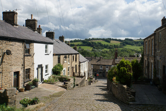
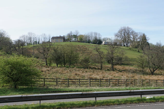
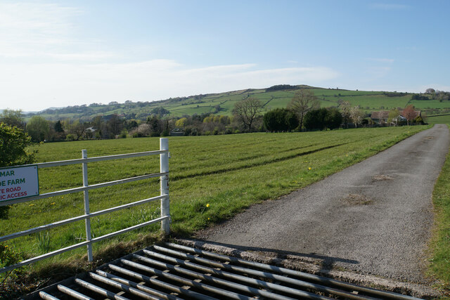
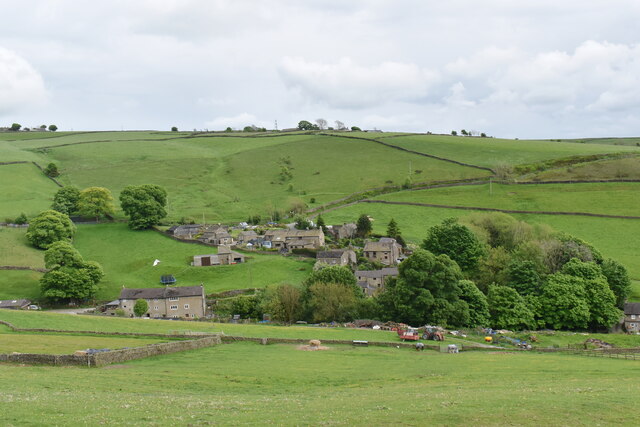
Chapel-en-le-Frith is a small market town located in the High Peak district of Derbyshire, England. Situated in the beautiful Peak District National Park, it is surrounded by rolling hills and picturesque landscapes. The town lies approximately 20 miles southeast of Manchester and 25 miles west of Sheffield.

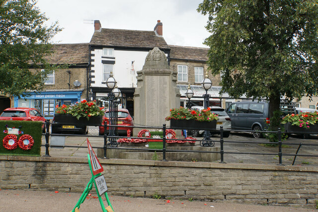
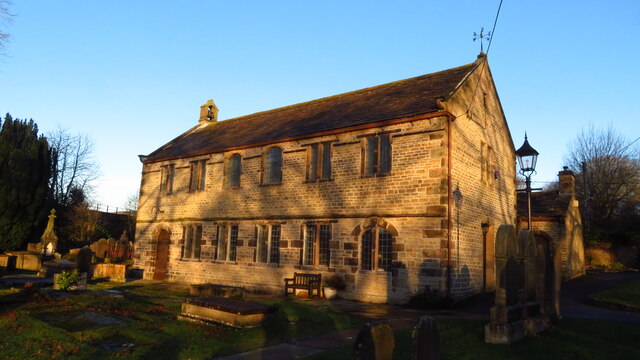
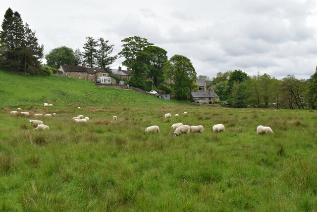
With a population of around 9,000, Chapel-en-le-Frith has a friendly and close-knit community. The town's name translates to "Chapel in the Forest" as it was originally a chapel within the ancient Forest of High Peak. The historic St. Thomas Becket Church, dating back to the 13th century, is a prominent landmark in the town center.

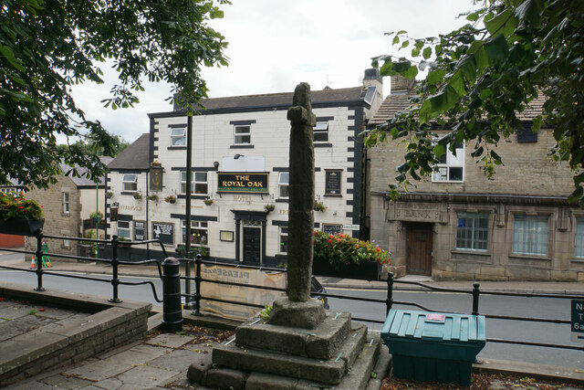
Chapel-en-le-Frith offers a range of amenities and services, including local shops, supermarkets, cafes, restaurants, and traditional pubs. The town also hosts a regular market, where locals and visitors alike can browse a variety of stalls selling fresh produce, crafts, and other goods.

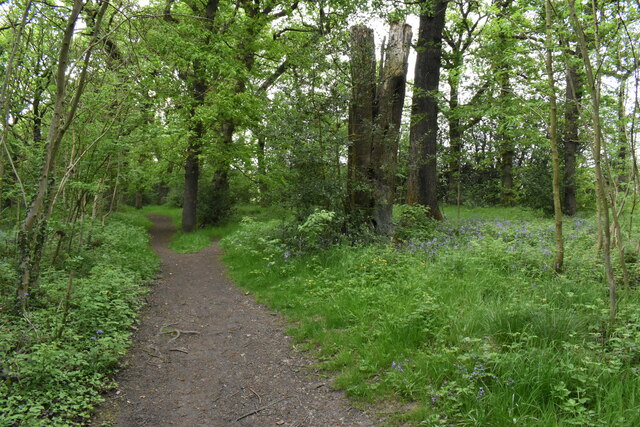
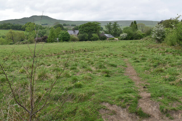
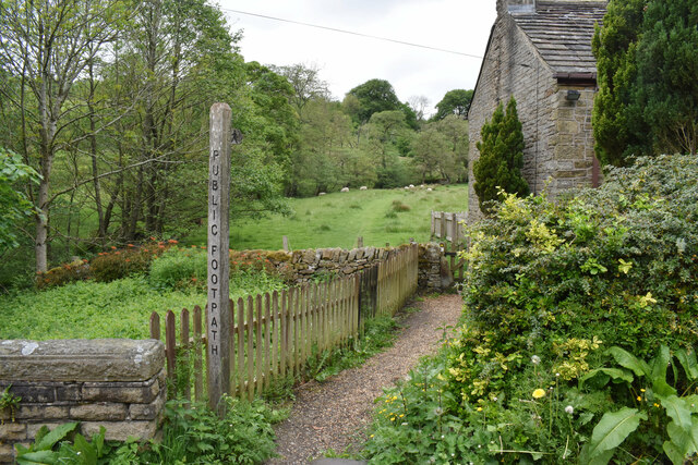
Outdoor enthusiasts are drawn to Chapel-en-le-Frith due to its proximity to the Peak District. The area provides ample opportunities for activities such as hiking, cycling, and horse riding, with numerous trails and paths to explore. The nearby Edale Valley and Kinder Scout, the highest point in the Peak District, are popular destinations for nature lovers.

Transport links are well-established, with Chapel-en-le-Frith having its own train station connecting it to Manchester and Sheffield. The town is also served by regular bus services, making it easily accessible for both residents and tourists.

Overall, Chapel-en-le-Frith offers a peaceful and picturesque setting, making it an ideal destination for those seeking a tranquil retreat in the heart of the Peak District.

If you have any feedback on the listing, please let us know in the comments section below.

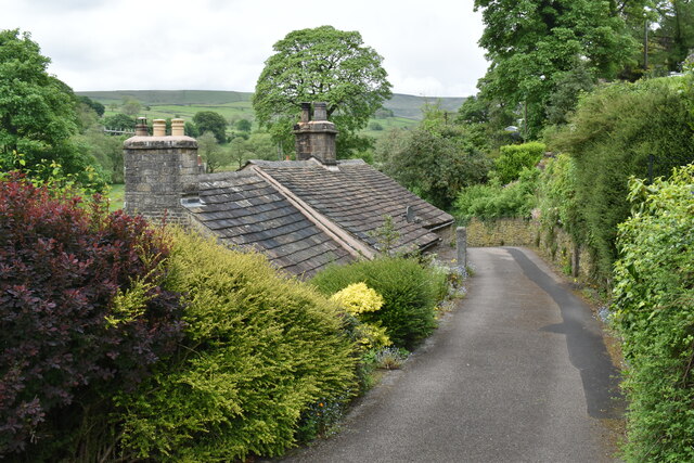
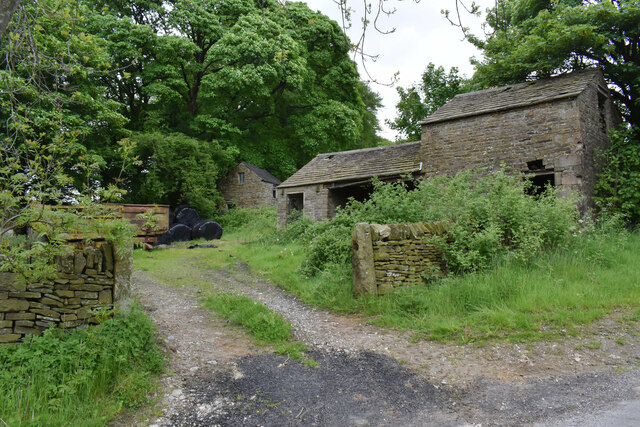
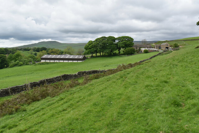
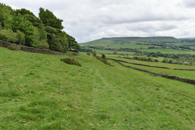
Chapel-en-le-Frith Images

Images are sourced within 2km of 53.324185/-1.911974 or Grid Reference SK0580. Thanks to Geograph Open Source API. All images are credited.

War memorial in Chapel-en-le-Frith Situated in the Market Place.
War memorial in Chapel-en-le-Frith
Situated in the Market Place.
Market Cross, Chapel-en-le-Frith Grade II listed and said to date from 1643. It is situated in Market Place overlooking Market Street which runs below.
Market Cross, Chapel-en-le-Frith
Grade II listed and said to date from 1643. It is situated in Market Place overlooking Market Street which runs below.
Churchyard of St Thomas Becket, Chapel-en-le-Frith Quite a large churchyard which extends down the hill to the left.
Churchyard of St Thomas Becket, Chapel-en-le-Frith
Quite a large churchyard which extends down the hill to the left.
Church Brow A largely unspoilt road in Chapel-en-le-Frith though there are a lot of telegraph wires.
Church Brow
A largely unspoilt road in Chapel-en-le-Frith though there are a lot of telegraph wires.
Chinley Chapel at Chapel Milton Chinley Independent Chapel was founded in 1662 by Rev. William Bagshawe who one of about 2,000 ministers and teachers of the church who failed to conform to the Uniformity Act of 1662. On St Bartholomew's Day, 24th August, 1662, Rev. Bagshawe who was then vicar of Glossop and others who rebelled against the Uniformity Act of 1662 were deprived of their living and ministries.

Rev. Bagshawe (who was also known as the 'Apostle of the Peak') then moved to Malcoffe Farm occupied by his brother-in-law who willingly consented for a barn on his farm to be converted into a Chapel. This became the place of worship for him and about 120 members who attended Sacramental Services there. He preached regularly to this gathering until 22nd March, 1702 -the day he preached his last sermon.

After Rev Bagshawe's death in 1702, the members of the church led by the Rev. James Clegg started the work on finding a suitable place for building of a new Chapel. In 1711, Chinley Independent Chapel was built. source <span class="nowrap"><a title="www.chinleyindependentchapel.org.uk" rel="nofollow ugc noopener" href="http://www.chinleyindependentchapel.org.uk">Link</a><img style="margin-left:2px;" alt="External link" title="External link - shift click to open in new window" src="https://s1.geograph.org.uk/img/external.png" width="10" height="10"/></span>
Chinley Chapel at Chapel Milton
Chinley Independent Chapel was founded in 1662 by Rev. William Bagshawe who one of about 2,000 ministers and teachers of the church who failed to conform to the Uniformity Act of 1662. On St Bartholomew's Day, 24th August, 1662, Rev. Bagshawe who was then vicar of Glossop and others who rebelled against the Uniformity Act of 1662 were deprived of their living and ministries. Rev. Bagshawe (who was also known as the 'Apostle of the Peak') then moved to Malcoffe Farm occupied by his brother-in-law who willingly consented for a barn on his farm to be converted into a Chapel. This became the place of worship for him and about 120 members who attended Sacramental Services there. He preached regularly to this gathering until 22nd March, 1702 -the day he preached his last sermon. After Rev Bagshawe's death in 1702, the members of the church led by the Rev. James Clegg started the work on finding a suitable place for building of a new Chapel. In 1711, Chinley Independent Chapel was built. source LinkExternal link
Grazing land near Chinley Chinley is seen ahead with Chinley Churn rising behind it.
Grazing land near Chinley
Chinley is seen ahead with Chinley Churn rising behind it.
Whitehough Head As viewed from the A6 which runs below.
Whitehough Head
As viewed from the A6 which runs below.
Farm track to Wilmar Farm and Roeside Farm A private track off the B5470 which is not a public footpath.
Farm track to Wilmar Farm and Roeside Farm
A private track off the B5470 which is not a public footpath.
Woodland path off Bowden Lane The surface of the path is nice and dry but I am sure it isn't always. The path leads to Wash.
Woodland path off Bowden Lane
The surface of the path is nice and dry but I am sure it isn't always. The path leads to Wash.
Footpath to Wash Passing through a field of sheep. Some of the houses of the small village of Wash are seen ahead. South Head is seen on the skyline.
Footpath to Wash
Passing through a field of sheep. Some of the houses of the small village of Wash are seen ahead. South Head is seen on the skyline.
Small road in Wash Wash is a very small village with traditional cottages.
Small road in Wash
Wash is a very small village with traditional cottages.
Footpath leaving Wash The path goes up the valley of Hockham Brook.
Footpath leaving Wash
The path goes up the valley of Hockham Brook.
Sheep near Wash The sheep are grazing in the valley of Hockham Brook. Some of the houses of Wash are behind.
Sheep near Wash
The sheep are grazing in the valley of Hockham Brook. Some of the houses of Wash are behind.
Old farm buildings at Slackhall The hamlet of Slackhall is not much more than a farm.
Old farm buildings at Slackhall
The hamlet of Slackhall is not much more than a farm.
Maglow Farm On the western slope of the Pennines with a view down to Chapel-en-le-Frith. South Head is the prominent peak behind.
Maglow Farm
On the western slope of the Pennines with a view down to Chapel-en-le-Frith. South Head is the prominent peak behind.
Footpath to Bagshaw Traversing a hillside with Chapel-en-le-Frith down to the right. Ahead you can see Combs Moss on its plateau.
Footpath to Bagshaw
Traversing a hillside with Chapel-en-le-Frith down to the right. Ahead you can see Combs Moss on its plateau.
Bagshaw A small upland Peak District village.
Bagshaw
A small upland Peak District village.
Road out of Bagshaw The main connection for the village of Bagshaw with the outside world. Chapel-en-le-Frith is seen down to the right.
Road out of Bagshaw
The main connection for the village of Bagshaw with the outside world. Chapel-en-le-Frith is seen down to the right.
Show me another place!

Chapel-en-le-Frith is located at Grid Ref: SK0580 (Lat: 53.324185, Lng: -1.911974)

Administrative County: Derbyshire

District: High Peak

Police Authority: Derbyshire

What 3 Words

///ally.passenger.notch. Near Chapel en le Frith, Derbyshire

Nearby Locations

Chapel-en-le-Frith

Related Wikis

Chapel-en-le-Frith Town Hall

Chapel-en-le-Frith Town Hall is a municipal building in Market Street, Chapel-en-le-Frith, Derbyshire, England. The structure operates as a community events...

High Peak Radio

High Peak Radio was an Independent Local Radio station broadcasting to the Peak District, Derbyshire, from studios in Chapel-en-le-Frith. It broadcast...

Chapel-en-le-Frith

Chapel-en-le-Frith () is a town and civil parish in the Borough of High Peak in Derbyshire, England. It has been dubbed the "Capital of the Peak", in...

Chapel-en-le-Frith Central railway station

Chapel-en-le-Frith Central railway station was an intermediate stop on the Derby–Manchester line of the Midland Railway. It served the Derbyshire town...

Nearby Amenities

Located within 500m of 53.324185,-1.911974
Chinley Signal CY168
Railway: site
Ref Tiploc: CHNL168
Lat/Long: 53.3256973/-1.9186546
Shoulder of Mutton
Lat/Long: 53.3249403/-1.9086488
Mini Roundabout
Direction: clockwise
Lat/Long: 53.3244415/-1.9113441
Pub
The Royal Oak
Addr City: High Peak
Addr Country: GB
Addr Housenumber: 11
Addr Postcode: SK23 0HH
Addr Street: Market Street
Fhrs Id: 1258903
Source Addr: FHRS Open Data
Wikidata: Q26380408
Lat/Long: 53.3231212/-1.9153973
Post Office
Chapel-en-le-Frith Post Office
Addr City: High Peak
Addr Country: GB
Addr Postcode: SK23 0EW
Brand: Post Office
Brand Wikidata: Q1783168
Check Date Collection Times: 2014-10-05
Collection Times: Mo-Fr 18:15; Sa 11:30; Su off
Contact Website: https://www.postoffice.co.uk/branch-finder/3154327/chapel-en-le-frith
Fixme: Is there a postbox and a post office here? If so this should be split into two OSM objects.
Ref: SK23 85
Ref Pol Id: 12570
Royal Cypher: EIIR
Lat/Long: 53.3234183/-1.9160095
Pub
The Roebuck
Addr City: High Peak
Addr Country: GB
Addr Housenumber: 9
Addr Postcode: SK23 0EN
Addr Street: Market Place
Fhrs Id: 1258712
Source Addr: FHRS Open Data
Tourism: guest_house
Lat/Long: 53.3235505/-1.9157781
Pub
Kings Arms Hotel
Lat/Long: 53.3230874/-1.9162935
Chapel-en-le-Frith
Is In County: Derbyshire
Place: town
Population: 8635
Population Date: 2011
Source Population: wikipedia
Wikidata: Q2361780
Wikipedia: en:Chapel-en-le-Frith
Lat/Long: 53.3232509/-1.9148352
Crossing
Crossing: uncontrolled
Crossing Island: no
Crossing Markings: zebra
Lat/Long: 53.3246016/-1.9118164
Fast Food
High Street Fish & Chips
Addr City: High Peak
Addr Country: GB
Addr Housenumber: 20
Addr Postcode: SK23 0HD
Addr Street: High Street
Cuisine: fish_and_chips
Fhrs Id: 1258635
Source Addr: FHRS Open Data
Lat/Long: 53.3227437/-1.9179473
Atm
NatWest
Brand: NatWest
Brand Wikidata: Q2740021
Operator: NatWest
Operator Wikidata: Q2740021
Lat/Long: 53.3232819/-1.9155274
Toilets
Access: yes
Operator: local council
Toilets Disposal: flush
Lat/Long: 53.3232575/-1.915647
Reading Matters
Shop: books
Website: https://readingmattersbookshop.co.uk/
Lat/Long: 53.3241226/-1.9127395
Chapel-en-le-Frith Central
Historic Railway: station
Railway: site
Wikidata: Q5072980
Wikipedia: en:Chapel-en-le-Frith Central railway station
Lat/Long: 53.3244626/-1.9192711
Railway: switch
Lat/Long: 53.3266341/-1.9182587
Railway: switch
Lat/Long: 53.3264656/-1.9183458
Railway: switch
Lat/Long: 53.3261847/-1.9184122
Leisure: playground
Lat/Long: 53.324107/-1.9053767
Fixme: continue
Lat/Long: 53.3256482/-1.9153397
Chinley South Junction
Railway: junction
Lat/Long: 53.3265466/-1.9182735
Generator Method: photovoltaic
Generator Output Electricity: yes
Generator Source: solar
Generator Type: solar_photovoltaic_panel
Location: roof
Power: generator
Lat/Long: 53.320421/-1.9137983
Generator Method: photovoltaic
Generator Output Electricity: yes
Generator Source: solar
Generator Type: solar_photovoltaic_panel
Location: roof
Power: generator
Lat/Long: 53.320413/-1.9137044
Generator Method: photovoltaic
Generator Output Electricity: yes
Generator Source: solar
Generator Type: solar_photovoltaic_panel
Location: roof
Power: generator
Lat/Long: 53.3200637/-1.9128541
Generator Method: photovoltaic
Generator Output Electricity: yes
Generator Source: solar
Generator Type: solar_photovoltaic_panel
Location: roof
Power: generator
Lat/Long: 53.3221529/-1.9055103
Generator Method: photovoltaic
Generator Output Electricity: yes
Generator Source: solar
Generator Type: solar_photovoltaic_panel
Location: roof
Power: generator
Lat/Long: 53.3204979/-1.912028
Generator Method: photovoltaic
Generator Output Electricity: yes
Generator Source: solar
Generator Type: solar_photovoltaic_panel
Location: roof
Power: generator
Lat/Long: 53.3204258/-1.9124947
Generator Method: photovoltaic
Generator Output Electricity: yes
Generator Source: solar
Generator Type: solar_photovoltaic_panel
Location: roof
Power: generator
Lat/Long: 53.3213615/-1.9123097
Generator Method: photovoltaic
Generator Output Electricity: yes
Generator Source: solar
Generator Type: solar_photovoltaic_panel
Location: roof
Power: generator
Lat/Long: 53.3213535/-1.9123848
Generator Method: photovoltaic
Generator Output Electricity: yes
Generator Source: solar
Generator Type: solar_photovoltaic_panel
Location: roof
Power: generator
Lat/Long: 53.3211468/-1.9122936
Generator Method: photovoltaic
Generator Output Electricity: yes
Generator Source: solar
Generator Type: solar_photovoltaic_panel
Location: roof
Power: generator
Lat/Long: 53.3211083/-1.9122024
Generator Method: photovoltaic
Generator Output Electricity: yes
Generator Source: solar
Generator Type: solar_photovoltaic_panel
Location: roof
Power: generator
Lat/Long: 53.3221802/-1.913227
Generator Method: photovoltaic
Generator Output Electricity: yes
Generator Source: solar
Generator Type: solar_photovoltaic_panel
Location: roof
Power: generator
Lat/Long: 53.3237709/-1.9079135
Generator Method: photovoltaic
Generator Output Electricity: yes
Generator Source: solar
Generator Type: solar_photovoltaic_panel
Location: roof
Power: generator
Lat/Long: 53.3235995/-1.9072591
Generator Method: photovoltaic
Generator Output Electricity: yes
Generator Source: solar
Generator Type: solar_photovoltaic_panel
Location: roof
Power: generator
Lat/Long: 53.3214927/-1.9068728
Generator Method: photovoltaic
Generator Output Electricity: yes
Generator Source: solar
Generator Type: solar_photovoltaic_panel
Location: roof
Power: generator
Lat/Long: 53.3232438/-1.9055344
Generator Method: photovoltaic
Generator Output Electricity: yes
Generator Source: solar
Generator Type: solar_photovoltaic_panel
Location: roof
Power: generator
Lat/Long: 53.323069/-1.9065477
Generator Method: photovoltaic
Generator Output Electricity: yes
Generator Source: solar
Generator Type: solar_photovoltaic_panel
Location: roof
Power: generator
Lat/Long: 53.3230497/-1.9066281
Bus Stop
Chapel en le Frith, High Street / opposite New Inn
Bus: yes
Network: Derbyshire County Council
Operator: Derbyshire County Council
Public Transport: platform
Lat/Long: 53.3225927/-1.9189381
Bus Stop
Chapel en le Frith, Market Street / opposite Town Hall
Bus: yes
Naptan AtcoCode: 1000DCFM3097
Naptan NaptanCode: dbsajmjm
Network: Derbyshire County Council
Operator: Derbyshire County Council
Public Transport: platform
Lat/Long: 53.323679/-1.9140594
Bus Stop
Chapel en le Frith, Market Street / adjacent Old Pack Horse
Bus: yes
Naptan AtcoCode: 1000DCFT3548
Naptan NaptanCode: dbsajmpm
Network: Derbyshire County Council
Operator: Derbyshire County Council
Public Transport: platform
Lat/Long: 53.3249113/-1.9074625
Bus Stop
Chapel en le Frith, Market Street / opposite Old Pack Horse
Bus: yes
Network: Derbyshire County Council
Operator: Derbyshire County Council
Public Transport: platform
Lat/Long: 53.3247979/-1.9087164
Bus Stop
Chapel en le Frith, Market Street / adjacent Town Hall
Bus: yes
Naptan AtcoCode: 1000DCFM3511
Naptan NaptanCode: dbsajmjp
Network: Derbyshire County Council
Operator: Derbyshire County Council
Public Transport: platform
Lat/Long: 53.3238317/-1.9132948
Bus Stop
Chapel en le Frith, High Street / opposite Kings Arms
Bus: yes
Naptan AtcoCode: 100052944
Naptan NaptanCode: dbsjdgat
Network: Derbyshire County Council
Operator: Derbyshire County Council
Public Transport: platform
Lat/Long: 53.3229022/-1.9165078
Oak Close Path
Description: Path linking Oak Close to Park Road
Lat/Long: 53.3198648/-1.9110379
T&T Barbers
Phone: +44 1298 813349
Shop: hairdresser
Website: https://www.ttbarbers.com/
Lat/Long: 53.3241978/-1.9117759
The data included in this document is from www.openstreetmap.org. The data is made available under ODbL.

Have you been to Chapel-en-le-Frith?

Leave your review of Chapel-en-le-Frith below (or comments, questions and feedback).