Lang Stane Wood

Wood, Forest in Aberdeenshire

Scotland

Lang Stane Wood

Entrance to the fisherman's carpark
Entrance to the fisherman's carpark Credit: Ralph Greig

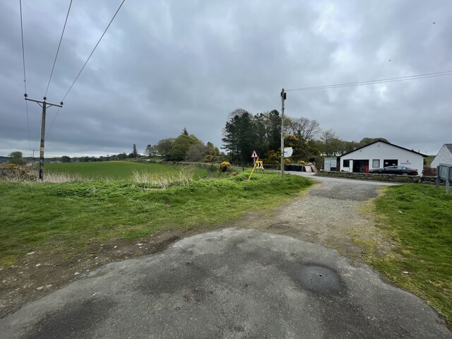
Lang Stane Wood is a picturesque forest located in Aberdeenshire, Scotland. Covering an area of approximately 20 hectares, the wood is situated near the village of Cullerlie. The name "Lang Stane" means "long stone" in the local dialect, referring to a large standing stone found within the wood.

The wood is predominantly composed of native broadleaf trees, including oak, birch, and rowan. These trees provide a diverse habitat for a variety of wildlife, such as red squirrels, roe deer, and a wide range of bird species. The wood is also home to a number of rare plant species, including wood sorrel and bluebells, which create a stunning display during the springtime.

Lang Stane Wood is a popular destination for nature enthusiasts and hikers, offering a network of well-maintained trails that wind through the forest. These trails provide visitors with the opportunity to explore the wood's natural beauty and observe its wildlife. There are also designated picnic areas and benches scattered throughout the wood, allowing visitors to relax and enjoy the peaceful surroundings.

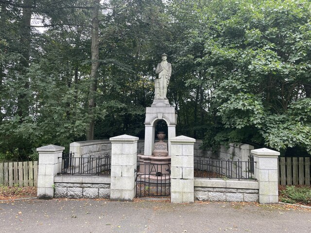
In addition to its natural attractions, Lang Stane Wood has historical significance as well. The aforementioned standing stone, known as the "Lang Stane," is believed to be a remnant from prehistoric times, adding an air of mystery and intrigue to the wood.

Overall, Lang Stane Wood is a captivating destination that offers a combination of natural beauty, biodiversity, and historical interest. It is a place where visitors can immerse themselves in the tranquility of nature while appreciating the rich history of the area.

If you have any feedback on the listing, please let us know in the comments section below.

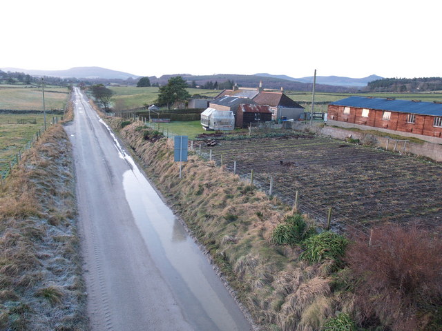
Lang Stane Wood Images

Images are sourced within 2km of 57.22339/-2.4588394 or Grid Reference NJ7214. Thanks to Geograph Open Source API. All images are credited.

Entrance to the fisherman's carpark
James Mitchell Memorial In 1840ish travel to and from Kemnay to Aberdeen was by Stage-Coach called ‘The Banks of Don’ which travelled between Inverurie and Aberdeen.

To catch the Stage-Coach you had to walk the Four miles to get to the Inverurie – Aberdeen road. The road from Kemnay did not follow the route of today, but went from the Pleasure Park up past Leschangie rejoining the road of today at Cotton about two miles west of Kemnay. 

In these early days Parcels and Goods were delivered to Kemnay by a Local Carrier James Mitchell who could have been seen setting off early in the morning, winding his way round past Leschangie and slowly making his way up the Tyrebagger Hill on his way to Aberdeen.  He would make his way back later in the day laden with goods bound for Kemnay and the surrounding area.

James Mitchell could neither read nor write, but he had a good memory and with the careful placing of goods on his cart could deliver them in the most part without error.  He also delivered fresh water from a stream that used to run from the drinking fountain on the statue. Sadly it has now been disconnected.  James Mitchell was characteristically dressed in Cord Knee length Britches, Broad Blue Hat and Knee length Boots..

The Memorial was erected in 1936 at the West end of Kemnay on the B993 Kintore to Tillyfourie (Alford) road.
James Mitchell Memorial
In 1840ish travel to and from Kemnay to Aberdeen was by Stage-Coach called ‘The Banks of Don’ which travelled between Inverurie and Aberdeen. To catch the Stage-Coach you had to walk the Four miles to get to the Inverurie – Aberdeen road. The road from Kemnay did not follow the route of today, but went from the Pleasure Park up past Leschangie rejoining the road of today at Cotton about two miles west of Kemnay. In these early days Parcels and Goods were delivered to Kemnay by a Local Carrier James Mitchell who could have been seen setting off early in the morning, winding his way round past Leschangie and slowly making his way up the Tyrebagger Hill on his way to Aberdeen. He would make his way back later in the day laden with goods bound for Kemnay and the surrounding area. James Mitchell could neither read nor write, but he had a good memory and with the careful placing of goods on his cart could deliver them in the most part without error. He also delivered fresh water from a stream that used to run from the drinking fountain on the statue. Sadly it has now been disconnected. James Mitchell was characteristically dressed in Cord Knee length Britches, Broad Blue Hat and Knee length Boots.. The Memorial was erected in 1936 at the West end of Kemnay on the B993 Kintore to Tillyfourie (Alford) road.
Farmland by Muchalls Farmland north of Castle Fraser with a view to Bennachie.
Farmland by Muchalls
Farmland north of Castle Fraser with a view to Bennachie.
Tractor by Muchalls A tractor operating in a field by Muchalls Burn with woodland of Alton Brae behind.
Tractor by Muchalls
A tractor operating in a field by Muchalls Burn with woodland of Alton Brae behind.
St Anne's Scottish Episcopal Church, Kendal Road, Kemnay A simple, even austere building dating from 1938.  Its stone came from Kemnay Quarry, just one kilometre away.
St Anne's Scottish Episcopal Church, Kendal Road, Kemnay
A simple, even austere building dating from 1938. Its stone came from Kemnay Quarry, just one kilometre away.
Bound for glory? (Bogbeth Park, Kemnay) Kemnay FC (black and white shirts) play Banchory FC (purple) in the first round of the Scottish Youth FA Cup (under 17s section) on 14 September 2013.  Kemnay won 4-3. Can you spot the ball?
Bound for glory? (Bogbeth Park, Kemnay)
Kemnay FC (black and white shirts) play Banchory FC (purple) in the first round of the Scottish Youth FA Cup (under 17s section) on 14 September 2013. Kemnay won 4-3. Can you spot the ball?
This way to paradise? Looking down Paradise Road, Kemnay.  Several roads in the village have been deemed one-way streets.
This way to paradise?
Looking down Paradise Road, Kemnay. Several roads in the village have been deemed one-way streets.
The Burnett Arms Hotel, Kemnay The Burnetts have been major landowners in Kemnay since 1688: for the history of the Kemnay branch of the family, see: <span class="nowrap"><a title="http://www.burnett.uk.com/kemnay.htm" rel="nofollow ugc noopener" href="http://www.burnett.uk.com/kemnay.htm">Link</a><img style="margin-left:2px;" alt="External link" title="External link - shift click to open in new window" src="https://s1.geograph.org.uk/img/external.png" width="10" height="10"/></span>
The Burnett Arms Hotel, Kemnay
The Burnetts have been major landowners in Kemnay since 1688: for the history of the Kemnay branch of the family, see: LinkExternal link
Kemnay Pharmacy and Post Office, High Street, Kemnay
Kemnay Primary School
Kemnay Village Hall
Kemnay Village Hall
Kemnay Petrol Station, Station Road, Kemnay It only seems to sell diesel, perhaps to farm vehicles.
Kemnay Petrol Station, Station Road, Kemnay
It only seems to sell diesel, perhaps to farm vehicles.
Tranquil bend in the River Don near Kemnay
Kemnay Scout Hut The Scout Hut was originally a drill hall. My thanks to the neighbours who allowed me to photograph it from their garden.
Kemnay Scout Hut
The Scout Hut was originally a drill hall. My thanks to the neighbours who allowed me to photograph it from their garden.
Kemnay Scout Hut The Scout Hut was originally a drill hall. I hear on the grapevine that there have been discussions about demolishing it and replacing it with a modern building.
Kemnay Scout Hut
The Scout Hut was originally a drill hall. I hear on the grapevine that there have been discussions about demolishing it and replacing it with a modern building.
urnett Arms Hotel This should of course read Burnett Arms Hotel, but the B has apparently been missing for some time. That, plus the banner advertising live sport, was quite enough to deter me from going in for a bite of lunch.
urnett Arms Hotel
This should of course read Burnett Arms Hotel, but the B has apparently been missing for some time. That, plus the banner advertising live sport, was quite enough to deter me from going in for a bite of lunch.
High Street The buildings in the High Street are of local grey granite.
High Street
The buildings in the High Street are of local grey granite.
Station Road This, rather than the High Street, is the principal street in Kemnay.
Station Road
This, rather than the High Street, is the principal street in Kemnay.
Show me another place!

Lang Stane Wood is located at Grid Ref: NJ7214 (Lat: 57.22339, Lng: -2.4588394)

Unitary Authority: Aberdeenshire

Police Authority: North East

What 3 Words

///magnitude.cook.solution. Near Kemnay, Aberdeenshire

Related Wikis

Kemnay House

Kemnay House is a 17th-century tower house, now incorporated in a later house, about 5.5 miles (8.9 km) south and west of Inverurie, Aberdeenshire, Scotland...

Kemnay, Aberdeenshire

Kemnay (Gaelic: Camnaidh) is a village 16 miles (26 km) west of Aberdeen in Garioch, Aberdeenshire, Scotland. == History == The village name Kemnay is...

Kemnay railway station

Kemnay railway station was a station on the Alford Valley Railway in Kemnay, Aberdeenshire, which opened in 1858 and closed in 1950. == References... ==

Kemnay Academy

Kemnay Academy is a secondary school in Kemnay, Aberdeenshire, situated on the banks of the River Don. It is one of seventeen secondary schools run by...

Fetternear Palace

Fetternear Bishop's Palace is an archaeological site of what was one of the palaces (or residences) of the medieval bishops of Aberdeen. It is near Kemnay...

Castle Fraser

Castle Fraser is the most elaborate Z-plan castle in Scotland and one of the grandest 'Castles of Mar'. It is located near Kemnay in the Aberdeenshire...

Aquithie

Aquithie is a hamlet in Aberdeenshire, Scotland, belonging to the parish of Kemnay. It is best known for its Aquithie Boarding & Quarantine Kennels....

House of Monymusk

The House of Monymusk is located on the outskirts of the Scottish village of Monymusk, in the Marr region of Aberdeenshire. The house is located near the...

Nearby Amenities

Located within 500m of 57.22339,-2.4588394
Material: wood
Power: pole
Lat/Long: 57.2195874/-2.463273
Material: wood
Power: pole
Lat/Long: 57.2202561/-2.4641273
Material: wood
Power: pole
Lat/Long: 57.2207806/-2.464922
Material: wood
Power: pole
Lat/Long: 57.2214278/-2.4659238
Material: wood
Power: pole
Lat/Long: 57.2231716/-2.4659678
Material: wood
Power: pole
Lat/Long: 57.2237008/-2.4649617
Material: wood
Power: pole
Lat/Long: 57.224261/-2.4638565
Material: wood
Power: pole
Lat/Long: 57.2248092/-2.4627799
Material: wood
Power: pole
Lat/Long: 57.2254433/-2.461536
Material: wood
Power: pole
Lat/Long: 57.225976/-2.4605386
Material: wood
Power: pole
Lat/Long: 57.2265254/-2.4594862
Material: wood
Power: pole
Lat/Long: 57.2270903/-2.458403
Material: wood
Power: pole
Lat/Long: 57.2276528/-2.4573088
The data included in this document is from www.openstreetmap.org. The data is made available under ODbL.

Have you been to Lang Stane Wood?

Leave your review of Lang Stane Wood below (or comments, questions and feedback).