Chapel Leigh

Settlement in Somerset Somerset West and Taunton

England

Chapel Leigh

Fitzhead: St James the Great In 1791 the church was dedicated to St Mary Magdalene. Until 1755 this was a daughter church or chapelry of Wiveliscombe; it was rebuilt in 1849. A new north aisle was added in 1887. The west tower survives from the earlier church and is 15th century
Fitzhead: St James the Great Credit: Martin Bodman

Chapel Leigh is a small village located in the county of Somerset, England. Situated approximately 6 miles west of the town of Taunton, it is nestled in the picturesque countryside of the Blackdown Hills Area of Outstanding Natural Beauty.

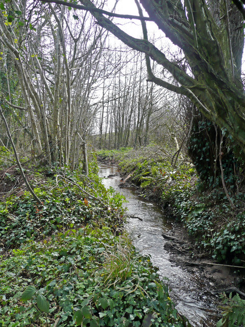
The village is home to a close-knit community of around 200 residents, who enjoy the tranquility and charm that Chapel Leigh offers. The landscape is predominantly rural, with rolling hills, lush green fields, and ancient woodland surrounding the village. This makes it an ideal destination for those seeking a peaceful retreat or a base to explore the natural beauty of the region.

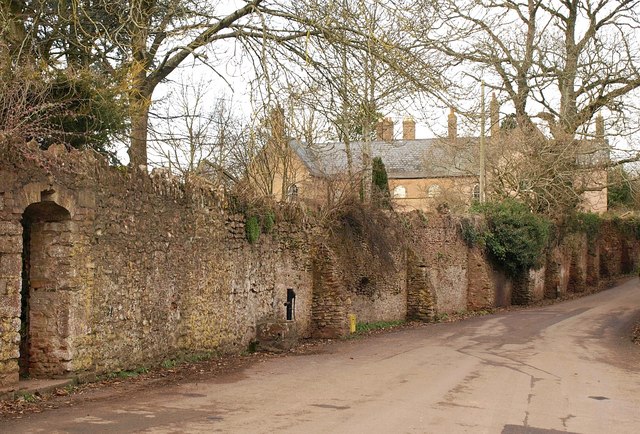
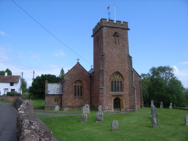
Chapel Leigh boasts a rich history, dating back to medieval times. The village is named after a chapel that once stood here, although little evidence of its existence remains. However, the local church of St. Mary's, which dates back to the 13th century, still stands as a testament to the village's heritage.

While Chapel Leigh may be small in size, it is not lacking in amenities. The village has a community hall, where various events and gatherings take place throughout the year, fostering a strong sense of community spirit. Additionally, there are several walking trails and footpaths that crisscross the surrounding countryside, offering residents and visitors the opportunity to explore the area's natural beauty.

Overall, Chapel Leigh is a charming and idyllic village, offering a peaceful retreat and a glimpse into Somerset's rich history and natural landscapes.

If you have any feedback on the listing, please let us know in the comments section below.
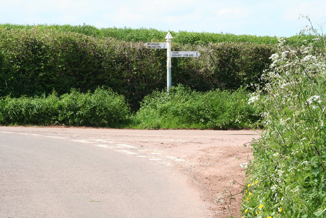
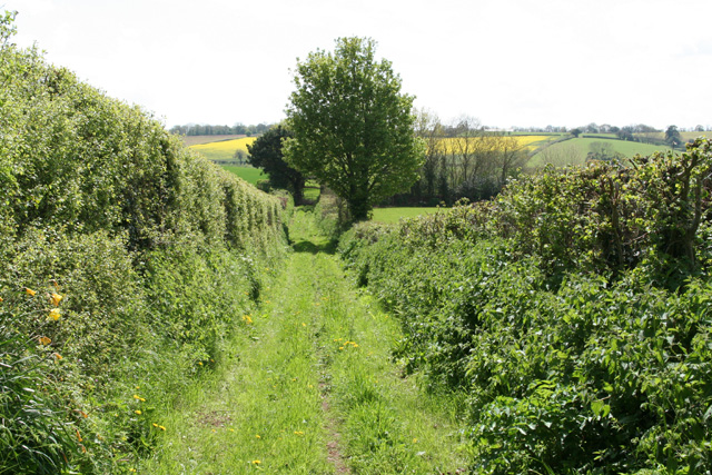
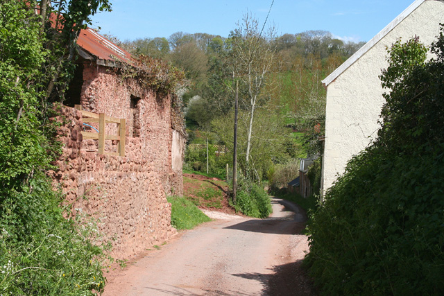
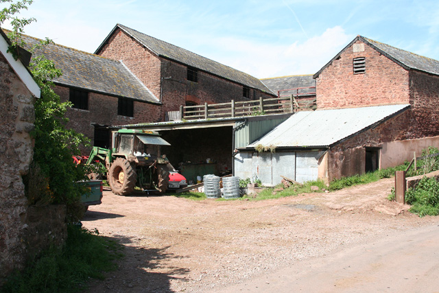
Chapel Leigh Images

Images are sourced within 2km of 51.059739/-3.24742 or Grid Reference ST1229. Thanks to Geograph Open Source API. All images are credited.

Fitzhead: St James the Great In 1791 the church was dedicated to St Mary Magdalene. Until 1755 this was a daughter church or chapelry of Wiveliscombe; it was rebuilt in 1849. A new north aisle was added in 1887. The west tower survives from the earlier church and is 15th century
Fitzhead: St James the Great
In 1791 the church was dedicated to St Mary Magdalene. Until 1755 this was a daughter church or chapelry of Wiveliscombe; it was rebuilt in 1849. A new north aisle was added in 1887. The west tower survives from the earlier church and is 15th century
Fitzhead: St James the Great The 15th century west tower, the survivor from the medieval church
Fitzhead: St James the Great
The 15th century west tower, the survivor from the medieval church
Fitzhead: north west from the village Landscape with woods and fields. Looking north towards the Quantocks
Fitzhead: north west from the village
Landscape with woods and fields. Looking north towards the Quantocks
Halse: Combe Cross Looking north west
Halse: Combe Cross
Looking north west
Fitzhead: near Brownsells Footpath to Dean Farm. Looking south-south-west
Fitzhead: near Brownsells
Footpath to Dean Farm. Looking south-south-west
Lydeard St Lawrence: Chapel Leigh Chapel Leigh is a hamlet consisting of two farms and a number of cottages. Looking east-north-east
Lydeard St Lawrence: Chapel Leigh
Chapel Leigh is a hamlet consisting of two farms and a number of cottages. Looking east-north-east
Halse: barns at Northway Farm Looking north-north-west
Halse: barns at Northway Farm
Looking north-north-west
Fitzhead: limekiln near Burrow Hill Farm Looking south
Fitzhead: limekiln near Burrow Hill Farm
Looking south
Fitzhead: near Brewers Farm Friendly horses by the footpath from Fitzhead to Ford
Fitzhead: near Brewers Farm
Friendly horses by the footpath from Fitzhead to Ford
Hoccombe Farm Hoccombe Farm seen from the meadow behind it. Leat running in the foreground. Date: 22/04/2006.
Hoccombe Farm
Hoccombe Farm seen from the meadow behind it. Leat running in the foreground. Date: 22/04/2006.
Hoccombe Farm Hoccombe Farm and buildings, seen from the orchard.
Hoccombe Farm
Hoccombe Farm and buildings, seen from the orchard.
Burrow Hill Viewed from the bridge south of Moor Mill Farm.
Burrow Hill
Viewed from the bridge south of Moor Mill Farm.
Somerset stream One of the head streams of the Tone which arise from the Brendon Hills east of Exmoor.
Somerset stream
One of the head streams of the Tone which arise from the Brendon Hills east of Exmoor.
Lower Stoford Seen across fields and a valley from Ash Priors Common. The thatched Stoford Farm (left of centre) may date from the C13 or C14 <span class="nowrap"><a title="http://webapp1.somerset.gov.uk/her/details.asp?prn=44073" rel="nofollow ugc noopener" href="http://webapp1.somerset.gov.uk/her/details.asp?prn=44073">Link</a><img style="margin-left:2px;" alt="External link" title="External link - shift click to open in new window" src="https://s1.geograph.org.uk/img/external.png" width="10" height="10"/></span> .
Lower Stoford
Seen across fields and a valley from Ash Priors Common. The thatched Stoford Farm (left of centre) may date from the C13 or C14 LinkExternal link .
Road to Northway Climbing away from the valley at Queensbridge, this is the C18 turnpike road from Bishop's Lydeard to Wiveliscombe, which here also forms the parish boundary between Halse (left) and Ash Priors.
Road to Northway
Climbing away from the valley at Queensbridge, this is the C18 turnpike road from Bishop's Lydeard to Wiveliscombe, which here also forms the parish boundary between Halse (left) and Ash Priors.
Road to Ash Priors The reverse view of <a href="https://www.geograph.org.uk/photo/1594159">ST1429 : Road to Northway</a>, looking down the turnpike beneath overhanging trees.
Road to Ash Priors
The reverse view of ST1429 : Road to Northway, looking down the turnpike beneath overhanging trees.
Road approaching Northway Farm The road from Ash Priors, still following the C18 turnpike from Bishop's Lydeard to Wiveliscombe shown in <a href="https://www.geograph.org.uk/photo/1594159">ST1429 : Road to Northway</a>, is dropping into the Halse Water valley. One of the barns at Northway Farm can be glimpsed around the bend.
Road approaching Northway Farm
The road from Ash Priors, still following the C18 turnpike from Bishop's Lydeard to Wiveliscombe shown in ST1429 : Road to Northway, is dropping into the Halse Water valley. One of the barns at Northway Farm can be glimpsed around the bend.
Northway Farm The C19 farmhouse, seen from the lane approaching from Ash Priors (see also <a href="https://www.geograph.org.uk/photo/1594275">ST1329 : Road approaching Northway Farm</a>) is listed <span class="nowrap"><a title="http://webapp1.somerset.gov.uk/her/details.asp?prn=40152" rel="nofollow ugc noopener" href="http://webapp1.somerset.gov.uk/her/details.asp?prn=40152">Link</a><img style="margin-left:2px;" alt="External link" title="External link - shift click to open in new window" src="https://s1.geograph.org.uk/img/external.png" width="10" height="10"/></span> .
Northway Farm
The C19 farmhouse, seen from the lane approaching from Ash Priors (see also ST1329 : Road approaching Northway Farm) is listed LinkExternal link .
Show me another place!

Chapel Leigh is located at Grid Ref: ST1229 (Lat: 51.059739, Lng: -3.24742)

Administrative County: Somerset

District: Somerset West and Taunton

Police Authority: Avon and Somerset

What 3 Words

///rots.solicitor.kebabs. Near Milverton, Somerset

Related Wikis

Fitzhead Court and The Manor

Fitzhead Court and The Manor in Fitzhead, Somerset, England was built in the late 16th century and has now been split into two buildings. It is a Grade...

Church of St James the Great, Fitzhead

The Anglican Church of St James the Great in Fitzhead, Somerset, England was built in the 15th century. It is a Grade II* listed building. == History... ==

Fitzhead

Fitzhead is a village and civil parish in Somerset, England, situated approximately 6 miles (9.7 km) north west of Taunton. The village has an estimated...

Halse, Somerset

Halse is a village and civil parish in Somerset, England, situated 6 miles (9.7 km) north west of Taunton. The village has a population of 290. == History... ==

Church of the Holy Trinity, Ash Priors

The Church of the Holy Trinity in Ash Priors, Somerset, England was built in the 15th century. It is a Grade II* listed building. == History == In the...

Ash Priors

Ash Priors is a village and parish in Somerset, England, situated 5 miles (8.0 km) north west of Taunton. The village has a population of 155. == History... ==

Gaulden Manor

Gaulden Manor (also Gavelden or Gaveldene) is a Grade II* listed country house to the southeast of Tolland, Somerset, England. It is a double storied building...

Lydeard St Lawrence

Lydeard St Lawrence or St Lawrence Lydiard is a village and civil parish in Somerset, England, situated 7 miles (11.3 km) north west of Taunton. The village...

Nearby Amenities

Located within 500m of 51.059739,-3.24742
Chapel Leigh
Is In: Somerset, England, United Kingdom
Place: hamlet
Postal Code: TA4 3RB
Lat/Long: 51.0594707/-3.2457179
Ele: 90
Lat/Long: 51.0620942/-3.246081
Brand: National Grid
Brand Wikidata: Q1465461
Material: wood
Operator: National Grid Electricity Distribution Plc
Operator Old: Western Power Distribution
Operator Wikidata: Q7988183
Owner: National Grid Electricity Distribution (South West) Plc
Owner Wikidata: Q114397866
Power: pole
Lat/Long: 51.0590984/-3.2449821
Brand: National Grid
Brand Wikidata: Q1465461
Material: wood
Operator: National Grid Electricity Distribution Plc
Operator Old: Western Power Distribution
Operator Wikidata: Q7988183
Owner: National Grid Electricity Distribution (South West) Plc
Owner Wikidata: Q114397866
Power: pole
Lat/Long: 51.0586516/-3.2447816
Brand: National Grid
Brand Wikidata: Q1465461
Material: wood
Operator: National Grid Electricity Distribution Plc
Operator Old: Western Power Distribution
Operator Wikidata: Q7988183
Owner: National Grid Electricity Distribution (South West) Plc
Owner Wikidata: Q114397866
Power: pole
Lat/Long: 51.059825/-3.2457143
Access: private
Door: overhead
Entrance: yes
Motorcar: private
Lat/Long: 51.0597367/-3.2457979
Access: private
Door: hinged
Door Type: double
Entrance: yes
Material: wood
Motorcar: private
Lat/Long: 51.059074/-3.2460469
Fire Hydrant
Emergency: fire_hydrant
Fire Hydrant Count: 1
Fire Hydrant Position: lane
Fire Hydrant Type: underground
Operator: Wessex Water
Lat/Long: 51.0594406/-3.2459188
Brand: National Grid
Brand Wikidata: Q1465461
Material: wood
Operator: National Grid Electricity Distribution Plc
Operator Old: Western Power Distribution
Operator Wikidata: Q7988183
Owner: National Grid Electricity Distribution (South West) Plc
Owner Wikidata: Q114397866
Power: pole
Lat/Long: 51.0595038/-3.24681
Brand: National Grid
Brand Wikidata: Q1465461
Devices: 1
Frequency: 50
Material: wood
Operator: National Grid Electricity Distribution Plc
Operator Old: Western Power Distribution
Operator Wikidata: Q7988183
Owner: National Grid Electricity Distribution (South West) Plc
Owner Wikidata: Q114397866
Phases: 1
Power: pole
Transformer: distribution
Lat/Long: 51.0595417/-3.2451846
Brand: National Grid
Brand Wikidata: Q1465461
Layer: 1
Operator: National Grid Electricity Distribution Plc
Operator Old: Western Power Distribution
Operator Wikidata: Q7988183
Owner: National Grid Electricity Distribution (South West) Plc
Owner Wikidata: Q114397866
Power: terminal
Lat/Long: 51.059377/-3.2460109
Brand: National Grid
Brand Wikidata: Q1465461
Line Management: branch
Material: wood
Operator: National Grid Electricity Distribution Plc
Operator Old: Western Power Distribution
Operator Wikidata: Q7988183
Owner: National Grid Electricity Distribution (South West) Plc
Owner Wikidata: Q114397866
Power: pole
Lat/Long: 51.0595308/-3.2456969
Communication: pole
Material: wood
Operator: British Telecommunications PLC
Telephone: pole
Lat/Long: 51.059476/-3.2459946
Brand: National Grid
Brand Wikidata: Q1465461
Material: wood
Operator: National Grid Electricity Distribution Plc
Operator Old: Western Power Distribution
Operator Wikidata: Q7988183
Owner: National Grid Electricity Distribution (South West) Plc
Owner Wikidata: Q114397866
Power: pole
Lat/Long: 51.0595274/-3.2462065
Brand: National Grid
Brand Wikidata: Q1465461
Material: wood
Operator: National Grid Electricity Distribution Plc
Operator Old: Western Power Distribution
Operator Wikidata: Q7988183
Owner: National Grid Electricity Distribution (South West) Plc
Owner Wikidata: Q114397866
Power: pole
Lat/Long: 51.0597356/-3.2467014
Watering Place
Access: private
Lat/Long: 51.0592948/-3.2493286
Disused: yes
Historic: yes
Man Made: kiln
Product: lime
Lat/Long: 51.0576098/-3.2455426
Brand: National Grid
Brand Wikidata: Q1465461
Material: wood
Operator: National Grid Electricity Distribution Plc
Operator Old: Western Power Distribution
Operator Wikidata: Q7988183
Owner: National Grid Electricity Distribution (South West) Plc
Owner Wikidata: Q114397866
Power: pole
Lat/Long: 51.0573615/-3.24394
The data included in this document is from www.openstreetmap.org. The data is made available under ODbL.

Have you been to Chapel Leigh?

Leave your review of Chapel Leigh below (or comments, questions and feedback).