Howbog Plantation

Wood, Forest in Berwickshire

Scotland

Howbog Plantation

Dyeshaugh Plantation A long established small woodland by Redpath
Dyeshaugh Plantation Credit: Richard Webb

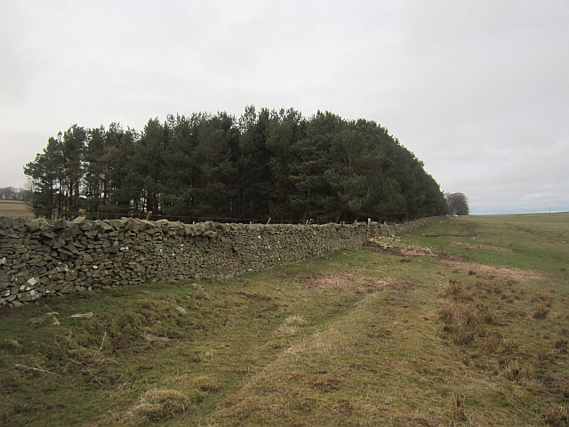
Howbog Plantation is a picturesque woodland located in the rural area of Berwickshire, Scotland. Covering an impressive area of approximately 200 acres, it is a haven for nature enthusiasts and those seeking tranquility amidst the beauty of the countryside.

The plantation is primarily composed of a diverse range of trees, including oak, ash, beech, and birch. These towering trees create a lush canopy, providing shade and shelter for various flora and fauna. The forest floor is adorned with a rich tapestry of wildflowers, ferns, and mosses, adding to its enchanting appeal.

The plantation is crisscrossed with a network of well-maintained footpaths, allowing visitors to explore its natural wonders at their own pace. As visitors traverse the trails, they may come across charming wooden bridges that span over babbling brooks, enhancing the ethereal atmosphere of the woodland. The paths also lead to a small freshwater lake nestled within the plantation, where visitors can enjoy a serene picnic or simply sit and admire the peaceful surroundings.

Howbog Plantation is a biodiversity hotspot, attracting a wide array of wildlife. Birdwatchers can spot various species, including woodpeckers, owls, and buzzards, while mammals such as red squirrels, deer, and foxes are also known to inhabit the woodland. The plantation also serves as a habitat for numerous insects, amphibians, and small mammals, making it a fascinating destination for nature lovers and wildlife enthusiasts.

In conclusion, Howbog Plantation in Berwickshire is a captivating woodland that offers visitors a chance to immerse themselves in the beauty of nature. With its diverse ecosystem, well-maintained trails, and abundant wildlife, it is a destination that truly embodies the serenity and charm of the Scottish countryside.

If you have any feedback on the listing, please let us know in the comments section below.

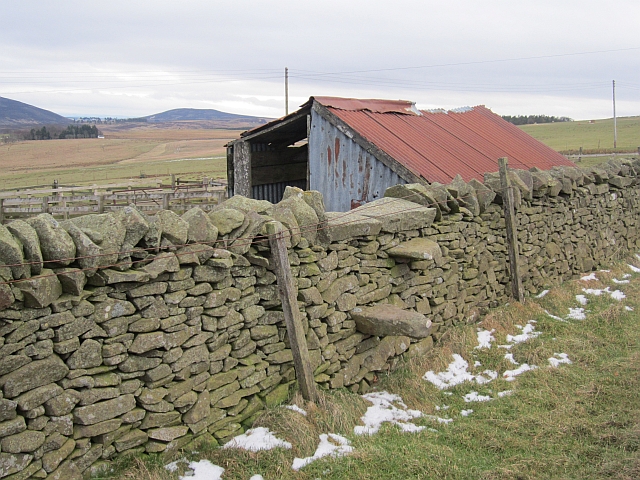
Howbog Plantation Images

Images are sourced within 2km of 55.84024/-2.4954524 or Grid Reference NT6960. Thanks to Geograph Open Source API. All images are credited.

Dyeshaugh Plantation A long established small woodland by Redpath
Dyeshaugh Plantation
A long established small woodland by Redpath
Dyke, Redpath The woodland is a recent addition to the landscape, it does not appear on older maps.
Dyke, Redpath
The woodland is a recent addition to the landscape, it does not appear on older maps.
Townhead Plantation A small wood, next to a house.
Townhead Plantation
A small wood, next to a house.
Stile, Redpath A stone stile off the road to Redpath.
Stile, Redpath
A stone stile off the road to Redpath.
Crook Burn East Near the rising of the burn, a very muddy and wet reentrant in a field.
Crook Burn East
Near the rising of the burn, a very muddy and wet reentrant in a field.
Fields, Redpath The road to Dyeshaugh crosses the field.
Fields, Redpath
The road to Dyeshaugh crosses the field.
Haddington Covert The foot of a felled strip wood. The mapped track here, shown as a right of way on the Scottish Borders Council core paths map no longer exists on the ground, but can be followed due to the construction of high quality stiles here and at either end of Twiggy's Belt.
Haddington Covert
The foot of a felled strip wood. The mapped track here, shown as a right of way on the Scottish Borders Council core paths map no longer exists on the ground, but can be followed due to the construction of high quality stiles here and at either end of Twiggy's Belt.
An old tractor at Smiddyhill This old model has seen better days.
An old tractor at Smiddyhill
This old model has seen better days.
A detail on an old tractor at Smiddyhill The information on the small panel lower left reads:

MADE IN ENGLAND BY
INTERNATIONAL HARVESTER CO.
OF GREAT BRITAIN LTD.
MODEL B-250 DIESEL
SERIAL NO. 22727
MAX IDLE SPEED 1925 R.P.M.
DO NOT OVERLOAD

For a view of the tractor, see <a href="https://www.geograph.org.uk/photo/7107516">NT6961 : An old tractor at Smiddyhill</a>.
A detail on an old tractor at Smiddyhill
The information on the small panel lower left reads: MADE IN ENGLAND BY INTERNATIONAL HARVESTER CO. OF GREAT BRITAIN LTD. MODEL B-250 DIESEL SERIAL NO. 22727 MAX IDLE SPEED 1925 R.P.M. DO NOT OVERLOAD For a view of the tractor, see NT6961 : An old tractor at Smiddyhill.
Cranshaws Village Hall Cranshaws Village Hall was opened as a recreational hall in the 1920s and has a prominent site in the middle of the village. The hall has recently been refurbished with new toilets and a new kitchen.
Regular events in Cranshaws Village Hall include Carpet Bowling, Concerts, Family Fun Days, Community parties, Art and craft workshops and courses and Big Screen International Rugby days.
Cranshaws Village Hall
Cranshaws Village Hall was opened as a recreational hall in the 1920s and has a prominent site in the middle of the village. The hall has recently been refurbished with new toilets and a new kitchen. Regular events in Cranshaws Village Hall include Carpet Bowling, Concerts, Family Fun Days, Community parties, Art and craft workshops and courses and Big Screen International Rugby days.
Smiddy Hill Farm Overlooking Whiteadder Water.
Smiddy Hill Farm
Overlooking Whiteadder Water.
Near Fellcleugh
Near Fellcleugh
The B6355 on Smiddyhill Bridge, which bridges Whiteadder Water
Smiddyhill Bridge over Whiteadder Water, near Cranshaws
Whiteadder Water upstream from Smiddyhill Bridge, near Cranshaws
Track and footpath off the B6355 near Cranshaws
Bridge over the Boontree Burn, on the B6355, near Cranshaws
Cranshaws Church of Scotland kirk, in the Scottish Borders
Show me another place!

Howbog Plantation is located at Grid Ref: NT6960 (Lat: 55.84024, Lng: -2.4954524)

Unitary Authority: The Scottish Borders

Police Authority: The Lothians and Scottish Borders

What 3 Words

///discouraged.error.advancing. Near Duns, Scottish Borders

Related Wikis

Bothwell Water

The Bothwell Water is a river in the Scottish Borders area of Scotland. It rises in the Lammermuir Hills near Caldercleugh and continues past the Upper...

Cranshaws Castle

Cranshaws Castle or Cranshaws Tower is a privately owned 15th-century pele situated by the village of Cranshaws in Berwickshire, Scotland. The building...

Cranshaws

Cranshaws is a village on the B6355 road, near Duns, in the Scottish Borders area of Scotland, in the former Berwickshire. Of Cranshaws Castle only the...

Dye Water

The Dye Water (Scottish Gaelic: Uisge DhĂ idh) is a river in the Lammermuir Hills in the Scottish Borders area of Scotland. It rises in the Hope Hills,...

Nearby Amenities

Located within 500m of 55.84024,-2.4954524
The data included in this document is from www.openstreetmap.org. The data is made available under ODbL.

Have you been to Howbog Plantation?

Leave your review of Howbog Plantation below (or comments, questions and feedback).