Birnyedge Plantation

Wood, Forest in Roxburghshire

Scotland

Birnyedge Plantation

Minor road near Baittens This ection of road also forms part of the route of St Cuthbert's Way, as indicated by the fingerpost on the far side of the road.
Minor road near Baittens Credit: James T M Towill

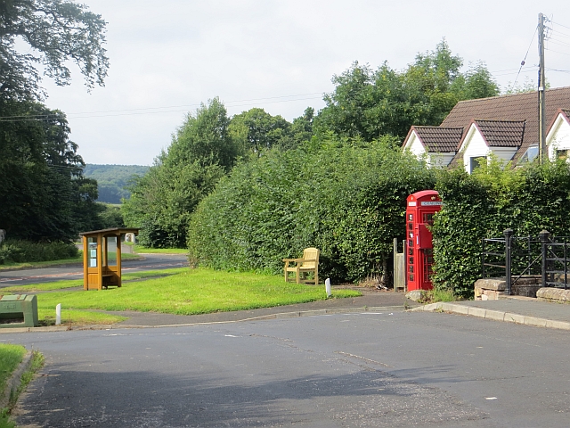
Birnyedge Plantation is a picturesque woodland located in Roxburghshire, Scotland. Covering an expansive area, it is a popular destination for nature enthusiasts and outdoor lovers. The plantation is situated in a serene and tranquil setting, offering visitors a peaceful escape from the hustle and bustle of city life.

The woodland is characterized by a diverse range of tree species, including oak, beech, and birch, creating a rich and vibrant landscape. The dense canopy provides ample shade and shelter for a variety of wildlife, making it an ideal habitat for numerous bird species, small mammals, and insects.

Walking trails wind their way through the plantation, allowing visitors to explore its natural beauty at their own pace. These well-maintained paths offer scenic views of the surrounding countryside, including rolling hills and meandering streams. The plantation is also home to several ancient ruins, adding a touch of historical charm to the area.

Birnyedge Plantation is a paradise for birdwatchers, as it attracts a wide range of avian species throughout the year. Visitors may spot woodland birds such as woodpeckers, robins, and thrushes, as well as raptors like buzzards and owls. The plantation is also home to rare and protected species, making it an important site for conservation efforts.

Overall, Birnyedge Plantation is a captivating woodland that offers a perfect blend of natural beauty, wildlife, and history. Its idyllic setting makes it an ideal destination for those seeking a peaceful retreat and an opportunity to connect with nature.

If you have any feedback on the listing, please let us know in the comments section below.

Birnyedge Plantation Images

Images are sourced within 2km of 55.495669/-2.5071655 or Grid Reference NT6822. Thanks to Geograph Open Source API. All images are credited.

Minor road near Baittens This ection of road also forms part of the route of St Cuthbert's Way, as indicated by the fingerpost on the far side of the road.
Minor road near Baittens
This ection of road also forms part of the route of St Cuthbert's Way, as indicated by the fingerpost on the far side of the road.
Across the fields to Crailing A view towards Crailing in pleasant early June conditions.
Across the fields to Crailing
A view towards Crailing in pleasant early June conditions.
Dere Street - former Roman Road - beside Stubcross Plantation Looking north-westward. Walkers, horseriders and farmers continue to make use of this ancient route.
For more detail see : <span class="nowrap"><a title="https://en.wikipedia.org/wiki/Dere_Street#Roman_route" rel="nofollow ugc noopener" href="https://en.wikipedia.org/wiki/Dere_Street#Roman_route">Link</a><img style="margin-left:2px;" alt="External link" title="External link - shift click to open in new window" src="https://s1.geograph.org.uk/img/external.png" width="10" height="10"/></span>
Dere Street - former Roman Road - beside Stubcross Plantation
Looking north-westward. Walkers, horseriders and farmers continue to make use of this ancient route. For more detail see : LinkExternal link
Grazing land hosting sheep and hay bales Looking south-westward.
Grazing land hosting sheep and hay bales
Looking south-westward.
Hedge-lined minor road at Baittens Looking north-eastward.
Hedge-lined minor road at Baittens
Looking north-eastward.
Blacksmiths at Crailing A closer look at the symbolic stones on the blacksmiths' graves at Crailing Old Parish Church. See also <a href="https://www.geograph.org.uk/photo/615338">NT6824 : Crailing Old Parish Churchyard</a> for a wider view with explanatory details of the carving. The old parish church was built in the 12th century and remained in use until the new church was built in 1757. Only a few fragments remain now.
Blacksmiths at Crailing
A closer look at the symbolic stones on the blacksmiths' graves at Crailing Old Parish Church. See also NT6824 : Crailing Old Parish Churchyard for a wider view with explanatory details of the carving. The old parish church was built in the 12th century and remained in use until the new church was built in 1757. Only a few fragments remain now.
A Fine Set of Teeth The skull on this symbolic stone in Crailing Old Parish Churchyard displays a fine set of teeth. The long neck connects with the crossed spades that were used to dig graves.
A Fine Set of Teeth
The skull on this symbolic stone in Crailing Old Parish Churchyard displays a fine set of teeth. The long neck connects with the crossed spades that were used to dig graves.
The King of Terrors at Crailing This wonderful skeleton, which almost seems to be grinning at the observer, is the biggest stone in the abandoned graveyard at Crailing Old Parish Church. See also <a href="https://www.geograph.org.uk/photo/2908211">NT6824 : The King of Terrors Gravestone at Crailing Old Parish Churchyard</a> for a closer view with explanatory details of the carving. The old parish church was built in the 12th century and remained in use until the new church was built in 1757. Only a few fragments remain now.
The King of Terrors at Crailing
This wonderful skeleton, which almost seems to be grinning at the observer, is the biggest stone in the abandoned graveyard at Crailing Old Parish Church. See also NT6824 : The King of Terrors Gravestone at Crailing Old Parish Churchyard for a closer view with explanatory details of the carving. The old parish church was built in the 12th century and remained in use until the new church was built in 1757. Only a few fragments remain now.
Field edge view at Wester Ulston Triangulation Pillar Looking north-eastward.
Field edge view at Wester Ulston Triangulation Pillar
Looking north-eastward.
Field edge view at Overwells Triangulation Pillar Looking eastward.
Field edge view at Overwells Triangulation Pillar
Looking eastward.
Jedburgh Circular Walk crossing Country Lane near Crouchie Wood Looking westward.
Jedburgh Circular Walk crossing Country Lane near Crouchie Wood
Looking westward.
Crailing countryside Farmland high above the west bank of the Oxnam Water south of Crailing.
Crailing countryside
Farmland high above the west bank of the Oxnam Water south of Crailing.
St Cuthbert's Way near Crailing This section of St Cuthbert's Way leads down and across the Oxnam Water, south of Crailing.
St Cuthbert's Way near Crailing
This section of St Cuthbert's Way leads down and across the Oxnam Water, south of Crailing.
Sandstone cliffs beside the Oxnam Water Towering sandstone cliffs above the west bank of the Oxnam Water, south of Crailing.
Sandstone cliffs beside the Oxnam Water
Towering sandstone cliffs above the west bank of the Oxnam Water, south of Crailing.
A cave high above the Oxnam Water One of three surviving caves cut into sandstone above the Oxnam Water south of Crailing - they were believed to have been inhabited at one time.  Further information here: <span class="nowrap"><a title="https://canmore.org.uk/site/57084/crailing" rel="nofollow ugc noopener" href="https://canmore.org.uk/site/57084/crailing">Link</a><img style="margin-left:2px;" alt="External link" title="External link - shift click to open in new window" src="https://s1.geograph.org.uk/img/external.png" width="10" height="10"/></span>
A cave high above the Oxnam Water
One of three surviving caves cut into sandstone above the Oxnam Water south of Crailing - they were believed to have been inhabited at one time. Further information here: LinkExternal link
A cave in sandstone One of the remaining caves high above the Oxnam Water.  There are presumed to be two others at a slightly lower level to the north but access to these would require safety equipment.  Further information on the caves can be found at: <span class="nowrap"><a title="https://canmore.org.uk/site/57084/crailing" rel="nofollow ugc noopener" href="https://canmore.org.uk/site/57084/crailing">Link</a><img style="margin-left:2px;" alt="External link" title="External link - shift click to open in new window" src="https://s1.geograph.org.uk/img/external.png" width="10" height="10"/></span>
A cave in sandstone
One of the remaining caves high above the Oxnam Water. There are presumed to be two others at a slightly lower level to the north but access to these would require safety equipment. Further information on the caves can be found at: LinkExternal link
A Crailing cave interior A view from the rear of the most easily accessible cave in the sandstone above the Oxnam Water at Crailing.  Further information can be found at <span class="nowrap"><a title="https://canmore.org.uk/site/57084/crailing" rel="nofollow ugc noopener" href="https://canmore.org.uk/site/57084/crailing">Link</a><img style="margin-left:2px;" alt="External link" title="External link - shift click to open in new window" src="https://s1.geograph.org.uk/img/external.png" width="10" height="10"/></span> where the dimensions of this cave are noted as being '1.7m wide by 3.0m long and 2.0m high'.
A Crailing cave interior
A view from the rear of the most easily accessible cave in the sandstone above the Oxnam Water at Crailing. Further information can be found at LinkExternal link where the dimensions of this cave are noted as being '1.7m wide by 3.0m long and 2.0m high'.
A view across the Oxnam Water floodplain The view of the Oxnam Water floodplain south of Crailing from the mouth of a sandstone cave high above the river.
A view across the Oxnam Water floodplain
The view of the Oxnam Water floodplain south of Crailing from the mouth of a sandstone cave high above the river.
Show me another place!

Birnyedge Plantation is located at Grid Ref: NT6822 (Lat: 55.495669, Lng: -2.5071655)

Unitary Authority: The Scottish Borders

Police Authority: The Lothians and Scottish Borders

What 3 Words

///feuds.former.hoaxes. Near Jedburgh, Scottish Borders

Nearby Locations

Birnyedge Plantation

Related Wikis

Crailing

Crailing is a village on the A698, in Teviotdale, 4m east of Jedburgh in the Scottish Borders area of Scotland, in the historic county of Roxburghshire...

Roxburghshire

Roxburghshire or the County of Roxburgh (Scottish Gaelic: Siorrachd Rosbroig) is a historic county and registration county in the Southern Uplands of Scotland...

Roxburgh, Ettrick and Lauderdale

Roxburgh, Ettrick and Lauderdale (Rosbrog, Eadaraig agus Srath Labhdair in Scottish Gaelic) is a lieutenancy area of Scotland. The lieutenancy area was...

Crailinghall

Crailinghall is a village near Oxnam in the Scottish Borders area of Scotland, in the former Roxburghshire. Crailinghall is on the route of the St. Cuthbert...

Hartrigge House

Hartrigge House or Stewartfield House was a country house in Jedburgh in the Scottish Borders. Its first owner was in 1614 and it was rebuilt in 1854....

Nisbet, Scottish Borders

Nisbet is a small hamlet on the B6400, in Roxburghshire, along the River Teviot, in the Scottish Borders area of Scotland. It is located 5.5 kilometres...

Jedfoot railway station

Jedfoot railway station served the town of Jedburgh, Scottish Borders, Scotland from 1856 to 1948 on the Jedburgh Railway. == History == The station opened...

Bonjedward

Bonjedward (Scottish Gaelic: Bun Jedward) is a hamlet in the Scottish Borders area of Scotland, two miles north of Jedburgh where the Jed Water joins the...

Have you been to Birnyedge Plantation?

Leave your review of Birnyedge Plantation below (or comments, questions and feedback).