Chapel End

Settlement in Bedfordshire

England

Chapel End

DHL Warehouse at Bedford
DHL Warehouse at Bedford Credit: Anthony Parkes

Chapel End is a small village located in the county of Bedfordshire, England. Situated approximately 5 miles south of the town of Bedford, it lies within the civil parish of Cardington. The village is known for its picturesque countryside and tranquil atmosphere.

Chapel End is home to a close-knit community, with a population of around 300 residents. The village offers a range of amenities, including a village hall, a local pub, and a primary school. The village hall serves as a gathering place for various events and activities, providing a hub for social interaction within the community.

Surrounded by beautiful natural landscapes, Chapel End is a popular destination for outdoor enthusiasts. The village is flanked by extensive fields and rolling hills, offering opportunities for leisurely walks and cycling. Nearby attractions include the renowned Cardington Hangars, which were used during the First World War and have since become iconic landmarks.

Transport links in Chapel End are relatively limited, with the closest major road being the A600, which connects the village to Bedford and other nearby towns. The village is also serviced by a few bus routes, providing connections to the wider region.

Overall, Chapel End is a charming village that offers a peaceful and idyllic countryside setting. Its close-knit community and scenic surroundings make it an attractive place to live or visit for those seeking a tranquil retreat away from the busier urban areas.

If you have any feedback on the listing, please let us know in the comments section below.
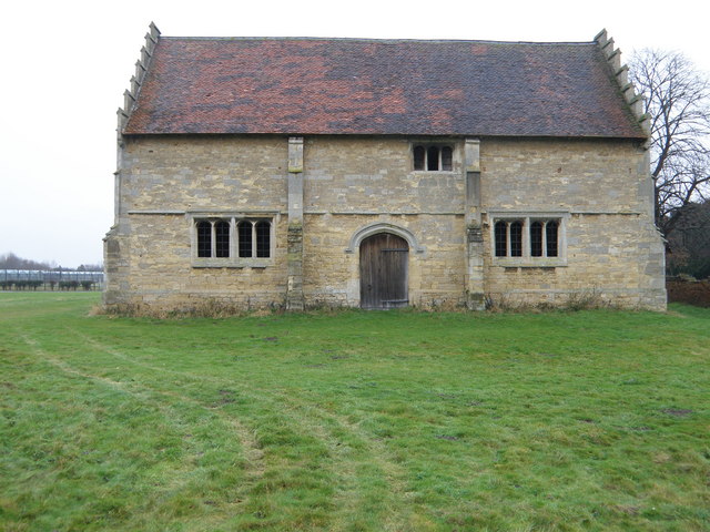
Chapel End Images

Images are sourced within 2km of 52.121699/-0.402747 or Grid Reference TL0948. Thanks to Geograph Open Source API. All images are credited.

DHL Warehouse at Bedford
Otter sculpture and beach at Priory Country Park
Telephone Box, Church Lane, Cardington
Airship hangars The old airship hangars at Cardington.  Known as the Royal Airship Works, it built airships for the Admiralty between 1919 and 1930, until the crash of airship R101 stopped all airship work.  It later built barrage balloons for the WW2 effort.
Airship hangars
The old airship hangars at Cardington. Known as the Royal Airship Works, it built airships for the Admiralty between 1919 and 1930, until the crash of airship R101 stopped all airship work. It later built barrage balloons for the WW2 effort.
Disused railway bridge on Southill Road The old Bedford to Hitchin line of the Midland Railway passed under this bridge near Cardington.  The line was opened in 1857, but became a backwater when the main Bedford to St. Pancras line was built for the Midland's access to London.  it closed in 1963 and the track was removed sometime after 1964.
Disused railway bridge on Southill Road
The old Bedford to Hitchin line of the Midland Railway passed under this bridge near Cardington. The line was opened in 1857, but became a backwater when the main Bedford to St. Pancras line was built for the Midland's access to London. it closed in 1963 and the track was removed sometime after 1964.
Footpath? The footpath is clear until it reaches a healthy crop of field beans.
Footpath?
The footpath is clear until it reaches a healthy crop of field beans.
All Saints Cople
All Saints Cople
The Five Bells Cople
Gravel Pit Entrance
Gravel Pit Entrance
St Lawrence Willington
Middle Farm entrance
The five bells Cople
The five bells
Cople
Willington Quarry Entrance to Willington Quarry, from near where their driveway crosses the main bedford-sandy cycle path
Willington Quarry
Entrance to Willington Quarry, from near where their driveway crosses the main bedford-sandy cycle path
All Saints, Cople, Beds
Park Lane (track) looking south Public Bridleway between the fields of Wood End Farm
Park Lane (track) looking south
Public Bridleway between the fields of Wood End Farm
Park Lane (track) looking north Public Bridleway between the fields on Wood End Farm
Park Lane (track) looking north
Public Bridleway between the fields on Wood End Farm
Manor farm stables, Willington Tudor building built around 1539 as part of the Manor farm. Now in the stewardship of the National Trust, opening times are seasonal so check <span class="nowrap"><a title="http://www.nationaltrust.org.uk/main/w-willingtondovecote" rel="nofollow ugc noopener" href="http://www.nationaltrust.org.uk/main/w-willingtondovecote">Link</a><img style="margin-left:2px;" alt="External link" title="External link - shift click to open in new window" src="https://s1.geograph.org.uk/img/external.png" width="10" height="10"/></span> for up to date information.
Manor farm stables, Willington
Tudor building built around 1539 as part of the Manor farm. Now in the stewardship of the National Trust, opening times are seasonal so check LinkExternal link for up to date information.
Show me another place!

Chapel End is located at Grid Ref: TL0948 (Lat: 52.121699, Lng: -0.402747)

Unitary Authority: Bedford

Police Authority: Bedfordshire

What 3 Words

///justifies.makes.uproot. Near Cardington, Bedfordshire

Nearby Locations

Chapel End

Related Wikis

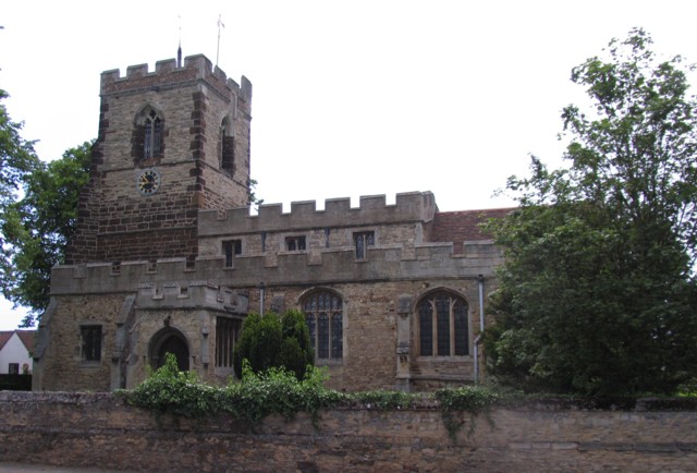
Church of All Saints, Cople

Church of All Saints is a Grade I listed church in Cople, Bedfordshire, England. It became a listed building on 13 July 1964. The church, dedicated to...

Cople

Cople is a village and civil parish in the English county of Bedfordshire. The name Cople is derived from the phrase Cock Pool, a place where chickens...

Cardington, Bedfordshire

Cardington is a village and civil parish in the Borough of Bedford in Bedfordshire, England. Part of the ancient hundred of Wixamtree, the settlement is...

Real Bedford F.C.

Real Bedford Football Club is a football club based in Bedford, England. Established in 2002 as a merger of Bedford United and US Valerio, the club are...

Nearby Amenities

Located within 500m of 52.121699,-0.402747
Bus: yes
Public Transport: stop_position
Lat/Long: 52.1205652/-0.4053808
Chapel End
Place: locality
Source: OS_OpenData_StreetView
Lat/Long: 52.1205346/-0.4031934
Summerhill Farm Shop
Addr Postcode: MK44 3SH
Addr Street: Cople Road
Fhrs Id: 103036
Phone: +44 1234 831222
Shop: farm
Website: http://summerhillfarmshop.co.uk
Lat/Long: 52.1202413/-0.406576
Colour: white
Inscription: 107 L uparrow 10km
Marker: post
Material: concrete
Utility: oil
Lat/Long: 52.1221849/-0.3978149
Colour: white
Inscription: TOTAL HIGH PRESSURE PIPELINE 0800 592246
Marker: sign
Material: concrete
Utility: oil
Lat/Long: 52.1221767/-0.3978095
The data included in this document is from www.openstreetmap.org. The data is made available under ODbL.

Have you been to Chapel End?

Leave your review of Chapel End below (or comments, questions and feedback).