Wood of Craigbrae

Wood, Forest in Aberdeenshire

Scotland

Wood of Craigbrae

Postie's Wood Beeches caught with a long exposure in the morning gloom. This was the day before the Winter Solstice and daylight is short this far north.
Postie's Wood Credit: Richard Webb

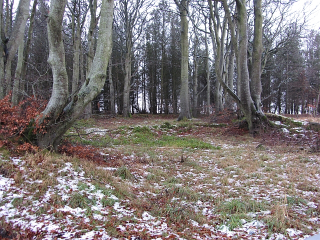
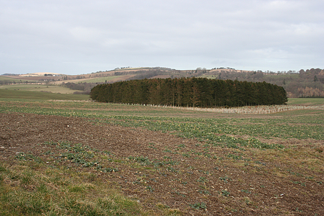
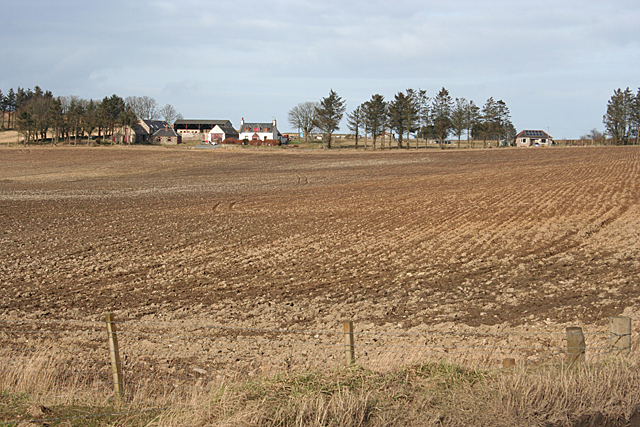
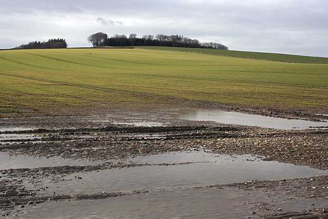
Wood of Craigbrae is a picturesque forest located in Aberdeenshire, Scotland. Covering an expansive area of approximately 100 acres, it is a haven for nature enthusiasts and outdoor adventurers alike. The woodland boasts a diverse range of tree species, including oak, birch, and pine, creating a rich and vibrant landscape.

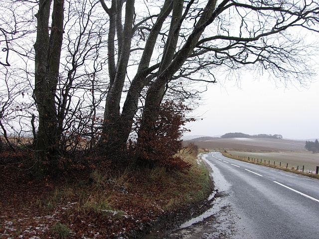
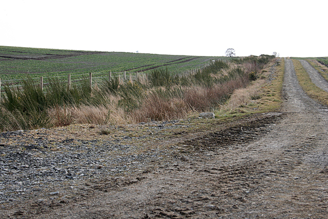
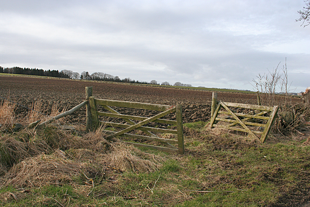
Visitors to Wood of Craigbrae can enjoy a multitude of recreational activities. The forest is crisscrossed with well-maintained trails, making it perfect for leisurely walks or invigorating hikes. These trails also offer stunning viewpoints, allowing visitors to appreciate the breathtaking beauty of the surrounding countryside.

Wildlife is abundant in the Wood of Craigbrae, providing a unique opportunity for nature lovers to observe a variety of species in their natural habitat. Red squirrels, roe deer, and a multitude of bird species can often be spotted among the trees, adding to the enchanting atmosphere of the forest.

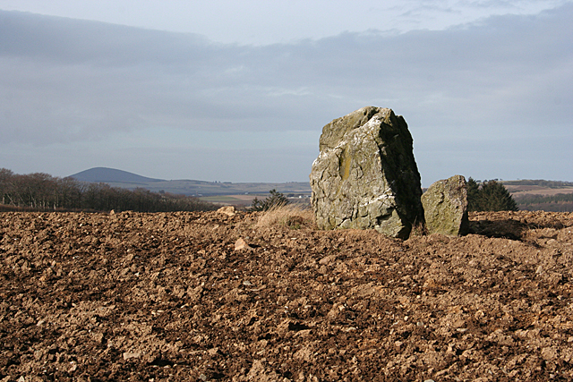
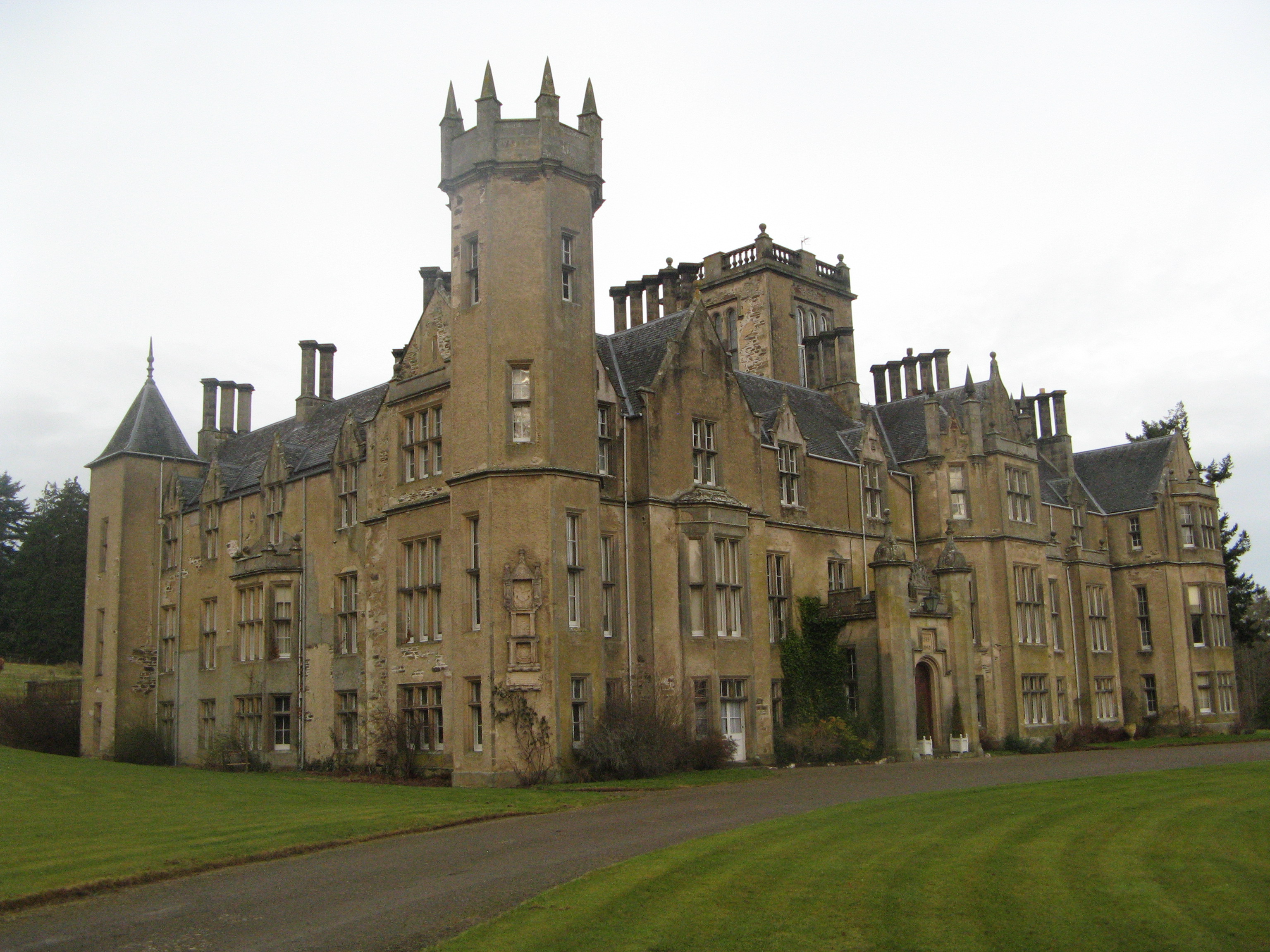
In addition to its natural beauty, Wood of Craigbrae also holds historical significance. The forest is home to ancient ruins, including the remains of a castle and a burial mound, providing a glimpse into the region's rich past.

The Wood of Craigbrae is easily accessible, with ample parking facilities and well-marked entrances. Its tranquil setting and diverse landscapes make it a popular destination for both locals and tourists seeking a peaceful retreat into nature.

If you have any feedback on the listing, please let us know in the comments section below.

Wood of Craigbrae Images

Images are sourced within 2km of 57.520131/-2.550276 or Grid Reference NJ6747. Thanks to Geograph Open Source API. All images are credited.

Postie's Wood Beeches caught with a long exposure in the morning gloom. This was the day before the Winter Solstice and daylight is short this far north.
Postie's Wood
Beeches caught with a long exposure in the morning gloom. This was the day before the Winter Solstice and daylight is short this far north.
B9024, Postie's Wood A grey dawn on the Huntly to Turriff road where it leaves Postie's Wood.
B9024, Postie's Wood
A grey dawn on the Huntly to Turriff road where it leaves Postie's Wood.
Woodland near Ardfour This square is almost all open fields, with just a couple of blocks of forest.
Woodland near Ardfour
This square is almost all open fields, with just a couple of blocks of forest.
Drainage Ditch A wide road, not shown on the maps, parallels the ditch.
Drainage Ditch
A wide road, not shown on the maps, parallels the ditch.
Backhill of Drachlaw The foreground is in this square, but the farm buildings are in the next square.
Backhill of Drachlaw
The foreground is in this square, but the farm buildings are in the next square.
Carlin Stone Named on the maps as the Carlin Stone, it is also known as Cairn Rib, Cairn Riv, and Cairn Rieve. It is a remnant of a stone circle, thought by some authorities to be a recumbent. For a full description see <span class="nowrap"><a title="http://canmore.rcahms.gov.uk/en/site/18323/details/cairn+riv/" rel="nofollow ugc noopener" href="http://canmore.rcahms.gov.uk/en/site/18323/details/cairn+riv/">Link</a><img style="margin-left:2px;" alt="External link" title="External link - shift click to open in new window" src="https://s1.geograph.org.uk/img/external.png" width="10" height="10"/></span>
Carlin Stone
Named on the maps as the Carlin Stone, it is also known as Cairn Rib, Cairn Riv, and Cairn Rieve. It is a remnant of a stone circle, thought by some authorities to be a recumbent. For a full description see LinkExternal link
Gates at Laithers A double gate into a field beside the road to Mains of Laithers.
Gates at Laithers
A double gate into a field beside the road to Mains of Laithers.
Cottages near Mains of Laithers A pair of whitewashed cottages beside the road to Mains of Laithers.
Cottages near Mains of Laithers
A pair of whitewashed cottages beside the road to Mains of Laithers.
Looking towards Hill of Laithers The standing stone part way up the field is in the next square.
Looking towards Hill of Laithers
The standing stone part way up the field is in the next square.
Milnbank I had hoped to get down to the corner of the field, but as you can see the ground is very wet and boggy, so I had to make do with a view through the trees.
Milnbank
I had hoped to get down to the corner of the field, but as you can see the ground is very wet and boggy, so I had to make do with a view through the trees.
Bogs of Laithers The farm house at Bogs of Laithers, with an assortment of agricultural odds and ends on the edge of the vast open area beside it.
Bogs of Laithers
The farm house at Bogs of Laithers, with an assortment of agricultural odds and ends on the edge of the vast open area beside it.
Bogs of Laithers The nearest gable looks like the oldest part of the steading, now dwarfed by huge modern sheds to the north-west.
Bogs of Laithers
The nearest gable looks like the oldest part of the steading, now dwarfed by huge modern sheds to the north-west.
Near Bogs of Laithers Looking from the access road towards the brow of the hill at Ardmiddle. There is a crow's nest in the contorted tree on the left - the bird flew away as I walked past.
Near Bogs of Laithers
Looking from the access road towards the brow of the hill at Ardmiddle. There is a crow's nest in the contorted tree on the left - the bird flew away as I walked past.
Dog-legged Drain This field drain takes run-off from the fields at Bogs of Laithers to the Burn of Garble.
Dog-legged Drain
This field drain takes run-off from the fields at Bogs of Laithers to the Burn of Garble.
Towards the Burn of Garble The drain here flows into the Burn of Garbler, which is in the dip marked by the trees in the middle distance. In the background is the Hill of Laithers.
Towards the Burn of Garble
The drain here flows into the Burn of Garbler, which is in the dip marked by the trees in the middle distance. In the background is the Hill of Laithers.
Backhill of Ardmiddle Backhill is the nearest house, beside the bridge over the Burn of Garble. The former Ardmiddle School is at the top of the brae.
Backhill of Ardmiddle
Backhill is the nearest house, beside the bridge over the Burn of Garble. The former Ardmiddle School is at the top of the brae.
Milnbank There are three or four houses at Milnbank, most hidden by trees. The Burn of Garble runs in the dip beyond the ploughed field.
Milnbank
There are three or four houses at Milnbank, most hidden by trees. The Burn of Garble runs in the dip beyond the ploughed field.
Garbal and Boghead of Laithers Garbal is the farm on the right. Boghead of Laithers, on the left, is just in the next grid square.
Garbal and Boghead of Laithers
Garbal is the farm on the right. Boghead of Laithers, on the left, is just in the next grid square.
Show me another place!

Wood of Craigbrae is located at Grid Ref: NJ6747 (Lat: 57.520131, Lng: -2.550276)

Unitary Authority: Aberdeenshire

Police Authority: North East

What 3 Words

///senders.dearest.excusing. Near Turriff, Aberdeenshire

Nearby Locations

Wood of Craigbrae

Related Wikis

Bogton

Bogton is a rural area in Aberdeenshire, Scotland. To the south is Whitehill Wood and megalithic circle. == References ==

Whitehill Wood, Aberdeenshire

Whitehill Wood is a wood and megalithic stone circle in Aberdeenshire, Scotland, located off the B9025 road between Aberchirder and Turriff and between...

Dorlaithers Castle

Dorlaithers Castle was a castle about 2.5 miles (4.0 km) south-west of Turriff, Aberdeenshire, Scotland at Dorlaithers, south of the burn of Gask. It may...

Inverkeithny

Inverkeithny is a village in the Formartine area of Aberdeenshire, Scotland. The village lies near where the Burn of Forgue flows into the River Deveron...

Forglen House

Forglen House is a mansion house that forms the centrepiece of the Forglen estate in the parish of Forglen, north-west of Turriff, Aberdeenshire, in the...

Turriff United F.C.

Turriff United Football Club are a senior football club currently playing in the Highland Football League in Scotland. They play their matches at The Haughs...

Turriff Castle

Turriff Castle was a tower house, on Castlegate, Turriff, north of Idoch Water, Aberdeenshire, Scotland. The castle was also called Tower of Torrey of...

Turriff railway station

Turriff railway station was a railway station in Turriff, Aberdeenshire, Scotland. It was opened in 1857 by the Banff Macduff & Turriff Junction Railway...

Nearby Amenities

Located within 500m of 57.520131,-2.550276
Hill of Laithers
Natural: peak
Lat/Long: 57.5224737/-2.5442342
Power: pole
Lat/Long: 57.5222997/-2.55134
Power: pole
Lat/Long: 57.5235248/-2.5515767
Power: pole
Lat/Long: 57.5229836/-2.5514714
Power: pole
Lat/Long: 57.52434/-2.5517449
Power: pole
Lat/Long: 57.5242913/-2.5528118
The data included in this document is from www.openstreetmap.org. The data is made available under ODbL.

Have you been to Wood of Craigbrae?

Leave your review of Wood of Craigbrae below (or comments, questions and feedback).