Chieftain Plantation

Wood, Forest in Roxburghshire

Scotland

Chieftain Plantation

Field edge view from Howden Triangulation Pillar Looking south-westward.
Field edge view from Howden Triangulation Pillar Credit: Peter Wood

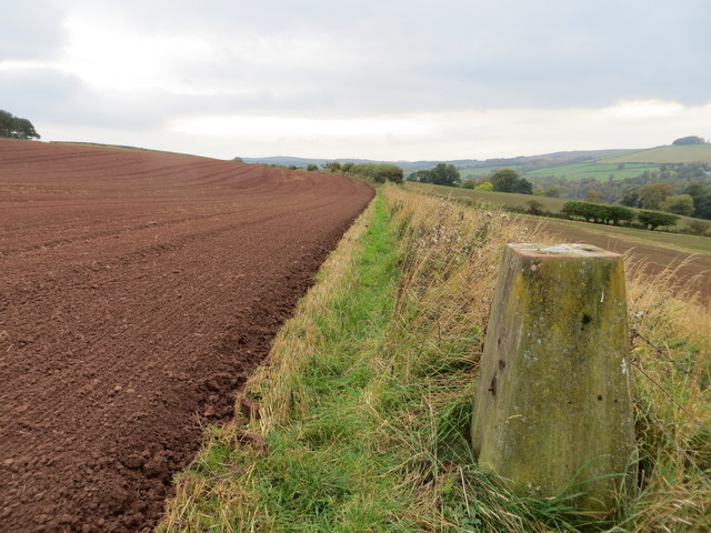
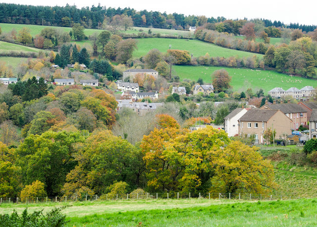
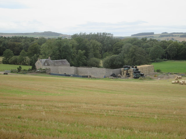
Chieftain Plantation is a picturesque woodland located in Roxburghshire, Scotland. Situated amidst the scenic beauty of the Scottish Borders, this plantation covers a vast area and is known for its lush greenery and diverse flora and fauna.

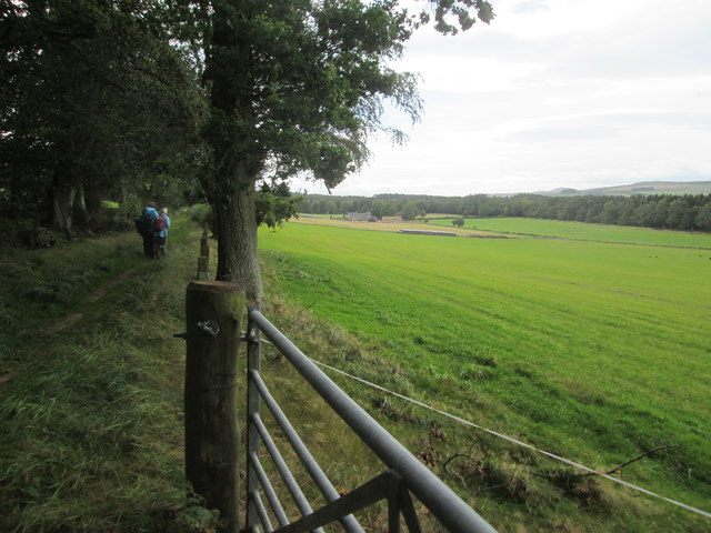
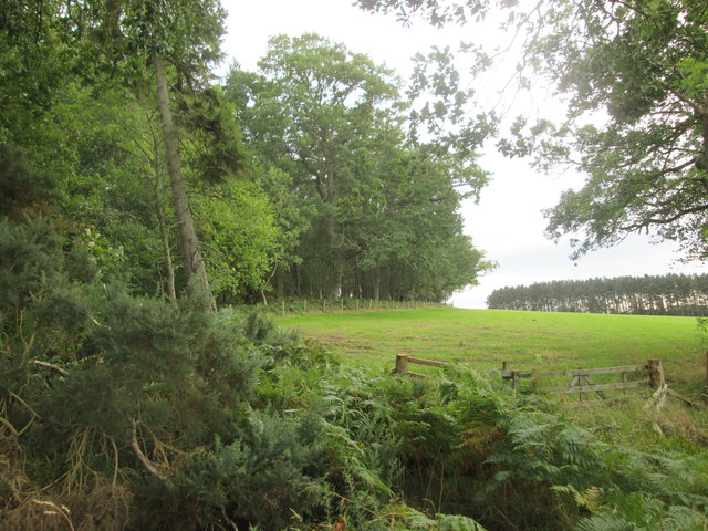
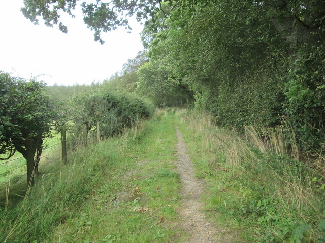
The woodland is predominantly made up of native trees such as oak, beech, and birch, which create a dense and vibrant canopy overhead. The forest floor is covered in a carpet of mosses, ferns, and wildflowers, adding to the natural beauty of the area. Chieftain Plantation also boasts a number of well-maintained walking trails, allowing visitors to explore the woodland at their own pace and immerse themselves in nature.

The plantation is home to a rich variety of wildlife, making it a haven for nature enthusiasts and birdwatchers. The tranquil environment supports a wide range of bird species, including woodpeckers, owls, and various songbirds. Visitors may also be lucky enough to spot red squirrels, roe deer, and other small mammals that call this woodland their home.

Chieftain Plantation offers a serene and peaceful retreat from the bustle of everyday life. It is a popular destination for hikers, picnickers, and families looking to engage with nature. The plantation is easily accessible, with well-marked paths and ample parking facilities available for visitors.

Whether one is seeking solitude, a peaceful walk, or a chance to observe wildlife, Chieftain Plantation in Roxburghshire is a must-visit destination for nature lovers and those who appreciate the beauty of Scotland's woodlands.

If you have any feedback on the listing, please let us know in the comments section below.

Chieftain Plantation Images

Images are sourced within 2km of 55.479048/-2.5279629 or Grid Reference NT6620. Thanks to Geograph Open Source API. All images are credited.

Field edge view from Howden Triangulation Pillar Looking south-westward.
Field edge view from Howden Triangulation Pillar
Looking south-westward.
Autumnal trees at edge of Howdenburn Glen The Howden Burn (of the Howdenburn Glen) is a minor stream entering the Jed Water to the south of Jedburgh. The houses beyond are of course in the town.
Autumnal trees at edge of Howdenburn Glen
The Howden Burn (of the Howdenburn Glen) is a minor stream entering the Jed Water to the south of Jedburgh. The houses beyond are of course in the town.
Footpath  coming  out  of  Natural  Wood  onto  farmland The footpath then becomes a track to fields. Looking toward Hunthill Farm
Footpath coming out of Natural Wood onto farmland
The footpath then becomes a track to fields. Looking toward Hunthill Farm
Field  and  edge  of  Natural  Wood
Field and edge of Natural Wood
Footpath  back  into  Natural  Wood
Footpath back into Natural Wood
Over  field  to  Hunthill  Farm From track from Natural Wood
Over field to Hunthill Farm
From track from Natural Wood
Lane  and  Coach  House The footpath from Hunthill through the woods comes out on to the lane here
Lane and Coach House
The footpath from Hunthill through the woods comes out on to the lane here
Howden  Farm  buildings  alongside  road
Howden Farm buildings alongside road
Indian Mutiny Memorial near Jedburgh A memorial fountain or well by the A68 south of the town. Two local families lost relatives in the Indian Mutiny uprising in 1857, resulting in this memorial fountain by the roadside, dated 1857. The panel is inscribed 

To the women and children who suffered in India during the Sepoy mutiny.

The fountain is known locally as the 'Dribbly Well'. (From the information panel on the west side of the road).
Indian Mutiny Memorial near Jedburgh
A memorial fountain or well by the A68 south of the town. Two local families lost relatives in the Indian Mutiny uprising in 1857, resulting in this memorial fountain by the roadside, dated 1857. The panel is inscribed To the women and children who suffered in India during the Sepoy mutiny. The fountain is known locally as the 'Dribbly Well'. (From the information panel on the west side of the road).
Waymarks in Jedburgh Waymarks for the Borders Abbeys Way, Jedburgh Paths, Jedforest Trails, the Justice Trail (a 40km cycle route) and the Jedburgh Circular Riding Route (total length 22km).
Waymarks in Jedburgh
Waymarks for the Borders Abbeys Way, Jedburgh Paths, Jedforest Trails, the Justice Trail (a 40km cycle route) and the Jedburgh Circular Riding Route (total length 22km).
Field and wood at Sunnybrae Scaur The wood drops steeply down to the Jed Water.
Field and wood at Sunnybrae Scaur
The wood drops steeply down to the Jed Water.
Steps near Allar's Mill, Jedburgh A long flight of steps leads down from the lane used by the Borders Abbeys Way to the Jed Water, on one of the Jedburgh paths.
Steps near Allar's Mill, Jedburgh
A long flight of steps leads down from the lane used by the Borders Abbeys Way to the Jed Water, on one of the Jedburgh paths.
Bridge at Allar's Mill, Jedburgh A bridge over the Jed Water giving access to the old mill buildings now used as a storage depot.
Bridge at Allar's Mill, Jedburgh
A bridge over the Jed Water giving access to the old mill buildings now used as a storage depot.
Stripwood, Howden A long strip between Howden and Hunthill. A track runs down this one.
Stripwood, Howden
A long strip between Howden and Hunthill. A track runs down this one.
Hilltop arable Ormistonleys Strip runs to the right of a field growing winter cereals. The land here is quite high, over 200m and there is evidence of small scale coal mining here. Often altitude and coal measures is a combination which leads to very poor farmland, but not here.
Hilltop arable
Ormistonleys Strip runs to the right of a field growing winter cereals. The land here is quite high, over 200m and there is evidence of small scale coal mining here. Often altitude and coal measures is a combination which leads to very poor farmland, but not here.
Dippingpool Strip A minor road runs through one of the many stripwoods in the hills around Jedburgh.
Dippingpool Strip
A minor road runs through one of the many stripwoods in the hills around Jedburgh.
Stripwood, Hunthill A beech wood beside a minor road. The fence surrounds a covered reservoir.
Stripwood, Hunthill
A beech wood beside a minor road. The fence surrounds a covered reservoir.
Camp Wood Earthworks in Camp Wood, marked on maps as a settlement.
Camp Wood
Earthworks in Camp Wood, marked on maps as a settlement.
Show me another place!

Chieftain Plantation is located at Grid Ref: NT6620 (Lat: 55.479048, Lng: -2.5279629)

Unitary Authority: The Scottish Borders

Police Authority: The Lothians and Scottish Borders

What 3 Words

///croaking.heap.catchers. Near Jedburgh, Scottish Borders

Related Wikis

Hartrigge House

Hartrigge House or Stewartfield House was a country house in Jedburgh in the Scottish Borders. Its first owner was in 1614 and it was rebuilt in 1854....

Jedburgh

Jedburgh (; Scottish Gaelic: Deadard; Scots: Jeddart or Jethart) is a town and former royal burgh in the Scottish Borders and the traditional county town...

Jedburgh railway station

Jedburgh railway station served the town of Jedburgh, Scottish Borders, Scotland from 1856 to 1964 on the Jedburgh Railway. == History == The station opened...

Canongate Bridge

The Canongate Bridge is a pedestrian bridge in the Scottish Borders town of Jedburgh. It was built as the town's main bridge over the Jed Water in the...

Mary Queen of Scots House

Queen Mary's House is a listed sixteenth century building in Jedburgh which is where Mary, Queen of Scots, stayed for a few weeks in 1566. The building...

Jedburgh Grammar School

Jedburgh Grammar School is a state secondary school in Jedburgh, Scotland, with around 440 pupils, 40 teaching staff, and 15 non-teaching staff. ��2�...

St John's Church, Jedburgh

St John's Church is a Scottish Episcopal church (part of the Anglican communion) in Jedburgh. It was founded by Cecil Chetwynd Kerr, Marchioness of Lothian...

Jedburgh Abbey

Jedburgh Abbey, a ruined Augustinian abbey which was founded in the 12th century, is situated in the town of Jedburgh, in the Scottish Borders 10 miles...

Nearby Amenities

Located within 500m of 55.479048,-2.5279629
Power: pole
Lat/Long: 55.4822931/-2.5326882
Power: pole
Lat/Long: 55.4817416/-2.5317355
Power: pole
Lat/Long: 55.4811783/-2.5307647
The data included in this document is from www.openstreetmap.org. The data is made available under ODbL.

Have you been to Chieftain Plantation?

Leave your review of Chieftain Plantation below (or comments, questions and feedback).